Sold2022Pinkerton french Map of Great Britain & Ireland 1806John Pinkerton (Scottish, 1758-1826): Map of Great Britain & Ireland 1806, copper hand colored engraving, from Abrege de la geographie moderne published in 1806 in Paris by Dentu Imprimeur.8" X 11 1/2See Sold Price
Sold2019Group of Five (5) 19th Century MapsIncluding England Scotland and Ireland Britain or the United Kingdom published by Cummings & Hillard No. 1 Cornhill Boston, Newfoundland Nova Scotia and New Brunswick map, French map of North America,See Sold Price
Sold2022BLAEU 1659 MAP OF IRELANDFrench text verso. Dimensions: H 16" x W 18.75" Condition: With center fold as published, left and right margins trimmed. Faint coloring. Age toning.See Sold Price
Sold2023Henri Abraham Chatelain (1684-1743) Map of IrelandHenri Abraham Chatelain (French 1684-1743) Nouvelle Carte De L'Irlande, ou on Remarque l'Etat Present De Cette Isle- Map of Ireland from "Atlas Historique" first published in 1721 - This three part maSee Sold Price
Sold2017Two 17th Century Maps of England/Scotland andTwo 17th Century Maps of England/Scotland and Ireland/France. Two hand-colored engravings, with text in French, with genealogies of the kings Larger: 15" x 19" Frames: 22.75" x 26.75"See Sold Price
Sold2019Encyclopaedia Britannica 1911 Mixed Lot of 16 MapsIncl French West Africa, Turkestan, French Indo-China & Siam, Germany, Central America, Northern/Southern Hemisphers, Ireland, Polar Regions, Denmark, France, Norway/Sweden, Spain and Portugal, FranceSee Sold Price
Sold201718th C. French Map w/ Oiled Paper, ex-Sotheby'sEurope, France, map from 1709 CE, oiled paper overlays from 1756 to 1763 CE, owned by Louis-Alexandre Berthier (1753 to 1815 CE), Marshal, Vice-Constable of France, and Chief of Staff (Major general)See Sold Price
Sold2021Antique French Map of MississippiAntique French Map of Mississippi , "Carte Geographique, Statistique et Historique du Mississipi", Paris, Buchon, 1825, sight 21 in. x 27 1/2 in., framed Provenance: Estate of Julia Evans ReedSee Sold Price
Sold2021Antique French Map of United States- Etats-Unis De L'Amerique Septentrionale Avec Les Isles Royale, De Terre Neuve, De St. Jean, L'Acadie &c.; Hand-colored; Ches Boudet Imprimeur du Roi; Paris; undated (circa 1785). One of the early maSee Sold Price
Sold2022Mannevillette French Map of the Indian Ocean, 1753D'APRES DE MANNEVILLETTE, Jean-Baptiste-Nicolas-Denis (1707-1780). [Indian Ocean] Carte Reduite de l'Ocean Oriental depuis le Cap de Bonne Esperance... Engraved map with original hand color in part. PSee Sold Price
Sold20241812 large French map of Paris plan routier de la Ville et faubourgLarge engraving of Paris and its surrounding area dated 1812 , cooper engraving in the manner of the Turgot map ,Jean Pierre printer , a Paris, chez Jean, Rue St Jean de Beauvais, N° 10, It is thSee Sold Price
Sold20221738 Antique French Map of North America1738 Antique French Map of North America, 1783 - Antique Map of North America, with documentation, This map is 221 years old - it is not a modern reproduction or copy, This map comes from: ATLAS DE TOSee Sold Price
Sold201718th Century French Map of North AmericaL’Amerique Septentrionale. Daniel de la Feuille (1640-1709). Engraved map with hand color in full. Amsterdam, 1702 or 1706. 6 x 8 inches visible, 13 x 14 1/2 inches framed. Nicely colored early 18thSee Sold Price
Sold2022c. 1788 French Map of the Eastern United StatesHistoric Maps c. 1788 Map, "Les Etats Unis de L'Amerique Septentrionale, Partie Orientale" (Eastern Part of the Northern United States of America) by M. (Rigobert) Bonne c. 1788 Map titled, "Les EtatsSee Sold Price
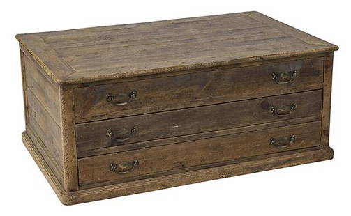
Sold2020Country French Map CabinetThree drawer case in pine with original brass hardware. Drawers pull out from both sides. 49w x 31 1/2d x 20 1/2hSee Sold Price
Sold2023Guillaume De L'Isle Philippe Buache Large Antique French Map of the AmericasImportant map of Guillaume de L'Isle corrected by Philippe Buache and edited by Dezauche in 1800 ,after the conclusion of the American revolutionary war and the treaty of Paris Dezauche updated the neSee Sold Price
Sold20211736 large French map of Paris and surrounding areaLarge engraving of Paris and its surrounding area dated 1736 , cooper engraving in the manner of the Turgot map , name of printer not lisible ,the date is clear . H.23 1/4 x W. 36 , suitable for framiSee Sold Price
Sold202118th C. French Map "Le Noveau Mexique …"Ribobert Bonne (French, 1727-1794). "Le Nouveau Mexique, Avec La Partie Septentrionale De L'Ancien, ou De La Nouvelle Espagne" Published in Paris, 1780. Among the most collected late 18th century mapsSee Sold Price
Sold2021French Map of the World Decorative ArtsFrench Map of the World, piece appears to be hand drawn and colored, inscriptions to piece in French, label to reverse reads ‘Le Normand, Charles 14 x 19 Manuscript World Map’, subject a map of thSee Sold Price
Sold202118TH CENTURY FRENCH MAP OF SOUTHEASTERN USRigobert Bonne (French, 1727-1794). "Carte De la Partie Sud Des Etats Unis De L'Amerique Septentrionale" -circa 1780, engraving. Provenance: From the Lifetime Collection of Billy S. Arant, Jr., ChattaSee Sold Price
Sold2022FRENCH MAP "AFRIQUE" Circa 1720 Color engraving, 8" x 9" sight. Framed 15.5" x 16.5".FRENCH MAP "AFRIQUE"Circa 1720Color engraving, 8" x 9" sight. Framed 15.5" x 16.5".See Sold Price
Sold2018AN 1659 FRENCH MAP OF DENMARK BY NICOLAS SANSONA hand-colored map of Northern Denmark by Nicolas Sanson (1600-1667), signed Sanson and dated with a cartouche on the lower left. Sheet measures 16.25 x 21 inches. Frame measures 20.5 x 26.5 inches. WSee Sold Price
Sold2021Two Early Engraved Maps: Ireland & GloucestershireA pairing of early hand-colored engraved maps to include a Christopher Saxon and William Hole map of "Glocestriae Comitatus Olim Sedes Dobuncrum", and a William Hole map of Ireland titled "Hiberniae".See Sold Price
BonhamsBURKE (EDMUND) Reflections on the Revolution in France, Dublin, 1790; PAINE (THOMAS) Rights of M...£400
3 days LeftThe Ross Art GroupOriginal Air France Map - Burgundy Small by Lucien Boucher 1952$800(1 bid)
1 day LeftEldred'sASSORTED VINTAGE CONTINENTAL COPPER COOKWARE Mostly Belgium, France and Ireland, 20th Century$250(1 bid)
6 days LeftEast Coast Fine Arts LLC1777 US Revolutionary War Map French Brion de la Tour Theatre de Guerre$1,000


![Mannevillette French Map of the Indian Ocean, 1753: D'APRES DE MANNEVILLETTE, Jean-Baptiste-Nicolas-Denis (1707-1780). [Indian Ocean] Carte Reduite de l'Ocean Oriental depuis le Cap de Bonne Esperance... Engraved map with original hand color in part. P](https://p1.liveauctioneers.com/1968/250616/130196497_1_x.jpg?height=310&quality=70&version=1654190895)