Sold20221879 Powell US Rain Chart Map -- Rain Chart of the United States Showing by Isothermal Lines theTitle: 1879 Powell US Rain Chart Map -- Rain Chart of the United States Showing by Isothermal Lines the Distribution of the Mean Annual Precipitation in Rain and Melted Snow Cartographer: J W Powell /See Sold Price
Sold2018Two Large Maps of the WorldTwo Large Maps of the World, American Air Lines & Menier Chocolate. American Airlines Air World Map, showing the distances to various cities and locations from the geographical center of the United StSee Sold Price
Sold201918th C Map Ancient World JerusalemEngraved plate showing maps of ancient world including inset of Judea and Samaria and one of Jerusalem. Early 18th century.Very Good, trimmed to plate lines, measures 7 x 5.5". Reserve: $20.00 ShippinSee Sold Price
Sold2017Gray World Map, Mountains and Rivers, 1875Map: Gray World Mountains and Rivers - Mountains and Rivers Cartographer: O Gray Date: 1875 Origin: Philadelphia Size: 16.4 x 25 inches A very handsome and colorful double-page chart showing the majorSee Sold Price
Sold20231858 Colton Map of Co-Tidal Lines [with] Ocean Currents and River Systems -- Map of the WorldTitle: 1858 Colton Map of Co-Tidal Lines [with] Ocean Currents and River Systems -- Map of the World Illustrating ... the Land & Co-Tidal Lines [on sheet with] Map of the World Showing ... Ocean CurreSee Sold Price
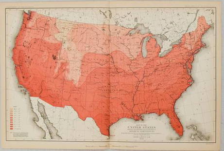
Sold20211880 Gannett Climate Map of the US with IsothermalTitle: 1880 Gannett Climate Map of the US with Isothermal Minimum Temperature Lines -- Map of the United states Showing the Distribution of Lines of Minimum Temperature… Cartographer: H Gannett / DeSee Sold Price
Sold2019MAPS - Ireland. Manesson MalletIreland. Allain Manesson Mallet, [Lot of 2] Royaume d'Irlande [and] Isle d Irlande, 1683 (published). A nice pair of copper-engraved maps showing counties, lakes, and rivers. Titles in simple block foSee Sold Price
Sold2020Bartholomew, John 1922 Pair Maps. New Zealand & Pacific"New Zealand" and "Islands of Oceania" The latter showing Hawaii and other Pacific Islands. Large Lithograph Maps Published 1922 by The Times, London for "The Times Survey Atlas of the World" Maps bySee Sold Price
Sold2019Bartholomew, John 1922 Pair Large Maps of East Indies"Farther India" showing Siam, Indonesia, Singapore, Malaysia. Together with "Malay Archipelago" Large Lithograph Map Published 1922 by The Times, London for "The Times Survey Atlas of the World" MapsSee Sold Price
Sold2021Gray’s 1875 map of Boston w/orig. hand colorLovely and collectible example of O. W. Gray's map of Boston and the neighboring cities, showing marvelous local details throughout, including well-defined railroad lines and individual buildings thatSee Sold Price
Sold2020Philip, George C1900 Physical Hemisphere MapShowing Ocean Currents, Vegetation. Lithograph Map Published C1900, London for "Philips' New Handy General Atlas of the World" by George Philip. Paper Size: 21 x 14.5 inch (53 x 37cm) Good ConditionSee Sold Price
Sold20211875 San Francisco – earliest full-pg mapEarliest full-page map of the city of San Francisco to appear in a commercial atlas. Detailed map hand-colored by wards and showing streets, docks, wharves, railroad lines, streetcar lines, parks andSee Sold Price
Sold2019Scarce 1850 plants distributionScarce 1850 map or chart by Joseph Meyer depicting plant geography. Shows the distribution of vegetation throughout the world. Features five illustrations showing the vegetation in various regions, inSee Sold Price
Sold2022WORLD WAR 2. Maginot & Siegfried lines defences. Pre-invasion. Belgium 1940 mapTITLE/CONTENT OF MAP: 'Western Front showing forests and main defences: Section 2' DATE PRINTED: March 1940 IMAGE SIZE: Approx 26.5 x 42.0cm, 10.25 x 16.5 inches (Large) TYPE: Vintage colour map; ScalSee Sold Price
Sold20221823 Woodbridge Maps of Climate, Vegetation and AnimalsTitle: 1823 Woodbridge Maps of Climate, Vegetation and Animals of the World -- Isothermal Chart or View of Climates & Production… Cartographer: W. Woodbridge Year / Place: 1823, Hartford Map DimSee Sold Price
Sold20241831 Woodbridge Maps of Climate, Vegetation and Animals of the World -- Isothermal Chart or View ofTitle: 1831 Woodbridge Maps of Climate, Vegetation and Animals of the World -- Isothermal Chart or View of Climates & Productions… [verso] Chart of the Principal Animals of the World CartographeSee Sold Price
Sold20231831 Woodbridge Maps of Climate, Vegetation and Animals of the World -- Isothermal Chart or View ofTitle: 1831 Woodbridge Maps of Climate, Vegetation and Animals of the World -- Isothermal Chart or View of Climates & Productions… [verso] Chart of the Principal Animals of the World CartographeSee Sold Price
Sold2019Gross, Alexander 1920 Pair of LG Maps. Cuba & Jamaica"Cuba and Jamaica" and "West Indies" also showing Cuba and Jamaica. Large Lithograph Maps Published 1920, London for "The Daily Telegraph Victory Atlas of the World" by Alexander Gross. Centre fold asSee Sold Price
Sold2023WORLD WAR 2. Maginot & Siegfried lines defences. Pre-invasion. Belgium 1940 mapTitle: WORLD WAR 2. Maginot & Siegfried lines defences. Pre-invasion. Belgium 1940 map Description: Western Front showing forests and main defences: Section 2' by George Philip & Son (March 1940). VinSee Sold Price
Sold2023WORLD WAR 2. Maginot & Siegfried line defences. Pre-invasion of France 1940 mapTitle: WORLD WAR 2. Maginot & Siegfried line defences. Pre-invasion of France 1940 map Description: Western Front showing forests and main defences: Section 1' by George Philip & Son (March 1940). VinSee Sold Price
Sold2022World.- Bordone (Benedetto di) [World Map], woodcut, [1522].World.- Bordone (Benedetto di) [World Map], early map showing the recent developments in cartography and departing from Ptolemaic models, including open water between the two continents and not joininSee Sold Price
Sold2016Rare Vintage Map of Afghanistan War Rug: 5'9'' x 7'3''Rare Vintage Afghanistan War Rug showing map of world with Afghanistan at its center from refugee camp in Peshawar, Pakistan. 1997. Size: 5'9'' x 7'3'' (175 x 221 cm). An outstanding and large exampleSee Sold Price
Sold2016Celebrated 16th Century World Map by Abraham OrteliusTypvs Orbis Terrarvum, Antwerp, dated 1587, with hand-coloring; Spanish text on the back credits the cartographer's sources in this updated edition showing the Solomon Islands and a corrected South AmSee Sold Price
Sold20241875 Sweden, Norway, Denmark / Austria by HardestyTitle: 1875 Sweden, Norway, Denmark / Austria by Hardesty Date/Period: 1875 Materials: Hand color, steel engraving Size: 19 1/2 x 26” 1875 map from H.H. Hardesty's 'Historical Atlas of the WorldSee Sold Price
BonhamsASHER AND ADAMS Asher & Adams' New Historical and Topographical Atlas of the United States. With...£300
Jun 28Rail & Road AuctionsTwenty Pieces of Railroad China and Glass - Chesapeake & Ohio Parliament, Pennsylvania Keystone and$70
5 days LeftWorld Auction Gallery LLCEmile Galle Antique Pair of Hand Painted Pottery Vases, Japanese taste$150
14 hrs LeftJasper52Map Showing the Line of the Brooklyn Water-Works, 1871 | Section of Long Island from North to South.$45
Jun 27Rail & Road AuctionsPair of Baltimore & Ohio Railroad China Centenary Hot Chocolate Cups & Saucers$40
3 days LeftCoronari AuctionsFollower of Emile Prangey (1832-?): A pair of pendants with Arab riders on horseback, oil on canvas€1,600
BonhamsMITCHELL (SAMUEL AUGUSTUS) A New Universal Atlas Containing Maps of the Various Empires, Kingdom...£1,300


![1858 Colton Map of Co-Tidal Lines [with] Ocean Currents and River Systems -- Map of the World: Title: 1858 Colton Map of Co-Tidal Lines [with] Ocean Currents and River Systems -- Map of the World Illustrating ... the Land & Co-Tidal Lines [on sheet with] Map of the World Showing ... Ocean Curre](https://p1.liveauctioneers.com/5584/291311/154333687_1_x.jpg?height=310&quality=70&version=1685623945)
![MAPS - Ireland. Manesson Mallet: Ireland. Allain Manesson Mallet, [Lot of 2] Royaume d'Irlande [and] Isle d Irlande, 1683 (published). A nice pair of copper-engraved maps showing counties, lakes, and rivers. Titles in simple block fo](https://p1.liveauctioneers.com/6576/136723/69438030_1_x.jpg?height=310&quality=70&version=1550846033)


![1831 Woodbridge Maps of Climate, Vegetation and Animals of the World -- Isothermal Chart or View of: Title: 1831 Woodbridge Maps of Climate, Vegetation and Animals of the World -- Isothermal Chart or View of Climates & Productions… [verso] Chart of the Principal Animals of the World Cartographe](https://p1.liveauctioneers.com/5584/319185/171438327_1_x.jpg?height=310&quality=70&version=1707858212)
![1831 Woodbridge Maps of Climate, Vegetation and Animals of the World -- Isothermal Chart or View of: Title: 1831 Woodbridge Maps of Climate, Vegetation and Animals of the World -- Isothermal Chart or View of Climates & Productions… [verso] Chart of the Principal Animals of the World Cartographe](https://p1.liveauctioneers.com/5584/285598/150695005_1_x.jpg?height=310&quality=70&version=1681855790)


![World.- Bordone (Benedetto di) [World Map], woodcut, [1522].: World.- Bordone (Benedetto di) [World Map], early map showing the recent developments in cartography and departing from Ptolemaic models, including open water between the two continents and not joinin](https://p1.liveauctioneers.com/5458/252576/131355887_1_x.jpg?height=310&quality=70&version=1655911671)


