Sold20191807 Map Charleston, South CarolinaPublished Philadelphia by C.P. Wayne. The piece titled ÒPlan of the Siege of Charleston in S. CarolinaÓ. Sight size: H10" W15" (without frame)See Sold Price
Sold2024MAP FROM ‘THE LIFE OF GEORGE WASHINGTON’Plate X from the atlas volume of ‘The Life of George Washington’, dated 1807, an engraved map, 17.5 x 11 in., boldly titled ‘PLAN of the SIEGE of CHARLESTON in S. CAROLINA’. ThSee Sold Price
Sold2017Revolutionary War MapMap, 18” x 11,” “Plan of the Siege of Charleston in S. Carolina" 1807, publishedC.P. Wayne, Philadelphia, withdrawn from book. Showing the location of downtown Charleston, Fort Sullivan (later nSee Sold Price
Sold2022FRENCH MARITIME WORLD MAP TAPESTRYFrench 20th c. Jacquard Woven Tapestry Maritime Map of the World. Lined. Measures 32"x41". Weight 2 pds. PROVENANCE: A Private Charleston SC Estate.See Sold Price
Sold201718th C. French Map w/ Oiled Paper, ex-Sotheby'sEurope, France, map from 1709 CE, oiled paper overlays from 1756 to 1763 CE, owned by Louis-Alexandre Berthier (1753 to 1815 CE), Marshal, Vice-Constable of France, and Chief of Staff (Major general)See Sold Price
Sold202118th C. French Map "Le Noveau Mexique …"Ribobert Bonne (French, 1727-1794). "Le Nouveau Mexique, Avec La Partie Septentrionale De L'Ancien, ou De La Nouvelle Espagne" Published in Paris, 1780. Among the most collected late 18th century mapsSee Sold Price
Sold2018Framed 18th C. French Map of Ancient Rome**First Time At Auction** Louis Brion de la Tour (French, 1743-1810) & Louis Charles Desnos (French, 1725-1805), "Suite De L'Histoire De Rome", ca. 1760 to 1770. Copperplate engraved with original hanSee Sold Price
Sold201919th C. French Map - The Port of Vera Cruz Mexico100% of the Hammer price of all lots sold in this auction will be donated to Community Food Share by Artemis Gallery. $1.00 = 3 meals! **First Time At Auction** Europe, France, ca. 19th century CE.See Sold Price
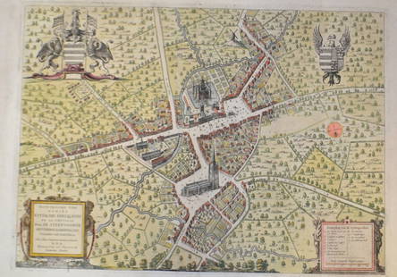
Sold201518th C French Map Of SteenvoordePLOUICH, Vedastus du -" Illvstrissimo viro domino" .The city of Steenvoorde is a small town located north of France. The city of Steenvoorde is located in the department of Nord of the french region.See Sold Price
Sold2021Pair 18th C French Maps after the AntiqueTo include "A View of the Town-House or Guild Hall of Paris" and "Vue de Chateau Royal D'amboise" : mid 20th century prints after the antique, housed in concave giltwood frames. Copperplate engravingsSee Sold Price
Sold202417TH C. ANTIQUE MAP SIEGE OF LA ROCHELLE, FRANCE, FRAMED"Seige et Reddition de La Rochelle, Octobre 1628", handcolored engraving on wove paper, Claes Jansz. Visscher (II), (workshop of), Germany, 1627 - 1629. In gilt molded frame, matted under UV non-glareSee Sold Price
Sold2022c. 1788 French Map of the Eastern United StatesHistoric Maps c. 1788 Map, "Les Etats Unis de L'Amerique Septentrionale, Partie Orientale" (Eastern Part of the Northern United States of America) by M. (Rigobert) Bonne c. 1788 Map titled, "Les EtatsSee Sold Price
Sold2022Rare map Siege of Charleston in Amer. Rev. War, Marshall 1832Rare plan of the Revolutionary War Siege of Charleston in South Carolina. From John Marshall’s 1832 edition of the Life of Washington. Covers the area comprising Charleston Harbor and parts of the CSee Sold Price
Sold202117th C. French Engraving Map of N. Africa MoroccoFrench hand-colored engraving of North Africa, including Morrocco, parts of Algeria, Strait of Gibraltar. Dated 1655. Measures 16"H x 21"W visual image , 23.75"H x 27.75"W framed. Condition report: GoSee Sold Price
Sold2017Antique 19th C French Hand Colored Map of AriegeAntique 19th C French Hand Colored Map of Ariege. Hand colored well detailed engraving showing the French department of Ariege with scenes of regional trade, products and life along with a coat of armSee Sold Price
Sold2017Antique 19th C French Hand Colored Map of CalvadosAntique 19th C map of the French area of Calvados. This area of France is known for its production of Calvados. The engraving is surrounded by scenes showing the region and its products. Published bySee Sold Price
Sold202219TH C. BYRRH FRENCH CYCLISTS MAPLate 19th c.-1900's small bound cyclists map of the southwest of France. Published as publicity for Byrrh. Dimensions: H 4.75" x W 3.5" x D .5" Condition: As is; binding falling apart. Toning, tears,See Sold Price
Sold201818th C. Spanish Oil, Map of the Siege of BarcelonaContinental School, likely Spanish, late 18th century Overhead landscape painting depicting a stylized map view of Barcelona as seen in 1705, bearing inscription loosely translating to "The Viceroy VeSee Sold Price
Sold2024Europe exhibiting its principal states &c. First French Empire. FADEN 1791 mapTITLE/CONTENT OF MAP: 'Europe exhibiting its principal states &c' DATE PRINTED: 1791 IMAGE SIZE: Approx 54.5 x 69.5cm, 21.5 x 27.25 inches (Large); Please note that this is a folding map. TYPE: LargeSee Sold Price
Sold20151807 POLAND MAP C. BRIGHTLY & E. KENNERSTY BUNGAY1807 POLAND MAP C. BRIGHTLY & E. KENNERSTY BUNGAY Map of "Poland Shewing the Claims of Russia, Prussia, and Austria from the beft Authorities" by C. Brightly and E. Kennersty Bungay in Suffolk, April,See Sold Price
Sold20171807 William Guthrie French ATLAS Illustrated MAPS1807 William Guthrie French ATLAS Illustrated MAPS Asia Africa France America Originally translated into French in 1801, William Guthrie’s “Geographical, Historical and Commercial Grammar’, hasSee Sold Price
Sold201619th C French set of 3 engraving maps19th C French set of 3 engraving maps. 14” H x 20” W. Shipping in USA is $ 50.00. International bidders ask for shipping before bid.See Sold Price
Sold2022c 1760 Northern Colonies French + Indian War MapHistoric Maps Louisiana & Florida French & Indian War Era Map c. 1760 c. 1760 French & Indian War Era, Hand-Colored Map of Pennsylvania and New England titled, "Carte de la Partie Nord, Des Etats UnisSee Sold Price
May 22Thomaston Place Auction GalleriesHAND COLORED MAP OF PERU & COUNTRY OF THE AMAZONS, 1747, BY EMANUEL BOWEN, FRAMED$250
20 hrs LeftJasper521720 c. Homann Map of Northeast France, the Lorainne Region -- Lotharingiae Tabula Generalis in qua$85
May 21Freeman's | HindmanJacques Adnet (French, 1900-1984) Saddle Stitched Leather Armchair, c. 1950 France$2,500
May 21Freeman's | HindmanFrench Art Deco Early 20th Century Mahogany and Mohair Armchair, c. 1930 France$400(1 bid)
May 21Freeman's | HindmanPrimavera 20th Century Pair of Ceramic VasesAtelier Primavera, c. 1930 France$500(1 bid)
May 21Freeman's | HindmanJacques Adnet (French, 1900-1984) Leather Covered Floor Lamp, c. 1950 France$1,500(1 bid)
May 21Freeman's | HindmanJacques Adnet (French, 1900-1984) Pair of Leather Shelves, c. 1960 France$750
May 21Freeman's | HindmanJacques Adnet (French, 1900-1984) Set of Three Nesting Tables, c. 1950 France$1,600(2 bids)
May 21Freeman's | HindmanJacques Adnet (French, 1900-1984) Leather Magazine Rack, c. 1960 France$550(2 bids)
May 21Freeman's | HindmanJacques Adnet (French, 1900-1984) Leather Covered Mounted Shelf, c. 1960 France$1,500(1 bid)
6 days LeftKCM GalleriesFRAMED 1800s Gustave DORE Woodcut Orlando Furioso the Siege of Paris SIGNED$870
May 21Freeman's | HindmanVerot & Clément c. 1955 Satinwood Cabinet with Painted Roundels France$3,250(5 bids)
C & T Auctioneers and Valuers LtdA Great War British War medal to an Officer in the Royal Field Artillery Special Reserve who was Men£20(1 bid)
May 21Freeman's | HindmanF. Moreau for Teco Pottery (French/American, 1853-1920) Vase, model 127, c. 1910 Teco, USA$1,000(1 bid)
5 days LeftHELIOS AUCTIONSA CUT-CRYSTAL CUP FROM THE PERSONAL SERVICE OF EMPEROR MAXIMILIAN I OF MEXICO, 19TH C.$500
Jun 07Freeman's | Hindman[MAP]. SARTINE, Antoine Plan de la Barre et du Havre de Charles-Town...1778. RARE REVOLUTIONARY WAR$1,000(1 bid)


![[MAP]. SARTINE, Antoine Plan de la Barre et du Havre de Charles-Town...1778. RARE REVOLUTIONARY WAR (1 of 1)](https://p1.liveauctioneers.com/197/329395/177650540_1_x.jpg?height=282&quality=70&version=1715364962)