Sold2019Land Ho! Antique Block Island Sound, RI USCGDescription: Ahoy! Antique U.S. Coast Guard nautical chart of Block Island Sound and Approaches. Numbered C. & G. S. 1211; published 1968. Material: paper. Measurement: approximate 36" x 41" (INCHES).See Sold Price
Sold2022Large lot of 1960s Nautical Chart Maps Martha's Vineyard, Block Island, LI Sound Cape Cod Bay & moreLarge lot of 1960s Nautical Chart Maps Martha's Vineyard, Block Island, LI Sound Cape Cod Bay & moreSee Sold Price
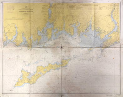
Sold2021Nautical Map / Sea Chart, #362 Block Island Sound andDescription: Nautical Map / Sea Chart, United States East Coast, New York, Long Island, Block Island Sound and Gardiner's Bay, 6th edition, Feb 10/69; Shipping: $20; different rate to California, AlasSee Sold Price
Sold2020Nautical Map / Sea Chart, #1211 MarthaDescription: Nautical Map / Sea Chart, United States East Coast, Rhode Island - Connecticut - New York, Block Island Sound and Approaces9th edition, dec 23/63 stamped CORRECTED ONLY FOR AIDS & HAZARDSSee Sold Price
Sold2023NAUTICAL CHART EAST COAT/ ROBINSONS HOLE TO CUTTYHUNK HARBORDescription: NAUTICAL CHART EAST COAT/ ROBINSONS HOLE TO CUTTYHUNK HARBOR. MASSACHUSETTS – ELIZABETH ISLANDS. Published at Washington, D.C. U.S. Department of Commerce Environmental Science SerSee Sold Price
Sold2023Large 1876 chart of Long Island Sound from Newport to New York. Compiled by George Eldridge, publishLarge 1876 chart of Long Island Sound from Newport to New York. Compiled by George Eldridge, published by S. Thaxter & Son, Boston. Nautical chart with notable coastal towns and landmarks. Canvas backSee Sold Price
Sold2023Nautical Chart: PLUM ISLAND TO STRATFORD SHOAL/ LONG ISLAND SOUNDDescription: PLUM ISLAND TO STRATFORD SHOAL/ LONG ISLAND SOUNDMeasurement approximate: 32 x 22 Inches Material: PaperSee Sold Price
Sold2023NAUTICAL CHART: RHODE ISLAND/ PROVIDENCE HARBORDescription: UNITED STATES - EAST COAST RHODE ISLAND/ PROVIDENCE HARBORMeasurement approximate: 30 x 37 Inches Material: PaperSee Sold Price
Sold2023The Island Sainte Croix, 1831 British Admiralty Nautical ChartScarce Original 1831 British Admiralty Nautical Chart: The Island Sainte Croix, of From the 1799 Danish Survey of General Oxholm. An Extraordinary 18th-Century Map of the Danish Sugar-Plantation IslanSee Sold Price
Sold2017Ferrer: Antique Nautical Chart of Norman Island, 18091809 Nautical Chart of Norman Island BVI (Treasure Island). Original engraving from José Joaquín de Ferrer y Cafranga's sea atlas, the 'Portulano de los Estados Unidos', published in Madrid in 1818.See Sold Price
Sold2022Nautical chart of Coiba island, Panama, by the English pirate Anson. 1749Title: Nautical chart of Coiba island, Panama, by the English pirate Anson. 1749 Date/Period: 1749 Materials: Copper plate engraved Size: 15 1/2 x 10” Nautical chart of the east end of Quibo (CoSee Sold Price
Sold2020Land Ho! Antique Fishers Island Sound, RI-CT-NY USCGDescription: Ahoy! Antique Coast Guard nautical chart of Fishers Island Sound, RI-CT-NY. Numbered C. & G. S. 358; published 1968. Material: paper. Measurement: approximate 36" x 45" (INCHES). ShippingSee Sold Price
Sold2021Fishers Island Sound, RI-CT-NY USCGFishers Island Sound, RI-CT-NY USCG, Coast Guard nautical chart of Fishers Island Sound, RI-CT-NY. Numbered C. & G. S. 358; published 1968. Approximate measurements: 36" x 45" (INCHES) Materials: PapeSee Sold Price
Sold2019Eldridge's Long Island Sound Nautical Chartfrom New York to New London 24" x 76" published by Geo. W. Eldridge, 1911See Sold Price
Sold2022Nautical chart of Juan Fernandez island. (Robinson Cruseo is) by the English pirate Anson, 1749Title: Nautical chart of Juan Fernandez island. (Robinson Cruseo is) by the English pirate Anson, 1749 Date/Period: 1749 Materials: Copper plate engraved Size: 15 1/2 x 10” Nautical chart of JuaSee Sold Price
Sold2023Antique Nautical Chart of Juan Fernandez Island: Northeast Side by English Pirate George Anson,1749Title: Antique Nautical Chart of Juan Fernandez Island: Northeast Side by English Pirate George Anson,1749 Date/Period: 1749 Materials: Copperplate engraved Size: 15 1/2 x 10” Explore the legendSee Sold Price
Sold2023NAUTICAL CHART East River TALLMAN ISLAND TO QUEENSBOROUGH BRIDGEDescription: NAUTICAL CHART East River TALLMAN ISLAND TO QUEENSBOROUGH BRIDGE. Published at Washington D.C/ US Department of Commerce National Oceanic and Atmosphere Administration National Ocean SurvSee Sold Price
Sold2021KERRY HALLAM PAINTED NAUTICAL CHARTLarge hand painted nautical chart (NOAA, Conn. Long Island Sound, 1983) with mixed media scene of yachts signed Kerry Hallam. Image 33 x 43 inches, framed 50 x 59 inches. VG condition. (Kerry Hallam,See Sold Price
Sold2023NAUTICAL CHART: EASTERN PART OF LONG ISLAND SOUNDDescription: NAUTICAL CHART: EASTERN PART OF LONG ISLAND SOUNDMeasurement approximate: 30 x 37 InchesMaterial: PaperSee Sold Price
Sold20221970s Nautical Navigations Maps Martha's Vineyard, Block Island & More 47"x35"1970s Nautical Navigations Maps Martha's Vineyard, Block Island & More 47"x35"See Sold Price
Sold2023Nautical Chart: EASTERN PART OF LONG ISLAND SOUNDDescription: EASTERN PART OF LONG ISLAND SOUND Measurement approximate: 30 x 37 Inches Material: PaperSee Sold Price
Sold2023Nautical Chart: SOUTHERN COAST OF LONG ISLAND SOUND/ MONTAUK POINT TO EAST HAMPTONDescription: SOUTHERN COAST OF LONG ISLAND SOUND/ FROM MONTAUK POINT TO EAST HAMPTON Measurement approximate: 32 x 22 InchesMaterial: PaperSee Sold Price
Sold2023NAUTICAL CHART CONNECTICUT NORTH SHOREOF LONG ISLAND SOUND STRATFORD TO SHERWOOD POINTDescription: NAUTICAL CHART CONNECTICUT NORTH SHOREOF LONG ISLAND SOUND STRATFORD TO SHERWOOD POINT. Published at Washington, D.C. U.S. Department of Commerce Environmental Science Services AdministraSee Sold Price
Sold2017Ferrer: Antique Nautical Chart of St. Mary's, 18091809 Nautical Chart of St. Mary's & Cumberland Island, Georgia. Original engraving from José Joaquín de Ferrer y Cafranga's sea atlas, the 'Portulano de los Estados Unidos', published in Madrid in 1See Sold Price
5 days LeftJasper52Nouvelle Caledonie. Baies de Kuakue et de Uinne'. CHAMBEYRON sea chart 1891 map$100
5 days LeftJasper52Caroline Islands Palau Malakal Ngulu Angaur. ADMIRALTY sea chart 1928 (1956) map$120
5 days LeftJasper52Hawaiian–Emperor seamount chain Midway-Kauai ADMIRALTY chart 1950 (1955) map$140
5 days LeftJasper52South west Pacific Ocean Melanesia Polynesia ADMIRALTY sea chart 1875 (1968) map$120
5 days LeftJasper52South Pacific Ocean. French Polynesia Cook Islands. US Navy sea chart 1895 map$130
5 days LeftJasper52Marshall Islands North Pacific Ocean Micronesia ADMIRALTY chart 1891 (1953) map$120
2 days LeftGold Coast AuctioneersPaul Jenkins (American 1923-2012) Rolling Maple Butcher Block Island$50
May 16Zikorn Arts & History ObjectsBosporus & Constantinople 1839 British Admiralty Nautical Chart$100
May 16Zikorn Arts & History ObjectsCentral America West Coast 1855 British Admiralty Nautical Chart$100(1 bid)
May 16Zikorn Arts & History ObjectsWest Indies, Providence, Windward, Cuba 1834 British Admiralty Map$100(1 bid)
5 days LeftBonhamsFrancis Augustus Silva (1835-1886) Cuttyhunk Light 20 x 36 1/8 in. (50.8 x 91.8 cm.) (Painted in...$25,000