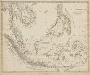
Sold2017Eastern Islands Or Malay Archipelago Map, 1836Eastern Islands Or Malay Archipelago. Baldwin & Cradock/S.D.U.K. 1836-12-01. Drawn from authorities Horsburgh, Raffles, Crawfurd, Duperray, Laplace &c. Printed by Russell, Penge. Please note that thisSee Sold Price
Sold2020MALAY ARCHIPELAGO Indonesia Malaysia PhilippinesTITLE/CONTENT OF MAP: 'EASTERN ISLANDS OR THE MALAY ARCHIPELAGO. Sumatra, Java, Borneo, etc' The top image on the right hand side shows the entire map. To view a close up of the map showing the levelSee Sold Price
Sold2020MALAY ARCHIPELAGO Indonesia Malaysia PhilippinesTITLE/CONTENT OF MAP: 'EASTERN ISLANDS OR THE MALAY ARCHIPELAGO. Sumatra, Java, Borneo, etc' The top image on the right hand side shows the entire map. To view a close up of the map showing the levelSee Sold Price
Sold2018Eastern Islands Or Malay ArchipelagoMap: Eastern Islands Or Malay Archipelago Date: 1852 Cartographer: WALKER, J. & C. Publisher: GEORGE COX/S.D.U.K. Size (inches): 12.5X16 Map showing southern Siam, Archipelago Filipino, Celebes, BorneSee Sold Price
Sold2022Earl, The Eastern Seas w/ four mapsHeading: Author: Earl, George Windsor Title: The Eastern Seas, or Voyages and Adventures in the Indian Archipelago in 1832-33-34, Comprising a Tour of the Island of Java- Visits to Borneo, the MalaySee Sold Price
Sold2018SDUK: Antique Map of Greece, Ionian Islands, 1845Title/Content of Map: 'GREECE'. United States of the Ionian Islands. Peloponnese Cyclades. Date Printed: 1845 Image Size: Approx 33.5 x 39.5cm, 13.25 x 15.5 inches (Large) Type: Antique steel engravedSee Sold Price
Sold2018SDUK: Antique Map of British West Indies Islands, 1830The British Islands in the West Indies The typically detailed SDUK composite map of British possessions in the Caribbean. The large central map of Jamaica is surrounded by fourteen inset maps of indivSee Sold Price
Sold2018SDUK: Antique Map of Europe, 1845TITLE/CONTENT OF MAP: 'EUROPE; inset table of population by country' The map shows Lombardia-Venetia as part of the Austrian Empire, the independent Ionian Islands, and Turkish Crete DATE PRINTED: 184See Sold Price
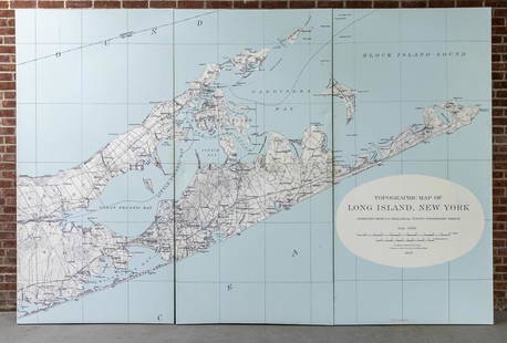
Sold2022Three Panel Water Current Map of Eastern Long Island on Canvas with FrameOver scaled Eastern Long Island water current map on three panel canvas, strengthened on frame. Please note of wear consistent with age. Each panel measures 48"W x 2"D x 96"H.See Sold Price
Sold2024Siam and the Malay Archipelago. Indonesia Indochina Philippines. TIMES 1895 mapTITLE/CONTENT OF MAP: 'Siam and the Malay Archipelago' DATE PRINTED: 1895 IMAGE SIZE: Approx 38.5 x 25.5cm, 15.25 x 10 inches (Large) TYPE: Antique colour atlas map CONDITION: Good; suitable for framiSee Sold Price
Sold2018Bellin: Antique Map of Maluku Islands, 1740Title/Content of Map: Maluku Islands of Eastern Indonesia Date Printed: 1740-70's Cartographer: J.N. Bellin & J.F. La Harpe Material/Medium: Paper Size: 6" x 9 3/4" Copperplate engraved. Published inSee Sold Price
Sold2021Antique Map of North Eastern United StatesMap of North Eastern of the United States, Asher and Adams, signature to lower right reads Asher & Adams’ New Hampshire, Vermont, Massachusetts, Rhode Island and Connecticut, subject a map of EasterSee Sold Price
Sold2023New Zealand Sandwich Galapagos Islands. Papuan Archipelago. Melanesia 1859 mapNew Zealand. // Sandwich Islands, or Hawaiian Group, // Galapagos Islands // Papuan Archipelago' by John Bartholomew (1859). Antique engraved atlas map with original hand colour/color, 37.0 x 53.5cm,See Sold Price
Sold2021MALAY ARCHIPELAGO/EAST INDIA ISLANDS PhilippinesTITLE/CONTENT OF MAP: 'Malay Archipelago or East India Islands' Vignettes: Victoria Mount - New Guinea; Near Sarawak - Borneo; Natives of New Guinea; The Bee Bear. The map covers the area from Burma aSee Sold Price
Sold2019BRITISH INDIA 'Eastern Provinces'. Ceylon BurmahTITLE/CONTENT OF MAP: 'India the Eastern Provinces; Inset Map of the Island of Ceylon' DATE PRINTED: 1863 IMAGE SIZE: Approx 45.5 x 31.0cm, 18 x 12.25 inches (Large) TYPE: Antique map with original ouSee Sold Price
Sold20241756 The Remote Chilean Juan Fernandez Archipelago, Eastern Robinson Crusoe Island, by G. AnsonTitle: 1756 The Remote Chilean Juan Fernandez Archipelago, Eastern Robinson Crusoe Island, by G. Anson Date/Period: 1756 Materials: Copper plate engraved Size: 17 1/2? x 20? This map depicts the remotSee Sold Price
Sold20232 Antique Books: Wallace, J.G. WoodA lot of 2 antique books, one entitled "The Malay Archipelago" by Alfred Russel Wallace dated 1886 with a fold-out map in very good condition, and "Natural History" by J. G. Wood dated 1897, with 480See Sold Price
Sold2018Baldwin & Cradock/SDUK: Empire of Japan, 1835Empire of Japan The highly detailed Japan map from the SDUK atlas with insets of Nagasaki Harbour and the "Eastern Point of Yeso (Hokkaido island)." Beneath the title are notes identifying Yedo (todaySee Sold Price
Sold2017SDUK: Antique Map of Southwestern USA, 1846CENTRAL AMERICA, SHEET II., INCLUDING TEXAS, CALIFORNIA AND THE NORTHERN STATES OF MEXICO' The map, published in 1846, shows the Republic of Texas as an independent state as it existed between 1836 anSee Sold Price
Sold2018SDUK: Antique Map of St Petersburg, 1847TITLE/CONTENT OF MAP: 'ST PETERSBURG' DATE PRINTED: 1847 IMAGE SIZE: Approx 34.0 x 40.0cm, 13.25 x 15.75 inches (Large) TYPE: Antique steel engraved map with original outline hand colouring. Inset: PaSee Sold Price
Sold2018SDUK: Antique Map of Boston & Charlestown, 1847Title/Content of Map: 'BOSTON WITH CHARLESTOWN AND ROXBURY' Antique town city map plan Date Printed: 1847 Image Size: Approx 39.0 x 32.0cm, 15.25 x 12.75 inches (Large) Type: Antique steel engraved maSee Sold Price
Sold2017SDUK: Antique Map, City Plan of Philadelphia, 1847Title/Content of Map: 'PHILADELPHIA' Antique town city map plan. Inset US Bank, Exchange. Date Printed: 1847 Image Size: Approx 39.5 x 31.5cm, 15.5 x 12.5 inches (Large) Type: Antique steel engraved mSee Sold Price
Sold2022Antique map Eastern North AmericaAntique map of Eastern North America. Overall with frame. Early 20th century. 22 1/2"h x 25 1/4"wSee Sold Price
Sold2017Neele: Antique Map Islands of the Pacific Ocean, 1817Map: Map of the Islands in the Pacific Ocean Publication Date: 1817 Cartographer: NEELE, sc. Publisher: THOMSON'S NEW GENERAL ATLAS Size: Folio – 19.50 H x 23.75 W Inches From a famous Scottish atlaSee Sold Price
3 days LeftJasper52BRITISH WEST INDIES Jamaica Trindad Antilles Virgin Cayman Islands SDUK 1844 map$160
3 days LeftJasper52BRITISH WEST INDIES. Jamaica Antilles Virgin Cayman Islands. SDUK 1844 old map$160
4 days LeftNY Elizabeth FIRST US EDITION OF 1869 MALAY ARCHIPELAGO BY A.WALLACE, ANTIQUE ILLUSTRATED WITH MAPS$100
3 days LeftActivity AuctionsAntique 1787 French Maritime Hydrography Map Eastern Coast United States M Bonne$150
Featured3 days LeftJasper52The Bahamas, Cuba & Bermuda "or Summer Islands". THOMSON 1817 old antique map$190
3 days LeftJasper52WEST INDIES Caribbean Windward Leeward Islands Barbados Pirates? MALLET 1683 map$240
3 days LeftJasper52Windward or South Caribbean Islands. Barbados St. Lucia Trinidad. LOWRY 1860 map$55(1 bid)
3 days LeftJasper52Leeward Islands. Cuba, Hayti/Haiti or Santo Domingo, Puerto Rico. LOWRY 1859 map$110
Featured3 days LeftJasper52British West Indies. Virgin Leeward Windward Islands. Bermuda. SWANSTON 1860 map$120
3 days LeftJasper52Puerto Rico & Virgin Islands. Haiti, Hispaniola or St. Domingo. THOMSON 1817 map$140
3 days LeftJasper52Amér Sep Porto Rico #69 Puerto Rico & Virgin Islands VANDERMAELEN 1827 old map$140
3 days LeftJasper52Puerto Rico & Virgin Islands. Haiti, Hispaniola or St. Domingo. THOMSON 1817 map$140
3 days LeftJasper52West Indies. Caribbean islands Antilles Gulf of Mexico Florida. THOMSON 1830 map$160
3 days LeftJasper52Guadaloupe Archipelago. Marie-Galante Iles des Saintes. Lesser Antilles 1885 map$15
3 days LeftJasper52West India Islands. West Indies Caribbean Jamaica Antilles. BARTHOLOMEW 1882 map$35