Sold20181573 Map of the Siege of La Rochelle -- [Untitled]Title/Content of Map: 1573 Map of the Siege of La Rochelle -- [Untitled] Siege of La Rochelle Date Printed: 1573 c. Cartographer: Anonymous Size: 9 x 11.1 in. A very interesting map of the Siege of LaSee Sold Price
Sold202417TH C. ANTIQUE MAP SIEGE OF LA ROCHELLE, FRANCE, FRAMED"Seige et Reddition de La Rochelle, Octobre 1628", handcolored engraving on wove paper, Claes Jansz. Visscher (II), (workshop of), Germany, 1627 - 1629. In gilt molded frame, matted under UV non-glareSee Sold Price
Sold2017Late 16th Century Maps, Incl. Siege of La Rochelle &Two maps on one sheet. Hand-colored map of Ghent (approx. 8.5 x 11 in.), tipped onto reverse side of page with map of the Siege of La Rochelle (approx. 8.25 x 11 in. plate size). Both maps printed witSee Sold Price
Sold2023The Siege of La Rochelle (1631) from Jacques CallotFramed Print of The Siege of La Rochelle from Jacques Callot , war-events during the 14-month siege of La Rochelle in France in 1627-1628. It was the culmination of the tensions bSee Sold Price
Sold201617th century politics.- - [Index of events in 1627 and[Index of events in 1627 and 1628], manuscript, c. 160pp. excluding blanks, unbound, 8vo, [19th century]. Mentions the siege of La Rochelle, William Laud Archbishop of Canterbury, Sir Thomas Roe etc.See Sold Price
Sold2021FRAMED PRINTS, PHOTOS AND 1657 MAP OF ROCHELLEThe collection includes. 1. Town view map of Poitou-Charentes, La Rochelle. Printed in Frankfurt by Caspar Merian in 1657. 2. A pencil signed woodcut signed Raymond Enard. 3. A watercolor on paper sigSee Sold Price
Sold2019Five Maps by the Hydrographic Office U. S. Navy,Five Maps by the Hydrographic Office U. S. Navy, consisting of "Pertuis D'Antioche and Approaches to La Rochelle and Rochefort," 1922, H. - 29 3/4 in., W. - 42 in.; "France North Coast- Port of CherboSee Sold Price
Sold20231893 Civil War Map of Siege of Vicksburg and Vicksburg to Jackson, Miss. -- …Siege of Vicksburg …Title: 1893 Civil War Map of Siege of Vicksburg and Vicksburg to Jackson, Miss. -- …Siege of Vicksburg … [with] …Country Between Milliken's Bend, LA and Jackson, Miss… [Plate XXXVI] CartographSee Sold Price
Sold2016Map of New York Bay. North America. 1839.Print of steel engraving titled „Plan de la baie de New-York“.Drawn by unknown.Engraved by Blondeau.From „Etats-Unis D‘Amerique by M. Roux de Rochelle. Published by Firmin didot freres. Paris.See Sold Price
Sold2017Matain a la Rochelle by Marcel MoulyMatain a la Rochelle by Marcel Mouly Original Oil on Canvas, Circa 1988 16 x 20 in, Framed Signed by Artist, Certificate of Authenticity Excellent Condition Please note that this lot has a confidentiaSee Sold Price
Sold2022PAUL VICTOR JULES SIGNAC (FRANCE, 1863-1935)"La Rochelle, 1911", watercolor and graphite on paper, pencil signed, dated and titled, labels verso from Mercury Gallery in London, Pitt & Scott of London and Nohra Haime Gallery of NYC. Original (noSee Sold Price
Sold2020Untitled. [Map of the United States With TwelveTitle/Content of Map: Untitled. [Map of the United States With Twelve Portraits] Cartographer: BOYNTON'S STYLOGRAPHY Date: 1861 Publisher: H.H. LLOYD & CO. Size: 27.75Height - 25.5Width Not in StephenSee Sold Price
Sold2022EUGÈNE FROMENTIN ARABER VOR EINER OASEEUGÈNE FROMENTIN 1820 La Rochelle - 1876 Ibid. Arabs at an oasis Oil on wooden panel. 12 x 20.5 cm. Signed (hardly legible) lower right. Verso: On label on panel handwritten indicated. Part. min. rSee Sold Price
Sold2018Atlas with 36 colored maps. Les Tablettes guerrieres.Rare Atlas with 36 colored maps. LA FEUILLE D.; de. Les Tablettes guerrieres, ou Cartes choisies pour la commoditè des officiers et des voyageurs. Contenant toutes les Cartes gènèrales du Monde.AmsSee Sold Price
Sold2020UGO LA PIETRA Untitled.Untitled. 1963. Mixed media on canvas. Cm 80,00 x 100,00. Signature and year lower right. At the back signature, year and Premio San Fedele 1963 label.See Sold Price
Sold2021Prefete Duffaut (Haitian/Haiti) La Siren OfferingsPrefete Duffaut (Haitian/Jacmel, 1923-2012) Untitled (La Siren Offerings), dated 3/7/57 Oil on masonite 24 x 28 1/2 inches Framed dimensions: 30 x 35 inches Provenance: Bob Brictson Estate Lot essay:See Sold Price
Sold2021FREDERIC BRULY BOUABRE (1923 - 2014, IVORIAN) Untitled,FREDERIC BRULY BOUABRE (1923 - 2014, IVORIAN) Untitled, (La Joie de Vivre). (Group of 35 cards) Ballpoint pen ink and colored pencil on card. Signed, FB Bouabre, and dated, 4-2-2009, on verso of each.See Sold Price
Sold2021A COLONIAL MAP, "Carte de la Louisiane et du Cours duA COLONIAL MAP, "Carte de la Louisiane et du Cours du Mississipi," PARIS, JUNE 1718, hand colored engraving on paper, "Dressée sur un grand nombre de Mémoires entr'autres sur ceux de Mr. le Maire paSee Sold Price
Sold201818th C. Spanish Oil, Map of the Siege of BarcelonaContinental School, likely Spanish, late 18th century Overhead landscape painting depicting a stylized map view of Barcelona as seen in 1705, bearing inscription loosely translating to "The Viceroy VeSee Sold Price
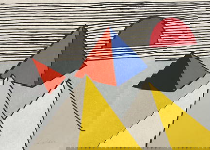
2024Alexander Calder - Untitled from La Memoire ElementaireArtist: Alexander Calder Title: Untitled from La Memoire Elementaire Year: 1976 Dimensions: 20 3/8 x 28 1/4 in. Publisher: Editions de la Difference, Paris Suite:</See Sold Price
Sold2022(HAWAII.) Group of 7 eighteenth and nineteenth century engraved maps.(HAWAII.) Group of 7 eighteenth and nineteenth century engraved maps. Vp, vd - La Perouse, after. Chart of the Parts of the Sandwich Islands. / Chart of the Sandwich Islands. 20¾x16¾ inchesSee Sold Price
Sold2022Ismael de la Serna Spanish, 1898-1968 Untitled, 1941Ismael de la Serna Spanish, 1898-1968 Untitled, 1941 Signed and dated De La Serna 41 (lr) Oil on Masonite 36 x 28 inches (91.4 x 71.1 cm) Provenance: Sale; Gallery 68 C The Collection of Dr. Thomas ChSee Sold Price
Sold2017de la Rochette/Faden: Antique Map Lesser Antilles, 1784Map: A Chart of the Antilles, or: Charibbee, or: Caribs Islands, with the Virgin Isles Cartographer: De la Rochette/Faden Place & Date: London / 1784 Size: 18" x 20 3/8" Condition: b&w (except for wasSee Sold Price
Sold2021Bertil Vallien Untitled, from the Maps series, c.1990'sBertil Vallien (Swedish, b. 1938) Untitled, from the Maps series, c. 1990's Sand-cast glass relief and mixed media on iron display stand 21.5 x 22 x 8 (in) Incised B Vallien, back of glass elementSee Sold Price
5 days LeftDane Fine Art AuctionsAlexander Calder - Untitled from La Memoire Elementaire$1,200(1 bid)
6 days LeftRago Arts and Auction CenterHubert Denis Etcheverry, Untitled (View of Hotel de la Marine, Paris)$800
4 days LeftJasper521753 Robert de Vaugondy Map of Central France -- Gouvernemens Generaux De La Marche, Du Limosin Et$45
May 14Fleischer's Auctions1755 Map Partie de l'Amerique Septentrionale, qui comprend Le Cours de L'Ohio...$200(3 bids)
5 days LeftHunt and Peck Estate Services, Inc.Jacques Nicolas Bellin Map Of Western Part Of New France Or Canada$200(1 bid)
May 12Schilb Antiquarian Rare Books1844 Siege of Gibraltar American Revolution SPAIN France Drinkwater MAP History$1(1 bid)
5 days LeftHunt and Peck Estate Services, Inc.ANTONIO ZATTA (ITALIAN, 18TH CENTURY) MAP OF VIRGINIA$80(2 bids)
6 days LeftHermann Historica GmbH"Operation Chariot" - a military map of the 22nd Naval Flak Regiment, March 27/28, 1942€720
5 days LeftHunt and Peck Estate Services, Inc.ANTONIO ZATTA (ITALIAN, 18TH CENTURY) MAP OF VIRGINIA$70(1 bid)
2 days LeftAmbrosiana Casa d'asteMAHLANGU Esther, Untitled, 2009, acrylic on canvas, cm 89,5x118,5€6,000


![1573 Map of the Siege of La Rochelle -- [Untitled]: Title/Content of Map: 1573 Map of the Siege of La Rochelle -- [Untitled] Siege of La Rochelle Date Printed: 1573 c. Cartographer: Anonymous Size: 9 x 11.1 in. A very interesting map of the Siege of La](https://p1.liveauctioneers.com/5584/124870/63536014_1_x.jpg?height=310&quality=70&version=1531863645)


![1573 Map of the Siege of La Rochelle -- [Untitled] First Image](https://p1.liveauctioneers.com/5584/115198/59163890_1_x.jpg?height=300&quality=1&version=1516150533&width=300)
![1573 Map of the Siege of La Rochelle -- [Untitled] First Image](https://p1.liveauctioneers.com/5584/115198/59163890_1_x.jpg?height=300&quality=95&version=1516150533&width=300)


![17th century politics.- - [Index of events in 1627 and: [Index of events in 1627 and 1628], manuscript, c. 160pp. excluding blanks, unbound, 8vo, [19th century]. Mentions the siege of La Rochelle, William Laud Archbishop of Canterbury, Sir Thomas Roe etc.](https://p1.liveauctioneers.com/410/87791/45004065_1_x.jpg?height=310&quality=70&version=1461161196)


![1893 Civil War Map of Siege of Vicksburg and Vicksburg to Jackson, Miss. -- …Siege of Vicksburg …: Title: 1893 Civil War Map of Siege of Vicksburg and Vicksburg to Jackson, Miss. -- …Siege of Vicksburg … [with] …Country Between Milliken's Bend, LA and Jackson, Miss… [Plate XXXVI] Cartograph](https://p1.liveauctioneers.com/5584/293457/155766038_1_x.jpg?height=310&quality=70&version=1687903812)


![Untitled. [Map of the United States With Twelve: Title/Content of Map: Untitled. [Map of the United States With Twelve Portraits] Cartographer: BOYNTON'S STYLOGRAPHY Date: 1861 Publisher: H.H. LLOYD & CO. Size: 27.75Height - 25.5Width Not in Stephen](https://p1.liveauctioneers.com/5584/168933/85173928_1_x.jpg?height=310&quality=70&version=1589924071)