Sold201612 Vols: Map reference, atlas facsimile.[Map Reference/Atlas facsimile] 11 Titles (12 Vols). ++ SPIEGEL DER ZEEVAERDT, VANDE NAVIGATIE DER WESTERSCHE ZEE… (Lausanne: Sequoia, 1964). Facsimile of 1584 edition. Minor stains and surface wearSee Sold Price
Sold2022(12) Vol. 1967 -1968 volume set of Le Grande Atlas facsimile addition Published in AmsterdamThe 3rd. Centenary Addition of Johan Blaeu's Cosmographies, Complete 12 Vol. Set in original slip Covers and boxes. Incls: 609 Double Page Maps (Some in Color)  Published by Theatrvm OrSee Sold Price
Sold202112 VOLS. HISTORICAL WRITINGS OF JOHN FISKE, 1902The Historical Writings of John Fiske, complete in (12) volumes; Standard Library Edition illustrated with many photogravures, charts, maps, facsimiles, etc.; pub. Houghton Mifflin, 1902. Dimensions:See Sold Price
Sold202112 VOLS. HISTORICAL WRITINGS OF JOHN FISKE, 1911The Historical Writings of John Fiske, complete in (12) volumes; Standard Library Edition illustrated with many photogravures, charts, maps, facsimiles, etc.; pub. Houghton Mifflin, dated 1902-1911. DSee Sold Price
Sold2023Bibical Atlas and Gazetteer 1890Bibical Atlas and Scripture Gazetteer With Geographical Descriptions and Copious Bible References. The Maps by Henry Coutrier, F.R.G.S. 12 1/2" x 10" canvas hardcover Published: The Religious Tract SoSee Sold Price
Sold2021Courtier, Henry 1890 Biblical Atlas, 12 Maps"Biblical Atlas and Scripture Gazetteer" Maps by Henry Courtier. London: The Religious Tract Society, 1890. Complete with 12 Color Lithograph Maps of the Holy Land. Brown Cloth with Gilt Title. SpineSee Sold Price
Sold2018Mitchell’s New Reference Atlas.[Maps] Mitchell’s New Reference Atlas. Philadelphia: E.H. Butler & Co., 1865. Three-quarter leather over maroon cloth, gilt-stamped cover, gilt title on banded spine, marbled endpapers. Fifty-siSee Sold Price
Sold2022Public Health.- Houses of Parliament. First [-Third] Report of the Commissioners...into...PreventingPublic Health.- Houses of Parliament. First Report of the Commissioners...into...the Best Means of Preventing the Pollution of Rivers (River Thames), 2 vol., 12 maps & plans, most folding including laSee Sold Price
Sold2020Ogilby, John 1939 Facsimile Atlas. Road Maps, UK"Britannia, Volume the First..." Facsimile Edition of the 1675 Edition by John Ogilyby & Alexander Duckham, 1939. Oblong 4to (315 x 250mm) 100 Maps printed both sides on 50 sheets. Cloth bound, a littSee Sold Price
Sold2021Uncommon map of Texas – Mitchell/Butler 1868Title: Uncommon map of Texas – Mitchell/Butler 1868 Description: "Copperplate engraved map from Mitchell’s New Reference Atlas, a somewhat elusive school geography. Published by E. H. Butler in 18See Sold Price
Sold20211887 Map of Quebec CityAuthor: Watson Title: 1887 Map of Quebec City Medium: Ink on Paper Dimensions: 14.5"X11.5" Map of Quebec City, dated 1887. Engraved for Watson's General Atlas. Double folio map. Reference key locatedSee Sold Price
Sold2019Historic J. Bartholomew Map, Folio from LibraryDescription: Folio from the Library Reference Atlas, page 34, Map of Austria-Hungary by John Bartholomew & Co. Born in Edinburgh in 1831, John Bartholomew was a noted Scottish cartographer. From humblSee Sold Price
Sold2023Atlas Maior, vol 4, map 45 - Joan Blaeu, 1667 Antique Copper Engraving Detailed Map. Rhenolandiae etAtlas Maior, vol 4, map 45 - Joan Blaeu, 1667 Antique Copper Engraving Detailed Map. Rhenolandiae et Amstellandiae exactißima Tabula. Original antique copper engraving, hand colored in outline andSee Sold Price
Sold2019VOL. VLADIMIR KAGAN REFERENCE CATALOGVOL. VLADIMIR KAGAN REFERENCE CATALOG W/ SIGNED FACSIMILE LETTER MARCH 11, 1999See Sold Price
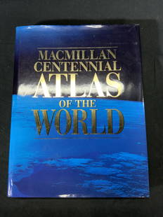
Sold2022Macmillan Centennial Atlas of the World BookMacmillan Centennial Atlas of the World. Published by Macmillan, 1997. Wear to cover and jacket consistent with exposure. Measures approx. 12 x 15.5 inches. Atlas, map, topography, photo book, referenSee Sold Price
Sold2022Bindings.- Grote (George) A History of Greece, 12 vol., 1846; and others similar (44)Bindings.- Grote (George) A History of Greece, 12 vol., half-titles, vol. 12 with engraved portrait frontispiece, maps, some folding, one or two with short tears and expert linen repairs, scattered faSee Sold Price
Sold2018ANTONIO ZATTA (ITALIAN, 18TH CENTURY) MAP / ATLAS OFANTONIO ZATTA (ITALIAN, 18TH CENTURY) MAP / ATLAS OF NORTH AMERICA, SET OF 12, hand-colored, on laid paper, comprising title page lettered in part "LE / COLONIE UNITE / DELL' / AMERICA SETTENTR'LE." aSee Sold Price
Sold2019Harmonia Macrocosmica Atlas Map Set [Cosmos]The 1963 Map Reprint set with title Harmonia Macrocosmica Atlas. In VG/EX-EX+ condition, and includes 12 maps and one title page (scuffed) measuring 18.5-in. x 22.5-in sheet size. Also included is a bSee Sold Price
Sold2023Gray's Atlas Map of MaineTitle: Gray's Atlas Map of Maine Publication Date: 1873 Cartographer: Gray, Ormando W. Publisher: Stedman, Brown & Lyon Height: 15.3 Width: 12 Map showing counties separately colored, towns, townshipsSee Sold Price
Sold2022Powell (Anthony) [A Dance to the Music of Time], 12 vol., first editions, 1951-75.Powell (Anthony) [A Dance to the Music of Time], 12 vol., first editions, light browning to endpapers, original cloth, dust-jackets, A Question of Upbringing first state, jacket in facsimile, some ligSee Sold Price
Sold2022Marvels of the American West, Iroquois Lore, etc. 12 vols.Thayer, William M. Marvels of the New West: A Vivid Portrayal of the stupendus Marvels in the vast Wonderland West of the Missouri River. Illustrated with over 359 engravings and maps. Norwich, Conn.:See Sold Price
Sold2021(12) VOL. EPOCHS OF HISTORY, ED. MORRIS, 19TH C.(12) vol. Epochs of History, edited by Edward E. Morris, M.A. Pub. Scribner, Armstrong, & Co., New York. c. 1860-1875. Few volumes with pull-out maps. Partial leather binding, marbled covers and pageSee Sold Price
Sold2016Leather Bound Book Lot, Easton Press"History of England" in 10 vols, complete, 1993, together with 12 vols Lives of English Royalty (1996), together with Atlas Shrugged & The Fountainhead (4 vols), 3 vols Wodehouse, "Muhammad" by RobinsSee Sold Price
Sold2017Mitchell: Antique Map of Illinois, 1869Title/Content of Map: Illinois by Mitchell Date Printed: 1869 Cartographer: Augustus S. Mitchell Material/Medium: Paper Size: 15" x 12" Hand colored engraved Map. From 'Mitchell's New General Atlas.'See Sold Price
5 days LeftJasper52West India Islands. West Indies Caribbean Jamaica Antilles. BARTHOLOMEW 1882 map$30
5 days LeftJasper52Antilles, Golfe du Mexique & Amérique Centrale. Caribbean. MALTE-BRUN c1871 map$35
6 hrs LeftTrillium Antique Prints & Rare BooksDe Jode, Rare, pub. 1593 - Map of Part of Germany (Sveviae Utriusq cum Germicae tum Rheticae$100
6 hrs LeftTrillium Antique Prints & Rare BooksDe Jode, Rare, pub. 1593 - Map of Austria (Austriae Ducatus Seu Pannoniae Superioris?)$100
May 16Potter & Potter AuctionsBODLEY, Helen (1906 – 1997). A Map of Concord / The Old Mus...$400
3 days LeftRobinhood AuctionsDC Comics, Batman "Rogues Gallery" Numbered Limited Edition Giclee with Certificate of Authenticity.$70
May 12Hoch LTD.Twelve Americana Reference Books - Antique American Furniture, Philadelphia, Boston, Colonial,$50(1 bid)


![12 Vols: Map reference, atlas facsimile.: [Map Reference/Atlas facsimile] 11 Titles (12 Vols). ++ SPIEGEL DER ZEEVAERDT, VANDE NAVIGATIE DER WESTERSCHE ZEE… (Lausanne: Sequoia, 1964). Facsimile of 1584 edition. Minor stains and surface wear](https://p1.liveauctioneers.com/179/96603/49249208_1_x.jpg?height=310&quality=70&version=1479429231)


![Mitchell’s New Reference Atlas.: [Maps] Mitchell’s New Reference Atlas. Philadelphia: E.H. Butler & Co., 1865. Three-quarter leather over maroon cloth, gilt-stamped cover, gilt title on banded spine, marbled endpapers. Fifty-si](https://p1.liveauctioneers.com/928/124137/63148814_1_x.jpg?height=310&quality=70&version=1530051387)
![Public Health.- Houses of Parliament. First [-Third] Report of the Commissioners...into...Preventing: Public Health.- Houses of Parliament. First Report of the Commissioners...into...the Best Means of Preventing the Pollution of Rivers (River Thames), 2 vol., 12 maps & plans, most folding including la](https://p1.liveauctioneers.com/5458/260724/135800356_1_x.jpg?height=310&quality=70&version=1662479034)


![Harmonia Macrocosmica Atlas Map Set [Cosmos]: The 1963 Map Reprint set with title Harmonia Macrocosmica Atlas. In VG/EX-EX+ condition, and includes 12 maps and one title page (scuffed) measuring 18.5-in. x 22.5-in sheet size. Also included is a b](https://p1.liveauctioneers.com/5755/154409/77936384_1_x.jpg?height=310&quality=70&version=1573094011)

![Powell (Anthony) [A Dance to the Music of Time], 12 vol., first editions, 1951-75.: Powell (Anthony) [A Dance to the Music of Time], 12 vol., first editions, light browning to endpapers, original cloth, dust-jackets, A Question of Upbringing first state, jacket in facsimile, some lig](https://p1.liveauctioneers.com/5458/250450/130079850_1_x.jpg?height=310&quality=70&version=1654080007)


