Sold2019Nicolas Sanson d'Abbeville (1600-1667), "Mexique ouNicolas Sanson d'Abbeville (1600-1667), "Mexique ou Nouvelle Espagne, Nouvelle Gallice Iucatan, Panama," 1656, hand colored, H.- 15 1/2 in., W.- 22 1/2 in.See Sold Price
Sold2020Basse Lombardie Ou Sont Les Estats De Venise En ItalieTitle/Content of Map: Basse Lombardie Ou Sont Les Estats De Venise En Italie Mantove, Parme, Modene, Trente Par N. Sanson... Cartographer: SANSON, NICOLAS (1600-1667) Date: 1648 Size: 17Height - 22.5WSee Sold Price
Sold2024Sanson, Nicolas - Map of Ethiopia, Abyssinia, NubiaSanson, Nicolas (1600-1667) Map of Ethiopia, Abyssinia, Nubia Description (FR): Colorée main, texte et cartouche en latin. Description (EN): Hand colored, text and cartouche in Latin. Rapport de condSee Sold Price
Sold2022Sanson World Atlas, 1659SANSON D'ABBEVILLE, Nicholas (1600-1667). Cartes Generales de Toutes les Parties du Monde. Paris: The Author and Pierre Mariette, 1658 [but 1659]. Comparables: Arader Galleries, 2015 - $97,600; ChristSee Sold Price
Sold2020Nicolas Sanson Map of AsiaNicolas Sanson (1600-1667) "L'Asie divisee en ses Principales Regions, et ou se peuvent voir l'estendue, Des Empires, Monarchies, Royaumes, et Estats," Paris: Jaillot, ca. 1719. Hand colored map of AsSee Sold Price
Sold2018AN 1659 FRENCH MAP OF DENMARK BY NICOLAS SANSONA hand-colored map of Northern Denmark by Nicolas Sanson (1600-1667), signed Sanson and dated with a cartouche on the lower left. Sheet measures 16.25 x 21 inches. Frame measures 20.5 x 26.5 inches. WSee Sold Price
Sold2018RARE 17TH C. SANSON MAP OF LUXEMBOURGAlexis-Hubert Jaillot (c. 1632-1712); Nicolas Sanson (1600-1667) "Le Duche de Luxembourg Divise en Quarter Walon et Allemand....", hand colored engraving, published 1700 from earlier plates, Paris, frSee Sold Price
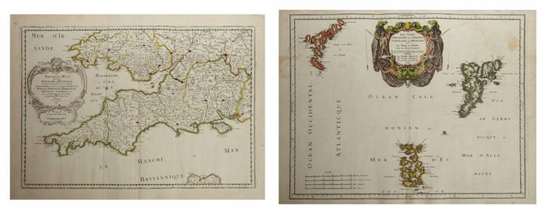
Sold2019Nicolas Sanson (1600-1667), "L'Escosse Royaume en sesNicolas Sanson (1600-1667), "L'Escosse Royaume en ses deux Principales Parties qui sont Deca, Dela le Tay, Chaque," 1665, hand colored, H. - 18 in., W. - 24 in.See Sold Price
Sold2022Antique Map of France by Nicolas SansonAntique map of France engraved by Nicolas Sanson 1600-1667, published by Covens and Mortier in Amsterdam, 18th century. Measures 20 inches x 25 inches, in good condition.See Sold Price
Sold2019Three Maps by Nicolas Sanson (1600-1667, Paris), Two-Three Maps by Nicolas Sanson (1600-1667, Paris), Two- "Carte Generalle d'Espagne .. Royaumes," 1641; together with "Gouvernement General d'Orteans Maine, le Perche, la Beauce..Gastinois," 1650, hand cSee Sold Price
Sold2019Nicolas Sanson (1600-1667), "Carte Generale des RoyaumeNicolas Sanson (1600-1667), "Carte Generale des Royaume d'Angleterre Escosse et lrlande," 1640, hand colored, H.- 17 in., W. - 24 in.See Sold Price
Sold2019Nicolas Sanson (1600-1667), "Carte General des RoyaumeNicolas Sanson (1600-1667), "Carte General des Royaume d'Anglatere Escosse et lrlande Britaniques," 1658, hand colored, H.- 17 1/2 in., W.- 24 in.See Sold Price
Sold2019Nicolas Sanson (1600-1667), "Les Isles BritanniquesNicolas Sanson (1600-1667), "Les Isles Britanniques Divisees en peuples soivant Ptolomee," 1641, hand colored, H.- 17 1/4 in., W.- 23 1/4 in.See Sold Price
Sold2019Nicolas Sanson (1600-1667), "lrlande Royaume diviseeNicolas Sanson (1600-1667), "lrlande Royaume divisee en ses quatre Provinces et ces Provinces en leurs Comtes," 1665, hand colored, H.- 18 in., W.- 24 in.See Sold Price
Sold2019Nicolas Sanson (1600-1667), "Britiannicae lnsulaeNicolas Sanson (1600-1667), "Britiannicae lnsulae inquibus albium sine," 1641, hand colored, H. - 17 in., W. - 24 in.See Sold Price
Sold2019Nicolas Sanson (1600-1667), " L'Escosse deca le TayNicolas Sanson (1600-1667), " L'Escosse deca le Tay divisee en ses Provinces tirees de touts les Carts," 1665, hand colored, H.- 18 in., W.- 24 in.See Sold Price
Sold2019Two Maps by Nicolas Sanson (1600-1667, Paris), "Isle deTwo Maps by Nicolas Sanson (1600-1667, Paris), "Isle de France, Champagne, Lorraine," 1679; together with "Le Royaume de France, Toutes ses Provinces, et ses Acquisitions, L'Espagne le Luxembourg," 16See Sold Price
Sold2019Three Maps by Nicolas Sanson (1600-1667, Paris),Three Maps by Nicolas Sanson (1600-1667, Paris), "Lespagne en Plusieurs Peuples suiant Peolomee," 1641; together with two- "Galliae Antiquae Descriptio Geographica," 1629 Geographica- H. - 17 in., W.See Sold Price
Sold2019Nicolas Sanson (1600-1667), "Amerique MeridionaleNicolas Sanson (1600-1667), "Amerique Meridionale divisee en ses Principales Parties au sont, Les Estats, Francois Castillans Portugais, Hollandois," 1691, hand colored, H.- 25 in., W.- 37 in.See Sold Price
Sold2019Two Maps by Nicolas Sanson (1600-1667, Paris), " LaTwo Maps by Nicolas Sanson (1600-1667, Paris), " La France L'Ancienne Gaule Primatiats… ar Evesches et Evesches," 1679; together with "Le Royaume de France et es Acqusitions Pays Bas L'AllemagneSee Sold Price
Sold2019Group of Three Maps by Nicolas Sanson (1600-1667,Group of Three Maps by Nicolas Sanson (1600-1667, Paris), "La Gaule en dixsept provinces Romain," 1641; together with "Gouvernment General du Lyonnois, Forez, Beavoilais," 1679; and "Gouvernment De FrSee Sold Price
Sold2019Two Maps by Nicolas Sanson (1600-1667, Paris),Two Maps by Nicolas Sanson (1600-1667, Paris), "Provinces d'West Royame d'Westsex," 1679; together with"Les Isles Orcadney, ou Orkney Farre," 1665, Orcadney- H. - 16 in., W. - 23 in., d'Westsex- H. -See Sold Price
Sold2019Nicolas Sanson (1600-1667), "Le Royaume d'Anglaterre,Nicolas Sanson (1600-1667), "Le Royaume d'Anglaterre, divise dane les sept Royaumes ou Heptarchie des Saxons; et la Principle de Galles," 1665, hand colored, H. - 18 in., W. - 24 in.See Sold Price
Sold2019Two Maps by Nicolas Sanson (1600-1667, Paris), "LeCoursTwo Maps by Nicolas Sanson (1600-1667, Paris), "LeCours de la Riviere du Rhein. Tous LeDauphin les Estats et Souverainetes," 1692; together with "Gallia Vetus ex C.lulii C aefaris comentarii descripaeSee Sold Price
13 hrs LeftJasper52Antique Felix Delamarche Vaugondy Mappemonde Double hemisphere world map 1838$95(1 bid)
13 hrs LeftJasper52Antique French Engraving Felix Delamarche set of celestial and solar system 1838$95
Oct 14Burns Auction & Appraisal LLCCard Players, Oil on Canvas, School of Jacob Duck (c.1600-1667)$90(3 bids)
4 days LeftTrillium Antique Prints & Rare BooksSanson - Map of the World (L'Hydrographie ou Description de l'Eau?)$75
4 days LeftTrillium Antique Prints & Rare BooksSanson - Map of the World (Mappe-monde ou Carte Generale due Globe Terrestre)$75
2 days LeftAlex CooperNicolas Visscher. "Orbis Terrarum Tabula Recens Emendata et in Lucem Edita Per N. Visscher,"$400
16 hrs LeftFairfield AuctionGeorge Catlin (1796-1872), North American Indian Portfolio, Abbeville Press$400
Oct 06Schilb Antiquarian Rare Books1663 1st ed Court of Rome Papacy of Pope Alexander VII Vatican Elzevier Corraro$38(2 bids)
1 day LeftLeland LittleFrançois Nicolas Martinet (French, circa 1725-1804), Two Engravings from Histoire Naturelle$50(1 bid)
1 day LeftForum AuctionsErotica.- Bretone (Nicolas Edmé Restif de la) Le Paysan perverti ou les dangers de la ville£550
2 days LeftFrost & NicklausFrench Marshal Nicolas de Catinat, 1701 Engraving by Martin Bernigeroth$90(1 bid)
Oct 26Sofe Design AuctionsRare Map with the marking of Sea of Korea/East Sea by Jacques Nicolas Bellin ? 18th Century.$100
1 day LeftForum AuctionsErotica.- [Bretone (Nicolas Edmé Restif de la)] La Paysane pervertie ou les dangers de la ville...,£260


![Sanson World Atlas, 1659: SANSON D'ABBEVILLE, Nicholas (1600-1667). Cartes Generales de Toutes les Parties du Monde. Paris: The Author and Pierre Mariette, 1658 [but 1659]. Comparables: Arader Galleries, 2015 - $97,600; Christ](https://p1.liveauctioneers.com/1968/250616/130196469_1_x.jpg?height=310&quality=70&version=1654190895)


![Erotica.- [Bretone (Nicolas Edmé Restif de la)] La Paysane pervertie ou les dangers de la ville..., (1 of 1)](https://p1.liveauctioneers.com/5458/342368/185863389_1_x.jpg?height=282&quality=70&version=1725378977)


