Sold20191764 Asia Minor Turkey and Syria Map1764 map showing Turkey with Dardanelles peninsula in detail,Syria and Mesopotamia and Cyprus. Author D'AnvilleSee Sold Price
Sold2022(ANATOLIA.) Pierre Mortier. Natolia. Asia Minor Auctore Phi. de la Rue.(ANATOLIA.) Pierre Mortier. Natolia. Asia Minor Auctore Phi. de la Rue. Large folio engraved map of Turkey, Cyprus and coastal Syria. 20¼x24¾ inches sheet size, wide margins, blank verso; orSee Sold Price
Sold2019Delamarche, Felix 1829 Pair of Maps Turkey & Asia Minor"Asiae Minoris Tabula" and "Turquie d'Europe" Copper Engraved Maps Published 1829, Paris for "Atlas de La Geographie..." by Felix Delamarche. Contemporary outline hand colour. Centre fold as publishedSee Sold Price
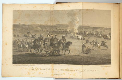
Sold2022WITTMAN, WILLIAM. Travels in Turkey, Asia-Minor, Syria, and Across the Desert into Egypt, durin...WITTMAN, WILLIAM. Travels in Turkey, Asia-Minor, Syria, and Across the Desert into Egypt, during the years 1799, 1800, and 1801.... London: Richard Phillips, 1803. 4o (265 x 210 mm). Engraved foldingSee Sold Price
Sold2017Hughes: Antique Map of Asia Minor & Syria, 1856Map: Asia Minor and the Northern Part of Syria Date: 1856 By William Hughes from Long's Classical Atlas Size: 13 x 10 inches Please note that this lot has a confidential reserve. When you leave a bidSee Sold Price
Sold2024TRAVELS IN TURKEY, ASIA MINOR, SYRIA William WOUTSTANDING TRAVEL MEMOIR OF A BRITISH PHYSICIAN WHO ACCOMPANIED THE TURKISH ARMY ON THIS 3 YEAR EXCURSION INTO EXPLORATION.. A LITERATE ANECDOTAL ACCOUNT OF EXPERIENCES AND PLACES OF UNUSUAL INTERESTSee Sold Price
Sold2019Ancient Asia Minor (Turkey)Title/Content of Map: Ancient Asia Minor (Turkey) Date: 1598/99 Cartographer: By Ruscelli Size: 11x9” Provenance: Venice Reserve: $70.00 Shipping: Domestic: Free shipping to anywhere within the contSee Sold Price
Sold20231700s MAP of ASIA MINOR ARMENIA SYRIA SYCILY PERSIA antiqueMap of Asia Minor early 18th century hand colored Size 14 1/2 by 18 3/4" Very good condition Reserve: $160.00 Shipping: Domestic: Flat-rate of $25.00 to anywhere within the contiguous U.S. InternaSee Sold Price
Sold2023Rapkin, John 1860 Pair of Maps. Turkey in Europe and Asia MinorSteel Engraved Map Published 1860 by The London Printing & Published Company, London for "The Royal Dictionary-Cyclopedia for Universal Reference" by Thomas Wright. Drawn & Engraved by John Rapkin. FoSee Sold Price
Sold2023Barclay, James 1808 Antique Map. Turkey in Europe with Asia MinorCopper Engraved Map Published 1806-09, London for "Barclay's Complete and Universal English Dictionary" by the Rev. James Barclay. Paper Size: 10 x 8 inch (26 x 21cm) Minor toning, otherwise Good CondSee Sold Price
Sold2019Natolia quae olim Asia Minor Old MapBlaeu's decorative map of Asia Minor, showing Turkey, Cyprus and the Islands in the Aegean. This attractive map shows all of Turkey, Cyprus and the Aegean Islands to a relatively high degree of accuraSee Sold Price
Sold2020Bartholomew, John 1922 Lot of 5 Maps Egypt & Holy LandIncl Egypt and The Nile, Lower Egypt, Asia Minor/Syria/Mesopotamia, Palestine and Persia. Large Lithograph Maps Published 1922 by The Times, London for "The Times Survey Atlas of the World" Maps by JoSee Sold Price
Sold2019Bartholomew, John 1922 Lot of 3 Maps of the Holy Land"Asia Minor, Syria & Mesopotamia" "Palestine" and "Persia" Large Lithograph Maps Published 1922 by The Times, London for "The Times Survey Atlas of the World" Maps by John George Bartholomew of the EdSee Sold Price
Sold2017Map of Asia Minor Tallis/Rapkin 1851Asia Minor, Turkey Cyprus Dodecanese Rhodes View Tallis/Rapkin C1851 Approx 36.5 x 26.5cm, 14.5 x 10.25 inches (Large) Asia Minor' Vignettes: Olympus; Rhodes; Ship; People. Includes Cyprus, the DodecaSee Sold Price
Sold2020ASIA MINOR. Turkey Cyprus Dodecanese. Rhodes view.TITLE/CONTENT OF MAP: 'Asia Minor' Vignettes: Olympus; Rhodes; Ship; People. Includes Cyprus, the Dodecanese and easterm Aegean islands. Rhodes and Scarpanto are indicated as being Turkish. DATE PRINTSee Sold Price
Sold2018ASIA MINOR. Turkey Anatolia. Shows Smyrna/Izmir-AydinTITLE/CONTENT OF MAP: 'Asia Minor' The map shows the first railway line constructed in Anatolia (and opened a couple of years prior to the publication of the map in 1860), between Smyrna (Izmir) and ASee Sold Price
Sold2019ANCIENT ASIA MINOR. Turkey. Cappadocia Cyprus GalatiaTITLE/CONTENT OF MAP: 'ASIA MINOR (ANCIENT)' DATE PRINTED: This map was originally published by Baldwin & Cradock in 1830; this date is printed on the map. This edition of the map was printed and publSee Sold Price
Sold2018Mallet: Antique Map of Asia Minor with Black Sea, 1683Title of the Map: 'Natolie' Shows the Black sea & Cyprus. Asia Minor Turkey. Black Sea Cyprus Rhodes. Date Printed: 1683 Image Size: Approx Overall page size 13 x 21cm approximately (5 x 8 inches); imSee Sold Price
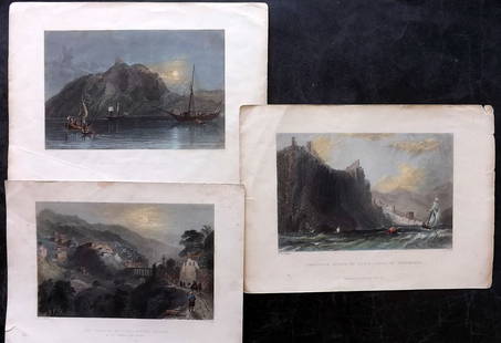
Sold2024Bartlett - Holy Land 1838 Lot of 3 Hand Col Prints. Turkey, SyriaMount Amanus, Cliffs of Alaya, and Mount Casius. Hand Colored Steel Engraving Published 1836-38, London for "Syria, the Holy Land, Asia Minor, &c." by William Bartlett. Paper Size: Up to 10.5 x 7.5 inSee Sold Price
Sold2022Antique Print - Map of Adakoy Koyu - Ankara - Turkey - Asia Minor - Joseph RouxOriginal copper engraving print originates from ”Recueil des Principaux Plans des Ports et Rades de la Mer Mediterranee …” by Joseph Roux of the edition of 1804. The charts are engraSee Sold Price
Sold2019Bartholomew, John 1922 Mixed Lot of 9 Large MapsIncl Mapping of the World, World Climate, Germany East, Southern Russia, Asia Minor/Syria/Mesopotamia, Palestine, Indian Ocean, North America - Political, North Atlantic Ocean. Large Lithograph Maps PSee Sold Price
Sold2019TURKEY. Asia Minor provinces. Karamania Adana ItchiTITLE/CONTENT OF MAP: 'TURKEY, CONTAINING THE PROVINCES IN ASIA MINOR' DATE PRINTED: 1846 IMAGE SIZE: Approx 32.5 x 42.0cm, 12.75 x 16.5 inches (Large) TYPE: Antique steel engraved map with original oSee Sold Price
Sold2018TURKEY. Asia Minor provinces. Karamania Adana CyprusTITLE/CONTENT OF MAP: 'TURKEY, CONTAINING THE PROVINCES IN ASIA MINOR' DATE PRINTED: 1846 IMAGE SIZE: Approx 32.5 x 42.0cm, 12.75 x 16.5 inches (Large) TYPE: Antique steel engraved map with original oSee Sold Price
Sold2017Mercator (Gerard) - Atlas sive Cosmographicae,Editio Quinta, engraved pictorial title, prelims, 49 double-page maps, including Asia, Russia, Turkey, Lithuania, Asia Minor and Persia, regions of Italy Spain, Germany and Eastern Europe, and 11 singSee Sold Price
May 09Hunt and Peck Estate Services, Inc.1696 Jaillot Mapping The Ottoman Empire at the End of the 17th Century$140
5 days LeftJasper521680 Jansson/Duval Map of Middle East -- Tabula Itineris Decies Mille Graecorum sub Cyro Contra$140(1 bid)
May 09Hunt and Peck Estate Services, Inc.Abraham Ortelius Natoliae, Quae Olim Asia Minor, Nova Descriptio$100
5 days LeftJasper52Ancient Persia, Achaemenid Empire, Various Rulers, 485-375 B.C.E. Silver Siglos, King Running$110
May 09Rail & Road Auctions1882 New York, Ontario and Western / New York West Shore and Buffalo Railroad Map$40
Freeman's | HindmanCONFLICT IN THE MIDDLE EAST & SOUTH ASIA | A group of 9 works, most INSCRIBED TO ALBRIGHT.$50(1 bid)
2 days LeftBid Again Auctions (American Space Museum)Original NASA Lunar Earth Side Mosaic Map 1962$50
May 09Rail & Road Auctions1951 Chicago, Milwaukee, St. Paul & Pacific Railroad Wall Map - Route of the Hiawathas$50
2 days LeftTrillium Antique Prints & Rare BooksPtolemy & Magini, pub. 1620 - Map of the Ancient World with Africa, Europe, Asia$50


![Finlandia / Suomi. 1949. [Five copies]. Helsinki: Kustannus... (1 of 1)](https://p1.liveauctioneers.com/928/325952/175495564_1_x.jpg?height=282&quality=70&version=1712935174)


