Sold20161812 Handcolored Map Tribe of Manasseh Holy Land1812 Hand Colored Map of the Holy Land “The Tribe of Manasseh beyond Jordan”. Printed for Mathews and Leigh, measures 9 x 11.5”. Free shipping within the continental USSee Sold Price
Sold20151812 Hand Colored Map Holy landHandcolored map of the “Tribe of Manasseh” in the Holy land , printed by Mathews and Leigh, 1812. Measures 11 x 9”.See Sold Price
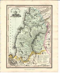
Sold20151812 Handcolored Map of Holy LandHand colored map of the “Tribe of Gad” in the Holy land , printed by Mathews and Leigh, 1812. Measures 11 x 9”.See Sold Price
Sold20151812 Hand Colored Map of Holy landHand colored map of the “Tribe of Asher” in the Holy land , printed by Mathews and Leigh, 1812. Measures 9 x 11”.See Sold Price
Sold2019Engraved Map of the Holy Land, 1613Detailed map of the lands of the Tribe of Zabulun, Issachar and Manasseh in the Holy Land, from Christian van Adrichom's Theatrum Terrae Sanctae, first published in 1590 with subsequent edition in 159See Sold Price
Sold20171864 hand-colored map of Palestine by S. AugustusA beautiful example of S. A. Mitchell Jr.'s 1864 map of Palestine, Israel or the Holy Land. Updated from the 1860 variant with new details, an inset of Jerusalem, and a new 1864 copyright. Includes boSee Sold Price
Sold2022Theodore Danckerts (Dutch, 1663-1727) - Holy Land Map Divided to Tribes, Etching, Amsterdam, CaTheodore Danckerts (Dutch, 1663-1727) - The Holy Land Map Divided to Tribes, Colored Etching, Amsterdam, Circa 1690. Title: Judaea sive Terra Sancta quae Israelitarum In Suas Duodecim Tribus DestincatSee Sold Price
Sold2022Map of the Holy Land, Hand Colored Etching, Paris, 1717.Map of the Holy Land, Hand Colored Etching, Paris, 1717. Title: Terre des fils de Chanaan dont ils s'emparerent sur les descendants de Sem Cartograph: Moullart Sanson. Engraver: Delahaye. Plate: 35.5xSee Sold Price
2018Seutter: Antique Map of Holy Land, 1740Title/Content of Map: Holy Land by Sutter Date Printed: c1740 Cartographer: Matthaus Seutter Material/Medium: Paper Size: 24" x 19 1/2" Original hand colored Copperplate engraved. Published in AugsburSee Sold Price
Sold2023Antique Map of Holy Land Palestine Map, Israel Twelve Tribes Jerusalem 1833 Lapie Large Folio MapAntique Holy Land Palestine Israel Twelve Tribes Jerusalem Antique 1833 Lapie Large Folio MapAntique Holy Land Palestine Israel Twelve Tribes Jerusalem 1833 Lapie Large Folio Map. Carte de la PalestinSee Sold Price
Sold2016Map of Holy Lands. 1854.Print of hand colored steel engraving .Drawn by L. Dussieux. Engraved by unknown.From „Atlas General De Geographie physique, politique et historique par L. Dussieux. Atlas de Geographie ancienne, duSee Sold Price
2018Mitchell: Antique Map of Palestine, 18641864 hand-colored map of Palestine by S. Augustus Mitchell. A beautiful example of S. A. Mitchell Jr.'s 1864 map of Palestine, Israel or the Holy Land. Updated from the 1860 variant with new details,See Sold Price
Sold2021Sebastian Munster (German, 1488-1552) - Holy Land andSebastian Munster (German, 1488-1552) - Holy Land and Cyprus Map, Woodcut, Circa 1550. Hand colored woodcut. Printed in Basle by Petri. Sheet: 31.5x19.5cm. Plate: 26.5x16.5cm.See Sold Price
Sold2016c. 1670 Engraved Holy Land + Mediterranean MapHistoric Maps c. 1670 Engraved Map of the Holy Land & Mediterranean Sea c. 1670, Historic Hand-Colored Engraved Map entitled: “Terra Sancta sive Promissionis olim Palestina recens delineata,” by FSee Sold Price
Sold2017Stackhouse: Antique Map of Judaea / Holy Land, 1783Map: Judaea or the Holy Land Date Printed: 1783 Cartographer: Thomas Stackhouse Material/Medium: Paper Size: 16" x 20" Condition: Excellent Hand colored. Coperplate engraved. Published in London, PublSee Sold Price
Sold2023Antique German Map of the Holy LandGerman, circa 1730, hand-colored engraving on paper depicting the path of the Children of Israel after their escape from Egypt, 16 1/2" x 20 1/2" sheet size, 21" x 24 1/2" mat size.See Sold Price
Sold2015Map of the Holy Land. Israel. 1835.Print of hand colored steel engraving titled „Carte de la Terre Sainte.Author C. V. Monin.Engraved by unknown.From the „Atlas Universel de Geography by C. V. Monin. Parsi. 1835.The Holy Land as aSee Sold Price
Sold2020Promised Land Map LotLot of two maps of the Holy Land: 1. "A map of the Land of Promise Compiled by the Author out of the Book of Joshua". Hand-colored copperplate engraving. From: Calmet, Augustin Antoine. A historical,See Sold Price
Sold2022Ancient Holy Land with 4 regions divide. 1794 by Vaugondy/ DelamarcheTitle: Ancient Holy Land with 4 regions divide. 1794 by Vaugondy/ Delamarche Date/Period: 1794 Materials: Hand colored copper plate engraved. Size: 16 x 11 1/2" Map shows the holy land from both sidesSee Sold Price
Sold2017Harenburg/Homann Heirs: Holy Land, 12 Tribes, 1750Palaestina in XII tribus divisa. Homann's fascinating map of the Holy Land "divided into 12 tribes and it adjacent lands" was "revised and augmented by J.C. Harenburg" according to the French title trSee Sold Price
Sold2022Ancient Holy land. 12 tribes 1810 by DelalainAncient Holyland showing the twelve tribes. 1810 published in ‘Atlas tables elementaires de geographie ancienne et moderne’, Paris, by Auguste Delalain. Hand-colored outline copperplate enSee Sold Price
Sold2022Impressive 1st ed. map of Palestine from J. H. Colton, 1855Detailed map of the Holy Land, colored by tribes and showing scripture names, classical names, modern names, roads, rivers, towns, villages, mountains, etc. Includes the modern-day nations of Israel,See Sold Price
202316th c. Map, Israel, Middle East - TRIBUS ASER by Christian van AdrichomDescription16th c. Engraved Map of Israel, Middle East - TRIBUS ASER [Territory of the Tribe of Asher in the Holy Land] by Christiaan van Adrichem, (1533-1585) and Arnold Mylius (1540-1604) | PublisheSee Sold Price
Sold20231874 map of Palestine from S. A. Mitchell, Jr.Very clean and sharp map of Palestine from S. A. Mitchell Jr’s 1874 New General Atlas. A New Map of Palestine of the Holy Land. Beautifully hand-colored at the time of publishing. Has an insetSee Sold Price
Jun 02Schilb Antiquarian Rare Books1871 Holy BIBLE & MAPS Holy Land Hitchcock Analysis Gruden Concordance Theology$82(2 bids)
24 hrs LeftTrillium Antique Prints & Rare BooksDavid Roberts - Interior of the Temple of Aboo Simbel$200
May 11Trillium Antique Prints & Rare BooksDavid Roberts - View from under the Portico of the Temple of Dendera$200
May 11Trillium Antique Prints & Rare BooksDavid Roberts - Fragments of the Great Colossi, at the Memnonium$200
May 11Hess Fine AuctionsAntique Sword Knights Of Columbus Charles Miesse Ornate Inscribed Holy Land Blade Fancy Helmet Hilt$10(1 bid)
May 16Zikorn Arts & History ObjectsSteven Brooke, Signed 1st Edition: Views of Jerusalem & the Holy Land$50
4 days LeftMynt AuctionsJIMMY CARTER Signed "We Can Have Peace In The Holy Land" hardcover book-JSA$10(1 bid)
6 days LeftNadeau's Auction Gallery1996 My Jerusalem 18k Gold Israel Medal Holy Land Jewish Capital$300


![16th c. Map, Israel, Middle East - TRIBUS ASER by Christian van Adrichom: Description16th c. Engraved Map of Israel, Middle East - TRIBUS ASER [Territory of the Tribe of Asher in the Holy Land] by Christiaan van Adrichem, (1533-1585) and Arnold Mylius (1540-1604) | Publishe](https://p1.liveauctioneers.com/6084/291748/157234438_1_x.jpg?height=310&quality=70&version=1689539413)


