Sold2023Huge map of Texas in fine condition from scarce atlasA map that will not show up in many collections of Texas maps. Extremely large 2-page map of Texas from the very scarce 1894 Potter-Bradley atlas. This is the last atlas published with hand-colored maSee Sold Price
Sold2021Scarce 2-pg map of S. Calif/Arizona, 1882Great hand-colored and scarce map of lower California and Arizona. This map comes from the extremely scarce 1882 Cram’s Unrivaled Family Atlas of the World, one of the few Cram atlases to includSee Sold Price
Sold20231894 hand-colored RR map of ColoradoLovely and informative, hand colored steel plate engraved railroad map of Colorado by William Bradley in 1894. From the Potter-Bradley atlas, a scarce atlas that appears to have had only one edition.See Sold Price
Sold2023Scarce Wm. Bradley RR map of the U. S. circa 1894Significant map of the network of railroad lines in the United States from possibly the last American atlas to feature hand-coloring on its maps. Solid red lines represent railroads with dashed linesSee Sold Price
Sold2018(2) U.S. MAPS & AN ATLASIncluding: "Huntington's School Atlas, Drawn and Engraved expressly to Illustrate and Accompany The System of Modern Geography" by G. Huntington, A.M. Third Edition, 1853. Hartford, Published by R. WhSee Sold Price
Sold2018MAPS: (2) U.S. Regional 1846 Meyer's AtlasMAPS: (2) U.S. Regional 1846 Meyer's Atlas, Pair of United States regional maps. Framed, sizes given are area inside mat followed by overall framed size. Both from Meyer's Universal Atlas and marked SSee Sold Price
Sold2021Scarce RR map of Colorado - 1897Scarce and large 2-page map from the very scarce Cram’s 1897 Standard American Railway System Atlas of the World. Cram was unique in producing a special group of atlases for just a few years that hiSee Sold Price
Sold2022Scarce map of U. S. from McNally Indexed atlas, 1891Vintage and large single page map of the United States from the scarce Rand McNally 1897 Indexed Atlas of the World, likely the finest atlas the Rand McNally company ever produced. Oklahoma still showSee Sold Price
Sold20211876 RR map - NE U.S. in uncommon formatLarge and uncommon map of the upper eastern seaboard of the United States in an unusual layout. From the very scarce 1876 Jones and Hamilton Historical Atlas of the World Illustrated. Clean and soundSee Sold Price
Sold2022Sharp Colton map of Atlantic Coastal statesColton’s huge 2-page map of Delaware, Maryland, Virginia and W. Virginia. This map is from an extremely scarce 1890 edition of Colton’s General Atlas, at present the only one known to exSee Sold Price
Sold2018Scarce 1853 map from Colton’s 1856 Atlas of the WorldReserve Reduced! An attractive and scarce 1853 Colton map of Washington and Oregon, inclusive of the modern-day states of Idaho, Montana & Wyoming. This map appeared in the 1856 Colton 2-volume AtlasSee Sold Price
Sold2019Scarce Cram map of MontanaThis large, 2-page map of Montana, with the yellow and carmine color scheme, is much scarcer than the green and rose versions in later 1883 and 1884 Cram atlases. Created at a time when the West was sSee Sold Price
Sold2022Scarce & large map of United States, Colton 1876"Large format two-page map of the U. S. from what is likely the last atlas produced by the Colton company. Although the map is dated 1876, it was found in an 1890 Colton’s General Atlas. This aSee Sold Price
Sold2017CHILDREN'S PUZZLES (2)Colorful paper litho in original boxes; (1) Milton Bradley "Sectional Steamer & Hose"; (1) McLoughlin Dissected Map of the U.S. with insert page; largest 7" x 9", VG-EXSee Sold Price
Sold2022Scarce 1855 Minnesota from Colton’s Atlas of the WorldImportant early atlas map of Minnesota Territory, immediately after the creation of Dakota Territory. This map appeared in the 1856 Colton 2-volume Atlas of the World. Map is by Johnson & Browning. ItSee Sold Price
Sold2016George Cram: Nova Scotia Map Plate 2, 1891Map: Nova Scotia Plate 2 Maker: George Cram Date: 1891 Size: 21.75 x 13.5 inches For "The Home Knowledge Atlas" George F. Cram (1842-1928) served in the U.S. Army during the American Civil War. AfterSee Sold Price
Sold2019Lot of 2 Tin Wind-Up Pinocchio Toys. 1939. Marx, US:Lot of 2 Tin Wind-Up Pinocchio Toys. 1939. Marx, US: Pinocchio Walker, 8 ½”, scarce moving-eye version; a few scratches to his cheeks, but strong colors, works well; and Pinocchio The AcrobSee Sold Price
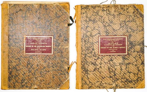
Sold2024Two Atlases USGS1. Atlas to Accompany a Monograph on the Geology of the Eureka District, Nevada. U. S. Geological Survey 1883. Folio, covers detached, contains 19 colored maps, 22 sheets total. 2. Atlas to AccompanySee Sold Price
Sold2018Colton’s Atlas of the World.[Maps] Colton, George Wollworth. Colton’s Atlas of the World. New York: J.H. Colton and Co., 1856. Vol. 2 of a two volume set. Publisher’s brown cloth, gilt and blind stamped with black moSee Sold Price
Sold20191886 California from Mitchell atlasFine antique lithograph map with original hand color. “County Map of the State of California” by William Bradley and found in the 1887 Mitchell New General Atlas. Detailed, scarce and interestingSee Sold Price
Sold20205-TRIBUTE COIN FOLDERS / SETSRARE AMERICAN QTRS (2), SCARCE U.S. COINS, LINCOLN DESIGN COLLECTION, WORLD WAR II COIN & STAMP SET, SILVER CERTIFICATE "IN GOD WE TRUST"See Sold Price
Sold2020Grp: 2 Maps of San Francisco U.S. Coast SurveyTwo maps of San Francisco, California, by the U.S. Coast Survey, featuring a high level of topographical and hydrographical detail. SKU: 03479See Sold Price
Sold2022Carl Rose Collection of 2 Original Illustrations MapsCarl Rose Collection of 2 Original Illustrations. MAP Of U.S. G. R. Gin Rummy locations. Map of Straw Hat Circuit 1947 . Carl Rose, 1903 – 1971 was an American cartoonist whose work appeared inSee Sold Price
Sold2016Carte Des Etats-Unis, 1856Map: Carte Des Etats-Unis Maker: Louis Etienne Dussieux Date: 1856 Size: Folio - 11 inches high x 15.25 inches wide "Grave par Marlier." U.S. map from his Atlas Generale showing unusual Western territSee Sold Price
2 days LeftForum AuctionsEuropean Satirical Map.- Tanaka (Ryozo) A Humoros [sic] Atlas of the World. The Illustration of the£900
22 hrs LeftJasper521901 Rand McNally Map of US West -- New Commersial Map of Denver to Pacific Coast$55
22 hrs LeftJasper521787 Bonne Map of Southeast Asia with Indo-China-- La Presqu'Isle De L'Inde Au Dela du Gange, avec$50
22 hrs LeftJasper521814 Carey Map of Southeast Asia and Northern Australia -- The Islands of the East Indies with the$110
Featured22 hrs LeftJasper521856 Colton View of Lakes and Islands Globally -- Comparative Size Lakes, Islands$50


![Colton’s Atlas of the World.: [Maps] Colton, George Wollworth. Colton’s Atlas of the World. New York: J.H. Colton and Co., 1856. Vol. 2 of a two volume set. Publisher’s brown cloth, gilt and blind stamped with black mo](https://p1.liveauctioneers.com/928/124137/63148812_1_x.jpg?height=310&quality=70&version=1530051387)


![European Satirical Map.- Tanaka (Ryozo) A Humoros [sic] Atlas of the World. The Illustration of the (1 of 1)](https://p1.liveauctioneers.com/5458/342368/185863674_1_x.jpg?height=282&quality=70&version=1725378977)


![[CIVIL WAR]. Group of Illustrated Histories and Atlases. 18... (1 of 10)](https://p1.liveauctioneers.com/928/342606/186002948_1_x.jpg?height=282&quality=70&version=1725643038)
![[BLACK MILITARIANA]. Archive of photographs taken by a Blac... (1 of 6)](https://p1.liveauctioneers.com/928/342606/186002977_1_x.jpg?height=282&quality=70&version=1725643038)
![[PHOTOGRAPHY]. Five Color Photographs, Two Magnum Photograp... (1 of 9)](https://p1.liveauctioneers.com/928/342606/186003036_1_x.jpg?height=282&quality=70&version=1725643038)
![[CIVIL WAR] Military Map of Sherman's March to the Sea (1 of 2)](https://p1.liveauctioneers.com/7226/343781/186766904_1_x.jpg?height=282&quality=70&version=1726333566)


![[CIVIL WAR] Rare Belle Isle POW, Seated (1 of 2)](https://p1.liveauctioneers.com/7226/343781/186766818_1_x.jpg?height=282&quality=70&version=1726333566)


