Sold2023AFRICA. Africa. General Map; Inset map of Population map 1907 old antiqueTITLE/CONTENT OF MAP: 'Africa: General Map; Inset map of Population map' DATE PRINTED: 1907 IMAGE SIZE: Approx 37.0 x 48.5cm, 14.5 x 19.25 inches (Large); Please note that this is a folding map. TYPE:See Sold Price
Sold2024AFRICA. Industries & Communications; Horn of 1907 old antique map plan chartCAPTION PRINTED BELOW PICTURE: 'Africa: Industries and Communications; Inset map of The Horn of Africa' DATE PRINTED: 1907 IMAGE SIZE: Approx 49.0 x 37.0cm, 19.25 x 14.5 inches (Large); Please note thSee Sold Price
Sold2023SOUTH AMERICA. North-west; map of Galapagos Isles 1907 old antique chartTitle: SOUTH AMERICA. North-west; map of Galapagos Isles 1907 old antique chart Description: South America: North-West; Inset map of Galapagos Isles' by Harmsworth (1907). Colour antique map, 50.0 x 3See Sold Price
Sold2023WEST INDIES. Lesser Antilles; maps of Jamaica; Guyana 1907 old antiqueTitle: WEST INDIES. Lesser Antilles; maps of Jamaica; Guyana 1907 old antique Description: West Indies: Lesser Antilles; Inset maps of Jamaica; British Guiana' by Harmsworth (1907). Colour antique mapSee Sold Price
Sold2023EARLY COLONIAL AFRICA pre Scramble for Africa. Mountains of Kong. LETTS 1883 mapTITLE/CONTENT OF MAP: 'Letts's General map of Africa; Inset map of British Isles' Shows the non-existent Mountains of Kong DATE PRINTED: 1883 IMAGE SIZE: Approx 36.0 x 42.5cm, 14 x 16.75 inches (LargeSee Sold Price
Sold2023EARLY COLONIAL AFRICA pre Scramble for Africa. Mountains of Kong. LETTS 1884 mapTITLE/CONTENT OF MAP: 'Letts's General map of Africa; Inset map of British Isles' Shows the non-existent Mountains of Kong DATE PRINTED: 1884 IMAGE SIZE: Approx 36.0 x 42.5cm, 14 x 16.75 inches (LargeSee Sold Price
Sold2023L'Africa. DE ROSSI / SANSON 1677 old antique vintage map plan chartTITLE/CONTENT OF MAP: L'Africa [Africa] DATE PRINTED: 1677 IMAGE SIZE: Approx 42.5 x 57.0cm, 16.75 x 22.25 inches (Large) TYPE: Antique 17th century folio atlas map CONDITION: Good; suitable for framiSee Sold Price
Sold2023AFRICA. Africa. Britannica 9th edition 1898 old antique vintage map plan chartTITLE/CONTENT OF MAP: 'Africa' DATE PRINTED: 1898 IMAGE SIZE: Approx 26.0 x 32.5cm, 10.25 x 12.75 inches (Large); Please note that this is a folding map. TYPE: Antique coloured map CONDITION: Good; suSee Sold Price
Sold2018W. Williams - Colored Map of AfricaAntique map of the continent with inset map of Island of St. Helena. 11" X 13.5" (19" X 21.5")See Sold Price
Sold2023AFRICA. Pre 'Scramble for Africa'. BARTHOLOMEW 1876 old antique map plan chartCAPTION PRINTED BELOW PICTURE: 'Africa' DATE PRINTED: 1876 IMAGE SIZE: Approx 31.0 x 24.0cm, 12.25 x 9.25 inches (Large); Please note that this is a folding map. TYPE: Antique colour map CONDITION: GoSee Sold Price
Sold2024Isothermal Lines of Africa. Sketch map 1885 old antique vintage plan chartTITLE/CONTENT OF MAP: 'Isothermal Lines of Africa' DATE PRINTED: 1885 IMAGE SIZE: Approx 13.5 x 12.0cm, 5.25 x 4.75 inches (Small) TYPE: Antique engraved sketch map CONDITION: Good; suitable for framiSee Sold Price
Sold2022Antique Map Print - Map of Africa - The Royal Atlas - Kate JohnstonMap of Africa. Kate Johnston, F.R.S.E. Engraved and printed by W. & A.K. Johnston. Prime meridian: Greenwich; Relief shown by dashes. Top left: "Keith Johnston's General Atlas." Separated from Keith JSee Sold Price
Sold2024North East Africa 1885 old antique vintage map plan chartTITLE/CONTENT OF MAP: 'North East Africa' DATE PRINTED: 1885 IMAGE SIZE: Approx 31.5 x 23.0cm, 12.5 x 9 inches (Large); Please note that this is a folding map. TYPE: Antique colour map CONDITION: GoodSee Sold Price
Sold2023Africa drawn from the best maps by T. Jefferys. Tribal regions 1748 oldTITLE/CONTENT OF MAP: 'Africa drawn from the best maps by T. Jefferys, Geographer to his Royal Highness the Prince of Wales' One of few pre-1800 antique maps of Africa to be delineated by tribal regioSee Sold Price
Sold2023Brookes, Richard 1791 Antique Map. AfricaCopper Engraved Map Published 1791, London for "The General Gazetteer; Or, Compendious Geographical Dictionary" by Richard Brookes. Folds as issued. Paper Size: 10 x 8 inch (26 x 21cm)See Sold Price
Sold2023Brookes & Baker 1797 Antique Map. AfricaCopper Engraved Map Published 1797, London for "The General Gazetteer; Or, Compendious Geographical Dictionary" by Richard Brookes. Engraved by B. Baker. Original outline hand color. Folds as issued.See Sold Price
Sold2021Barlow 1807 Antique Map. AfricaCopper Engraved Map Published 1807 by Brightly & Kinnersley, Bungay, England for "A General View of the World, Geographical, Historical and Philosophical" by The Rev. E. Blomfield. Engraved by Barlow.See Sold Price
Sold2021Barlow 1807 Antique Map of Africa ContinentCopper Engraved Map Published 1807 by Brightly & Kinnersley, Bungay, England for "A General View of the World, Geographical, Historical and Philosophical" by The Rev. E. Blomfield. Maps Engraved by BaSee Sold Price
Sold2020Buffon & Vaugondy 1791 Map of Africa Continent"Map of the Old Continent" Copper Engraved Map Published 1791, London for "Natural History, General and Particular" by the Comte de Buffon. Translated by William Smellie. Engraved A. Bell after RobertSee Sold Price
Sold2018Barlow 1807 Antique Map of Africa ContinentCopper Engraved Map Published 1807 by Brightly & Kinnersley, Bungay, England for "A General View of the World, Geographical, Historical and Philosophical" by The Rev. E. Blomfield. Maps Engraved by BaSee Sold Price
Sold2024Buffon, Vaugody & Bell 1785 Map of the Old Continent. Africa, AsiaEngraved A. Bell, based on Vaugondy's earlier Map. Copper Plate Published 1785, London for "Natural History, General and Particular" by the Count de Buffon. Translated by William Smellie Folds as issuSee Sold Price
Sold2019Nice 1860 map of AfricaMap of Africa, Showing Its Most Recent Discoveries (with Inset of the Island of St. Helena). Full hand coloring. 1860 date; from 1866 Mitchell New General Atlas. Good impression. Foxed heavily in margSee Sold Price
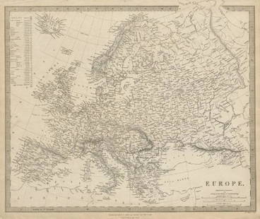
Sold2019EUROPE. General map. Inset table of population &TITLE/CONTENT OF MAP: 'EUROPE; inset table of population by country' The top image on the right hand side shows the entire map. To view a close up of the map showing the level of printed detail, pleasSee Sold Price
Sold2023EUROPE. General map. Inset table of population & density by country. SDUK 1844TITLE/CONTENT OF MAP: 'EUROPE; inset table of population by country' DATE PRINTED: This map was originally published by Baldwin & Cradock in 1836; this date is printed on the map. This edition of theSee Sold Price
23 hrs LeftJasper52Amér Sep Porto Rico #69 Puerto Rico & Virgin Islands VANDERMAELEN 1827 old map$130


![L'Africa. DE ROSSI / SANSON 1677 old antique vintage map plan chart: TITLE/CONTENT OF MAP: L'Africa [Africa] DATE PRINTED: 1677 IMAGE SIZE: Approx 42.5 x 57.0cm, 16.75 x 22.25 inches (Large) TYPE: Antique 17th century folio atlas map CONDITION: Good; suitable for frami](https://p1.liveauctioneers.com/5584/308981/165185503_1_x.jpg?height=310&quality=70&version=1699996168)