Sold2021Antique Framed Map of East HamptonAntique map of East Hampton, Long Island, NY, framed under glass. [Sight: 10" H x 14 1/2" W; Frame: 17 1/2" H x 21" W]. Minor creases.See Sold Price
Sold2020LOT OF THREE ANTIQUE c.1819 FRAMED MAPSLOT OF THREE ANTIQUE c.1819 FRAMED MAPS - EAST INDIES, DENMARK, SWEDEN, & NORWAY Height: 16 1/2 & 8 in. by Width: 18 1/2 & 10 in.See Sold Price
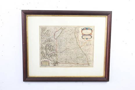
Sold2023Antique Framed Map of "Pars Scotiae Australi's"Description: This lot includes what appear to be an antique map titled "Pars Scotiae Australi's". The map is not dated however it appears to have age to it. See photos for details. Condition: ExpectedSee Sold Price
Sold2021Antique Framed Map of Europe, Europa Guilielmo BlaeuwAntique Color Map of Europe, Dutch Cartography. "Europa Recens Descripta" by Guilielmo Blaeuw, a cartographer for the Dutch East India Company. Lots of colorful detail of different nationalitiSee Sold Price
Sold2023Antique American Modernist Abstract Landscape East Hampton Estate Original Oil PaintingOil on canvas. Framed. No signature found. Image size, 13L x 13H.See Sold Price
Sold2022East Hampton Beach Original Long Island Impressionist Sunset Oil PaintingAntique American school impressionist sunset landscape painting. Oil on board. Unsigned. Framed. Image size, 16L x 12H.See Sold Price
Sold2019Group antique etchings and engravingsGroup antique etchings and engravings, 19th c., includes "Princeton University", 1836, framed; "New Covent Garden", 1810, framed; the remainder loose: "Spring", "The Custom House", "East Hampton, fromSee Sold Price
Sold2023MAPS CARTOGRAPHY ITEMS WITH 2 HAND DRAWINGSThe lot includes a framed mid century American map Penobscot Bay And Approaches, United States - East Coast - Maine, Scale 1:80 000; Raritan River From Raritan Bay to New Brunswick New Jersey, Scale 2See Sold Price
Sold2022MAPS CARTOGRAPHY ITEMS WITH 2 HAND DRAWN PIECESThe lot includes a framed mid century American map Penobscot Bay And Approaches, United States - East Coast - Maine, Scale 1:80 000; Raritan River From Raritan Bay to New Brunswick New Jersey, Scale 2See Sold Price
Sold2023ANTIQUE EAST INDIA ISLANDS C 1840 MAPAntique East India Color Lithograph Map c. 1840 by a British Mapmaker. Purchased at Wattis Fine Art, Hong Kong. Professionally framed and matted. In frame measures 23.25"x22.25"x1.25" Weight 7 pds. PRSee Sold Price
Sold2021Antique Framed Map. Virginia Marylandia et Carolina. JoAntique Framed Map. Virginia Marylandia et Carolina. Johannes Baptisa Homann-- Dimensions: Image Size: H: 21 inches: W: 24.5 inches -- FRAME SIZE: Frame Height 25 inches - Frame Width 28.5 inches ---See Sold Price
Sold2022Antique East Hampton Fauvist Landscape Oil PaintingUp for sale here is a really nice antique American modernist landscape. From our East Hampton estate. Unsigned. Oil on canvas. Image size, 36L x 28H.See Sold Price
Sold2016Antique Framed Map of Israel, C. 1748.Ivdaea Sev Palaestina, ... Terra Sancta. By Johann Baptist Homann. Framed, 18.5" x 21.5" sight size. Visible foxing. From a Larchmont NY estate. Dimensions: 23" w x 20" h framed. Condition: Foxing, noSee Sold Price
Sold2023Antique Framed Map of CubaAntique Framed Map of Cuba. Framed measures 15 inches x 20 inchesSee Sold Price
Sold2021Antique Framed Map Livingston,Germantown,Claremont NYAntique Framed Map of Livingston, Germantown and Claremont, Columbia County, NY. Dated 1850. Engraved by R.H.Pease, Albany, NY. Lovely early map is nicely framed in dark brown wood, and wired on the bSee Sold Price
Sold2017Antique framed map of Indian Ocean, Asia, AustraliaTitle/Content of Map: Antique framed map of Indian Ocean, Asia, Australia Date Printed: 1713 Cartographer: Aa, Pieter van der Size (in): 11 x 8 Very attractive framed copper-engraved antique map by PiSee Sold Price
Sold2017Janssonius: Antique Map East Asia. Japan & Korea, 1630Title/Content of Map: East Asia. Japan and Korea (as an island), Amsterdam Date Printed: 1630's Cartographer: Janssonius Joannes Material/Medium: Paper Size: 22" x 19" French text on verso. PublishedSee Sold Price
Sold2021Antique Framed Map of Columbia County, NY 1829Antique Framed Map of Columbia County, NY, dated 1829. Engraved by Rawdon Clark & Co, Albany, NY. Also marked Rawdon Wright, New York. Map includes locations of mills, churches and stage roads. NicelySee Sold Price
Sold2019Antique Framed Map Showing Estonia Coast & RussiaAntique Framed Map Showing Estonia Coast & Russia. Professionally framed and matted. Showing the current coast and islands of Estonia as well as a portion of Russia. Measures 26 x 31 inches.See Sold Price
Sold2023Antique Framed Map of Greece by Nicolaum VisscherAntique Framed Map of Greece by Nicolaum Visscher. 21 inches x 25 inches.See Sold Price
Sold2018Tallis/Rapkin: Antique Map East Canada & New BrunswickTitle/Content of Map: 'East Canada and New Brunswick' The map shows the southern part of Quebec and New Brunswick, in districts/counties. Vignettes: North American Indians; Quebec City Date Printed: 1See Sold Price
Sold2021Antique Framed Map of Germany by A Christophoro HurteroAntique Framed Map of Germany by A Christophoro Hurtero. Full title: Alemannia Sive Svevia Superior. Date of printing is somewhere in 1640's, and possibly engraved. Golden painted inner frame. DimSee Sold Price
Sold2021(2) ANTIQUE FRAMED MAPSAntique world map approximately 16" x 9.75" w/ frame and Asia minor 11.75" x 9.25" w/ frame.See Sold Price
3 days LeftTrillium Antique Prints & Rare BooksCarey, pub. 1814 - Map of the East Indies with India, China, & New Holland (Australia)$50(1 bid)
1 hr LeftJasper52Côte Nord-Est de la Nouvelle Calédonie…'. ROUBET. New Caledonia 1849 old map$180
4 days LeftCurated Gallery AuctionsHenry Hammond Ahl (1869 - 1953) Antique American Tonalist Forest Interior View Sunset Oil Painting$90(3 bids)
4 days LeftCurated Gallery AuctionsStanley Sobossek (1918 - 1996) WPA Lower East Side New York City Street Scene Original Oil Painting$10(1 bid)
2 days LeftMynt AuctionsHampton by Gorham Sterling Silver Pastry Fork 3-Tine 5 3/4" Flatware Antique$10


![Antique Framed Map of East Hampton: Antique map of East Hampton, Long Island, NY, framed under glass. [Sight: 10" H x 14 1/2" W; Frame: 17 1/2" H x 21" W]. Minor creases.](https://p1.liveauctioneers.com/1221/225810/117094074_1_x.jpg?height=310&quality=70&version=1637685024)