Sold2017Bradford: Antique Map of Four US Cities, 1838Title/Content of Map: Cities of Washington D.C., New Orleans, Cincinnati and Louisville Date Printed: 1838/1841 Cartographer: Thomas G. Bradford Material/Medium: Paper Size: 13" x 16 1/2" Hand coloredSee Sold Price
Sold2023Antique Map of Four Cities in IrelandAntique hand colored print depicting maps of Galway, Dublin, Limerick, and Cork. Map originally by Braun, Georg, Hogenberg, Franz. [Map: 17" H x 22" W; Frame: 19" H x 24" W].See Sold Price
Sold2017Bradford: Antique Map of Louisiana, 1838Title/Content of Map: Louisiana by Bradford Date Printed: 1838/1841 Cartographer: Thomas G. Bradford Material/Medium: Paper Size: 16 1/2" x 13" Hand colored. A General Atlas of the World with a SeparaSee Sold Price
Sold20181846 Bradford Maps of Key US Cities -- Washington,Title/Content of Map: 1846 Bradford Maps of Key US Cities -- Washington, Louisville and Jeffersonville, New Orleans, Cincinnati Date: 1846 Boston Cartographer: T. Bradford Size: 11 x 13.5 in Well engrSee Sold Price
Sold2017Bradford: Antique Map of Ohio, 1838Title/Content of Map: Ohio by Bradford Date Printed: 1838/1841 Cartographer: Thomas G. Bradford Material/Medium: Paper Size: 13" x 16 1/2" Hand colored. A General Atlas of the World with a Separate MaSee Sold Price
Sold2017Bradford: Antique Map of Philadelphia, 1838Title/Content of Map: Philadelphia b Bradford Date Printed: 1838/41 Cartographer: Thomas G. Bradford Material/Medium: Paper Size: 13" x 16 3/4" Condition: Excellent Hand colored. A General Atlas of thSee Sold Price
Sold2017Bradford: Antique Map of Maine, 1838Title/Content of Map: Maine by Bradford Date Printed: 1838/1841 Cartographer: Thomas G. Bradford Material/Medium: Paper Size: 13" x 16 1/2" Hand colored. A General Atlas of the World with a Separate MSee Sold Price
Sold2017Bradford: Antique Map of Tennessee, 1838Title/Content of Map: Tennessee by Bradford Date Printed: 1838/1841 Cartographer: Thomas G. Bradford Material/Medium: Paper Size: 13" x 16 1/2" Hand colored. A General Atlas of the World with a SeparaSee Sold Price
Sold2017Bradford: Antique Map of Philadelphia, 1838Title/Content of Map: Philadelphia by Bradford Date Printed: 1838/1841 Cartographer: Thomas G. Bradford Material/Medium: Paper Size: 16 3/4" x 13" Hand colored. A General Atlas of the World with a sepSee Sold Price
Sold2017Bradford: Antique Map of Kentucky, 1838Title/Content of Map: Kentucky by Bradford Date Printed: 1838/1841 Cartographer: Thomas G. Bradford Material/Medium: Paper Size: 16 1/2" x 13" Hand colored. A General Atlas of the World with a SeparatSee Sold Price
Sold2017Bradford: Antique Map of Arkansas, 1838Title/Content of Map: Arkansas by Bradford Date Printed: 1838/1841 Cartographer: Thomas G. Bradford Material/Medium: Paper Size: 13" x 16 1/2" Hand colored. A General Atlas of the World with a SeparatSee Sold Price
Sold2017Bradford: Antique Map of Illinois, 1838Title/Content of Map: Illinois by Bradford Date Printed: 1838/1841 Cartographer: Thomas G. Bradford Material/Medium: Paper Size: 13" x 16 1/2" Hand colored. A General Atlas of the World with a SeparatSee Sold Price
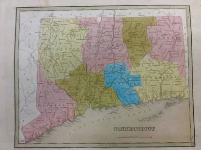
Sold2018Bradford: Antique Map of Connecticut, 1838Title/Content of Map: Connecticut by Bradford Date Printed: 1838 Cartographer: Thomas G. Bradford Size: 14" x17" Material/Medium: Paper Provenance: New York A General Atlas of the World with a separatSee Sold Price
Sold2017Bradford: Antique Map of Alabama, 1838Title/Content of Map: Alabama by Bradford Date Printed: 1838/1841 Cartographer: Thomas G. Bradford Material/Medium: Paper Size: 13" x 16 1/2" Hand colored. A General Atlas of the World with a SeparateSee Sold Price
Sold2017Bradford: Antique Map of Pennsylvania, 1838Title/Content of Map: Pennsylvania by Bradford Date Printed: 1838/1841 Cartographer: Thomas G. Bradford Material/Medium: Paper Size: 16 1/2" x 13" Hand colored. A General Atlas of the World with a SepSee Sold Price
Sold2017Bradford: Antique Map of Indiana, 1838Title/Content of Map: Indiana by Bradford Date Printed: 1838/1841 Cartographer: Thomas G. Bradford Material/Medium: Paper Size: 13" x 16 1/2" Hand colored. A General Atlas of the World with a SeparateSee Sold Price
Sold2017Bradford: Antique Map of Massachusets, 1838Title/Content of Map: Massachusets by Bradford Date Printed: 1838/1841 Cartographer: Thomas G. Bradford Material/Medium: Paper Size: 13" x 16 1/2" Hand colored. A General Atlas of the World with a SepSee Sold Price
2017Bradford: Antique Map of Conneticut, 1838Title/Content of Map: Conneticut by Bradford Date Printed: 1838/1841 Cartographer: Thomas G. Bradford Material/Medium: Paper Size: 13" x 16 1/2" Hand colored. A General Atlas of the World with a SeparSee Sold Price
Sold2017Bradford: Antique Map of Vermont, 1838Title/Content of Map: Vermont by Bradford Date Printed: 1838/1841 Cartographer: Thomas G. Bradford Material/Medium: Paper Size: 13" x 15" A General Atlas of the World with a seperate Map of each of thSee Sold Price
Sold2017Bradford: Antique Map of Iowa & Wisconsin, 1838Title/Content of Map: Rare and Important early Iowa and Wisconsin Date Printed: 1838/1841 Cartographer: Thomas G. Bradford Material/Medium: Paper Size: 13" x 16 1/2" Hand colored. A General Atlas of tSee Sold Price
Sold2017T.G Bradford: Antique Map of United States, 1838Title: Map of United States by T.G Bradford Date: 1838 Medium: Wax Engraving Dimensions (in): 25 x 16 Condition: Excellent Condition Thomas G. Bradford was the author of the Illustrated Atlas of the USee Sold Price
Sold2017Bradford: Antique Map of New Hampshire, 1838Title/Content of Map: New Hampshire by Bradford Date Printed: 1838/1841 Cartographer: Thomas G. Bradford Material/Medium: Paper Size: 13" x 16 1/2" Hand colored. A General Atlas of the World with a SeSee Sold Price
Sold2017Bradford: Antique Map of New Jersey, 1838Title/Content of Map: New Jersey by Bradford Date Printed: 1838/1841 Cartographer: Thomas G. Bradford Material/Medium: Paper Size: 13" x 16 1/2" Condition: Excellent Hand colored. A General Atlas of tSee Sold Price
Sold2017Bradford: Antique Map of Upper Canada, 1838Map: Upper Canada Date Printed: 1838/1841 Cartographer: Thomas G. Bradford Material/Medium: Paper Size: 16 1/2" x 13 1/2" Hand colored. A General Atlas of the World, with a seperate map of each of theSee Sold Price
Featured4 days LeftJasper52PACIFIC OCEAN currents British French German US Spanish colonies. LETTS 1889 map$15
4 days LeftJasper52South Pacific Ocean. French Polynesia Cook Islands. US Navy sea chart 1895 map$130
4 days LeftJasper52PACIFIC OCEAN showing British French Dutch US territory. US Philippines 1947 map$20
4 days LeftJasper52South west Pacific Ocean Melanesia Polynesia ADMIRALTY sea chart 1875 (1968) map$120
Featured4 days LeftJasper52NW Coast of America & NE Coast of Asia… ROBERTS / DELAROCHETTE. Pacific 1794 map$700
7 days LeftTrillium Antique Prints & Rare BooksMitchell's A New Universal Atlas.. - Volume with 73 Maps$1,000(1 bid)
4 days LeftJasper52Océanique. Iles des Navigateurs #41 Samoa & American Samoa VANDERMAELEN 1827 map$60
4 days LeftJasper52Océanique. Partie des Iles Salomon #32. Solomon Islands. VANDERMAELEN 1827 map$75
4 days LeftJasper52Nouvelle Caledonie. Baies de Kuakue et de Uinne'. CHAMBEYRON sea chart 1891 map$100
4 days LeftJasper52Carte d'Assemblage de l'Océanique. Pacific Ocean Oceania. VANDERMAELEN 1827 map$150
4 days LeftJasper52Carte réduite de la Mer du Sud'. Pacific Ocean. BELLIN/SCHLEY 1757 old map$200


![Antique Map of Four Cities in Ireland: Antique hand colored print depicting maps of Galway, Dublin, Limerick, and Cork. Map originally by Braun, Georg, Hogenberg, Franz. [Map: 17" H x 22" W; Frame: 19" H x 24" W].](https://p1.liveauctioneers.com/1221/275442/145337791_1_x.jpg?height=310&quality=70&version=1674615534)