Sold20231632 EUROPE DESCRIPTION by MERCURII GALLOBEGICI antique VELLUM BOUND w/ MAPMERCURII GALLOBEGICI sive, rerum in Gallia et Belgio potissimum; Hispania quoqve Italia, Anglia, Germania, Ungaria, Bohemia... Frankfurt; 1632 Illustrated with one plate and the map of Western EuropeSee Sold Price
Sold2023Findlay, Alexander 1828 Map. EuropeCopper Engraved Map Published 1828, London for "The Oxford Encyclopaedia: Or, Dictionary of Arts, Sciences and General Literature" by Rev. W. Harris, J. A. Stewart, C. Butler, Rev. J. H. Hinton et al.See Sold Price
Sold2020Antique MapMAP OF GALLIA, ANNO 1598. WESTERN EUROPE, FRENCE.Sheet, 66.8 x 47.5cmMap, 57.3 x 43cmSee Sold Price
Sold2023Findlay, Alexander 1828 Mixed Lot of 10 Antique MapsIncl Low Countries, Austrian Dominions, Spain & Portugal, Russian Empire, Switzerland, Turkey in Asia, Turkey in Europe, Asia Continent, Germany, Prussia. Copper Engraved Map Published 1828, London foSee Sold Price
Sold2021Wilkes, John 1804 Map. Ancient EuropeCopper Engraved Map Published 1796-1828 London for "Encyclopaedia Londinensis, or universal dictionary of arts, sciences and literature" by John Wilkes et al. Paper Size: 10.5 x 8.5 inch (27 x 22cm) VSee Sold Price
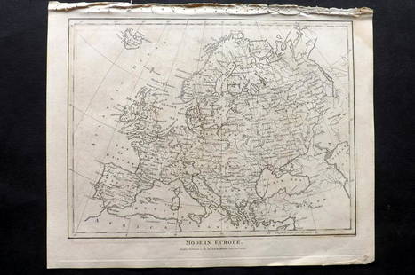
Sold2021Wilkes, John 1804 Map. Modern EuropeCopper Engraved Map Published 1796-1828 London for "Encyclopaedia Londinensis, or universal dictionary of arts, sciences and literature" by John Wilkes et al. Paper Size: 10.5 x 8.5 inch (27 x 22cm) VSee Sold Price
Sold2022Wilkes, John 1804 Pair of Maps. Ancient & Modern EuropeCopper Engraved Map Published 1796-1828 London for "Encyclopaedia Londinensis, or universal dictionary of arts, sciences and literature" by John Wilkes et al. Paper Size: 10.5 x 8.5 inch (27 x 22cm) VSee Sold Price
Sold2021Wilkes, John 1807 Hand Col Map. Ancient Spain"Hispania Antiqua" Finely Hand Colored Copper Engraved Map Published 1796-1828 London for "Encyclopaedia Londinensis, or universal dictionary of arts, sciences and literature" by John Wilkes et al. PaSee Sold Price
Sold2015Map of European Turkey. 1828.Print of steel engraving titled Turquie d‘ Europe“.Author Fellx Delamarche.Engraved by unknown.From Atlas de la Geographie ancienne du moyen age et moderne“ by Fellx Delamarche. Paris. 1829.FlixSee Sold Price
Sold2019Bryce, James 1881 Lot of 10 Maps of EuropeIncl Turkey in Europe, Austria-Hungary, German Empire, Denmark, Denmark, German Empire, Switzerland, France, Hispania/Germania, Italia, Sweden/Norway. Lithograph Maps Published 1881, London for ""TheSee Sold Price
Sold2021Framed 17th C. German Engraved Map of France**First Time At Auction** Europe, German, 17th century. "Das Konigreich Franckreich" (The Kingdom of France) Nova Gallia Tabula - copper plate engraving, ca. 1630. A finely engraved map of the KingdomSee Sold Price
Sold2022Map of Europe By Treaty by Edward Bertslet c. 1875Map of Europe by Treaty by Edward Bertslet were printed between 1875-1891. Condition is consistent with age and they measure 10" tall. The 4 volumes include 1. 1814-1827 2. 1828-1863 3. 1864-1875See Sold Price
Sold2024Marmocchi, F. C. 1845 Hand Col Map. Europe Political Map"Prospetto Geografico Politico della Gallia della Germania della Bretagna della Ibernia" Folio Hand Colored Etching/Engraving Published 1845, Florence for "Atlante di Geografia-Storica Universale" bySee Sold Price
Sold20221828 MAP of New York City Suburbs Railroads New Jersey EC Bridgman Color1828 MAP of New York City Suburbs Railroads New Jersey EC Bridgman Color An impressive, 19th-century map of New York City and its surrounding environs. This E.C. Bridgman map is a huge map folded intoSee Sold Price
Sold20191759 Delarochette Map of the German Empire and most ofTitle/Content of Map: 1759 Delarochette Map of the German Empire and most of Central Europe -- Map of the Empire of Germany, Including All the States Comprehended under that Name: with the Kingdom ofSee Sold Price
Sold2018France.- Ortelius (Abraham) Gallia, detailed map ofFrance.- Ortelius (Abraham) Gallia, detailed map of France, with part of southern England, northern Italy, and includes Belgium and the Netherlands, a large title cartouche with two putto decorating tSee Sold Price
Sold2020AN ANTIQUE MAP, "Europe (Evrop)," JOHN SPEED,AN ANTIQUE MAP, "Europe (Evrop)," JOHN SPEED, CARTOGRAPHER, 1626-1676, hand-colored engraving on paper, Abraham Goos (1589-1643), engraver, published for merchants Thomas Basset and Richard Chiswell iSee Sold Price
Sold2017Mexico sive N. Hispania Duval MapMexico sive N. Hispania. Pierre Duval (1618–1683). Engraved map with original hand color. Nuremberg, 1679. 5 x 5 1/2 inches sheet, 14 1/2 x 15 inches framedSee Sold Price
Sold20231850s Dufour ATLAS 42 HUGE MAPS Europe ENORMOUS & RARE Geography Cartography1850s Dufour ATLAS 42 HUGE MAPS Europe ENORMOUS & RARE Geography Cartography Adolphe Dufour was a 19th-century French cartographer and map maker known for his highly detailed maps of European cities aSee Sold Price
Sold20211790 Geography Dictionary World MAPS Europe History1790 Geography Dictionary World MAPS Europe History French Laurence Echard Laurence Echards Geographic Dictionary is a rare, late 18th-century history of world. This book is organized much like a modeSee Sold Price
Sold201718th C. French Map w/ Oiled Paper, ex-Sotheby'sEurope, France, map from 1709 CE, oiled paper overlays from 1756 to 1763 CE, owned by Louis-Alexandre Berthier (1753 to 1815 CE), Marshal, Vice-Constable of France, and Chief of Staff (Major general)See Sold Price
Sold2023U.S. MILITARY WWII FIELD MAPS 1943-1944(5)170300 U.S. MILITARY WWII FIELD MAPS 1943-1944(5) U.S. military WWII field maps 1943-1944 to include one original Europe Road Map Series 1 first edition France with name of soldier Caldwell, two WWIISee Sold Price
Sold2022Stephanie Woolley (b. 1954, NM), "Peregrine andStephanie Rentschler Woolley (b. 1954, New Mexico), "Peregrine and Kestrel" original watercolor over "Birds of Europe" geographical map dated 1850 image: 12 x 9", frame: 19 x 16" Stephanie Woolleys enSee Sold Price
Sold2017Homann Heirs: Antique Map of Europe, 1746Map: Europe ** Nuremberg?? Date Printed: 1746 Cartographer: Homann Heirs Material/Medium: Paper Size: 21" x 23 1/4" Nuremberg. Hand colored copperplate engraved. Beautiful baroque style cartouche. PleSee Sold Price
2 days LeftDOYLE Auctioneers & AppraisersSet of Twelve Satirical Anthropomorphic Maps of Europe$400(1 bid)
2 days LeftMark Louis Weseloh Estate LiquidationsSix - 17th c. Maps of Europe, Asia, England, Germany x2, Crete, Greece.8 ¼” x 6 5/8”$300
2 days LeftDOYLE Auctioneers & AppraisersA block puzzle with maps of Europe, England, Ireland, Scotland, America and the World$100
Jun 30Global Auctions CompanyHand Colored Engraved Map of Europe, Jean Baptiste Bourguignon Anville 1754$450
6 days LeftTrillium Antique Prints & Rare BooksChatelain - 4 Engravings related to Egypt & Barbary, Africa$75
2 days LeftJasper521872 Asher and Adams Map of Maine and Parts of Quebec, Vermont and New Hampshire -- Asher & Adams$30(1 bid)
4 days LeftThe Ross Art GroupOriginal Vintage Chocolat Menier Le Tour de Monde Poster by Jannot 1956 Chocolate Map$500
BonhamsCHAPBOOK St. Julien, the Emigrant; or, Europe Depicted: Exhibiting the Costumes, and Describing ...£10(1 bid)
BonhamsBOWYER (ROBERT) An Illustrated Record of Important Events in the Annals of Europe, During the La...£800