Sold2015Framed Antique Color Map of TransylvaniaBelieved 19th century. Nova Transilvaniae Principatus Tabula. Height: 20 inches. Width: 23 inches. Framed.See Sold Price
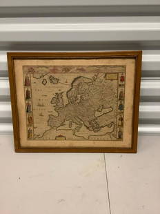
Sold2021Antique Framed Map of Europe, Europa Guilielmo BlaeuwAntique Color Map of Europe, Dutch Cartography. "Europa Recens Descripta" by Guilielmo Blaeuw, a cartographer for the Dutch East India Company. Lots of colorful detail of different nationalitiSee Sold Price
Sold2023ANTIQUE EAST INDIA ISLANDS C 1840 MAPAntique East India Color Lithograph Map c. 1840 by a British Mapmaker. Purchased at Wattis Fine Art, Hong Kong. Professionally framed and matted. In frame measures 23.25"x22.25"x1.25" Weight 7 pds. PRSee Sold Price
Sold2021Antique Framed Map of Russian Empire "Improved to 1321"Antique Framed Map of Russian Empire "Improved to 1321." Geographical and statistical map, with full color and cultural information. This includes natural history, national character, manners,See Sold Price
Sold2022A FRAMED ANTIQUE CHINESE MAP ON PAPERColor and ink on paper, the map depicting the area south of great wall of china, also including korea, parts of Japan, and Vietnam Early Qing Dynasty period. Height: 18 1/2 in (47.0 cm) Width: 15 in (See Sold Price
Sold2023Framed Antique Agricultural Map Of NY State, 1843Marked on lower left corner reads Agricultural map of the state of New York. Lith of G & W endicott New York, Map is colored in correspondence with the color of agriculture throughout the state. FrameSee Sold Price
Sold2017Allen: Framed Map of New Jersey Ocean Resorts, 1898Title/Content of Map: New Jersey Ocean Resorts on the Pennsylvania Railroad Date Printed: 1898 Cartographer: Allen, Lane, and Scott Size (inches): 12 x 16 Lithographed color Antique lithographed birdsSee Sold Price
Sold2022Framed Nicolas de Fer Four Grand Monarchies PrintDESCRIPTION: Framed color print of a map entitled "The Four Great Monarchies of the Assyrians, the Persians, the Greeks, and the Romans" by Nicolas de Fer depicting the lands around the MediterraneanSee Sold Price
Sold2022Antique Color Map [Vue Teneframonda] 1667Antique color map with text on verso. Plan vue Teneramonda, Dendermonde. 1667, W. A. Van Der Grient, Bruxelles. Taped at center. Measures 20.5 in. x 25 in. Unframed, loose and not mounted or glued dowSee Sold Price
Sold20222 PC. FRAMED ANTIQUE MAPS OF ISRAEL2 PC. FRAMED ANTIQUE MAPS OF ISRAEL: Comprising; 1- Detailed Ortelius Map of the Holy Land, Based on Tilemann Stella's Extremely Rare Holy Land Maps. 1- Homann based this map of the Holy Land on the cSee Sold Price
Sold2020Framed Antique Map Orbis Vetus, Robert De VaugondyItem/Description: Old print. Map of the world by Robert de Vaugondy from 1752. Orbis vetus in utraque continente : In both the old continent / world map / Vaugondy 1752. Material: Print framed under gSee Sold Price
Sold20182 Framed antique maps2 Framed antique maps, probably from an old atlas, British America & The United States, map drawn & engraved by J. Rapkin, illustrations by H. Warren & illustrations by R. Wallis, Maps are 10" x 13",See Sold Price
Sold2022Pair 19th C Framed Color Maps, Louisiana & New OrleansPair of 19th C Framed Color Maps, Louisiana & New Orleans. A set of framed maps; a state map of Louisiana from 1848 and a city plan of New Orleans from 1884. Both are published by S. Augustus MitchellSee Sold Price
Sold2021Framed Antique Map of Northwest Germany, DeutschlandFramed Antique Map of Northwest Germany. Nicely framed in dark wood with an interior gold border and off-white mat. Tag on the back, which is wood-covered, shows the location of the map within DeutschSee Sold Price
Sold2020FRAMED ANTIQUE MAP OF THE WORLDFRAMED ANTIQUE MAP OF THE WORLD, ROBERT DE VAUGONDY, ORBIS VET US, 1752, GEOGRAPHO REGIS ORDINARIO. PAPER IS ACID BURNED AND FOLDED IN THE CENTER. Height: 27 & 19 1/2 in. by Width: 36 1/2 & 29 in.See Sold Price
Sold2023"Orbis Romani Pars Occidentalis" Framed Antique Map by Charles Smith c1820s"Orbis Romani Pars Occidentalis" Framed Antique Map by Charles Smith c1820s.See Sold Price
Sold20191838 Antique Color Map Asia MinorAntique color map of Asia Minor, dated 1838 in plate. Drawn and engraved by B.R Davies. Mounted on paper board. Measures 8.125 in. x 10.375 in. Unframed. If lot is absent of a condition report a condiSee Sold Price
Sold2018Framed Color Map Of Old Quebec by Marietta BoivinFramed Color Map Of Old Quebec by Marietta Boivin, in gold toned frame. A large printed map of Old Quebec with labels of monuments and buildings written in french. Above center of map reads, Don De DiSee Sold Price
Sold2023Group of 4 Framed Antique MapsLargest overall is 24" x 21 1/2" Condition, some scratches and scuffs and missing paint to frames, some waves and creases to mapsSee Sold Price
Sold2017NORTH AMERICA COLORED MAP, C. 1763, POSTLETHWAYTFramed antique map c. 1770, "North America, Plate 1" from the publication "Dictionary of Trade and Commerce" by Malachy Postlethwayt (British, 1707-1767), hand colored, also reading "North America, PeSee Sold Price
Sold2017NORTH AMERICA COLORED MAP, C. 1763, POSTLETHWAYTFramed antique map c. 1770, "North America, Plate III" and "Part of North America, Plate IV", from the publication "Dictionary of Trade and Commerce" by Malachy Postlethwayt (British, 1707-1767), handSee Sold Price
Sold202118th Century Florida Gulf Of Mexico Caribbean MapFramed antique map, circa 1777. Depicts map of the Gulf of Mexico, the islands, and countries adjacent. For the Rev. Dr. Robertson's History of America. Contributed by Thomas Kitchen. Published accordSee Sold Price
2 days LeftKCM Galleries1976 VALEROI ADAMI Color Lithograph "Scholar James Frazer" GALLERY FRAMED$150
May 12TOISHINSEI Co., Ltd.Pottery Painting Gold Sparrow Leaf Inscription Painted Framed Antique Antique Art Art Antique$140


![Antique Color Map [Vue Teneframonda] 1667: Antique color map with text on verso. Plan vue Teneramonda, Dendermonde. 1667, W. A. Van Der Grient, Bruxelles. Taped at center. Measures 20.5 in. x 25 in. Unframed, loose and not mounted or glued dow](https://p1.liveauctioneers.com/5755/230508/119239958_1_x.jpg?height=310&quality=70&version=1639761935)