Sold2021Land office report w/ large colored map 1867Heading: (General Land Office) Author: Title: Report of the Commissioner of the General Land Office for the Year 1866. Place Published: [Washington, D.C.] Publisher:Government Printing Office DaSee Sold Price
Sold2016Lithographed Map of Oregon, 1866Oregon. U.S. General Land Office. hand-colored Lithograph. New York: Major & Knapp, c. 1866. 17 1/2 x 23 inches sheet, 27 x 32 1/2 inches framed. This map shows the state of Oregon seven years after sSee Sold Price
Sold20171862 Mitchell county map of Minnesota in near fineGreat chance to own an actual 150-year-old piece of history for a reasonable price. Beautiful and clean county map of Minnesota from Mitchell’s 1866 New General Atlas. When matted and framed, antiquSee Sold Price
Sold2019GERMANY general Map. Central Europe. Hungary.TITLE/CONTENT OF MAP: 'GERMANY, General map' The top image on the right hand side shows the entire map. To view a close up of the map showing the level of printed detail, please click on the bottom imSee Sold Price
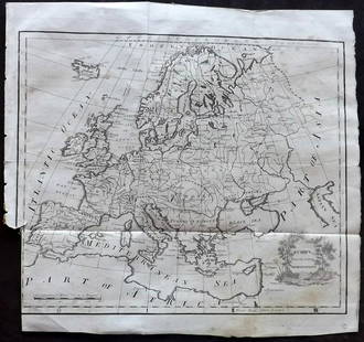
Sold2019EUROPE. General map. Inset table of population &TITLE/CONTENT OF MAP: 'EUROPE; inset table of population by country' The top image on the right hand side shows the entire map. To view a close up of the map showing the level of printed detail, pleasSee Sold Price
Sold2023EUROPE. General map. Inset table of population & density by country. SDUK 1844TITLE/CONTENT OF MAP: 'EUROPE; inset table of population by country' DATE PRINTED: This map was originally published by Baldwin & Cradock in 1836; this date is printed on the map. This edition of theSee Sold Price
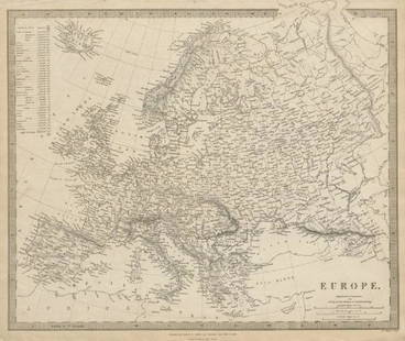
Sold20231866 Johnson Map of Europe -- Johnson's EuropeTitle: 1866 Johnson Map of Europe -- Johnson's Europe Cartographer: Johnson & Ward Year / Place: 1866, New York Map Dimension (in.): 17 X 23 in. This is a superb map of Europe. Much detail is shown inSee Sold Price
Sold2015Jansson (Jan) - [Atlas Novus: Germany],single vol. lacking title, 106 mostly regional maps of Germany and northern Europe, but also including a general map of Germany, and classical maps of both Germany and Scandinavia, and several city plSee Sold Price
Sold20221866 McNally Map of Texas -- TexasTitle: 1866 McNally Map of Texas -- Texas Cartographer: McNally & Co. Year / Place: 1866, New York Map Dimension (in.): 8.3 X 10.6 in. This is an outstanding and seldom seen map of Texas from just 21See Sold Price
Sold2023VOLKONSKY PYOTR: (1776-1852)VOLKONSKY PYOTR: (1776-1852) Russian Prince and General Field Marshal who commanded the Russian troops at the Battle of Austerlitz (1805) and was one of the closest advisers to Emperor Alexander I. A.See Sold Price
Sold2018Bartholomew's Large Scale Map of Central Europe.Title/Content of Map: Bartholomew's Large Scale Map of Central Europe. Date Printed: 1914 Cartographer: BARTHOLOMEW, JOHN & CO. Size: 23.5x35.25 [cover title] "General map showing European frontiers,See Sold Price
Sold2021Barlow 1807 Antique Map. EuropeCopper Engraved Map Published 1807 by Brightly & Kinnersley, Bungay, England for "A General View of the World, Geographical, Historical and Philosophical" by The Rev. E. Blomfield. Engraved by Barlow.See Sold Price
Sold2023Brookes & Baker 1797 Antique Map. EuropeCopper Engraved Map Published 1797, London for "The General Gazetteer; Or, Compendious Geographical Dictionary" by Richard Brookes. Engraved by B. Baker. Original outline hand color. Folds as issued.See Sold Price
Sold2021Lochhead (Pub) 1811 Rare Map. EuropeCopper Engraved Map Published 1811 by William Lochhead, Berwick for "Modern Geography: And a Compendious General Gazetteer" Rare. Folds as issued. Paper Size: 12 x 10.5 inch (30 x 27cm) Some tone spotSee Sold Price
Sold2019The Times 1895 Lot of 7 Maps of EuropeIncl Constantinople, Religions of Europe, Ethnographic Map of the Balkan Peninsula, Greece, Southern Scandinavia, Mediterranean Sea, and General Map of the Alps. Lithograph Maps Published 1895, LondonSee Sold Price
Sold2023Findlay, Alexander 1828 Map. EuropeCopper Engraved Map Published 1828, London for "The Oxford Encyclopaedia: Or, Dictionary of Arts, Sciences and General Literature" by Rev. W. Harris, J. A. Stewart, C. Butler, Rev. J. H. Hinton et al.See Sold Price
Sold2023Brookes, Richard 1791 Antique Map. EuropeCopper Engraved Map Published 1791, London for "The General Gazetteer; Or, Compendious Geographical Dictionary" by Richard Brookes. Folds as issued. Paper Size: 10 x 8 inch (26 x 21cm) Good ConditionSee Sold Price
Sold2017Johnson: New York State Map, 1866Map: 1866 Johnson's New York State Map -- Johnson's New York Cartographer: A Johnson & Co. Year/Place: 1866 New York Dimensions: 17 x 24 in. This is a large double page map of New York state with muchSee Sold Price
Sold2023U.S. MILITARY WWII FIELD MAPS 1943-1944(5)170300 U.S. MILITARY WWII FIELD MAPS 1943-1944(5) U.S. military WWII field maps 1943-1944 to include one original Europe Road Map Series 1 first edition France with name of soldier Caldwell, two WWIISee Sold Price
Sold2022Elements Of General History - 3 Volumes with MapsElements of General History has 3 volumes. They are I. Map of Europe. Printed in 1825 II. Map of Asia. Printed in 1825 III. Map of Africa. Printed in 1824 Condition is consistent with age and they meaSee Sold Price
Sold2021Barlow 1807 Antique Map of Europe ContinentCopper Engraved Map Published 1807 by Brightly & Kinnersley, Bungay, England for "A General View of the World, Geographical, Historical and Philosophical" by The Rev. E. Blomfield. Maps Engraved by BaSee Sold Price
Sold2020Fenning & Collyer 1765 Antique Map of Europe"A New & Accurate Map of Europe" Copper Engraved Map Published 1764-65, London for "A New System of Geography: or, A General Description of the World" by Daniel Fenning & Joseph Collyer. Maps by G. RoSee Sold Price
Sold2020Barlow 1807 Antique Map of Europe ContinentCopper Engraved Map Published 1807 by Brightly & Kinnersley, Bungay, England for "A General View of the World, Geographical, Historical and Philosophical" by The Rev. E. Blomfield. Maps Engraved by BaSee Sold Price
Jun 15Bazaar of PersiaLagerberg, Sven (1822-1905). Military, politician. 50 years officer service, 1889$60
Featured4 days LeftJasper521866 Johnson's Map of Hungary, Austria, Greece and Turkey in Europe -- Johnson's Austria, Turkey in$60
Jun 12Dan Morphy AuctionsINDIAN TERRITORY - DEPARTMENT OF THE INTERIOR GENERAL LAND OFFICE, C.1883$100
4 days LeftJasper521866 McNally Map of Huge Idaho, Dakota, Colorado, Nebraska, etc -- Nebraska, Kansas, Dakota,$70
6 days LeftPotter & Potter AuctionsSEGUR, General, Count Philip de (1780-1873). History of the...$80(1 bid)
Jun 06Freeman's | HindmanTHOREAU, Henry David (1817-1862). Walden: or, Life in the Woods. Boston: Ticknor & Fields, 1854.$3,000
6 days LeftForum AuctionsEurope.- A General Collection of Voyages and Discoveries, made by the Portuguese and the Spaniards,£200
2 days LeftUkiyoe Gallery Japanese Woodblock PrintsTanigami Konan - Dahlia 2 1925 Woodblock$70(1 bid)
2 days LeftUkiyoe Gallery Japanese Woodblock PrintsTanigami Konan - Poinsettia & Dracena 1925 Woodblock$80(1 bid)


![Land office report w/ large colored map 1867: Heading: (General Land Office) Author: Title: Report of the Commissioner of the General Land Office for the Year 1866. Place Published: [Washington, D.C.] Publisher:Government Printing Office Da](https://p1.liveauctioneers.com/642/218849/112379315_1_x.jpg?height=310&quality=70&version=1631923877)


![Jansson (Jan) - [Atlas Novus: Germany],: single vol. lacking title, 106 mostly regional maps of Germany and northern Europe, but also including a general map of Germany, and classical maps of both Germany and Scandinavia, and several city pl](https://p1.liveauctioneers.com/410/80717/41962763_1_x.jpg?height=310&quality=70&version=1445353131)


![Bartholomew's Large Scale Map of Central Europe.: Title/Content of Map: Bartholomew's Large Scale Map of Central Europe. Date Printed: 1914 Cartographer: BARTHOLOMEW, JOHN & CO. Size: 23.5x35.25 [cover title] "General map showing European frontiers,](https://p1.liveauctioneers.com/5584/120928/61572013_1_x.jpg?height=310&quality=70&version=1524615138)