Sold2023Genova, Paolo Rivara Geografia Commerciale Italian Hand Colored MapItalian hand colored map depicting the Eastern United States titled "Stati Occidentali Della Unione Americana" originally from Geografia Commerciale 1858. Sight Size: 11 1/2" H X 13 3/4" W.See Sold Price
Sold2022Early Map of Sebenicco, Scadona, VranaEarly Italian hand-colored map of Sebenicco, Scadona, Vrana (Croatia), unframed, sheet 7 3/4" x 10"See Sold Price
Sold2017Framed Italian Engraved Hand Colored Map of theFramed Italian Engraved Hand Colored Map of the Adriatic Sea, with Latin and Italian writing; focusing on three islands: San Domino, Santo Niccola, and La Caprara; written in Latin at the top "InsulaeSee Sold Price
Sold20218 Grand Tour Souvenir Artworks, incl. Paolo SalviatiEight (8) Grand Tour souvenir artworks on paper, including Venetian albumen print and watercolor paintings. 1st item: Paolo Salviati (Italian, 1818-1894) hand-colored albumen print depicting Saint MarSee Sold Price
Sold2021Paolo Petrini (17C.) Hand Colored Naples Italy Map17th to 18th Century panorama map by Paolo Petrini depicting the coastal region of Naples, Italy. Beautifully detailed and colored, with all divisions of the city gorgeous etching artwork throughout.See Sold Price
Sold2021Antique Italian MapAntique hand-colored map of "Galliae Veteris". [Sight: 15" H x 19" W; Frame: 18" H x 22" W]. In good condition.See Sold Price
Sold2021Antique Italian MapAntique hand-colored map of "Mosellae Fiuminis". [Sight: 19" H x 22" W; Frame: 23" H x 26" W]. In good condition.See Sold Price
Sold2021Antique Italian MapAntique hand-colored map of Tuscany. [Sight: 12" H x 18" W; Frame: 15" H x 25" W]. In good condition.See Sold Price
Sold2020Barbiellini, Carlo 1807 Hand Colored Map of England"Carta d'Inghilterra e del Principato di Galles" Hand Colored Copper Engraved Map Published 1807, Milan for "Atlante della geografia antica e moderna" by Carlo A. Barbiellini. Paper Size: 17 x 11.5 inSee Sold Price
Sold2023Three Piece Grouping of Hand Colored Engravings of Italian MapsThree Piece Grouping of Hand Colored Engravings of Italian Mapsto include, "Stato della Chiesa Dominium Ecclesasticum in Italia", 1636 by Henricus Hondius II (1597 - 1651 Dutch)16" x 20 1/2"Tabula ItaSee Sold Price
Sold202316th CENTURY MAP of ARMENIA BLACK & CASPAN SEA REGION by PTOLEMY ANTIQUEWOOD ENGRAVED HAND COLORED MAP of ARMENIA , BLACK & CASPAN SEA REGION from DELLA GEOGRAFIA DI TOLOMEO c. second half of 16th century Overall size 9 by 12 1/4" Very good condition Reserve: $104.00 ShipSee Sold Price
Sold2019Blaeu map of part of Italian bootHeading: Author: Blaeu, Willem Title: Calabria Citra olim Magna Graecia Place Published: Amsterdam Publisher: Date Published: c.1645 Description: Copper-engraved map, hand-See Sold Price
Sold2024Maps, Italian School (19th century)(lot of 2) Italian School (19th century), "Insula Balearides et Putivisa" and "Italia" Maps, hand-colored engravings, sight (for each): 15.5"h x 19.5"w, overall (with frame, for each): 26"h x 30"wSee Sold Price
Sold2023C. 1779, ANTARCTICA & CAPTAIN COOK'S TRAVELS MAPAntonio Zatta (Italian fl. 1775-1797), "Emisfero Terrestre Meridionale Tagliato su l'Equatore", circa 1779, hand colored etching on paper depicting map of Antarctica and Captain Cook's travels, unframSee Sold Price
Sold2018ANTONIO ZATTA (ITALIAN, 18TH CENTURY) MAP OF VIRGINIAANTONIO ZATTA (ITALIAN, 18TH CENTURY) MAP OF VIRGINIA AND MARYLAND, hand-colored, on laid paper, title and plate number to top margin "FOGL. VIII. IL MARYLAND, IL JERSEY MERIDIONALE, LA DELAWARE, E LASee Sold Price
Sold20231587 Abraham Ortelius Three part map of Italian Regions1587 Abraham Ortelius Three Part map of Italian Regions, including Anacona , Corsica and Sienna hand colored with some toning, center fold as issued- 13 x 19" 18 x 24" as framed.See Sold Price
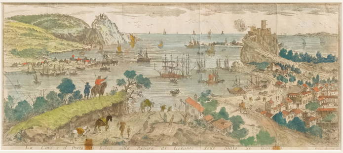
Sold2023Set of Hand-colored Views of Italy & FranceItalian, 18th century or earlier engravings with hand-colored details, 1) depicting Genova, 9 1/4" x 14 1/2" sight, 13" x 21 1/4" framed; 2) depicting the city of Nice, 6 1/4" x 14 1/2" sight, 13 1/4"See Sold Price
Sold2018ANTONIO ZATTA (ITALIAN, 18TH CENTURY) MAP / ATLAS OFANTONIO ZATTA (ITALIAN, 18TH CENTURY) MAP / ATLAS OF NORTH AMERICA, SET OF 12, hand-colored, on laid paper, comprising title page lettered in part "LE / COLONIE UNITE / DELL' / AMERICA SETTENTR'LE." aSee Sold Price
Sold2023Antique Map Of Italian Papal States Near RomeProbably 17th Century, Hand Colored Engraving With Patrimonio Di S. Pietro Sabina Et Ducato Di Castro, Sight 14 X 18 Inches, Later Frame 19 X 23 X 1 Inches. See Photos For Condition.See Sold Price
Sold2016ANTIQUE NEW-FRANCE HAND COLORED MAPANTIQUE NEW-FRANCE HAND COLORED MAP, H 27 1/2" IMAGE, W 20 1/2":Framed, measures H.30" x 23" overall.See Sold Price
Sold2024Matthaus Merian 1627 Antique Hand Colored Map "Virginia" from Theodore de Bry's "Grand Voyages" #2Antique 1627 hand-colored map of Virginia by Matthaus Merian after John Smith's 1612 map, from Theodore de Bry's "Grand Voyages". Good condition overall, with age-appropriate wear, repairs (see photosSee Sold Price
Sold2020F. B. Werner, "Roma" hand-colored map, 1730F. B. Werner, "Roma" hand-colored map, 1730, Panoramic view of Rome, hand-colored engraving on laid paper, no watermark observed, two sheets joined at center, marked "F. B. Werner delin Ao 1730" and "See Sold Price
Sold2020Small Hand-Colored Map of Nantucket by William SchontzeSmall Hand-Colored Map of Nantucket by William Schontzeler,rare pictorial map of Nantucket in original frame, signed, l.r William Cotton Schontzeler, trained as a draftsman in NY, he owned and workedSee Sold Price
Sold2021French Hand-Colored Map of America, 1750Antique French Hand-Colored Map of America , "Amerique Septentrionale, dressee, sur les Relations les plus modernes...", 1750, Robert de Vaugondy, the cartouche with an alligator flanked by figures, 1See Sold Price
8 hrs LeftHunt and Peck Estate Services, Inc.ANTONIO ZATTA (ITALIAN, 18TH CENTURY) MAP OF VIRGINIA$70(1 bid)
May 17Albion AuctionsMarmocchi, F. C. 1845 Hand Col Map. Holy Land. Persia Empire, Alexander the Great$5
2 days LeftTrillium Antique Prints & Rare BooksPtolemy & Magini, pub. 1620 - Map of Tuscany, Italy$50
2 days LeftTrillium Antique Prints & Rare BooksPtolemy & Magini, pub. 1620 - Map of the British Isles (Britain, Scotland, Ireland)$50
2 days LeftTrillium Antique Prints & Rare BooksPtolemy & Magini, pub. 1620 - 4 Maps of Parts of Asia$50
2 days LeftTrillium Antique Prints & Rare BooksBraun & Hogenberg, pub. 1575 - View of Bologna, Italy$100(1 bid)
May 18Blackstone Valley Auctions & Estates LLCRevolutionary Era War Map of the Attack on Ft. Moultrie.$120(2 bids)


![Antique Italian Map: Antique hand-colored map of "Galliae Veteris". [Sight: 15" H x 19" W; Frame: 18" H x 22" W]. In good condition.](https://p1.liveauctioneers.com/1221/202668/104343463_1_x.jpg?height=310&quality=70&version=1622581573)
![Antique Italian Map: Antique hand-colored map of "Mosellae Fiuminis". [Sight: 19" H x 22" W; Frame: 23" H x 26" W]. In good condition.](https://p1.liveauctioneers.com/1221/202668/104343462_1_x.jpg?height=310&quality=70&version=1622581573)
![Antique Italian Map: Antique hand-colored map of Tuscany. [Sight: 12" H x 18" W; Frame: 15" H x 25" W]. In good condition.](https://p1.liveauctioneers.com/1221/202668/104343461_1_x.jpg?height=310&quality=70&version=1622581573)