Sold2021Paolo Petrini (17C.) Hand Colored Naples Italy Map17th to 18th Century panorama map by Paolo Petrini depicting the coastal region of Naples, Italy. Beautifully detailed and colored, with all divisions of the city gorgeous etching artwork throughout.See Sold Price
Sold20231855 Colton Handcolored Map, Southern Italy Kingdom of NaplesSouthern Italy Kingdom of Naples Sardinia & Malta, dated 1855, beautifully engraved, pastel colored map of Southern Italy &identifies various cities, towns, rivers, rapids, mountain passes, and an assSee Sold Price
Sold2018Southern Italy. Kingdom of two Sicilies with insert ofSouthern Italy. Kingdom of two Sicilies with insert of Naples by Tanner 1843 based on the work of H.C. Tanner 17" x 14" Hand colored engraved Map based on the work of H.C. Tanner from the first editioSee Sold Price
Sold2023B.R.Davies Hand Colored Antique Venice Italy MapMarked on backside Authentic Antique Print, date London c.1840 Medium. Hand colored engraving, artist, B.R. Davies. Marked on lower right corner engraved by B.R.Davies, drawn by WB Clarke. Reads VenicSee Sold Price
Sold202019th CENTURY WILLIAM BLAEU "ITALY" ENGRAVING19th CENTURY WILLIAM BLAEU "ITALY" MAP HAND COLORED COPPER PLATE ENGRAVING. Height: 27 in. by Width: 31 in.See Sold Price
Sold2020Hand Colored Map Of ItalyHand colored map of Italy, Robert circa 1770, 13" x 14" unframed, 20" x 21" framed. Provenance: John's Island, Vero Beach, Florida.See Sold Price
Sold2023Genova, Paolo Rivara Geografia Commerciale Italian Hand Colored MapItalian hand colored map depicting the Eastern United States titled "Stati Occidentali Della Unione Americana" originally from Geografia Commerciale 1858. Sight Size: 11 1/2" H X 13 3/4" W.See Sold Price
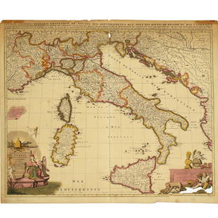
Sold2021Large Hand Colored Framed Map of Italy, StanfordsLarge Hand Colored Framed Map of Italy, Stanfords. Dated 1859. Sight size: 4'8"h x 47-1/2"w Overall: 5'4"h x 4'7"w. Item cannot be unframed as it consists of multiple hand colored maps completing theSee Sold Price
Sold202417C. Willem & Jan Blaeu Map of VenezuelaWillem & Jan Blaeu Netherlands 17th Century Hand colored map of Venezuela and the lower Antilles created by Willem Blaeu and Jan Blaeu with glass back to feature atlas pages. Lithograph on paper,ImageSee Sold Price
Sold20241839 Italy Map by MoninTitle: 1839 Italy Map by Monin Date/Period: 1839 Materials: Hand colored, engraved Size: 17 1/2” x 12 1/2” 1839. By V. Monin. Paris. Hand-colored, engraved. Good condition, with some foxinSee Sold Price
Sold2019Two Maps by Johnson & Browning, "Austria, Turkey,Two Maps by Johnson & Browning, "Austria, Turkey, Greece," 1859; together with "Northern and Southern Italy," 1860-1863, hand colored, Italy- H.- 26 1/2 in., W.- 36 in., Austria- H.- 18 in., W.- 26 1/See Sold Price
Sold2024TWO ANTIQUE HAND COLORED MAPS OF REGIONS OF ITALYTwo antique hand colored maps of different regions of Italy. The first map is of Perugia / Perusini Italy, frame 17" x 21.5" wide, published by Abraham Ortelius after a map by Egnatio Dante. The seconSee Sold Price
Sold2018Georg Matthaus Seutter (German, 1678-1757) 17C MapGeorg Matthaus Seutter (German, 1678-1757) 17th century map. Nova Belgii America Septentrionali hand colored engraved map. In good condition, not glued down, tape hinge at top, there is a quarter inchSee Sold Price
Sold2024Antique Hand-colored Harbour Plan - Map Milazzo - Sicily, Italy, MediterraneanOriginal hand-colored copper engraving print originates from "Recueil des Principaux Plans des Ports et Rades de la Mer Méditerranée …", translated from French as "CollectionSee Sold Price
Sold2022Barclay, James C1800 Hand Col Map. ItalyHand Colored Copper Engraved Map Published C1800 Halifax & Newcastle, England for "Barclay's Universal English Dictionary…" by James Barclay. Maps Engraved by Clerk, Milton and others. Paper Size: 1See Sold Price
Sold2022Barclay, James C1800 Hand Col Map. ItalyHand Colored Copper Engraved Map Published C1800 Halifax & Newcastle, England for "Barclay's Universal English Dictionary…" by James Barclay. Maps Engraved by Clerk, Milton and others. Paper Size: 1See Sold Price
Sold2024Aitchison, Alexander 1799 Hand Col Map. ItalyOutline Hand Colored Copper Engraved Map Published 1798-99, London for "The Modern Gazetteer; Being a compendious Geographical Dictionary?" by Alexander Aitchison. Folds as issued. Paper Size: 10 x 10See Sold Price
Sold2023Russell & Barclay 1839 Hand Col Map. ItalyHand Colored Copper Engraved Map Published 1823-40, by Fisher & Son, "A Complete Atlas of the World" by John Russell et al. A Very Rare Work which is compiled from the same plates used in different edSee Sold Price
Sold2022Barclay, James 1812 Hand Col Map. ItalyHand Colored Copper Engraved Map Published 1812-13 by Brightly & Childs, Bungay for "A Complete and Universal Dictionary of the English Language..." by the Rev. James Barclay. Paper Size: 10.5 x 8 incSee Sold Price
Sold2023Hoffmann, Carl 1869 Hand Col Print. Naples & Vesuvius, Italy 16Hand Colored Lithograph Published 1842-80, Stuttgart for "Das Buch der Welt" by Carl Hoffmann. Paper Size: 9.5 x 7 inch (25 x 18cm) Approx. Good Condition overallSee Sold Price
Sold2018Weigel: Antique Map of Italy, 1720Title/Content of Map: Italy by Weigel Date Printed: c1720 Cartographer: C. Weigel Material/Medium: Paper Size: 14" x 17 1/2" Hand colored copperplate engraved. Published in Nuremberg. Please note thatSee Sold Price
Sold2022Nicolas Sansom, map of Italy, 1701Nicolas Sansom, map of Italy, 1701, "L'Italie Divisee Suivant l'Estendue de Toutes ses Sourverainetes…", Pieter Schenk, Amsterdam, 1701, hand-colored copper plate engraving on laid paper, 20.25"See Sold Price
Sold20222 E. Bowen Maps of Italy & GreeceEmanuel Bowen, Welsh, 1694-1767. Two 18th century hand-colored engraved maps. Includes one titled "Middle or Proper Italy" and another titled "A Map of Great Greece and the Islands of Sardinia and CorSee Sold Price
Sold2021Nicolas Sansom, map of Italy, 1701Nicolas Sansom, map of Italy, 1701, "L'Italie Divisee Suivant l'Estendue de Toutes ses Sourverainetes…", Pieter Schenk, Amsterdam, 1701, hand-colored copper plate engraving on laid paper, 20.25"See Sold Price
May 09Hunt and Peck Estate Services, Inc.ANTONIO ZATTA (ITALIAN, 18TH CENTURY) MAP OF VIRGINIA$70(1 bid)
4 days LeftTrillium Antique Prints & Rare BooksHamilton - Pair of Engravings of a Painting from a Grecian Vase$100
4 days LeftTrillium Antique Prints & Rare BooksHamilton - Pair of Engravings of a Painting from a Grecian Vase$100
4 days LeftTrillium Antique Prints & Rare BooksHamilton - Pair of Engravings of a Painting from a Grecian Vase$100
5 days LeftTremont AuctionsJohn Speed and Francis Lamb "Map of New England and New York", ca. 1676. Hand colored engraved map$900(3 bids)
4 days LeftTrillium Antique Prints & Rare BooksMitchell's A New Universal Atlas.. - Volume with 73 Maps$1,000(1 bid)
May 14Fleischer's Auctions1755 Map Partie de l'Amerique Septentrionale, qui comprend Le Cours de L'Ohio...$200(3 bids)


![[MAP - TOURS] (1 of 1)](https://p1.liveauctioneers.com/292/326828/175962850_1_x.jpg?height=282&quality=70&version=1713473479)