Sold2023Hudson's Map of Minneapolis compiled from official sourcesTitle: Hudson's Map of Minneapolis compiled from official sources Publisher: Hudson Publishing Company Date: ©1921 Description: Name in ink on cover Height: 27.5 Width: 18.25 Reserve: $65.00 ShipSee Sold Price
Sold2017Hall: Map of Canada, Webster-Ashburton Treaty, 1943Map Title: 'British Possessions in North America, with part of the United States, compiled from official sources' Date: c1843 Size: Approx 38.0 x 64.5cm, 15 x 25.25 inches (Large) Type: Antique foldinSee Sold Price
Sold2022Map of the Leadville Mining District; 1901 [152843]Map of the Leadville Mining District Compiled from Official Records and Other Reliable Sources by Chas. F. Saunders. January 1901. Scale 1200 Ft. to the Inch. Printed by Denver Litho. Co. CopyrightedSee Sold Price
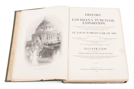
Sold2022HISTORY OF THE LOUISIANA PURCHASE EXPOSITIONHISTORY OF THE LOUISIANA PURCHASE EXPOSITIONCompiled from official sources by Mark Bennitt and Frank Parker Stockbridge, illustrated with thousands of images, Universal Exposition Publishing Company,See Sold Price
Sold2023Minneapolis / Official Map of the City of DuluthTitle: Minneapolis / Official Map of the City of Duluth Cartographer: CRAM, GEORGE F. Publisher: GEO. F. CRAM Date: ©1904 Description: Detailed early 20th C. plans. Height: 12.8 Width: 10 ReserveSee Sold Price
Sold2021Rare guide to San Diego with map 1911Heading: (California - San Diego) Author: Title: San Diego Pocket Guide: A compendium of general information of the city of San Diego, with latest map, carefully compiled from latest sources Place PuSee Sold Price
Sold2022Bancroft's large folding map of S.F. 1887Heading: -1887 Author: Title: Bancroft's Official Guide Map of City and County of San Francisco, Compiled from Official Maps in Surveyor's Office Place Published: San Francisco Publisher:The BancroftSee Sold Price
Sold2022Map of the settled part of San Francisco, 1883Heading: -1883 Author: Bancroft, Albert Little Title: Bancroft's Official Guide Map of City and County of San Francisco, Compiled from Official Maps in Surveyor's Office Place Published: San FranciscoSee Sold Price
Sold2020Geological Map of the United States and Canada...Title: Geological Map of the United States and Canada... Publication Date: 1896 Cartographer: VON HISE, C.R. Publisher: U.S.G.S./A. Hoen & Co. Brief Description: "...Compiled from Official maps of theSee Sold Price
Sold2016Map of Richmond, Virginia by Johnson, 1862 (James,Johnson’s Map of the Vicinity of Richmond, and Peninsular Campaign in Virginia Showing also the interesting localities along the James, Chickahominy and York Rivers. Compiled from the official mapsSee Sold Price
Sold2020History of Vernon Country Missouri''History of Vernon County, Missouri, Written and Compiled from the Most Authentic Official and Private Sources, including a History of its Townships, Towns and Villages...''. Brown & Co., 1887, 903 pSee Sold Price
Sold2021Large map of San Mateo County Cal. 1913Heading: (California - San Mateo County) Author: Denny, Edward, & Co. Title: Denny's Pocket Map of San Mateo County, California. Compiled from latest official and private data Place Published: San FraSee Sold Price
Sold20221881 Government Map of Yellowstone National Park -- Map of the Yellowstone National Park CompiledTitle: 1881 Government Map of Yellowstone National Park -- Map of the Yellowstone National Park Compiled from the Official Explorations & Surveys of the Superintendent of the Park.. Cartographer: US GSee Sold Price
Sold2023Official Map of Beaverhead County 1901Official Map of Beaverhead County, Montana, compiled from the latest official records by George R. Metlen, county surveyor, civil and mining engineer, Dillon, Montana, 1901. Measures approximately 44See Sold Price
Sold2021Antique New York State Map 1903 Color Roll Up RR Map1903 Scarborough's New Railroad, Post Office, Township and County Map of New York. Color map, compiled from the latest government and state surveys and original sources of the era. Insets: Map of NewSee Sold Price
Sold2022Wackenreuder map for 1861 Langley Directory of SFHeading: -1861 Author: Wackenreuder, Vitus Title: City and County of San Francisco. Compiled from official surveys, and sectionized in accordance with U.S. Surveys Place Published: San Francisco PubliSee Sold Price
Sold2020Eddy map of San Francisco 1849Heading: (California - San Francisco) Author: Eddy, William Marston Title: Official Map of San Francisco, Compiled from the Field Notes of the Official Re-Survey made by William M. Eddy, Surveyor of tSee Sold Price
Sold2022Eddy map of San Francisco 1849Heading: -1849 Author: Eddy, William Marston Title: Official Map of San Francisco, Compiled from the Field Notes of the Official Re-Survey made by William M. Eddy, Surveyor of the Town of San FranciscSee Sold Price
Sold2021Official Map of The United States Compiled from UnitedPublication Date: 1916 Title: Official Map of The United States Compiled from United Statesgovernment Surveys, Official State Surveys and Original Sources Cartographer: CROCKER, L.V. Publisher: THE NASee Sold Price
Sold2022Color map of San Francisco, 1885Heading: -1885 Author: Title: Guidemap of the City of San Francisco Compiled from the Official Surveys & engraved expressly for Langley's San Francisco Directory 1885 Place Published: San Francisco PSee Sold Price
Sold2022(KENTUCKY.) J.T. Lloyd. Lloyd's Official Map of the State of Kentucky.(KENTUCKY.) J.T. Lloyd. Lloyd's Official Map of the State of Kentucky. Compiled from Actual Surveys and Official Documents, Showing Every Rail Road & Rail Road Station with the Distances Between EachSee Sold Price
Sold2016RIGOBERT BONNE(1727–1795) MAP, ANTILLES & BERMUDAHand coloured copper engraving of the West Indies and Bermuda, 1780. Bonne succeeded Jacques Nicolas Bellin as official capacity, Bonne compiled some of the most detailed and accurate maps of the periSee Sold Price
Sold2022By rail from Buffalo to Chicago & beyondHeading: (United States) Author: Title: Map of the Lake Shore and Michigan Southern Railway and its connections: Compiled from the latest sources and showing the true location of each road Place PublSee Sold Price
Sold2017Wall map of Marin County 1892Heading: (California - Marin County) Author: Dodge, George M. Title: Official Map of Marin County, California 1892 Compiled from Records and Surveys Place Published: San Francisco Publisher:Schmidt LaSee Sold Price
7 hrs LeftJasper52Map No. 1. the Chickamauga Campaign... / Topographic Map of the Approaches and Defenses of$25
May 30Antiques Online AuctionsVintage Texas 1845 Map Printed in 1986, Compiled by John Davis$11(4 bids)
7 hrs LeftJasper521892 Cowles Civil War Map of Battles in Gettysburg, Virginia, W Virginia and Maryland -- Sketch of$75(2 bids)
Featured6 hrs LeftJasper521772 SALZBURG MONASTERY CHRONICLE PIGSKIN FOLIO antique ILLUSTRATED 76 PORTRAITS$650
Jun 23Schilb Antiquarian Rare Books1831 Northern Traveller Voyages to NIAGARA Falls Quebec Canada Illustrated MAPS$1


![Map of the Leadville Mining District; 1901 [152843]: Map of the Leadville Mining District Compiled from Official Records and Other Reliable Sources by Chas. F. Saunders. January 1901. Scale 1200 Ft. to the Inch. Printed by Denver Litho. Co. Copyrighted](https://p1.liveauctioneers.com/2699/258191/134290991_1_x.jpg?height=310&quality=70&version=1660351799)