Sold2024James Cook - Map of the Friendly Isles - Tonga IslandsThis is a French edition of Cook’s map of the Friendly Isles (Tonga Islands), published circa 1785.Size: 26 cm x 42 cmSee Sold Price
Sold2024James Cook - Map / Chart Of The Island TahitiEngraved nautical map from the 1774 first French edition of the first map of New Zealand, illustrating Lieutenant James Cook's 1769 exploration of the passage between New Zealand's North and South islSee Sold Price
Sold2024James Cook - Map of Tahiti, the Society Islands, and the VicinityEngraved nautical map from the 1774 first French edition of the first map of New Zealand, illustrating Lieutenant James Cook's 1769 exploration of the passage between New Zealand's North and South islSee Sold Price
Sold2018Antique Map of Capt. Cook’s Route / Friendly IslandsTitle/Content of Map: Carte von den Freundschaftlichen Inseln Place & Date: Germany / 1786 Size: 14 3/4" x 9 3/8" Condition: b&w; very light overall age toning, otherwise in excellent condition A simpSee Sold Price
Sold2024James Cook - Antique map Australia titled 'Gezigt van het Eil. Suffren'. Antique map of SuffrenAntique map Australia titled 'Gezigt van het Eil. Suffren'. Antique map of Suffren Island. Originates from 'Reizen Rondom de Waereld door James Cook (..)'. Artists and Engravers: Translated by J.D. PaSee Sold Price
Sold2018Antique Chart of the Island of Tahiti, 1775Title/Content of Map: Chart of the Island of Otaheite Date Printed: 1775 ca. Cartographer: Capt. James Cook R.N. Size (inches): 12.3x16.1 Large scale map of the Island of Tahiti, with detailed typograSee Sold Price
Sold2024Robert Benard - pitcairn map - 1774The Map of Pitcairn Island, by expedition of James Cook by French engraver Robert BenardSize 32,5 x 35,5See Sold Price
Sold2015Two maps of the Sandwich Islandsincluding Charte von den Sandwich Inseln by James Cook (1728- 1779), published in Des Capitan Jacob Cook's dritte Entdeckungsreise, 1788, depicting Cook's route through the Sandwich Islands/Hawaii, wiSee Sold Price
Sold2016James Cook, Carte Des Decouvertes Mer PacifiqueAn engraved map / chart of the Pacific Islands, Carte Des Decouvertes faites dans la Mer Pacifique, Commande par le Capitaine Cook, en 1774. Authored by Captain James Cook in 1774, with Nouvelle CaledSee Sold Price
Sold2022Wyld, James 1840 LG Hand Col Map. West Africa"Map of Part of the Western Coast of Africa Extending from the Isles de Loss to Sherboro Island" Showing Sierra Leone and area. Hand Colored Steel Engraved Map By Surgeon O'Beirne and Major Laing. PubSee Sold Price
Sold2023James Cook Antiquated MapAntiquated framed and glazed map / 'agenera chart' depicting the voyages and discoveries of Captain James Cook height 28 in. x width 42 in. x depth 1.5 in. We happily provide seamless shippiSee Sold Price
Sold2016Offering for Captain James Cook. Hawaii Islands. 1837.Print of steel engraving titled „Offrande faite a Cook“.Drawn by Danvin.Engraved by Lederer.From „L'univers pittoresque: histoire et description de tous les peuples“, Published by Firmin DidotSee Sold Price
Sold20191784 Map of the Friendly IslandsA map of the Friendly Islands published by Alex. Hogg, London, circa 1784. Trim to top margin, very good, measures 14 x 9.5”. Reserve: $20.00 Shipping: Domestic: Flat-rate of $5.00 to anywhere withiSee Sold Price
Sold2019Bryce, James 1881 Map of Islands. Singapore, Hong KongAlso Channel Islands, Malta, Malaysia, Gibraltar, and Aden. Lithograph Map Published 1881, London for ""The International Atlas and Geography..." by James Bryce. Maps by Edward Weller & John BartholomSee Sold Price
Sold2018James Island, Near Charleston, S.C., With the PositionTitle/Content of Map: James Island, Near Charleston, S.C., With the Position of the Federal Camps, And The Plan of The Advance Of Our Forces to Attack The Rebel Batteries Near Secessionville, June 16See Sold Price
Sold2022Barclay, James C1800 Map. East India IslandsCopper Engraved Map Published C1800 Halifax & Newcastle, England for "Barclay's Universal English Dictionary…" by James Barclay. Maps Engraved by Clerk, Milton and others. Paper Size: 10 x 8 inch (2See Sold Price
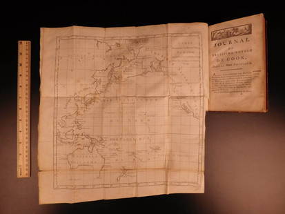
Sold2021The Geographical Journal - Captain CookCaptain James Cook and the Sandwich Islands. A paper contributed to the Celebrations at Honolulu in August 1928. Vol. LXXIII No. 2 Publishers brown cloth with gilt title. Portrait frontispiece + full-See Sold Price
Sold20241783 Captain James Cook Third Pacific Voyage Illustrated MAP Australia Rickman1783 Captain James Cook Third Pacific Voyage Illustrated MAP Australia Rickman “Remember, the greater the opportunity, the fewer are those who see it.” – James Cook James Cook was an 18th-ceSee Sold Price
Sold2021Antique Map of Captain James Cook's Voyages to theAntique map of Captain James Cook's voyages to the Pacific region. Captain Cook made numerous discoveries in the Pacific region during the late 1700's . Artists and mapmakers aboard the ship, includinSee Sold Price
Sold2020Large Pacific Islands Tapa Cloth, ca. 1970**First Time At Auction** Pacific Islands, Fiji, Samoa, Hawaii, Tonga, the Cook Islands, or Papua New Guinea, ca. 1970 CE. A stunning tapa cloth presenting multiple bands of stylized geometric motifsSee Sold Price
Sold20191783 Captain James Cook Third Pacific Voyage Illustrate1783 Captain James Cook Third Pacific Voyage Illustrated MAP Australia Rickman “Remember, the greater the opportunity, the fewer are those who see it.” – James Cook James Cook was an 18th-centurSee Sold Price
Sold20221787 Bonne Map of the Canary Islands -- Isles CanariesTitle: 1787 Bonne Map of the Canary Islands -- Isles Canaries Cartographer: R Bonne Year / Place: 1787, Paris Map Dimension (in.): 9.2 X 13.6 in. This is a very nice map of the Canary Islands with a sSee Sold Price
Sold2023Barclay, James 1808 Antique Map. Asia and its IslandsCopper Engraved Map Published 1806, London for "Barclay's Complete and Universal English Dictionary" by the Rev. James Barclay. Paper Size: 10 x 8 inch (26 x 21cm) Good ConditionSee Sold Price
Sold2019Bryce, James 1881 Map of New Zealand South IslandLithograph Map Published 1881, London for ""The International Atlas and Geography..." by James Bryce. Maps by Edward Weller & John Bartholomew. Uncommon. Paper Size: 18 x 13 inch (46 x 33cm) Good CondSee Sold Price
8 hrs LeftTrillium Antique Prints & Rare BooksWebber & Cook, Rare - A View in the Islands of Pulo Condore$500
May 11Trillium Antique Prints & Rare BooksWebber & Cook, Rare - View of the Harbour of Taloo, in the Islands of Eimeo$500
Jun 02Schilb Antiquarian Rare Books1880 Captain James Cook Voyages Hawaii Pacific Australia Kippis South Sea Navy$1
5 days LeftJasper52WEST INDIES Caribbean Windward Leeward Islands Barbados Pirates? MALLET 1683 map$220
5 days LeftJasper52Les Isles de la Guadeloupe, de Marie Galante… Îles des Saintes. BONNE 1780 map$45
5 days LeftJasper52Cartes de supplément pour les Isles Antilles. West Indies Islands BONNE 1790 map$40
5 days LeftJasper52Isles Antilles Extrait des Cartes Angloises. British West Indies. BONNE 1780 map$70
5 days LeftJasper52Puerto Rico & Virgin Islands. Haiti, Hispaniola or St. Domingo. THOMSON 1817 map$130
Featured5 days LeftJasper52Carte du Golfe du Mexique et des Isles de l'Amerique' Caribbean BELLIN 1754 map$200
5 days LeftJasper52HAWAII HISPANIOLA. Hawaiian Isles; Haiti San Domingo Dominican Republic 1898 map$20
5 days LeftJasper52Puerto Rico & Virgin Islands. Haiti, Hispaniola or St. Domingo. THOMSON 1817 map$130
8 hrs LeftTrillium Antique Prints & Rare BooksWebber & Cook, Rare - View in the Island of Cracatoa$500
8 hrs LeftTrillium Antique Prints & Rare BooksWebber & Cook, Rare - A View in Oheitepeha Bay, in the Island of Otaheite$500
5 days LeftHunt and Peck Estate Services, Inc.1784 Captain James Cook "A Voyage to the Pacific Ocean" 2 of 3 volumes$360(2 bids)
May 11Trillium Antique Prints & Rare BooksWebber & Cook, Rare - A Toopapaoo of a Chief, with a Priest Making His Offering to the Morai, in$500
5 days LeftJasper52L’Isle de St Domingue et… Porto-Rico. Hispaniola & Puerto Rico. BONNE 1788 map$40
5 days LeftJasper52Carte de l'Isle de la Martinique, Colonie Françoise…. Antilles. BONNE 1780 map$55
May 12Schilb Antiquarian Rare Books1844 Harper Library United States Poland Navigation MAPS 14v Voyages RARE LOT$56(5 bids)
May 16Potter & Potter AuctionsLISTER, James Wren (1897 – 1952). Avalon Town / Santa Catal...$100(1 bid)
4 days LeftJasper521850 James Maps from Mexican-American War of Battle of Sacramento and Brazito, Map of Santa Fe and$80