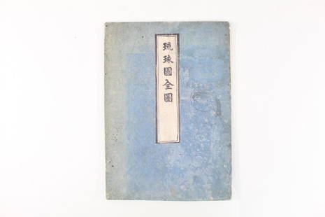
Sold2021Japanese Fold Out Handmade Ink Drawn Map,Islands,RoutesJapanese Fold Out Handmade Ink Drawn Map,Islands,Routes. This is a beautiful, handmade map of what appear to be islands and possibly routes. It is written in Japanese. The two hard covers are attachedSee Sold Price
Sold2021Tallis, John (Pub) 1852 Map Islands in the Indian OceanSteel Engraved Map with Original Outline Hand Color Published 1852-56 by John Tallis, London for "The Universal Pronouncing Dictionary" by Thomas Wright. Drawn & Engraved by John Rapkin. Centre fold aSee Sold Price
Sold2021Tallis, John (Pub) 1852 Map Falkland Islands, PatagoniaSteel Engraved Map with Original Outline Hand Color Published 1852-56 by John Tallis, London for "The Universal Pronouncing Dictionary" by Thomas Wright. Drawn & Engraved by John Rapkin. Centre fold aSee Sold Price
Sold2021Tallis, John (Pub) 1852 Map. Channel IslandsSteel Engraved Map with Original Outline Hand Color Published 1852-56 by John Tallis, London for "The Universal Pronouncing Dictionary" by Thomas Wright. Drawn & Engraved by John Rapkin. Centre fold aSee Sold Price
Sold2021Tallis, John (Pub) 1852 Map. Overland Route to IndiaSteel Engraved Map with Original Outline Hand Color Published 1852-56 by John Tallis, London for "The Universal Pronouncing Dictionary" by Thomas Wright. Drawn & Engraved by John Rapkin. Centre fold aSee Sold Price
Sold2022Kim Rugg, Crowded Islands, 2013Kim Rugg(Canada, b. 1963)Crowded Islands, 2013ink on papersigned, dated and titled lower left: Kim 2013 'Crowded Islands'*Hand drawn, re-envisioned map25 x 19 in. (63.50 x 48.26 cm.), Frame: 27See Sold Price
Sold2021Tallis, John (Pub) 1852 Map. West India IslandsSteel Engraved Map with Original Outline Hand Color Published 1852-56 by John Tallis, London for "The Universal Pronouncing Dictionary" by Thomas Wright. Drawn & Engraved by John Rapkin. Centre fold aSee Sold Price
Sold2021Tallis, John (Pub) 1852 Map. Polynesia. Pacific IslandsSteel Engraved Map with Original Outline Hand Color Published 1852-56 by John Tallis, London for "The Universal Pronouncing Dictionary" by Thomas Wright. Drawn & Engraved by John Rapkin. Centre fold aSee Sold Price
Sold2022Hughes, William C1865 Map. East India IslandsSteel Engraved Map Published C1865 London for "The History of England..." By David Hume, Tobias Smollett and others. Drawn and Engraved by William Hughes. Centre fold as published. Paper Size: 13.5 xSee Sold Price
Sold2022Hughes, William C1865 Map. East India IslandsSteel Engraved Map Published C1865 London for "The History of England..." By David Hume, Tobias Smollett and others. Drawn and Engraved by William Hughes. Centre fold as published. Paper Size: 13.5 xSee Sold Price
Sold2018Map of St. DomingueTitle: Map of St. Domingue (Hispaniola) Artist: A. Tardieu Medium: ink on paper Dimensions: 20" X 15" Map of the Island of St. Domingue dated 1802. Engraved and drawn by Ambroise Tardieu in Paris.ExtrSee Sold Price
Sold2021Tallis, John (Pub) 1852 Map. Japan & Corea. KoreaSteel Engraved Map with Original Outline Hand Color Published 1852-56 by John Tallis, London for "The Universal Pronouncing Dictionary" by Thomas Wright. Drawn & Engraved by John Rapkin. Centre fold aSee Sold Price
Sold2021Findlay, Alex 1840 Map of the MediterraneanSteel Engraved Map 1840 by Fisher & Son, London for "The Shores and Islands of the Mediterranean" By the Rev. George Newham Wright. Drawn & Engraved by Alexander Findlay. Center fold as issued. PaperSee Sold Price
Sold20231945 Geographical Map Of Japan & KoreaMarked copyright 1945 for The National Geographic Magazine. Depicts the geographical maps of the peninsula of Korea and Islands of Japan. Approximately 26 x 37 inches. Minor discoloration of folds ofSee Sold Price
Sold2019Japan C1880 Pair of Maps by Nolan & Blackie"The Islands of Japan with Corea..." Steel Engraved Map Published C1880, London for "The Illustrated History of the British Empire in India and the East" by Edward H. Nolan. Centre fold as published.See Sold Price
Sold2024HUGE ANATOLE KRASNYANSKY ORIGINAL PAINTINGKRASNYANSKY, Anatole, (American/Russian, 1930-2023): "Orchestra #3", 2008, Acrylic and Watercolor Painting on Handmade Japanese Paper, signed in ink lower left, fine heavy original custom framing, 51.See Sold Price
Sold202119th Century Map of MemphisPLAN DE LA VILLE DE MEMPHIS (ETATS-UNIS) 40,000 HABITANTS pen and ink with watercolor hand drawn drainage system map, circa 1870. Depicts a grid street plan of the city of Memphis with labeled streetSee Sold Price
Sold2022Work on paper, Chiura ObataChiura Obata (Japanese/American, 1885-1975), Angel Island, ink wash on paper, signed and stamped lower right, sheet (unframed): 15"h x 20.5"w. Note: In this historically significant view, the tugboatSee Sold Price
Sold2015A six-fold paper screen, Edo period, 19th centuryA six-fold paper screen, Edo period, 19th century , painted in ink and colour on a buff ground with autumn flowers, a bamboo fence, rocks, a pair of Oshidori (Mandarin ducks) and s hikishi (poem slipsSee Sold Price
Sold2020Keith Haring - Untitled, Drawing on New York MapKEITH HARING (1958-1990) Untitled (Crawling Baby) Ink on paper 27 1/2" x 22" Signed lower left side and inscribed "To Mike" Drawn on a 1983 New York City Transit Authority mapSee Sold Price
Sold20151867 Map of California and NevadaLeander Ransom & Amos Doolittle: A New Map of the States of California and Nevada, Exhibiting the Rivers, Lakes, Bays and Islands, with the principal Towns, Roads, Railroads and Transit Routes to theSee Sold Price
Sold2024Blackie (Pub) 1882 Folio Map. Chinese Empire and JapanLithograph Map Published 1882 by Blackie & Son, London for "The Comprehensive Atlas & Geography of the World" by W. G. Blackie. Centre fold as published. Paper Size: 22 x 15 inch (56 x 38cm) Good condSee Sold Price
Sold2021Toko Shinoda. Japanese. Ink on paper. AbstractToko Shinoda. Japanese. Ink on paper. Abstract composition. Red seal lower left. Signed and inscribed on reverse. Toning to paper. A few flake losses to paper, some in areas of ink application. OveralSee Sold Price
Sold2022Antique Japanese MapAntique Japanese Map, Marked Ishi-Kawa-Ryugi, Genroku Yonen-Ban-Nippon-zu, Tokyo, Sagamiya, 1691, Maps Of Japan. Folded Approximately 10.375L x 7.0625W in. Unfolded Approximately 66L x 40.25W in.See Sold Price
Jun 08Early American History Auctions1853 Map, Basin of the St. Lawrence, by T. Keefer showing Natural + Artificial North American Routes$220
1 day LeftDreweatts Donnington PrioryA Japanese Rimpa school six-fold byobu or floor standing screen£1,500
Featured20 hrs LeftJasper521764 Bellin Map of Lesser Antilles Northern Portion -- Petites Antilles ou Isles du Vent 3e. Partie.$130
Featured20 hrs LeftJasper52Johnson's New Military Map of the United States Showing the Forts, Military Posts &C. With Enlarged$65
Featured20 hrs LeftJasper52Railroad Map of the United States Showing the Through Lines of Communication...$50
20 hrs LeftJasper52Map No. 1. the Chickamauga Campaign... / Topographic Map of the Approaches and Defenses of$25
Jun 08Early American History Auctions1720 Colonial Northumberland County Virginia Manuscript Deed and Map Plot$400
20 hrs LeftJasper521892 Cowles Civil War Map of Battles in Gettysburg, Virginia, W Virginia and Maryland -- Sketch of$75(2 bids)
May 31Freeman's | Hindman[CIVIL WAR]. Soldier's letter describing the Battle of Fredericksburg. "Camp on Battle Field on the$200


![[CIVIL WAR]. Soldier's letter describing the Battle of Fredericksburg. "Camp on Battle Field on the (1 of 2)](https://p1.liveauctioneers.com/197/329785/177758368_1_x.jpg?height=282&quality=70&version=1715625218)


