Sold2015Map of The Asia divided in different states. 1828Print of steel engraving titled L‘ Asie divisee en ses differens Etats“.Author Fellx Delamarche.Engraved by unknown.From Atlas de la Geographie ancienne du moyen age et moderne“ by Fellx DelamarSee Sold Price
Sold20181787 Sayer Map of Asia -- Asia and Its IslandsTitle/Content of Map: 1787 Sayer Map of Asia -- Asia and Its Islands According to D'Anville; Divided Into Empires, Kingdoms, States, Regions &ca... Date Printed: 1787, London Cartographer: R Sayer SizSee Sold Price
Sold2021ASIA China Arabia Tartary Siam Persia India EastTITLE/CONTENT OF MAP: 'Asia' States marked on the map include Siberia, Cochin China, China, Hindoostan, Cabool (Kabul), Turkey, Arabia, Persia, Beloochistan, Birmah, Siam, Malaya, Independent Tartary,See Sold Price
Sold2019ASIA. Tartary Siam Persia Cabool Cochinchina EastTITLE/CONTENT OF MAP: 'Asia' States marked on the map include Siberia, Cochin China, China, Hindoostan, Cabool (Kabul), Turkey, Arabia, Persia, Beloochistan, Birmah, Siam, Malaya, Independent Tartary,See Sold Price
Sold2018Tallis/Rapkin: Antique Map of Asia, 1849TITLE/CONTENT OF MAP: 'Asia' States marked on the map include Siberia, Cochin China, China, Hindoostan, Cabool (Kabul), Turkey, Arabia, Persia, Beloochistan, Birmah, Siam, Malaya, Independent Tartary,See Sold Price
Sold2024Nicolas Sanson - Map of Asia / Asia divided into its Principal RegionsCopper engraving, 1600s/1700s, "Asia divided into its Principal Regions." By Mr. Sanson, Geographer Ordinary to the King. Size: 58 cm x 88 cm.See Sold Price
Sold2015Map of Asia Minor. 1828.Print of steel engraving titled Tableau de la retraite des dix mille“.Author Fellx Delamarche.Engraved by unknown.From Atlas de la Geographie ancienne du moyen age et moderne“ by Fellx Delamarche.See Sold Price
Sold2017Williams: Antique Pocket Map on New York State, 1828Map: 1828 Williams Pocket Map on New York State -- The Tourist's Map of the State of New York Compiled from the Latest Authorities in the Surveyor General's Office Cartographer: W. Williams Year / PlaSee Sold Price
Sold2016Asia Minor during Christian eraHeading: Author: Bowen, Emanuel Title: An Accurate Map of Asia Minor, as Divided into its Provinces, before it became Possess'd by the Turks Place Published: London Publisher: Date Published: </See Sold Price
Sold2023Findlay, Alexander 1828 Map. United StatesCopper Engraved Map Published 1828, London for "The Oxford Encyclopaedia: Or, Dictionary of Arts, Sciences and General Literature" by Rev. W. Harris, J. A. Stewart, C. Butler, Rev. J. H. Hinton et al.See Sold Price
Sold2018D.F.R. Robinson Map of the United States.D.F.R. Robinson Map of the United States. Connecticut, 1828. Engraved map in two colors. Framed and matted, 19 x 24" overall. Mild brownish discoloration along central vertical fold, otherwise fine.See Sold Price
Sold2020Map of Asia coloured by hand Lithography 1864Map of Asia coloured by hand Author: different author Atlas: Atlante Geografico Universale Antico e Moderno Date: 1864 Technique: Lithography Leaf Dimension: 39x29 cm (15.35x11.42 inches) Engraving DiSee Sold Price
Sold20211828 Map of Ancient Asia MinorAuthor: Hall Title: 1828 Map of Ancient Asia Minor Medium: Ink on Paper Dimensions: 10.5"X8.5" Map of Ancient Asia Minor dated 1828. Map captures modern day Turkey. Part of Butler's Antique World AtlaSee Sold Price
Sold2019L'America divisa ne'suoi principali stati North & SouthReserve Reduced! TITLE/CONTENT OF MAP: 'L'America divisa ne'suoi principali stati di nuova projezione' A map of the Americas divided into its main states. The obvious inaccuracies in the map reflect tSee Sold Price
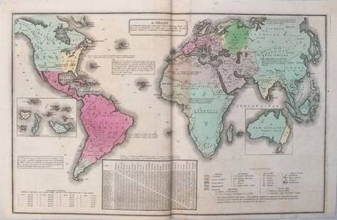
Sold2017Smith: Antique Map of the World, 1835Map: 1835 Smith World Map -- A Chart Exhibiting the Actual and Comparative Size of each Country, Nation, or Kingdom; its Population as a Whole and to a Square Mile. Also the Different States of SocietSee Sold Price
Sold20211835 Smith World Map -- A Chart Exhibiting the ActualTitle: 1835 Smith World Map -- A Chart Exhibiting the Actual and Comparative Size of each Country, Nation, or Kingdom; its Population as a Whole and to a Square Mile. Also the Different States of SociSee Sold Price
Sold2021Civil War era county map of Georgia & AlabamaS. Augustus Mitchell published some of the nicer atlases during the mid-19th century in America. Maps from these atlases are desirable documents showing what the different states looked like at the tiSee Sold Price
Sold20231828 Antique John Shury Eastern United States MapAn antique 1828 of the then United States engraved by John Shury stretching from the east coast to the border of present day Texas. Drawn by a 'J Assheton'.See Sold Price
Sold2022Europe en 1100. Europe in 1100. MALTE-BRUN c1871 old antique map plan chartTITLE/CONTENT OF MAP: 'Europe en 1100 indiquant la date de la fondation des différens etats [Europe in 1100 indicating the dates of the foundation of the different states]' DATE PRINTED: c1871 IMSee Sold Price
Sold2016A. Arrowsmith: Asia 1828Map: Asia Maker: A. Arrowsmith Publishing: London 1828 Size: 13.5 x 10.5 inches No Reserve: This lot starts at $1 and has no reserve as a courtesy so that collectors can determine the true market valuSee Sold Price
Sold2023Russell & Barclay 1839 Hand Col Map. AsiaHand Colored Copper Engraved Map Published 1823-40, by Fisher & Son, "A Complete Atlas of the World" by John Russell et al. A Very Rare Work which is compiled from the same plates used in different edSee Sold Price
Sold2022Cassini, Giovanni Maria - The Ecclesiastical State divided into its provinces with the adjacentRome, Chalcography Cam.le, 1805. Cm 195 x 187. Map divided into 10 parts with its own title, each consisting of 6 sheets 19 x 31 cm, with numerous ships, a large title cartouche, a cartouche entitledSee Sold Price
Sold20231828 Tourist's Map of the State of New York Compiled from the Latest Authorities Utica WilliamTourist's Map of the State of New York Compiled from the Latest Authorities. Utica: William Williams, 1828. This map was created to assist travelers and tourists in navigating through the state. The mSee Sold Price
3 days LeftTrillium Antique Prints & Rare BooksQuin - Map of AD 1783 Independence of the United States$50
7 days LeftJasper521894 Johnson Map of New England States -- Johnson's Section Map and Index of the New England States$80
May 09Hunt and Peck Estate Services, Inc.1794 Laurie & Whittle after Thomas Jefferys Map Of The United States Of America$340(1 bid)
9 hrs LeftDoyle New YorkThe proceedings of the first convention of abolitionist societies, scarce in wrappers$500
May 09Hunt and Peck Estate Services, Inc.1813 "A Concise History of the United States of America from the Discovery of America till 1813"$100
May 09Hunt and Peck Estate Services, Inc.1696 Jaillot Mapping The Ottoman Empire at the End of the 17th Century$140
May 16Potter & Potter AuctionsHANDY, R.D. (1879 – 1959). Paul Bunyan’s Pictorial Map of t...$200
May 16Potter & Potter AuctionsBOURNE, Emma (1906 – 1986). America – A Nation of One Peopl...$125(1 bid)
May 16Potter & Potter AuctionsCRAVATH, Glen (1897 – 1964). Py Your Leaf Baron Munchausen ...$80


![Europe en 1100. Europe in 1100. MALTE-BRUN c1871 old antique map plan chart: TITLE/CONTENT OF MAP: 'Europe en 1100 indiquant la date de la fondation des différens etats [Europe in 1100 indicating the dates of the foundation of the different states]' DATE PRINTED: c1871 IM](https://p1.liveauctioneers.com/5584/267896/140242912_1_x.jpg?height=310&quality=70&version=1668549165)


