Sold20191764 Asia Minor Turkey and Syria Map1764 map showing Turkey with Dardanelles peninsula in detail,Syria and Mesopotamia and Cyprus. Author D'AnvilleSee Sold Price
Sold2017Stackhouse: Antique Map of Turkey and Syria, 1783Title/Content of Map: Turkey and Syria Date Printed: 1783 Cartographer: Thomas Stackhouse Material/Medium: Paper Size: 16" x 20" Published in London in 'An universal Atlas.' Original hand color, coppeSee Sold Price
Sold20201764 d'Anville Map of Turkey and Parts of the MiddleTitle: 1764 d'Anville Map of Turkey and Parts of the Middle East -- Asiae, quae vulgo Minor Dicitur, et Syriae, Tabula Geographica… Year/Place: 1764, London Cartographer: J d'Anville Size: 20 x 24.5See Sold Price
Sold2022(ANATOLIA.) Pierre Mortier. Natolia. Asia Minor Auctore Phi. de la Rue.(ANATOLIA.) Pierre Mortier. Natolia. Asia Minor Auctore Phi. de la Rue. Large folio engraved map of Turkey, Cyprus and coastal Syria. 20¼x24¾ inches sheet size, wide margins, blank verso; orSee Sold Price
Sold2019Maps 1842-1920. Mixed Lot of 10Incl British Isles, Canada, Australia, Turkey/Greece, Persia, Syria, Asia Continent, Turkey in Asia, and Russia in Asia. Examples by Blackie/Weller, Starling, Stanford, and Gross. Paper Size: Up to 27See Sold Price
Sold2018Wyld, James C1840 Group of 4 Hand Coloured MapsIncl Spain/Portugal, Syria, Asia and Turkey in Asia. Hand Coloured Steel Engraved Map Published C1840, London for "Atlas of Modern Geography" by James Wyld. Centre fold as published. Paper Size: 11 xSee Sold Price
Sold2024MIDDLE EAST. Turkey Transjordan Palestine Israel Syria Levant States 1938 mapTITLE/CONTENT OF MAP: 'Western Asia; Palestine' DATE PRINTED: 1938 IMAGE SIZE: Approx 26.5 x 35.5cm, 10.25 x 14 inches (Large) TYPE: Vintage colour map: Scale 1:10,000,000; 1:1,400,000 CONDITION: GoodSee Sold Price
Sold20191855 1st ed Sevastopol Crimean War MAP Turkey1855 1st ed Sevastopol Crimean War MAP Turkey Constantinople McCormick Visit Richard McCormick was a 19th-century American politician. While touring Europe, McCormick became a war correspondent on theSee Sold Price
Sold2021Guthrie, William 1790 Map. Turkey in Europe & HungaryCopper Engraved Map Published 1790, London for "A New Geographical, Historical and Commercial Grammar..." by William Guthrie. The maps are by John Senex, Thomas Kitchin and others. Folds as issued. EaSee Sold Price
Sold2021Tallis, John (Pub) 1852 Map. SyriaSteel Engraved Map with Original Outline Hand Color Published 1852-56 by John Tallis, London for "The Universal Pronouncing Dictionary" by Thomas Wright. Drawn & Engraved by John Rapkin. Centre fold aSee Sold Price
Sold2020Middle East, todays turkey, Syria, Lebanon, Palestine,Title: Middle East, todays turkey, Syria, Lebanon, Palestine, Iran, Saudi Arabia, Iraq, Oman, Yemen, UAE, Qatar, Afghanistan. By Johnson Date/Period: 1861 Materials: Steel engraved. Size: 18x13” 186See Sold Price
Sold2022Salmon & Jeffreys 1749 Map. Turkey in AsiaCopper Engraved Map Published 1749, London for "A New Geographical and Historical Grammar" First or Early Edition by Thomas Salmon. Engraved by Thomas Jeffreys. Folds as issued. Paper Size: 10 x 8 incSee Sold Price
Sold2024Sale & Psalmanazar 1779 Map. Syria after the Death of Alexander the GreatCopper Enngraved Map Published 1779, London for "An Universal history, from the earliest account of time..." by George Sale, George Psalmanazar et al. Folds as issued. Paper Size: 12.5 x 8 inch (32 xSee Sold Price
Sold2021Tallis, John (Pub) 1852 Map. SyriaSteel Engraved Map with Original Outline Hand Color Published 1852-56 by John Tallis, London for "The Universal Pronouncing Dictionary" by Thomas Wright. Drawn & Engraved by John Rapkin. Centre fold aSee Sold Price
Sold2024C 1893 Victorian Map - Turkey - Armenia Cyprus Irak - Arabi - Turkish Empire 1850C 1893 Victorian Map - Turkey - Armenia Cyprus Irak - Arabi - Turkish Empire 1850 Measure 14"in H x 18"in WSee Sold Price
Sold2023Lizars, Daniel 1831 LG Rare HC Map. Turkey in AsiaLarge Folio Copper Engraved Map Published 1831-2 by John Hamilton, Successor to Daniel Lizars, Edinburgh for "The Edinburgh Geographical and Historical Atlas..." First Edition by Daniel Lizars. Very fSee Sold Price
Sold2023Rapkin, John 1860 Pair of Maps. Turkey in Europe and Asia MinorSteel Engraved Map Published 1860 by The London Printing & Published Company, London for "The Royal Dictionary-Cyclopedia for Universal Reference" by Thomas Wright. Drawn & Engraved by John Rapkin. FoSee Sold Price
Sold2019Barclay, James 1809 Antique Map. Turkey & Black Sea"Turkey in Europe with Asia Minor" Outline Hand Coloured Copper Engraved Map Published 1809, Leeds for "Barclay's Complete and Universal Dictionary of the English Language..." by the Rev. James BarclaSee Sold Price
Sold2021Tallis, John (Pub) 1852 Map. Turkey in AsiaSteel Engraved Map with Original Outline Hand Color Published 1852-56 by John Tallis, London for "The Universal Pronouncing Dictionary" by Thomas Wright. Drawn & Engraved by John Rapkin. Centre fold aSee Sold Price
Sold2021Guthrie, William 1798 Map. Turkey in Europe and HungaryCopper Engraved Map Published 1798, London for "A New Geographical, Historical and Commercial Grammar..." by William Guthrie. The maps are by John Senex, Thomas Kitchin and others. Folds as issued. PaSee Sold Price
Sold2024Cooke, George 1801 Antique Map. Turkey in EuropeCopper Engraved Map Published 1801-07 by Macdonald & Son, London for "Modern and Authentic System of Universal Geography" By George A. Cooke. Folds as issued. Paper Size: 12.5 x 10 inch (32 x 26cm) ApSee Sold Price
Sold2024Bartlett - Holy Land 1838 Lot of 3 Hand Col Prints. Turkey, SyriaMount Amanus, Cliffs of Alaya, and Mount Casius. Hand Colored Steel Engraving Published 1836-38, London for "Syria, the Holy Land, Asia Minor, &c." by William Bartlett. Paper Size: Up to 10.5 x 7.5 inSee Sold Price
Sold2021Tallis, John (Pub) 1852 Map. Turkey in EuropeSteel Engraved Map with Original Outline Hand Color Published 1852-56 by John Tallis, London for "The Universal Pronouncing Dictionary" by Thomas Wright. Drawn & Engraved by John Rapkin. Centre fold aSee Sold Price
Sold2024Cooke, George 1801 Antique Map. Turkey is AsiaCopper Engraved Map Published 1801-07 by Macdonald & Son, London for "Modern and Authentic System of Universal Geography" By George A. Cooke. Folds as issued. Paper Size: 12.5 x 10 inch (32 x 26cm) ApSee Sold Price
3 days LeftNY Elizabeth ERNEST FLOYER'S 1882 UNEXPLORED BALUCHISTAN ANTIQUE MAP ILLUSTRATED IN ENGLISH$50
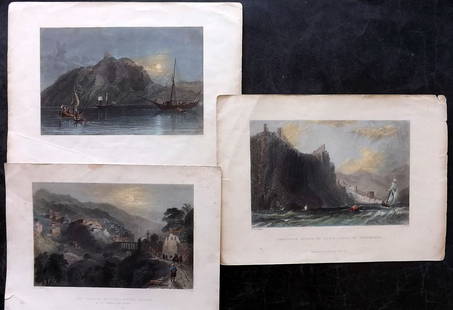
3 days LeftForum Auctionsd'Anville (Jean Baptiste Bourguignon) [Untitled Composite Atlas with 102 map sheets], [probably£2,000
1 day LeftJasper521696 SYRIA Asia Minor & Syrian-Arabic region HISTORY antique ILLUSTRATED vellum$360
2 days LeftJasper52La partie méridionale du Brésil et du Perou. SANTINI/D'ANVILLE 1784 old map$80
1 day LeftJasper521720 Homann Map of the Caspian Sea Region -- Provinciarum Persicarum Kilaniae nempe Chirvaniae$220


![d'Anville (Jean Baptiste Bourguignon) [Untitled Composite Atlas with 102 map sheets], [probably (1 of 3)](https://p1.liveauctioneers.com/5458/329231/177514974_1_x.jpg?height=282&quality=70&version=1715269091)


