Sold2021Mer Égée. Grèce des îlesMer Égée. Grèce des îles Ministère de la Culture et de la Communication (1979). Paris, Réunion des Musées Nationaux. ISBN: 2-7118-0115-2 CHF 50 / 100 EUR 45 / 91 ___See Sold Price
Sold2021Paul Jacoulet Woodblock - Fleurs Des Iles LointainesArtist: Jacoulet, Paul, 1902-1960 Title: Fleurs Des Iles Lointaines. Mers De Sud Edition: 175/350 Date: 1940 Medium: woodblock Image Size: 11 1/4 x 15 3/8 inchesSee Sold Price
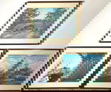
Sold2020Paul Jacoulet (1896-1960) Woodblock, FramedPaul Jacoulet (French 1896-1960). Framed woodblock titled "Fleurs Des Iles Lointaines, Mers du Sud", c.1947. Artist signed in pencil lower right above the Butterfly seal. Sheet sight measurement, 12.7See Sold Price
Sold2017Carre: Map of Sea of Japan & Korea, 1883Map: 'Carte des iles et mers du Japon, d'après les documents les plus récents' A large 19th century French sea chart of Japan, the sea of Japan, and the adjacent coast of north east Asia including tSee Sold Price
Sold2016LA PHALENE DES ILES DE LA MER lithographFranz Melcher. The Emerald of the Island of the Seas. Gorgeous stone lithograph. "L'Estampe Moderne," 1899-1900. 12 x 16" Artwork sold by the well-respected Century Guild gallery in Los Angeles, estabSee Sold Price
Sold2016Pacific.- Keate (George) Relation des Iles Pelew, 1788.Pacific.- Keate (George) Relation des Iles Pelew, first French edition, half-title, engraved portrait frontispiece, folding map and 15 plates, some folding, minor foxing at beginning and end, contempoSee Sold Price
Sold20162 Bände 'Relation des Iles Pelew' Captain Henri Wilson,2 Bände 'Relation des Iles Pelew' Captain Henri Wilson, Paris 1788 Genre: Reiseliteratur, Band I + II, Sprache: Französisch, aus dem Englischen übersetzt von George Keate, Datierung: 1788, Maße: 8See Sold Price
Sold20221820 French Koa Print Reine des Iles Sandwich (CsB)o23Item: Up for sale from a recent consignor in Honolulu Hawaii, this 1820 French Hawaiian Koa wood framed hand-colored engraving that is titled "Reine des Iles Sandwich" and depicts a Hawaiian male figuSee Sold Price
Sold2016Incunable leaves from La Mer des HystoiresHeading: (Early Printing - Incunabula) Author: Burchardus, de Monte Sion Title: Two original leaves from La Mer des Hystoires, on with a full page genealogical woodcut Place Published: Paris PublisherSee Sold Price
Sold2023Brass Hotel Des Iles Borromees Key HolderDESCRIPTION: Brass key holder from the Hotel Des Iles Borromees decorated with a green tassel and emblazoned with hotel name. CIRCA: 20th Century ORIGIN: Italy DIMENSIONS: H: 4.75" D: 1.5" Have a simiSee Sold Price
Sold2017Carte reduite des Iles Antilles/Carte reduite desMap: Carte reduite des Iles Antilles/Carte reduite des debouquements de St. Domingue Cartographer: Verdun de la Crenne Place & Date: Paris / 1775 Size: 22 1/4" x 34 1/4" An impressive two-in-one map oSee Sold Price
Sold2022Carte des Iles Antilles par J. B Poirson, 1802Property from the Collection of John and Virginia Duncan, Savannah, GA Description: Carte des Iles Antilles par J. B Poirson, 1802, Hand Colored Engraving, French map of the Antilles Islands, J. BSee Sold Price
Sold2019India.- Depot De La Marine. Mer Des Indes, CóteIndia.- Depot De La Marine. Mer Des Indes, Cóte Occidentale de L'Hindoustan de Goa á L'Indus, engraved sea chart, sheet 980 x 710 mm. (38 1/2 x 28 in), central horizontal fold reinforced verSee Sold Price
Sold20241920s Chanel no 22 and Chanel Bois de Ilesc1926 Parfums Chanel deluxe perfume presentation, Brosse Glassworks bottles for No. 22 and Bois des Iles (Wood of the Islands) in clear glass with flat gem facetted stoppers, paperlabels, underside moSee Sold Price
Sold2019Perouse Map of HawaiiGaloup, Jean Francois & Comte La Perouse Carte des Parties des Iles Sandwich... que ont ete Visitees au mois de Mai 1786 par les Fregates Francaises la Boussole et l'Astrolabe... [on sheet with] CarteSee Sold Price
Sold2018Very large map of South America, 1834Heading: Author: Brué, Adrien Hubert Title: Nouvelle carte de l'Amérique méridionale et des îles qui en dépendent... Place Published: Paris Publisher:Chez Chles. Piquet Date Published: 1834<See Sold Price
Sold2019Central Eastern Polynesian language. GAUSSIN.Ground-breaking study of the Central Eastern Polynesian languages. GAUSSIN, Pierre Louis Jean Baptiste. Du dialecte de Tahiti, de celui des îles Marquises, et, en général, de la langueSee Sold Price
Sold2021Prints, Jacques Etienne Victor Arago(lot of 4) Jacques Etienne Victor Arago (French, 1790-1855), "Ooro, Lun des Principaux chefs d'Ouriouriou, Roi des iles Sandwich," "Maniere de Punir de Mort un Coupable aux Iles Sandwich," "Maniere d'See Sold Price
Sold2020Henri Abraham Chatelain Map of Asia ca. 1700Henri Abraham Chatelain (1684-1743), "Carte des Indes, de la Chine & des Iles de Sumatra, Java &c, Dresee sur la Memoires les plus nouveaux & sur les meillures observations, tirees des RelatiSee Sold Price
Sold2023Three lithographs by VIKTOR SCHRECKENGOST (American 1906-2008)Lac des Iles offset color lithograph, signed in plate lower right some fading framed 16 1/4 x 22 1/2 inches image size Martin Luther King Drive Bridge offset color lithograph, signed in plate lower lSee Sold Price
Sold2017d'Urville: Antique Map of the Tonga Archipelago, 1834Title/Content of Map: 'Carte des Iles Tonga, pour servir au voyage pittoresque autour du Monde par M. d'Urville' A map of the Tonga archipelago including Tongatapu, 'Eua, Tofua, Vava'u & the Ha'apai GSee Sold Price
Sold20181846 Barbie du Bocage Map of the Principal Mountains ofTitle/Content of Map: 1846 Barbie du Bocage Map of the Principal Mountains of the World -- Hauteur au Dessus de la Mer, des Points les plus Eleves des Principles Chaines de Montagnes Date: 1846, ParisSee Sold Price
Sold2020Art des îles SalomonArt des îles Salomon Dans les collections du musée Barbier-Müller Waite, Deborah Geneva: Musée Barbier-Müller (1983). ISBN: 2-88104-002-0 French Text/Edition 152 pages 120 colour and b/w illustraSee Sold Price
Sold2019Sotheby's - Paris 5 décembre 2006Sotheby's - Paris 5 décembre 2006 Exceptionnelle Collection des îles Fidji (Art d'Océanie). Collection de Georges Thomann, Karel Timmermans et divers amateurs (Art d'Afrique). CHF 10 / 20 EUR 8 / 1See Sold Price
2 days LeftChurchill GalleriesMER MEDITERRANEE/ ILES BALEARES / MAJORQUE/ DE LA POINTE D'EN AMER AU CAP BLANCO/ d'apres la Carte$10
2 days LeftChurchill GalleriesMER MEDITERRANEE/ ILES BALEARES/ SERVICE HYDROGRAPHQUE ET OCEANOGRAPHIQUE DE LA MARINE - PARIS/$10
2 days LeftChurchill GalleriesMER MEDITERRANEE/ ILES BALEARES/ IVICE ET FORMENTERA/ d' apres la Carte levee de 1895 a 1897 a 1897$10
2 days LeftChurchill GalleriesMER MEDITERRANEE ILES BALEARES MAJORQUE/ DU CAP BLANCO A L'ILE DRACONERA/ 1890$10
5 days LeftJasper52GUADELOUPE. Marie-Galante, Désirade, Iles des Saintes.Vuillemin. 1903 old map$15
5 days LeftJasper52Guadaloupe Archipelago. Marie-Galante Iles des Saintes. Lesser Antilles 1885 map$15
5 days LeftJasper52GUADELOUPE. Basse-Terre; Pointe-à-Pitre. St-Martin Saint-Barthélemy 1938 map$15
5 days LeftJasper52GUADELOUPE. Basse-Terre; Pointe-à-Pitre. St-Martin Saint-Barthélemy 1931 map$15
5 days LeftJasper52GUADELOUPE. Basse-Terre; Pointe-à-Pitre. St-Martin Saint-Barthélemy 1929 map$20
5 days LeftJasper52Martinique, Guadeloupe, Marie-Galante, La Désirade & Saintes. BONNE 1788 map$20
5 days LeftJasper52Martinique, Guadeloupe, Marie-Galante, La Désirade & Saintes. BONNE 1790 map$20
5 days LeftJasper52Les Isles de la Guadeloupe, de Marie Galante… Îles des Saintes. BONNE 1780 map$45
2 days LeftChurchill GalleriesMER MEDITERRANEE / COTE EST DE SARDAIGNE/ DES BOUCHES DE BONIFACIO AU PORT BRANDINCHI/ du$10
May 28Carlo Bonte AuctionsFrederic De Smet (1876-1948), Oeuvre des hommes, travail de la mer', 1925, charcoal drawing on paper€300
4 days LeftJasper521753 Prevost Map of Pacific Wind Currents -- Representation du Cours ordinaire des Vents de Traverse$85
May 23Potter & Potter AuctionsHUGO. A. France Militaire. Histoire des Armées Françaises d...$250
May 16BonhamsRAOUL DUFY (1877-1953) Promenade au bord de la mer 19 3/4 x 25 9/16 in (50.1 x 65 cm) (Executed...$12,000
May 11Trillium Antique Prints & Rare BooksPrevost - Map of the South Pacific Ocean with New Holland (Australia), New Zealand, and part of the$50


![Perouse Map of Hawaii: Galoup, Jean Francois & Comte La Perouse Carte des Parties des Iles Sandwich... que ont ete Visitees au mois de Mai 1786 par les Fregates Francaises la Boussole et l'Astrolabe... [on sheet with] Carte](https://p1.liveauctioneers.com/1968/137602/69814326_1_x.jpg?height=310&quality=70&version=1551813193)