Sold2019Nicolas De Fer (1646-1720), "Mappe Mondeou CarteNicolas De Fer (1646-1720), "Mappe Mondeou Carte Universal," 1702, hand colored, H. - 11 1/4 in., W.- 15 1/4 in.See Sold Price
Sold2019Nicolas De Fer (1646-1720), "Cette Carte de CalifornieNicolas De Fer (1646-1720), "Cette Carte de Californie et du Nouveau Mexique," 1700, hand colored, H.- 11 1/2 in., W.- 15 1/4 in.See Sold Price
Sold2020DANET, GUILLAUME; after DE FER, NICOLAS. Mappe-Monde ouDANET, GUILLAUME; after DE FER, NICOLAS. Mappe-Monde ou Carte Generale de la Terre. Engraved decorative double-hemispheric wall map of the world on two sheets joined with additional title-banner and bSee Sold Price
Sold2021de Fer, Nicolas 1717 World Map. California as Island"Mappe-Monde ou Carte Generale de la Terre" Copper Engraved Map Published 1717, Paris for "Introduction a la Geographie" by Nicolas de Fer. Folds as issued. Paper Size: 14 x 10 inch (36 x 25cm) Very mSee Sold Price
Sold2019Nicolas De Fer (1646-1720)," Les Castes aux Environs deNicolas De Fer (1646-1720)," Les Castes aux Environs de la Riviere de Misisipi," 1701, H.- 11 1/4 in., W.- 15 1/4 in.See Sold Price
Sold2019Nicolas De Fer (1646-1720),'le Canada au NouvelleNicolas De Fer (1646-1720),'le Canada au Nouvelle France la Florida, la Virginie, Pensivanie, Caroline," 1702,hand colored, H. - 11 1/2 in., W. - 15 3/8 in.See Sold Price
Sold2019Nicolas De Fer (1646-1720), "Quebec," 1694, H.- 11 1/2Nicolas De Fer (1646-1720), "Quebec," 1694, H.- 11 1/2 in., W.- 15 1/2 in.See Sold Price
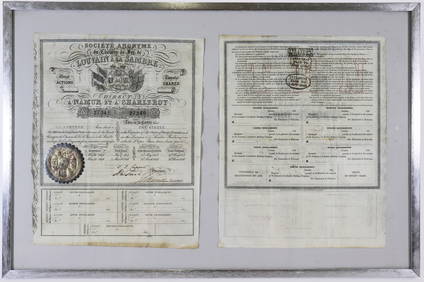
Sold2019Nicolas De Fer (1646-1720) " Duche de Montoue Paris,"Nicolas De Fer (1646-1720) " Duche de Montoue Paris," 1705, hand colored, H.- 20 in., W.- 27 in.See Sold Price
Sold2022Nicolas de La Mare (French, 1639–1723), Antoine Coquart (French, 1668–1707), and Nicolas de FerNicolas de La Mare (French, 1639–1723), Antoine Coquart (French, 1668–1707), and Nicolas de Fer (French, 1646-1720), "Cinquieme Plan de la Ville de Paris," c. 1705, hand-colored map, preSee Sold Price
Sold2024Nicolas De Fer (French 1646-1720)Nicolas De Fer (French 1646-1720) "L Amerique Méridionale, et Septentrionale" early state hand colored map engraving dated lower right "1699" 18" x 23" Condition: overall good condition, some yellowiSee Sold Price
Sold2024De Fer Map of the Mississippi RiverDE FER, Nicolas (1646-1720). Partie Meridionale de la Riviere de Missipi, et ses environs, dans l'Amerique Septentrionale. Mis au jour par N. de Fer. Geographe de sa Majeste Catolique 1718. Engraved mSee Sold Price
Sold2021De Fer Map of Italy, 1705[Europe, Italy] DE FER, Nicolas (1646-1720). Routes des Postes D'Italie... Engraved map with full original color and minor manuscript annotations. Paris, c. 1705. 19" x 27" sheet. This unusual, largeSee Sold Price
Sold2023III. Partie Du Nouveau Canal Fait Pour La Conduitte De Riviere D'eure Depuis Pontgouin, Jusques aTitle: III. Partie Du Nouveau Canal Fait Pour La Conduitte De Riviere D'eure Depuis Pontgouin, Jusques a Versailles." Publication Date: 1693 Cartographer: FER, NICOLAS DE (1646-1720) Publisher: DE FERSee Sold Price
Sold2018St. MaloTitle/Content of Map: St. Malo Date: 1693 Cartographer: FER, NICOLAS DE (1646-1720) Size: 8.5X10.3 "Ville de la Haut Bretagne..." L. Scherm, Fec. Please note that this lot has a confidential reserve.See Sold Price
Sold2024Nicholas de Fer, Map of California of 1705Nicholas de Fer (1646-1720) Map of California of 1705 (Cette carte de Californie et du Nouveau Mexique, 1705); together with two other California related framed ephemera.Assumed second state (1705) ofSee Sold Price
Sold2017Nicolas De Fer: Carte Generale du Globe Terrestre, 1705Map: Carte Generale du Globe Terrestre et Aquatiques ou Mappemonde en Deux Plans-Hemisphere [Scarce 1705 antique map with California as an island] Maker: Nicolas De Fer Size: 8.125 x 11.125 (10.25 x 1See Sold Price
Sold2021Scarce 1700s British Map of the East IndiesCreator: Edward Wells (British, 1667-1727). Based on map by Nicholas de Fer (1646-1720). Engraver: Sutton Nicholls (British, 1668-1729). Title: "A new map of the East Indies, taken from Mr. de Fer's mSee Sold Price
Sold20241717 MAP of AMERICA antique authentic CALIFORNIA AS AN ISLAND L'AmeriqueAmericas. L'Amerique, Meridionale et Septentrionale Dressee Selon les Dernieres Relations et Suivant les Nouvelles Decouverte... by Fer (Nicholas de) (1646-1720) engraver Inselin, C. A Paris :b Chez lSee Sold Price
Sold2017A Blondeau: Mappe-Monde ou Carte Generale de la TerreMap: Mappe-Monde ou Carte Generale de la Terre, 1817 Maker: A Blondeau Date: 1817, Paris Description: An uncommon two hemisphere world map. The shown US border far exceeds into Canada north of MinnesoSee Sold Price
Sold2019Delamarche, Felix 1829 Map of World Hemispheres"Mappe-Monde ou Carte Generale du Globe Terrestre" Copper Engraved Map Published 1829, Paris for "Atlas de La Geographie..." by Felix Delamarche. Contemporary outline hand colour. Centre fold as publiSee Sold Price
Sold20201705 - 1720 CHATELAIN ZACHARIAS (1684 - 1743)1705 - 1720 CHATELAIN ZACHARIAS (1684 - 1743) GUEUDEVILLE NICOLAS (1654 - 1721 ca.) INCISIONE in bianco e nero in due fogli "Carte genealogique des rois de Naples et de Sicile..."cm 38,5 x 92,5) trattSee Sold Price
Sold2017Nicolas de Fer: Map of Canada & New France, 1702Map: Nicolas de Fer's Map of Canada and New France Subtitle: La Canada, ou Nouvelle France, la Floride, la Virginie, Pensilvanie, Caroline, Nouvelle Angleterre et Nouvelle Yorck, Isle de Terre Neuve,See Sold Price
Sold2022Scarce 1705 map of North America by Nicolas de Fer (Calif. as island)Nice example of de Fer's scarce map of North America, first published in Paris in 1693. This specimen with a 1705 date is from the 1723 edition of de Fer’s Petit et Nouveau Atlas and features laterSee Sold Price
Sold2016Lion, Royaume de France. Nicolas de Fer.Lion, Ville tres Considerable du Royaume de France Maker: de Fer, Nicolas. Origin: Paris, 1700. Medium: Original engraving with later hand-coloring. Sheet size: 10 1/8 x 14 3/8 in. No Reserve: This loSee Sold Price
3 days LeftArt Legacy AuctionsChemin de Fer de Paris a Orleans et du midi salies de Bearn vintage travel poster 1931 by Rene$550
May 11Art Legacy AuctionsLithograph from 1931 Chemin de Fer de Paris a Orleans et du midi salies de Bearn vintage travel$550
4 days LeftJasper52Chemins De Fer - Moserboden - Art By J. Politzer (1921) 26.75x37.625 French Travel Poster LB$320
May 16Potter & Potter AuctionsPLANSON, Andre (1898 – 1981). Provence / Societe Nationale ...$125
Jun 01Galerie Moenius AGClaude I NIQUET (c.1770-c.1835) nach Louis-Nicolas DE LESPINASSE (1734-1808)€120
May 16Potter & Potter AuctionsCAVAILLES, Jules (1901 – 1977). Languedoc / Societe Nationa...$80
May 21Sworders Fine Art AuctioneersA ladies 18ct gold diamond set mechanical bracelet watch, c.1913,£30


![De Fer Map of Italy, 1705: [Europe, Italy] DE FER, Nicolas (1646-1720). Routes des Postes D'Italie... Engraved map with full original color and minor manuscript annotations. Paris, c. 1705. 19" x 27" sheet. This unusual, large](https://p1.liveauctioneers.com/1968/216191/110783529_1_x.jpg?height=310&quality=70&version=1629990486)


![Nicolas De Fer: Carte Generale du Globe Terrestre, 1705: Map: Carte Generale du Globe Terrestre et Aquatiques ou Mappemonde en Deux Plans-Hemisphere [Scarce 1705 antique map with California as an island] Maker: Nicolas De Fer Size: 8.125 x 11.125 (10.25 x 1](https://p1.liveauctioneers.com/5584/106187/54391534_1_x.jpg?height=310&quality=70&version=1499460562)