Sold2020"Northern provinces of the United States". THOMSON.TITLE/CONTENT OF MAP: 'Northern provinces of the United States' The map shows the "District of Maine", prior to its accession to the Union as the state of Maine in 1820. The top image on the right hanSee Sold Price
Sold2023Northern provinces of the United States. THOMSON. District of Main[e] 1817 mapTITLE/CONTENT OF MAP: 'Northern provinces of the United States' The map shows the "District of Maine", prior to its accession to the Union as the state of Maine in 1820. Some Native American Indian viSee Sold Price
Sold2019Northern provinces of the United States. THOMSON.TITLE/CONTENT OF MAP: 'Northern provinces of the United States' The map shows the "District of Maine", prior to its accession to the Union as the state of Maine in 1820. Some Native American Indian viSee Sold Price
Sold20162 United States Maps, including 1817.2 United States Maps, including 1817. 1st item: Northern Provinces of the United States map by John Thomson from "Thomson's New General Atlas", engraved by Nathaniel Rodgers Hewitt, 1817. Colored mapSee Sold Price
Sold2018Thomson: Antique Map Northeastern United States, 1817Northern Provinces of the United States The beautifully detailed and colored northern United States map from Thomson's New General Atlas, with a lovely inset view of "the Great Falls of Niagara.'" CarSee Sold Price
Sold2016Antique Map United States Thomson's 1817Antique Map United States Thomson's 1817, authentic antique map, inscribed, "drawn & engraved for Thomson's new general atlas 1817", along with "Northern Provinces of the United States", hand coloredSee Sold Price
Sold2018Southern provinces of the United States. THOMSON. WestTITLE/CONTENT OF MAP: 'Southern provinces of the United States' The map shows the United States including the first 17 states to acceed, including Tennessee, which had joined in 1796. Ohio, LouisianaSee Sold Price
2024Southern provinces of the United States. THOMSON. West & East Florida 1830 mapTitle: "Southern provinces of the United States". THOMSON. West & East Florida 1830 map Description: Southern provinces of the United States' by Drawn & engraved by Nathaniel Robert Hewitt for John ThSee Sold Price
Sold2023Southern provinces of the United States. THOMSON. West & East Florida 1830 mapTITLE/CONTENT OF MAP: 'Southern provinces of the United States' The map shows the United States including the first 17 states to acceed, including "Tenasee" (Tennessee), which had joined in 1796. OhioSee Sold Price
Sold2023Southern provinces of the United States. THOMSON. West & East Florida 1817 mapTITLE/CONTENT OF MAP: 'Southern provinces of the United States' The map shows the United States including the first 17 states to acceed, including Tennessee, which had joined in 1796. Ohio, LouisianaSee Sold Price
Sold2018Thomson: Antique Map of Southeastern United States 1817Southern Provinces of the United States A beautiful exemplar of the southern United States map from Thomson's New General Atlas, with a lovely inset view of "Characteristic Scenery of the Hudson RiverSee Sold Price
Sold20211800 Weld Map of Northern United States and Great LakesTitle: 1800 Weld Map of Northern United States and Great Lakes -- Partie des Etats-Unis de L'Amerique Septentrionale Cartographer: I Weld Year / Place: 1800, Paris Map Dimension (in.): 16.1 X !8.2 in.See Sold Price
Sold2021Northern United States, NY, NJ, MD, PA and the NewTitle: Northern United States, NY, NJ, MD, PA and the New England states, By Bonne/ Raynal 1780 Date/Period: 1780 Materials: Copperplate engraved Size: 13 1/2 x 9 3/4'' Early map of a recognized indepSee Sold Price
Sold2022Canada and Northern United States 1878 MapSize: 18 X 13 inches approx. Unframed. Printed 1878. Centerfold as issued.See Sold Price
Sold2023MANUAL OF THE BOTANY OF THE NORTHERN UNITED STATES, ASA GRAY, 1889MANUAL OF THE BOTANY OF THE NORTHERN UNITED STATES, ASA GRAY, 1889, Published by the American Book Company. Covers topics such as flora, synopsis of the natural orders, and table of orders. Includes sSee Sold Price
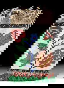
Sold202319th C. Yupik Wood Dance Mask, Restored by C. McIntyre**This item is heavy/oversized and will require 3rd party shipping. Please inquire about shipping cost prior to bidding.** **Originally Listed At $4000** Native American, Northern United States, AlaskSee Sold Price
Sold202220th C. Yupik / Inupiaq Wood Shamanic Mask w/ WolfNative American, Northern United States / Canada, Inupiaq or Yupik people, ca. mid-20th to 21st century CE. A remarkable shamanic dance mask with a wolf's head carved from wood with extending feathersSee Sold Price
Sold2023Early Winnebago / Ojibwe Beaded Leather PouchNative American / First Nations, Northern United States / Canada, Great Lakes Region & Midwest, Winnebago / Ojibwe, ca. early 20th century CE. A hide bag with beadwork across both sides, the front panSee Sold Price
Sold2022c. 1788 French Map of the Eastern United StatesHistoric Maps c. 1788 Map, "Les Etats Unis de L'Amerique Septentrionale, Partie Orientale" (Eastern Part of the Northern United States of America) by M. (Rigobert) Bonne c. 1788 Map titled, "Les EtatsSee Sold Price
Sold202220th C. Alaskan Inuit Wool Felt Nivingajuliat Wall ArtNorth America, Northern United States / Canada, Inuit, Yupik or Aleut people, ca. mid-20th century CE. This is a charming embroidered felt textile wall hanging known as a nivingajuliat, with a stylistSee Sold Price
Sold202220th C. Alaskan Inuit Wool Felt Panel w/ Appliques**Originally Listed At $450** North America, Northern United States / Canada, Inuit, Yupik or Aleut people, ca. mid-20th century CE. A beautiful wool felt and embroidered textile wall hanging known asSee Sold Price
Sold20231950s Native American Birch Bark Canoe Model w/ DollNative American, Northern United States, Great Lakes region, Iroquois / Seneca / Ojibwe, ca. 1950s CE. A hand-made vintage canoe model made from birchbark over a cedar / spruce wood frame with black pSee Sold Price
Sold2018Two American Cobalt Decorated Stoneware Vessels19th century, Mid Atlantic and Northern United States. One pitcher likely from Maryland or Virginia together with a storage jar marked “M. Tyler and Co Albany NYâ€. Each having some small nicSee Sold Price
Sold2023Antique Tin Tackle Box + 3 Wood Ice Fishing Decoys**Originally Listed At $400** North America, Midwestern / Northern United States, ca. mid-20th century CE. An antique "Thos. E. Wilson & Co." tin fishing tackle box containing 3 handmade wood and tinSee Sold Price
4 days LeftJasper521884 Rand McNally Map of US Railroad System -- Map Exhibiting the Several Pacific Railroads Prepared$140
Jun 02Schilb Antiquarian Rare Books1849 TEXAS 1ed Mexican War Porter Annexation Mexico Americana Peace Treaties$1
May 12Schilb Antiquarian Rare Books1844 Harper Library United States Poland Navigation MAPS 14v Voyages RARE LOT$56(5 bids)
2 days LeftTremont AuctionsJohn Adams. 1787 first edition "A Defence of the Constitutions of Government of the United States of$2,400
BonhamsPAIR OF TOMMY SIMPSON (B.1939) ARMCHAIRS, United States, c. 2000, mixed hardwoods, sheep skin, u...$1,600(1 bid)
3 days LeftHudson Valley Auctioneers LLC Beacon NYArchitectural drawings, blue prints, The Buddhist Association of the United States, temple plans$20
BonhamsBILL STEPHENS (1932-2007) FOR KNOLL INTERNATIONAL 1300 SERIES LOUNGE CHAIR, United States, desig...$200
BonhamsWROUGHT IRON AND STEEL FLOOR LAMP, probably United States, c. 1960, unmarked, two pull-chain soc...$200(1 bid)
BonhamsMID-CENTURY MODERN TULIP TABLE AND FOUR SWIVEL CHAIRS, United States, c. 1970, chairs, enameled ...$400
BonhamsPAIR OF WARREN PLATNER (1919-2006) FOR KNOLL INTERNATIONAL LOUNGE CHAIRS, United States, designe...$1,000(1 bid)
May 16Potter & Potter AuctionsKLEIN, David (1918 – 2005). Israel / Fly TWA. United States...$175(3 bids)


![Northern provinces of the United States. THOMSON. District of Main[e] 1817 map: TITLE/CONTENT OF MAP: 'Northern provinces of the United States' The map shows the "District of Maine", prior to its accession to the Union as the state of Maine in 1820. Some Native American Indian vi](https://p1.liveauctioneers.com/5584/309982/165835410_1_x.jpg?height=310&quality=70&version=1700599538)