Sold2022Original Antique Map - Mecklenburg-Schwerin - Map of Northern GermanyAntique outline hand colored map from edition of Meyer’s world atlas, edited by Ludwig Ravenstein, published by Bibliographic Institute in 1872. Technique: Engraving. Place: Leipzig, Germany. SSee Sold Price
Sold2022Antique Map Print - Map of Mecklenburg-Schwerin - Map of Germany - Roman EmpireAntique outline hand colored map from edition of Meyer’s world atlas, edited by Ludwig Ravenstein, published by Bibliographic Institute in 1872. Technique: Engraving. Place: Leipzig, Germany. SSee Sold Price
Sold2019Antique Map: Germany (Deutschland)Description: Antique Map: Germany (Deutschland), Holstein, Hanover, Mecklenburg, the Prussian States, Saxony. Antique steel engraved map with original outline hand coloring. Date of printing: 1844. CaSee Sold Price
Sold2023Baedeker, Karl 1904 Lot of 25 Antique Maps. Northern GermanyLithograph Maps Published 1904, Leipzig for "Northern Germany as far as the Bavarian and Austrian Frontiers. Handbook for Travellers" by Karl Baedeker. Folds as issued. Paper Size: Up to 13 x 13 inchSee Sold Price
Sold2017Isaac Tirion: Antique Map of Northern Germany, 1740Title: Map of Northern Germany by Isaac Tirion Date: 1740-62 Medium: Wax Engraving Dimensions (in.): 14 x 12 No Reserve: This lot starts at $1 and has no reserve as a courtesy so that collectors can dSee Sold Price
Sold2022Original Antique Map -Pommern Provinz - Map of Bornholm Island Baltic SeaAntique outline hand colored map from edition of Meyer’s world atlas, edited by Ludwig Ravenstein, published by Bibliographic Institute in 1872. Technique: Engraving. Place: Leipzig, Germany. SSee Sold Price
Sold2022Original Antique Map -Bremen Oldenburg - Map of Bremen OldenburgAntique outline hand colored map from edition of Meyer’s world atlas, edited by Ludwig Ravenstein, published by Bibliographic Institute in 1872. Technique: Engraving. Place: Leipzig, Germany. SSee Sold Price
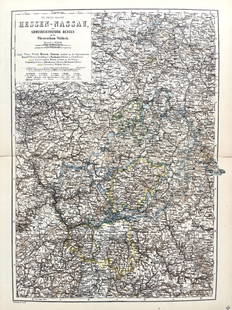
Sold2022Original Antique Map -Hessen Nassau - Map of Furstenthum WaldeckAntique outline hand colored map from edition of Meyer’s world atlas, edited by Ludwig Ravenstein, published by Bibliographic Institute in 1872. Technique: Engraving. Place: Leipzig, Germany. SSee Sold Price
Sold2022Original Antique Map - Konicreich Bohmen - Map of Bohmen - Prague - CarlsbadAntique outline hand colored map from edition of Meyer’s world atlas, edited by Ludwig Ravenstein, published by Bibliographic Institute in 1872. Technique: Engraving. Place: Leipzig, Germany. SSee Sold Price
Sold2017Stackhouse: Antique Map of Northern Italian States 1783Title/Content of Map: Northern Italian states Venice, Milan, Florence, Genoa with Switzerland Date Printed: 1783 Cartographer: Thomas Stackhouse Material/Medium: Paper Size: 16" x 20" Original hand coSee Sold Price
Sold2018Seutter: Antique Map of East Prussia, 1740Title/Content of Map: Today's northern Poland. East Prussia. Poland and Baltic regions by Seutter Date Printed: c1740 Cartographer: Mattaus Seutter Material/Medium: Paper Size: 19" x 23" Original handSee Sold Price
Sold2017Stackhouse: Antique Map of Ancient Northern Italy, 1783Title/Content of Map: Ancient Northern Italy Date Printed: 1783 Cartographer: Thomas Stackhouse Material/Medium: Paper Size: 16" x 20" Original hand color. Copperplate engraved. Published in 'An UniveSee Sold Price
Sold20191580 Regni Hispaniae Post Omnium EditionesThis original authentic antique map by Ortelius shows the Iberian Peninsula with the Balearic Islands and parts of northern Africa. Spain is well described, with towns and cities, mountain ranges andSee Sold Price
Sold2022Antique Map Print - Austria - Germany - Austrian EmpireSet of 4 Map Prints. Antique lithographic map originates from "Letts's Popular Atlas", being a series of maps delineating the whole surface of the globe, with many special and original features; and aSee Sold Price
Sold2023NORTHERN CENTRAL AMERICA. Mexico Belize Guatemala Honduras. ETTLING 1863 mapCentral America (Northern Part) Comprising Mexico, Guatemala, Honduras, San Salvador and Nicaragua' by Drawn & Engraved by T. Ettling (1863). Antique map with original outline colour, 31.5 x 44.0cm, 1See Sold Price
Sold20231702 ILLUSTRATED HISTORY OF GERMANY antique WITH MAP & 23 PORTRAITS in ENGLISHA Compleat History of Germany comprehending the Lives and Reigns of All Emperors... London, 1702 With 1 map and 23 copper engravings portraits of German emperors and rulers. Original leather binding,See Sold Price
Sold20231702 Antient & Present State of the Empire of Germany antique w/ MAP in ENGLISHThe Antient and Present State of the Empire of Germany... London, 1702 With 1 map and a frontispiece copper engraving. Original leather binding, covers are reinforced inside of the endpapers Very goodSee Sold Price
Sold2018Seutter: Antique Map of Brandenburg & Pomerania, 1740Title/Content of Map: Brandenburg & Pomerania region of Germany & Poland Date Printed: c1740 Cartographer: Matthaus Seutter Material/Medium: Paper Size: 19 1/2" x 23 3/4" Original hand colored copperpSee Sold Price
Sold2021Tallis, John (Pub) 1852 Lot of 12 European MapsIncl Northern Italy, Southern Italy, Brussels, Germany, Spain and Portugal, Prussia, Europe Continent, Greece, Denmark, Belgium, Holland and France. Steel Engraved Maps with Original Outline Hand ColoSee Sold Price
Sold2019R. Wilkinson Antique Hand Colored Map of SwabiaDescription: R. Wilkinson antique, hand colored map of Swabia. Swabia was a medieval Duchy in southwest Germany, that also included part of Poland. Possibly circa 1822 as indicated by original owner.See Sold Price
Sold2022Antique Map of Asia - Map of Northern India - Dabhol - Rigobert BonneTitle: Antique Map of Asia - Map of Northern India - Dabhol - Rigobert Bonne Date/Period: 1780 Dimension: 23 cm x 36 cm Material: Paper Additional Information: Antique map of northern India. Covers thSee Sold Price
Sold2022Antique Map - Map of Europe - Map of Germany - Berlin - Hamburg - MunichAntique map of Germany by Becker, published in London, c 1860. This antique map was engraved by the omnigraph method by Francis Paul Becker & Company, Patentees circa 1842, with contemporary hand coloSee Sold Price
Sold20191836 Tanner Map of Prussia / Northern Germany --Title/Content of Map: 1836 Tanner Map of Prussia / Northern Germany -- Prussia Cartographer: H S Tanner Size: 12 x 14.7 in. An attactive map Prussia, showing topographical and settlement details. TheSee Sold Price
Sold2022Antique Map Print - Map of Rheinprovinz - Map of Germany - Prussian StateAntique outline hand colored map from edition of Meyer’s world atlas, edited by Ludwig Ravenstein, published by Bibliographic Institute in 1872. Technique: Engraving. Place: Leipzig, Germany. SSee Sold Price
6 days LeftJasper52GUADELOUPE. Marie-Galante, Désirade, Iles des Saintes.Vuillemin. 1903 old map$15
1 day LeftTrillium Antique Prints & Rare BooksDe Jode, Rare, pub. 1593 - Map of Part of Germany (Sveviae Utriusq cum Germicae tum Rheticae$100
1 day LeftTrillium Antique Prints & Rare BooksDe Jode, Rare, pub. 1593 - Map of Austria (Austriae Ducatus Seu Pannoniae Superioris?)$100
Featured6 days LeftJasper52JAMAICA & HAITI. 'Hayti'. Caribbean West Indies. WELLER 1863 old antique map$35
6 days LeftJasper52British West Indies. Virgin Leeward Windward Islands. Bermuda. SWANSTON 1860 map$120
6 days LeftJasper52GUADELOUPE & MARIE-GALANTE. Soufrière. Dugommier. Antilles. VUILLEMIN 1879 map$25
6 days LeftJasper52Windward or South Caribbean Islands. Barbados St. Lucia Trinidad. LOWRY 1860 map$50
6 days LeftJasper52Windward or South Caribbean Islands. Barbados St. Lucia. Guianas. LOWRY 1859 map$60
6 days LeftJasper52Leeward Islands. Cuba, Hayti/Haiti or Santo Domingo, Puerto Rico. LOWRY 1859 map$100
1 day LeftTrillium Antique Prints & Rare BooksBlaeu?s Le Theatre du Monde? ? Volume 3 with 57 Fold Out Maps with Original Hand-coloring, 4 Smaller$1,000(1 bid)
Featured6 days LeftJasper52The Bahamas, Cuba & Bermuda "or Summer Islands". THOMSON 1817 old antique map$180
6 days LeftJasper52Antilles, Golfe du Mexique & Amérique Centrale. Caribbean. MALTE-BRUN c1871 map$35