Sold2022Original Antique Map - Konicreich Bohmen - Map of Bohmen - Prague - CarlsbadAntique outline hand colored map from edition of Meyer’s world atlas, edited by Ludwig Ravenstein, published by Bibliographic Institute in 1872. Technique: Engraving. Place: Leipzig, Germany. SSee Sold Price
Sold2022Original Antique Map - Mecklenburg-Schwerin - Map of Northern GermanyAntique outline hand colored map from edition of Meyer’s world atlas, edited by Ludwig Ravenstein, published by Bibliographic Institute in 1872. Technique: Engraving. Place: Leipzig, Germany. SSee Sold Price
Sold2022Original Antique Map -Pommern Provinz - Map of Bornholm Island Baltic SeaAntique outline hand colored map from edition of Meyer’s world atlas, edited by Ludwig Ravenstein, published by Bibliographic Institute in 1872. Technique: Engraving. Place: Leipzig, Germany. SSee Sold Price
Sold2022Original Antique Map -Bremen Oldenburg - Map of Bremen OldenburgAntique outline hand colored map from edition of Meyer’s world atlas, edited by Ludwig Ravenstein, published by Bibliographic Institute in 1872. Technique: Engraving. Place: Leipzig, Germany. SSee Sold Price
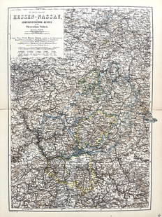
Sold2022Original Antique Map -Hessen Nassau - Map of Furstenthum WaldeckAntique outline hand colored map from edition of Meyer’s world atlas, edited by Ludwig Ravenstein, published by Bibliographic Institute in 1872. Technique: Engraving. Place: Leipzig, Germany. SSee Sold Price
Sold2023[CANADIAN ANTIQUE MAP] CITY [PLAN] OF QUEBEC. 1830[CANADIAN ANTIQUE MAP] CITY [PLAN] OF QUEBEC.Engraved by J.&.C. Walker.Image size (approx): 7.1/2"x9.1/4" Original engraved map, circa 1830s. Original antique map city plan, of The City of Montreal. SSee Sold Price
Sold2017Mitchell: Plan of BostonMap: Plan of Boston (original Antique map) Maker/Publisher: S. Augustus Mitchell Publishing Date: 1872 Size: 13.5 x 20.75 inches Hard-to-find 1872 Mitchll map of Boston in the more unusual 2-page formSee Sold Price
Sold2023PACIFIC OCEAN Sandwich Islands/Hawaii Australia New Zealand &c. WELLER 1863 mapTITLE/CONTENT OF MAP: 'The Pacific Ocean' DATE PRINTED: 1863 IMAGE SIZE: Approx 47.0 x 65.0cm, 18.5 x 25.75 inches (Large); Please note that this is a folding map. TYPE: Antique map with original outlSee Sold Price
Sold2024John Speed 1676 Original Antique Map of Virginia and Maryland No ColorAntique 1676 map of Virginia and Maryland engraved by Francis Lamb and republished by Thomas Basset & Richard Chriswell after John Speed's 1611 atlas. With "The Description of Mary-Land" text on reverSee Sold Price
Sold20241639 Jan Jansson Antique Map of North America Virginia to New York to New EnglandThis beautifully hand coloured, important original antique map of the north east regions of the United States from Virginia, Chesapeake Bay, to New York & New England by Jan Jansson was published in tSee Sold Price
Sold20221747 Mexico, California, New Mexico, Texas Original Antique Map by Emanuel Bowen1747 Mexico, California, New Mexico, Texas Original Antique Map by Emanuel BowenSee Sold Price
Sold2022LAPIE ORIGINAL ANTIQUE MAP ASIA MINOR 1831L' ASIE MINEURE 1831 SIZE: 25.5 X 20 INCHES APPROX. UNFRAMEDSee Sold Price
Sold2021LAPIE ORIGINAL ANTIQUE MAP ALGERIA TUNISIA TRIPOLI 1829Original Carte De La Barbarie -Maroc - D'Alger, De Tunis, De Tripoli 1829 SIZE: 25.5 X 20 INCHES APPROX. UNFRAMEDSee Sold Price
Sold20191867 NORTH + SOUTH CAROLINA MAPOriginal antique map of North and South Carolina published by S. Augustus Mitchell, Jr. Includes inset maps of Charleston Harbor in the bottom left and a Plan of Charleston in the bottom right. It feaSee Sold Price
Sold2022Scarce 1695 map of Wilt Shire with Stone Henge by Robert MordenScarce copper engraved original antique map by Robert Morden from the 1695 Atlas to Accompany Camden’s Britannia with decorative cartouche and enhanced with later hand coloring. Stone Henge circSee Sold Price
Sold2024Original Antique Map of China, Macau and Canton - Asia - Jacques Nicolas BellinIts finely engraved, hand-coloring engraved map from the Dutch edition of acques Nicolas Bellin Histoire General des Voyages. Published in Amsterdam, 1770 year. This fine copperplate map from that ediSee Sold Price
Sold2023[CANADIAN ANTIQUE MAP] FIFTH & SIXTH WARDS, CITY OF HAMILTON. COLOURED. C. 1870S[CANADIAN ANTIQUE MAP] COLOURED ANTIQUE MAP OF FIFTH & SIXTH WARDS, CITY OF HAMILTON. Printed circa 1870s.Image size (approx): 15.1/2"x25.3/4" Original antique map of Fifth & Sixth Wards of the CitySee Sold Price
Sold2023Scarce and lovely 1848 Mitchell map of West IndiesOriginal antique map of the Caribbean Islands from the scarce Mitchell's Universal Atlas of 1848. Exhibits lovely full hand coloring done at the time of publishing. Light tanning at extreme edges. TwoSee Sold Price
Sold2017Wilkinson: Map of Route of Alexander the Great, 18071807 map showing the route of Alexander the Great. Pub. by R. Wilkinson. 8.625 x 11.25. Detailed and attractive map showing the route of Alexander the Great. A beautiful and original antique map. ColoSee Sold Price
Sold20221872 map of Philadelphia - Camden by S. Augustus MitchellInteresting and informative original antique map of the two cities. Large double-page map that is nicely centered. Great detail—shows individual buildings and wharves, ferries, railroads, streetSee Sold Price
Sold2017Late 1800s Colored Engraved Map of San FranciscoLate 1800s People's Publishing Co. Colored Engraved Map of San Francisco *RARE* - This rare find is an original, antique map of San Francisco, believed to have been printed in the late 1800s. The mapSee Sold Price
Sold2022Antique Map - Map of Europe - Austrian Empire - Vienna - Salzburg - John DowerOriginal antique map of Austrian Empire by John Dower, published by Orr & Co. Technique: Steel Engraving. Date: 1840. Place: London, England. Size: 9” x 12” inches / 24 cm x 30 cm.See Sold Price
Sold2022Antique Map - Map of North America - Michigan - Wisconsin - Detroit - Oliver J.Original antique map of Michigan & Wisconsin from Francis McNally's System of Geography: National Geographical Series, (New York: S. Barnes & Co., c. 1871), drawn by J. Wells NY. Technique: Steel EngrSee Sold Price
Sold2022Antique Map Print of Oceania - Map of Madeira & The Azores - 1870 - James CookOriginal Antique Decorative Map of Madeira & The Azores, Fullarton, C.1870 This fascinating folio engraving is from Captain James Cook & James King's "A Voyage to the Pacific Ocean, for making DiscoveSee Sold Price
3 days LeftJasper52GUADELOUPE. Marie-Galante, Désirade, Iles des Saintes.Vuillemin. 1903 old map$15
Featured3 days LeftJasper52JAMAICA & HAITI. 'Hayti'. Caribbean West Indies. WELLER 1863 old antique map$35
3 days LeftJasper52British West Indies. Virgin Leeward Windward Islands. Bermuda. SWANSTON 1860 map$120
3 days LeftJasper52GUADELOUPE & MARIE-GALANTE. Soufrière. Dugommier. Antilles. VUILLEMIN 1879 map$25
3 days LeftJasper52Windward or South Caribbean Islands. Barbados St. Lucia Trinidad. LOWRY 1860 map$50
3 days LeftJasper52Windward or South Caribbean Islands. Barbados St. Lucia. Guianas. LOWRY 1859 map$60
3 days LeftJasper52Leeward Islands. Cuba, Hayti/Haiti or Santo Domingo, Puerto Rico. LOWRY 1859 map$100
Featured3 days LeftJasper52The Bahamas, Cuba & Bermuda "or Summer Islands". THOMSON 1817 old antique map$180
Featured3 days LeftJasper52St Vincent & "Barbadoes". Barbados. West Indies Caribbean. THOMSON 1817 map$140
3 days LeftJasper52WEST INDIES Caribbean Windward Leeward Islands Barbados Pirates? MALLET 1683 map$220
3 days LeftJasper52Antilles, Golfe du Mexique & Amérique Centrale. Caribbean. MALTE-BRUN c1871 map$35


![[CANADIAN ANTIQUE MAP] CITY [PLAN] OF QUEBEC. 1830: [CANADIAN ANTIQUE MAP] CITY [PLAN] OF QUEBEC.Engraved by J.&.C. Walker.Image size (approx): 7.1/2"x9.1/4" Original engraved map, circa 1830s. Original antique map city plan, of The City of Montreal. S](https://p1.liveauctioneers.com/8321/286473/155233365_1_x.jpg?height=310&quality=70&version=1686787412)


![[CANADIAN ANTIQUE MAP] FIFTH & SIXTH WARDS, CITY OF HAMILTON. COLOURED. C. 1870S: [CANADIAN ANTIQUE MAP] COLOURED ANTIQUE MAP OF FIFTH & SIXTH WARDS, CITY OF HAMILTON. Printed circa 1870s.Image size (approx): 15.1/2"x25.3/4" Original antique map of Fifth & Sixth Wards of the City](https://p1.liveauctioneers.com/8321/286473/155233340_1_x.jpg?height=310&quality=70&version=1686787412)


