Sold2021Wilkes, John 1807 HCol Map. Italia Antiqua ItalyFinely Hand Colored Copper Engraved Map Published 1796-1828 London for "Encyclopaedia Londinensis, or universal dictionary of arts, sciences and literature" by John Wilkes et al. Paper Size: 10.5 x 8.See Sold Price
Sold2021Wilkes, John 1807 HCol Map. Projection of Globes, MapsFinely Hand Colored Copper Engraved Map Published 1796-1828 London for "Encyclopaedia Londinensis, or universal dictionary of arts, sciences and literature" by John Wilkes et al. Paper Size: 10.5 x 8.See Sold Price
Sold2022Wilkes, John 1807 HCol Map. Projection of Globes, MapsFinely Hand Colored Copper Engraved Map Published 1796-1828 London for "Encyclopaedia Londinensis, or universal dictionary of arts, sciences and literature" by John Wilkes et al. Paper Size: 10.5 x 8.See Sold Price
Sold2021Wilkes, John 1807 HCol Map. Projection of Globes, MapsFinely Hand Colored Copper Engraved Map Published 1796-1828 London for "Encyclopaedia Londinensis, or universal dictionary of arts, sciences and literature" by John Wilkes et al. Paper Size: 10.5 x 8.See Sold Price
Sold2021Wilkes, John 1807 HCol Map. Projection of Globes, MapsFinely Hand Colored Copper Engraved Map Published 1796-1828 London for "Encyclopaedia Londinensis, or universal dictionary of arts, sciences and literature" by John Wilkes et al. Paper Size: 10.5 x 8.See Sold Price
Sold2021Wilkes, John C1810 HCol Map. Graeciae Antiqua GreeceFinely Hand Colored Copper Engraved Map Published 1796-1828 London for "Encyclopaedia Londinensis, or universal dictionary of arts, sciences and literature" by John Wilkes et al. Paper Size: 10.5 x 8.See Sold Price
Sold2021Wilkes, John 1807 Hand Col Map. Ancient Britain"Britannia Antiqua" Finely Hand Colored Copper Engraved Map Published 1796-1828 London for "Encyclopaedia Londinensis, or universal dictionary of arts, sciences and literature" by John Wilkes et al. PSee Sold Price
Sold2021Wilkes, John 1807 Hand Col Map. Ancient Spain"Hispania Antiqua" Finely Hand Colored Copper Engraved Map Published 1796-1828 London for "Encyclopaedia Londinensis, or universal dictionary of arts, sciences and literature" by John Wilkes et al. PaSee Sold Price
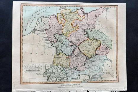
Sold2021Wilkes, John 1807 Hand Col Map. Ancient Germany"Germania Antiqua" Finely Hand Colored Copper Engraved Map Published 1796-1828 London for "Encyclopaedia Londinensis, or universal dictionary of arts, sciences and literature" by John Wilkes et al. PaSee Sold Price
Sold2021Wilkes, John 1807 HCol Astronomy Print. Sphere GlobeHand Colored Copper Plate Published 1796-1828 London for "Encyclopaedia Londinensis, or universal dictionary of arts, sciences and literature" by John Wilkes et al. Paper Size: 10.5 x 8.5 inch (27 x 2See Sold Price
Sold2021Wilkes, John 1810 Map. ItalyCopper Engraved Map Published 1796-1828 London for "Encyclopaedia Londinensis, or universal dictionary of arts, sciences and literature" by John Wilkes et al. Paper Size: 10.5 x 8.5 inch (27 x 22cm) TSee Sold Price
Sold2021Wilkes, John 1807 Hand Col Map. HampshireFinely Hand Colored Copper Engraved Map Published 1796-1828 London for "Encyclopaedia Londinensis, or universal dictionary of arts, sciences and literature" by John Wilkes et al. Paper Size: 10.5 x 8.See Sold Price
Sold2021Wilkes, John 1807 Hand Col Map. Modern India"Hindoostan or Modern India" Hand Colored Copper Engraved Map Published 1796-1828 London for "Encyclopaedia Londinensis, or universal dictionary of arts, sciences and literature" by John Wilkes et al.See Sold Price
Sold2021Wilkes, John 1807 Hand Col Map. HertfordshireFinely Hand Colored Copper Engraved Map Published 1796-1828 London for "Encyclopaedia Londinensis, or universal dictionary of arts, sciences and literature" by John Wilkes et al. Paper Size: 10.5 x 8.See Sold Price
Sold2021Wilkes, John 1807 Hand Col Map. PalestineFinely Hand Colored Copper Engraved Map Published 1796-1828 London for "Encyclopaedia Londinensis, or universal dictionary of arts, sciences and literature" by John Wilkes et al. Paper Size: 10.5 x 8.See Sold Price
Sold2021Wilkes, John 1807 Hand Col Map. GeographyFinely Hand Colored Copper Engraved Map Published 1796-1828 London for "Encyclopaedia Londinensis, or universal dictionary of arts, sciences and literature" by John Wilkes et al. Paper Size: 10.5 x 8.See Sold Price
Sold2021Wilkes, John 1807 Hand Col Map. PalestineFinely Hand Colored Copper Engraved Map Published 1796-1828 London for "Encyclopaedia Londinensis, or universal dictionary of arts, sciences and literature" by John Wilkes et al. Paper Size: 10.5 x 8.See Sold Price
Sold2021Wilkes, John 1807 Hand Col Map. GloucestershireFinely Hand Colored Copper Engraved Map Published 1796-1828 London for "Encyclopaedia Londinensis, or universal dictionary of arts, sciences and literature" by John Wilkes et al. Paper Size: 10.5 x 8.See Sold Price
Sold2016Map of Italy (Italia Antiqua of Oud Italje), 1704 HandElant, H., Engraved by, Map of Italy (Italia Antiqua of Oud Italje), 1704, Antique map of Italy and the islands Corsica, Sicily and Sardinia after N. Sanson, Published by Francois Halma, Engraving witSee Sold Price
Sold20182 Maps: L’Italia + Italia Antiqua.[De Rossi/Sanson/Italy] 2 Maps. ++ Nicholas Sanson. Italia Antiqua cum Itineribus antiquis. Cum Insulis Sicilia Sardinia & Corsica. Rome: Jo. Jacob. De Rubeis. [C. 1690s.] At lower left: “Joannes L�See Sold Price
Sold2020Grp: 7 Maps of Sicily Italy 18th/19th c. Blair ClGroup of seven maps of Sicily. Includes Rev. John Blair, "Sicilia Antiqua quae at Sicania et Trinacria dicta;" Philipp Cluver, "Siciliae Antiquae Descriptio," Leiden, 1697, which features a stunninglySee Sold Price
Sold2021Barlow 1807 Antique Map. ItalyCopper Engraved Map Published 1807 by Brightly & Kinnersley, Bungay, England for "A General View of the World, Geographical, Historical and Philosophical" by The Rev. E. Blomfield. Engraved by Barlow.See Sold Price
Sold2018Homann: Antique Map of Italy, 1720Title/Content of Map: Italia Cursoria'. Italy general map Date Printed: c1720 Image Size: Approx 52.0 x 63.0cm, 20.5 x 24.75 inches (Large); Please note that this is a folding map. Type: Large antiqueSee Sold Price
Sold2019Barlow 1807 Antique Map of ItalyCopper Engraved Map Published 1807 by Brightly & Kinnersley, Bungay, England for "A General View of the World, Geographical, Historical and Philosophical" by The Rev. E. Blomfield. Maps Engraved by BaSee Sold Price
24 hrs LeftTremont AuctionsJohn Speed and Francis Lamb "Map of New England and New York", ca. 1676. Hand colored engraved map$900(3 bids)
24 hrs LeftTremont Auctions17th century original map 1676 "Virginia and Maryland" by John Speed. 2 sided framing. Overall:$650(3 bids)
4 days LeftAste Bolaffi FONTANA ARTE Lampada a sospensione Italia anni ‘50 - FONTANA ARTE Ceiling lamp Italy 1950s€900(1 bid)
3 days LeftJohn Moran Auctioneers, Inc.Edgar Alwin Payne (1883-1947), Riding near Canyon de Chelly$35,000
3 days LeftJohn Moran Auctioneers, Inc.Colin Campbell Cooper (1856-1937), "Valley of the Arno (Italy)"$1,500


![2 Maps: L’Italia + Italia Antiqua.: [De Rossi/Sanson/Italy] 2 Maps. ++ Nicholas Sanson. Italia Antiqua cum Itineribus antiquis. Cum Insulis Sicilia Sardinia & Corsica. Rome: Jo. Jacob. De Rubeis. [C. 1690s.] At lower left: “Joannes L�](https://p1.liveauctioneers.com/179/117971/60557721_1_x.jpg?height=310&quality=70&version=1520636872)


![[LINCOLN] 1863 Booth as Romeo Broadside (1 of 1)](https://p1.liveauctioneers.com/7226/322253/173251622_1_x.jpg?height=282&quality=70&version=1710004847)


