
No upcoming results for "boston-proper-map"
But we've sold 443 before. Follow this search to get notified as soon as more arrive.


You May Also Like

![Framed 1789 Map of Boston Area, "Seat of the Late War": Framed 1789 Map of Boston Area, titled: "A Map of the Seat of the Late War at Boston in the State of Mafsachusetts [Massachusetts]" and penciled with the date 1789. On the back is the information wher](https://p1.liveauctioneers.com/9383/412951/229626213_1_x.jpg?height=310&quality=70&version=1781613378)

![[MAPS] 1820 Harmon's "Map of the Interior of America": A Map of the Interior of North America. Engraved map. Boston: Annin & Smith, [1820]. 1 page, 18 15/16 x 7 3/4 in. FROM Daniel W. Harmon. A Journal of Voyages and Travels in the I](https://p1.liveauctioneers.com/7226/422185/235035227_1_x.jpg?height=310&quality=70&version=1781916990)


![[California]. A group of 52 titles, many first editions, including:: [California]. A group of 52 titles, many first editions, including: CAPRON, E.S. History of California. Boston and Cleveland: John P. Jewett; Jewett, Proctor and Worthington, 1854. With folding map. -](https://p1.liveauctioneers.com/197/423392/235637688_1_x.jpg?height=310&quality=70&version=1783023069)

$300


Similar Items on
Explore similar finds from our sister marketplace, Chairish
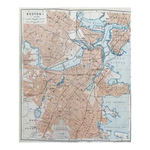
443 past auction results for "boston-proper-map"
Browse a record of outcomes from past auctions, including sale prices and unsold items.
Last ChanceIL, CA, OH, TX, FL, NY

Last ChanceIL, CA, OH, TX, FL, NY
![4 Maps: Bradford (1838): Mass., CT, NJ, Boston.: [United States/Northeast] 4 Maps. ++ MASSACHUSETTS. ++ BOSTON. ++ CONNECTICUT. ++ NEW JERSEY. ++ Maps 10, 11, 13, and 16 from T. G. Bradford, “An Illustrated Atlas, Geographical, Statistical, And Hi](https://p1.liveauctioneers.com/179/85723/44107996_1_x.jpg?height=280&quality=70&sharpen=true&version=1457209040&width=280)
Quinn's Auction GalleriesFalls Church, VA

Last ChanceIL, CA, OH, TX, FL, NY

King GalleriesRoswell, GA

Finney's Auction Inc.Schodack, NY

Waterford's Art & Antiques AuctioneersBerlin, NJ

Material CulturePhiladelphia, PA

Alexander Historical Auctions LLCChesapeake City, MD

Chandler's International EstatesWinston Salem, NC

Fairfield AuctionMonroe, CT

Boston Harbor Auctions Boston, MA

Flannery's Estate ServicesPine Bush, NY
![Campaign of Chancellorsville 1881 with Maps: Dodge [U.S. Army] Theodore Ayrault. The Campaign of Chancellorsville. With Two (2) maps. 261 pages. 1st edition. Original covers. Boston: James R. Osgood, 1881 Inv. 509](https://p1.liveauctioneers.com/2945/67691/35067323_1_x.jpg?height=280&quality=70&sharpen=true&version=1424113030&width=280)
Flannery's Estate ServicesPine Bush, NY

Early American History AuctionsRancho Santa Fe, CA

B.S. Slosberg, Inc. AuctioneersPhiladelphia, PA

Flying Pig AuctionsHampden, MA

Roland NYNew York, NY

John McInnis Auctioneers,LLCAmesbury, MA

PBA GalleriesSan Francisco, CA

MBA Seattle Auction HouseRenton, WA

Synesael Davies AuctionsLafayette, Indiana
![ANTIQUE MAPS: ANTIQUE MAPS Lot of three antique maps, all by mapmaker Jedidiah Morse, copperplate-engraved by Amos Doolittle and published by [Isaiah] Thomas & Andrews, Boston, 1796. The maps, each about 10" x 8 1/](https://p1.liveauctioneers.com/287/50915/24137829_1_x.jpg?height=280&quality=70&sharpen=true&version=1391552715&width=280)
Alexander Historical Auctions LLCChesapeake City, MD

Cady Auction Gallery & AppraisalCedar Rapids, IA
TOP