16th-20th Century Antiquarian Maps 2023-11-14 Auction - 164 Price Results - Jasper52 in NY - Page 5
LiveAuctioneers Logo

1833 Woodbridge World Map -- Map of the World Adapted to Woodbridge's Geography1891 Mitchell Map of New England -- Map of New England or Eastern States…The Netherlands Map. The region Around the city of Utrecht. 1660’s by W. Blaeu
Done
New York, NY, United States
Auction Details

16th-20th Century Antiquarian Maps

Jasper52

Jasper52

badge TOP RATED
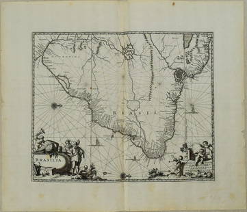
Explore both land and sea with this array of maps, which preserves the geography of nearly every region imaginable. Unlike modern maps, these original engravings trace borders as they evolved throughout history. Discover centuries-old views of every corner of America or a map of Portugal and parts of Spain from 1645! Not only will these maps serve as decorative pieces, but they also will reveal innumerable ways to view our world.
Lot Number: Lowest
24
Sold
1671 Ogilby Map of Brazil -- Brasilia: Title: 1671 Ogilby Map of Brazil -- BrasiliaCartographer: J OgilbyYear / Place: 1671, LondonMap Dimension (in.): 11.3 X 13.8 in. This is an excellent map of the eastern part of Brazil. There is an
0098: 1671 Ogilby Map of Brazil -- BrasiliaEst. $300-$350
See Sold Price
Louisiana 1900: Title/Content: Louisiana 1900Date: 1900Material: paperDimensions: approx. 10.5x13 inchesAdditional Information: Mast, Crowell & Kirkpatrick - edges repaired Reserve: $35.00 Shipping:Domestic:
0101: Louisiana 1900Est. $40-$50Lot Passed
Chart of the World 1889: Title/Content: Chart of the World 1889Date: 1889Material: paperDimensions: Approx. 21.5x14.25 inchesAdditional Information: Cram's Unrivaled Atlas of the World. W.H. Stewart Publisher, Rochester NY
0102: Chart of the World 1889Est. $50-$60Lot Passed
Asia 1900: Title/Content: Asia 1900Date: 1900Material: paperDimensions: approx. 10x13 inchesAdditional Information: Mast, Crowell & Kirkpatrick - edges repaired Reserve: $35.00 Shipping:Domestic: Flat-rate of
0106: Asia 1900Est. $40-$50Lot Passed
Maine 1900: Title/Content: Maine 1900Date: 1900Material: paperDimensions: approx. 10x13 inchesAdditional Information: Mast, Crowell & Kirkpatrick - edges repaired Reserve: $35.00 Shipping:Domestic: Flat-rate
0107: Maine 1900Est. $40-$50Lot Passed
New Orleans 1889: Title/Content: New Orleans 1889Date: 1889Material: paperDimensions: approx. 14.5"x10.75"Additional Information: George F. Cram, Chicago Reserve: $40.00 Shipping:Domestic: Flat-rate of $15.00 to
0109: New Orleans 1889Est. $50-$60Lot Passed
Georgia 1895: Title/Content: Georgia 1895Date: 1895Material: paperDimensions: 10.75"x13.75"Additional Information: Rand, McNally & Co. Reserve: $35.00 Shipping:Domestic: Flat-rate of $15.00 to anywhere within
0110: Georgia 1895Est. $40-$50Lot Passed
1837 Egypt Map by A. Perrot: Title: 1837 Egypt Map by A. PerrotDate/Period: 1837Materials: Hand-colored steel engravingSize: 7 x 10 3/4” This is an 1837 map of Egypt by Aristide Perrot. It was published in Paris and is part
0113: 1837 Egypt Map by A. PerrotEst. $30-$40Lot Passed
Pennsylvania1891: Title/Content: Pennsylvania1891Date: 1891Material: paperDimensions: approx. 11x14 inchesAdditional Information: Cram's Unrivaled Atlas of the World. Grand New Census Edition Reserve: $35.00
0117: Pennsylvania1891Est. $40-$50Lot Passed
Sold
The Maritime Provinces of Canada 1893: Title/Content: The Maritime Provinces of Canada 1893Date: 1893Material: paperDimensions: approx 13.5"x20.75"Additional Information: Rand, McNally & Co. Reserve: $35.00 Shipping:Domestic: Flat-rate
0120: The Maritime Provinces of Canada 1893Est. $40-$50
See Sold Price
View:
24
TOP