Sold2023Westbrook And Deering Maine Antique Map From 1872, Hand-coloredWestbrook And Deering Maine Antique Map From 1872, Hand-coloredSee Sold Price
Sold2019Map of New OrleansAntique Map of New Orleans, 1872, hand-colored lithograph, by Augustus Mitchell, 9 1/2 in. x 11 1/4 in., framedSee Sold Price
Sold2017Bradford: Antique Map of Maine, 1838Title/Content of Map: Maine by Bradford Date Printed: 1838/1841 Cartographer: Thomas G. Bradford Material/Medium: Paper Size: 13" x 16 1/2" Hand colored. A General Atlas of the World with a Separate MSee Sold Price
Sold2017Mitchell: Antique Map of Maine, 1869Title/Content of Map: Maine by Mitchell Date Printed: 1869 Cartographer: Augustus S. Mitchell Material/Medium: Paper Size: 12" x 15" Hand colored engraved Map. From 'Mitchell's New General Atlas.' PubSee Sold Price
Sold2018Colton: Antique Map of Maine, 1859Title/Content of Map: Maine by Colton Date Printed: 1859 Cartographer: H.J. Colton Material/Medium: Paper Size: 17 1/2" x 15" Hand colored,engraved. Published in New York in 'Colton's General Atlas.'See Sold Price
Sold2017Johnson: Antique Map of Maine, 1868Title/Content of Map: Maine by Johnson Date Printed: 1868 Cartographer: A.J. Johnson Material/Medium: Paper Size: 18" x 24" Hand colored steel engraved Map. From Johnson's New Illustrated Family AtlasSee Sold Price
Sold2017Colton: Antique Map of Maine, 1861Title/Content of Map: Colton's Maine Date Printed: 1861 Cartographer: J.H. Colton Material/Medium: Paper Size: 14" x 17" Hand colored, steel engraved. From 'Colton's General Atlas. Published in New YoSee Sold Price
Sold2021Hand Colored Map of Le Maine Province FranceA framed antique, hand-colored map of Le Maine Province, France. Sheet: approx. 16in x 20in. Frame: 23 x 27in.See Sold Price
Sold2017Antique Map of Philadelphia and Camden, Walling, 18721872 Map of the Compact Portions of Philadelphia and Camden, Walling. Very nice example with good margins and very clean. Hand-colored map was originally published in the 1872 "New Topographical AtlasSee Sold Price
Sold2022Antique Map Print - Map of Bohemia - Map of Czech Republic - KingdomAntique outline hand colored map from edition of Meyer’s world atlas, edited by Ludwig Ravenstein, published by Bibliographic Institute in 1872. Technique: Engraving. Place: Leipzig, Germany. SSee Sold Price
Sold2022Original Antique Map -Pommern Provinz - Map of Bornholm Island Baltic SeaAntique outline hand colored map from edition of Meyer’s world atlas, edited by Ludwig Ravenstein, published by Bibliographic Institute in 1872. Technique: Engraving. Place: Leipzig, Germany. SSee Sold Price
Sold2022Original Antique Map - Mecklenburg-Schwerin - Map of Northern GermanyAntique outline hand colored map from edition of Meyer’s world atlas, edited by Ludwig Ravenstein, published by Bibliographic Institute in 1872. Technique: Engraving. Place: Leipzig, Germany. SSee Sold Price
Sold2022Original Antique Map -Bremen Oldenburg - Map of Bremen OldenburgAntique outline hand colored map from edition of Meyer’s world atlas, edited by Ludwig Ravenstein, published by Bibliographic Institute in 1872. Technique: Engraving. Place: Leipzig, Germany. SSee Sold Price
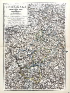
Sold2022Original Antique Map -Hessen Nassau - Map of Furstenthum WaldeckAntique outline hand colored map from edition of Meyer’s world atlas, edited by Ludwig Ravenstein, published by Bibliographic Institute in 1872. Technique: Engraving. Place: Leipzig, Germany. SSee Sold Price
Sold2022Antique Map Print - Map of Schleswig - Holstein - Map of Germany - LauenburgAntique outline hand colored map from edition of Meyer’s world atlas, edited by Ludwig Ravenstein, published by Bibliographic Institute in 1872. Technique: Engraving. Place: Leipzig, Germany. SSee Sold Price
Sold2022Antique Map Print - Map of Mecklenburg-Schwerin - Map of Germany - Roman EmpireAntique outline hand colored map from edition of Meyer’s world atlas, edited by Ludwig Ravenstein, published by Bibliographic Institute in 1872. Technique: Engraving. Place: Leipzig, Germany. SSee Sold Price
Sold2022Original Antique Map - Konicreich Bohmen - Map of Bohmen - Prague - CarlsbadAntique outline hand colored map from edition of Meyer’s world atlas, edited by Ludwig Ravenstein, published by Bibliographic Institute in 1872. Technique: Engraving. Place: Leipzig, Germany. SSee Sold Price
Sold2022Antique Map Print - Map of Rheinprovinz - Map of Germany - Prussian StateAntique outline hand colored map from edition of Meyer’s world atlas, edited by Ludwig Ravenstein, published by Bibliographic Institute in 1872. Technique: Engraving. Place: Leipzig, Germany. SSee Sold Price
Sold2022Antique Map Print - Map of Pomerania - Map of Germany - South of the Baltic SeaAntique outline hand colored map from edition of Meyer’s world atlas, edited by Ludwig Ravenstein, published by Bibliographic Institute in 1872. Technique: Engraving. Place: Leipzig, Germany. SSee Sold Price
Sold2022Antique Map Print - Map of Oldenburg - Map of Germany - Lower Saxony - HunteAntique outline hand colored map from edition of Meyer’s world atlas, edited by Ludwig Ravenstein, published by Bibliographic Institute in 1872. Technique: Engraving. Place: Leipzig, Germany. SSee Sold Price
Sold2022Antique Map Print - Map of Hesja-Nassau - Map of Austria - Prussian ProvinceAntique outline hand colored map from edition of Meyer’s world atlas, edited by Ludwig Ravenstein, published by Bibliographic Institute in 1872. Technique: Engraving. Place: Leipzig, Germany. SSee Sold Price
Sold20221872 C. LEWIS ENGRAVING " THE POACHER" 28.5"ANTIQUE 1872 HAND COLORED ENGRAVING BY C. LEWIS TITLED "THE POACHER"-21.5" X 28.5" APPROX-PRE OWNED CONDITION-DP92722 Bidding on this item requires bidders to agree to the Terms & Conditions of thSee Sold Price
Sold2017Antique European Map Alsatia, 15th CenturyAntique European Map Alsatia. Hand colored accents 15th century map Latin descriptions. Ca 30x24 inches framed dimensions.Frame included with purchase. Please note that this lot has a confidential resSee Sold Price
Sold2022ANTIQUE MAPS, 3 PCS, H 6.25"-14.75", CHARLESTON, SAVANNAH & YORKSHIREANTIQUE MAPS, 3 PCS, H 6.25"-14.75", CHARLESTON, SAVANNAH & YORKSHIRE A selection of three antique maps. Includes one hand-colored 'Parts of North and South Carolina' coastal map (H 14.75" x W 13"), oSee Sold Price
3 days LeftDOYLE Auctioneers & AppraisersOrtelius' historical map of antique "Magna Graecia," present-day Southern Italy$150
Jul 06Worthington GalleriesFirst Edition Hand-colored Map THE NORTH RIDING OF YORKSHIRE by Robert Morden$20
7 days LeftAntique FactoryJOHN SPEED (1552 - 1629), BUCKINGHAM 17th Century Copper Engraving Hand Colored Town Plan Map$200
2 days LeftJasper52World showing Dutch East India Co Possessions, c1720, CA as a island. By J.Malherbe$550
Featured3 days LeftJasper52Dominica, British West Indies. Caribbean. US Navy sea chart 1892 (1917) map$140
6 days LeftTrillium Antique Prints & Rare BooksCatesby, Folio - Little Sparrow with Purple Bindweed of Carolina. 1-35$200
6 days LeftTrillium Antique Prints & Rare BooksCatesby, Folio - Chattering Plover with Sorrel Tree. 1-71$200(1 bid)