Sold2020Australia Felix. New South Wales. Van Dieman's Land.TITLE/CONTENT OF MAP: 'Australia &c. // Colony of New South Wales // Van Dieman's Land'The western part of the continent still bears the name "New Holland". The area covered roughly by the present daySee Sold Price
Sold2020Untitled. [Australia] / Settled Part of New South WalesTitle/Content of Map: Untitled. [Australia] / Settled Part of New South Wales 1840 Cartographer: U.S. EXPLORING EXPEDITION Date: 1845 Publisher: LEA AND BLANCHARD Size: 8.5Height - 11.3Width From WilkSee Sold Price
Sold2021Tallis, John (Pub) 1852 Map. New South Wales, AustraliaSteel Engraved Map with Original Outline Hand Color Published 1852-56 by John Tallis, London for "The Universal Pronouncing Dictionary" by Thomas Wright. Drawn & Engraved by John Rapkin. Centre fold aSee Sold Price
Sold2022Tallis, John (Pub) 1854 Map. New South Wales, AustraliaSteel Engraved Map Published 1854-55 by John Tallis, London for "The British Colonies; Their History, Extent, Condition and Resources" by Robert Montgomery Martin. Drawn & Engraved by John Rapkin. CenSee Sold Price
Sold2023Barclay & Findlay C1835 Map. New South Wales AustraliaSteel Engraved Map Published C1835 by Thomas Kelly, London for "A New and Universal English Dictionary" by the Rev. James Barclay. Maps Drawn & Engraved by Alexander Findlay. Paper Size: 10.5 x 8 inchSee Sold Price
Sold20181855 Tallis Map of New South Wales, Australia -- NewTitle/Content of Map: 1855 Tallis Map of New South Wales, Australia -- New South Wales Date: 1855 London Cartographer: J. Tallis Size: 13 x 10 in. This is an ornate and highly decorative map of AustraSee Sold Price
Sold2018Bryce, James 1881 Map of New South Wales, AustraliaLithograph Map Published 1881, London for ""The International Atlas and Geography..." by James Bryce. Maps by Edward Weller & John Bartholomew. Uncommon. Paper Size: 18 x 13 inch (46 x 33cm) Good CondSee Sold Price
Sold2020Bartholomew, John 1922 Lot of 7 Maps. AustraliaIncl Australia Political, Australia West, Eastern Queensland, South Australia, New South Wales, Victoria/Tasmania, and Australia East. Large Lithograph Maps Published 1922 by The Times, London for "ThSee Sold Price
Sold2022Encyclo. Britannica 1890's Pair of Australia MapsNew South Wales and South Australia. Lithograph Map Published 1875-98, Edinburgh & London for "Encyclopaedia Britannica" Ninth Edition. Paper Size: 10.5 x 8 inch (27 x 21cm) Good ConditionSee Sold Price
Sold2017Johnson: Map of Australia, 18611861 Johnson's Map of Australia -- Johnson's Australia. An eloquent map showing six territories of Australia at the time: New South Wales, Victoria, Van Diemen Land, and West, North and South AustraliSee Sold Price
Sold2016New South Wales Australia 1814Heading: (Map) Author: Carey, Mathew Title: A New and Accurate Map of New South Wales with Norfolk and Lord Howe's Islands, Port Jackson &c. from Actual Surveys Place Published: Philadelphia PublisherSee Sold Price
Sold2018Victoria, Or Port Phillip.Title/Content of Map: Victoria, Or Port Phillip. Date Printed: 1850 ca. Cartographer: RAPKIN, J. Material/Medium: JOHN TALLIS Size: 9.5X12.75 Province in Australia just south of New South Wales. WithSee Sold Price
Sold2019The Times 1895 Mixed Lot of 6 MapsIncl Australia and New Zealand, England and Wales (South and North) Africa North East, Africa North West, and India North. Lithograph Maps Published 1895, London for "The Times Atlas" Paper Size: 21 xSee Sold Price
2024A New & Accurate Chart of the Discoveries of Captn Cook… CONDER 1794 old mapTITLE OF MAP (NOT PRINTED ON THE PAGE):'A New & Accurate Chart of the Discoveries of Captn Cook & other Later Circumnavigators : Exhibiting the whole coast of New South Wales, shewing the situations oSee Sold Price
Sold2018Pacific OceanTitle/Content of Map: Pacific Ocean Date Printed: 1840-05-15 Cartographer: WALKER, J. & C. Size: 12.2X15.5 Details from the Aleutian Island to Australia/New Zealand and to Cape Horn/South America. DetSee Sold Price
Sold2020STRAITS of MAGELLAN & TIERRA DEL FUEGO calledTitle: STRAITS of MAGELLAN & TIERRA DEL FUEGO called MAGELLANICA, with Cape Horn Date/Period: 1642-1665 Materials: Copperplate engraved Size: 18 1/4 x 21”. Maps shows the southern most tip of SouthSee Sold Price
Sold2024ASSOCIATED MOTORWAYS "LONDON TO NEW SOUTH WALES" BOOKING OFFICE TIN FLANGE SIGN.DST. Unique and well displaying Tin Flange Sign for Associated Motorways showing excellent Bus graphic on each side with "Booking Office". CONDITION: Side one is overall excellent with bright color &See Sold Price
Sold2015An Early Club New South Wales (early-mid nineteenthAn Early Club Upper Murray River Region, New South Wales (early-mid nineteenth century) carved hardwood 60 cm high PROVENANCE Private Collection, United Kingdom Private CSee Sold Price
Sold2016ARTIST KEVIN GILBERT (NEW SOUTH WALES 1933-1993)ABORIGINAL ARTIST Untitled (abstract dots, bold lines, colors and shapes) Acrylic on canvas Dimensions:H 40.5" x W 26 3/8" Condition: good, has some scuff marks to the surface and waves to the canvasSee Sold Price
Sold2016Major Taylor's Panorama of Sydney 1823, Three panoramicMajor Taylor's Panorama of Sydney 1823, Three panoramic views of Port Jackson in New South Wales, the town of Sydney and the adjacent scenery. The 1988 limited edition facsimile 74/100.See Sold Price
Sold2016A Victorian sterling silver circular pierced butterA Victorian sterling silver circular pierced butter tub, cover and stand by Barnard Brothers, London 1846 18 cm diameter PROVENANCE: Property of a Gentleman, New South WalesSee Sold Price
Sold2016French School Portrait of an Lady  French School Portrait of an Lady oil on canvas 62 x 51cm PROVENANCE: Property of a Gentleman, New South WalesSee Sold Price
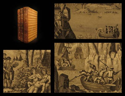
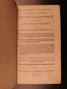
20201794 Voyages of Captain James Cook Australia1794 Voyages of Captain James Cook Australia New Zealand Hawaii Pacific Berenger “Remember, the greater the opportunity, the fewer are those who see it.” – James Cook James Cook was an 18th-centSee Sold Price
Sold20191786 VERY RARE Voyages of Captain James Cook Hawaii1786 VERY RARE Voyages of Captain James Cook Hawaii Pacific Australia New Zealand “Remember, the greater the opportunity, the fewer are those who see it.” – James Cook James Cook was an 18th-cenSee Sold Price
Jun 29Trillium Antique Prints & Rare BooksOxley - Map of the New South Wales, Australia (New Holland)$100
12 hrs LeftTrillium Antique Prints & Rare BooksPrevost - Volume 16 with 31 Maps & Engravings (Including Map or Australia)$210(2 bids)
12 hrs LeftTrillium Antique Prints & Rare BooksHarris - Map of the Southern Continent (Australia, New Holland)$210(3 bids)
6 days LeftLeland LittleEmanuel Bowen (English, 1697-1767), Map of the American Southeast$100(2 bids)
Jul 06Case Antiques, Inc. Auctions & AppraisalsColton's Atlas of the World, 1856, in Two Volumes; plus Africa / Mahdist War Map$500(1 bid)
3 days LeftATTIC TO AUCTION, LLCLUXURY ESTATE RARE South Sea 18kt gold 9.5 mm pearl earrings pierced 2.4 grams$200
Jul 14Schilb Antiquarian Rare Books1819 COLUMBUS 1ed America Magellan USA Washington Cortez MAPS Revolutionary War$70(4 bids)
2 days LeftSchilb Antiquarian Rare Books1786 Voyages James Cook New Zealand Tahiti Palestine Palmyra Temple SYRIA 4v$115(7 bids)
2 days LeftSchilb Antiquarian Rare Books1848 Emory Military Reconnaissance 1ed California MAP Indians Texas New Mexico$56(7 bids)
2 days LeftCurated Gallery AuctionsJohn Pauplis Signed New England Beach Scene Cape Cod Antique Impressionist Framed Oil Painting$10(1 bid)
Jul 06Case Antiques, Inc. Auctions & Appraisals5 TVA Map Books incl. Tennessee & New York c. 1935-1950$250
6 days LeftSouth Florida Auction & Estate Sale Services IncLimited Edition INVICTA Disney Mickey Mouse MENS Mechanical Watch$90(6 bids)
6 days LeftSouth Florida Auction & Estate Sale Services IncExtremely Rare LALIQUE Crystal Gold Luster Tiger New in Original Box$525(6 bids)
6 days LeftSouth Florida Auction & Estate Sale Services IncEX Cool Sabbatic Goat of Mendes Horned Skull God Door Knocker$150(3 bids)


![Untitled. [Australia] / Settled Part of New South Wales: Title/Content of Map: Untitled. [Australia] / Settled Part of New South Wales 1840 Cartographer: U.S. EXPLORING EXPEDITION Date: 1845 Publisher: LEA AND BLANCHARD Size: 8.5Height - 11.3Width From Wilk](https://p1.liveauctioneers.com/5584/167533/84481031_1_x.jpg?height=310&quality=70&version=1588715327)