Sold2023Map of Italy. Engraved by R. Alabern (1853)Title: Italia. Engraver: Ramon Alabern i Moles (Begues, Baix Llobregat, 1811 - Madrid, 1888). Publisher: Gaspar and Roig Production date: 1853. Size: 32x26,4 cms. Condition: fine. Reserve: $44.00 ShipSee Sold Price
Sold2024[NEW YORK CITY]. The New-York City Directory for 1853-1854....[NEW YORK CITY]. The New-York City Directory for 1853-1854. Twelfth Publication. New-York: Charles R. Rode, 1853. Thick 8vo. With folding, engraved map of New York present (map is loose). Bound in modSee Sold Price
Sold2018(2) U.S. MAPS & AN ATLASIncluding: "Huntington's School Atlas, Drawn and Engraved expressly to Illustrate and Accompany The System of Modern Geography" by G. Huntington, A.M. Third Edition, 1853. Hartford, Published by R. WhSee Sold Price
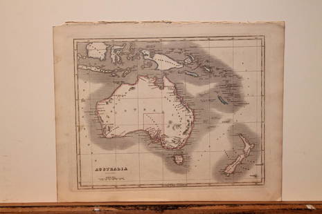
20201842 Map of AustraliaAuthor: Scott Title: 1842 Map of Australia Medium: Ink on Paper Dimensions: 11.5X9" Description: Map of Australia dated 1842. Copper plate map. Engraved by R. Scott. Published by Thomas Nelson in EdinSee Sold Price
Sold20201842 World MapAuthor: Scott Title: 1842 World Map Medium: Ink on Paper Dimensions: 17"X11.5" Description: Hemispherical map of the World dated 1842. Copper plate map. Engraved by R. Scott. Published by Thomas NelsoSee Sold Price
Sold20201842 Map of AsiaAuthor: Scott Title: 1842 Map of Asia Medium: Ink on Paper Dimensions: 11.5"X 9" Description: Map of Asia dated 1842. Copper plate map. Engraved by R. Scott. Published by Thomas Nelson in Edinburgh. PSee Sold Price
Sold20201842 Map of AustraliaAuthor: Scott Title: 1842 Map of Australia Medium: Ink on Paper Dimensions: 11.5"X9" Map of Australia dated 1842. Copper plate map. Engraved by R. Scott. Published by Thomas Nelson in Edinburgh. PartSee Sold Price
Sold20201842 Map of AfricaAuthor: Scott Title: 1842 Map of Africa Medium: Ink on Paper Dimensions: 11.5 X 9" Description: Map of Africa dated 1842. Copper plate map. Engraved by R. Scott. Published by Thomas Nelson in EdinburgSee Sold Price
Sold20201842 Map of ChinaAuthor: Scott Title: 1842 Map of China Medium: Ink on Paper Dimensions: 9"X11.5" Description: Map of China dated 1842. Copper plate map. Engraved by R. Scott. Published by Thomas Nelson in Edinburgh.See Sold Price
Sold2022Rollin & d'Anville 1744 Map of ItalyCopper Engraved Map Published 1739-44, London for "TheRoman History From The Foundation of Rome to The Battle of Actium that is to the end of The Commonwealth" by Charles Rollin. Maps Engraved by R. WSee Sold Price
Sold2022Rollin & d'Anville 1744 Map of Numidia, N. AfricaCopper Engraved Map Published 1739-44, London for "TheRoman History From The Foundation of Rome to The Battle of Actium that is to the end of The Commonwealth" by Charles Rollin. Maps Engraved by R. WSee Sold Price
Sold2022Rollin & d'Anville 1744 Map of Syracuse, Sicily ItalyCopper Engraved Map Published 1739-44, London for "TheRoman History From The Foundation of Rome to The Battle of Actium that is to the end of The Commonwealth" by Charles Rollin. Maps Engraved by R. WSee Sold Price
Sold2022Rollin & d'Anville 1744 Map of Numidia, N. AfricaCopper Engraved Map Published 1739-44, London for "TheRoman History From The Foundation of Rome to The Battle of Actium that is to the end of The Commonwealth" by Charles Rollin. Maps Engraved by R. WSee Sold Price
Sold2022Rollin & d'Anville 1744 Map of Gaul, FranceCopper Engraved Map Published 1739-44, London for "TheRoman History From The Foundation of Rome to The Battle of Actium that is to the end of The Commonwealth" by Charles Rollin. Maps Engraved by R. WSee Sold Price
Sold2023Thomson, John (Pub) 1825 Map. AustraliaCopper Engraved Map Published 1825 by John Thomson, Edinburgh for "The Edinburgh School Atlas" by N. R. Hewitt. Maps Engraved by Hewitt. Original Outline Hand Colour. Rare. Paper Size: 10.5 x 8 inch (See Sold Price
Sold2019Tallis (Pub) 1854 Map of Spain and PortugalSteel Engraved Map Published 1853-4 by John Tallis, London for "The Life and Times of the Late Duke of Wellington" by Thomas Gaspey. Paper Size: 14 x 10.5 inch (36 x 27cm) Good conditionSee Sold Price
Sold2021Thomson, John (Pub) 1825 Map. AfricaCopper Engraved Map Published 1825 by John Thomson, Edinburgh for "The Edinburgh School Atlas" by N. R. Hewitt. Maps Engraved by Hewitt. Engraved Vignette in corner. Original Outline Hand Colour. RareSee Sold Price
Sold2023Thomson, John (Pub) 1825 Map. United States of AmericaCopper Engraved Map Published 1825 by John Thomson, Edinburgh for "The Edinburgh School Atlas" by N. R. Hewitt. Maps Engraved by Hewitt. Original Outline Hand Colour. Rare. Paper Size: 10.5 x 8 inch (See Sold Price
Sold2023Thomson, John (Pub) 1825 Map. West Indies CaribbeanCopper Engraved Map Published 1825 by John Thomson, Edinburgh for "The Edinburgh School Atlas" by N. R. Hewitt. Maps Engraved by Hewitt. Original Outline Hand Colour. Rare. Paper Size: 10.5 x 8 inch (See Sold Price
Sold2023Thomson, John (Pub) 1825 Map. North AmericaCopper Engraved Map Published 1825 by John Thomson, Edinburgh for "The Edinburgh School Atlas" by N. R. Hewitt. Maps Engraved by Hewitt. Original Outline Hand Colour. Rare. Paper Size: 10.5 x 8 inch (See Sold Price
Sold2023Tallis, John (Pub) 1854 Antique Map. British IndiaSteel Engraved Map Published 1853-4 by John Tallis, London for "The Life and Times of the Late Duke of Wellington" by Thomas Gaspey. Drawn and Engraved by J. Rapkin. Folds as issued. Paper Size: 13.75See Sold Price
Sold2023Thomson, John (Pub) 1825 Map. Polar Regions. Canada GreenlandCopper Engraved Map Published 1825 by John Thomson, Edinburgh for "The Edinburgh School Atlas" by N. R. Hewitt. Maps Engraved by Hewitt. Original Outline Hand Colour. Rare. Paper Size: 10.5 x 8 inch (See Sold Price
Sold2021Thomson, John (Pub) 1825 Map. IrelandCopper Engraved Map Published 1825 by John Thomson, Edinburgh for "The Edinburgh School Atlas" by N. R. Hewitt. Maps Engraved by Hewitt. Engraved Vignette in corner. Original Outline Hand Colour. RareSee Sold Price
Sold2021Tallis, John (Pub) 1856 Map. Spain and PortugalSteel Engraved Map Published 1853-4 by John Tallis, London for "The Life and Times of the Late Duke of Wellington" by Thomas Gaspey. Centre fold as published. Drawn and Engraved by John Rapkin. PaperSee Sold Price
2 days LeftEarly American History Auctions1853 Map of Portion of British North America and Gulf of St. Lawrence, by Henry Perley$260
6 days LeftJasper52Plan of Newcastle upon Tyne and Gateshead 1788. Engraved by R. Beilby 1789 map$480
2 days LeftEarly American History Auctions1853 Map, Basin of the St. Lawrence, by T. Keefer showing Natural + Artificial North American Routes$220
BonhamsWESTALL (WILLIAM) AND SAMUEL OWEN Picturesque Tour of the River Thames, FIRST EDITION, R. Ackerm...£2,600
BonhamsAFRICA L'Afrique suivant les dernières observations de M. Hass... Paris, Georges-Louis Le R...£70(8 bids)
6 days LeftForum AuctionsSaint Helena.- Read (Lieut. R.P.) Geographical Plan of The Island & Forts of Saint Helena, engraved£80
BonhamsIRELAND (SAMUEL) Picturesque Views on the Upper, or Warwickshire Avon... to Its Junction with th...£300
BonhamsFORREST (CHARLES RAMUS) A Picturesque Tour Along the Rivers Ganges and Jumna in India, FIRST EDI...£3,600(1 bid)
13 hrs LeftFreeman's | HindmanWOOLWARD, Florence. The Genus Masdevallia... 1890-1896. FIRST EDITION.$1,200
6 days LeftForum AuctionsThe General Contents of the British Museum: With Remarks, second edition, 1762; and 2 others (3)£240
BonhamsJoseph Davey Cunningham, A History of the Sikhs, from the Origin of the Nation to the Battles of...£1,200
BonhamsCUNNINGHAM (JOSEPH DAVEY) A History of the Sikhs, from the Origin of the Nation to the Battles o...£500
7 days LeftSwann Auction GalleriesCOELLO, FRANCISCO. Group of 7 large engraved broadside maps of Puerto Rico, Cuba, The Philippines,$900


![[NEW YORK CITY]. The New-York City Directory for 1853-1854....: [NEW YORK CITY]. The New-York City Directory for 1853-1854. Twelfth Publication. New-York: Charles R. Rode, 1853. Thick 8vo. With folding, engraved map of New York present (map is loose). Bound in mod](https://p1.liveauctioneers.com/928/323637/174189222_1_x.jpg?height=310&quality=70&version=1711128397)