Sold2019Tobias Conrad Lotter (1717-1777, German), "MappaTobias Conrad Lotter (1717-1777, German), "Mappa Geographica Regionem Mexicanem et Floridam", 1740, hand colored, H. - 21 1/2 in., W. - 25 1/2 in.See Sold Price
Sold2019Matthias Seutter (1678-1781), " Mappa GeographicaMatthias Seutter (1678-1781), " Mappa Geographica Regionem Mexicanem et Floridam… Americae Unsulas Cursus," c. 1740, hand colored, H.-20 in., W.- 23 1/2 in.See Sold Price
Sold2019Tobias Conrad Lotter (1717-1777, German), "MappaTobias Conrad Lotter (1717-1777, German), "Mappa Geographica Regionem Mexicanem et Floridam," 1740, hand colored, H.- 21 1/2 in., W.- 25 1/2 in.See Sold Price
Sold2021A LATE BAROQUE MAP OF COLONIAL AMERICA, "MappaA LATE BAROQUE MAP OF COLONIAL AMERICA, "Mappa geographica Regionem Mexicanam et Floridam," AUGSBURG, CIRCA 1740, hand colored engraving on paper, "Terrasque adjacentes, ut et Anteriores Americæ insuSee Sold Price
2023Henry Popple, Amerique Septentrionale. Nova Mappa Geographica Americae Septentrionalis insulasTitle: Amerique Septentrionale. Nova Mappa Geographica Americae Septentrionalis insulas praecipuas Partes divisa. Artist: Henry Popple Publisher: Published by J. M. Probst, Augsburg. Hand colored coSee Sold Price
Sold20231730 MAP UKRAINE CRIMEA RUSSIA BLACK & AZOV SEA antique NOVA MAPPA GEOGRAPHICANOVA MAPPA GEOGRAPHICA MARIS ASSOVIENSIS vel de ZABACHE et PALUDIS MAEOTIDIS accuratè aeri incisa et in lucem edita per Matthaeum Seutter chalcograph. Augsburg; 1730 Overall size 21.5 by 25.5" ImSee Sold Price
Sold2019Johann Baptist Homann (1661-1774), "Mappa GeographicaJohann Baptist Homann (1661-1774), "Mappa Geographica Complectens lndiae Occidentalisi, lsthmum Panamensemii, Lchnographiam, Preaecipuorum Locorum Portum iii. Carte des Isles L'Amerique iv. Ver Cruzv.See Sold Price
Sold2022(CARIBBEAN.) Homann Heirs. Mappa Geographica Complectens I. Indiae Occidentalis Partem Mediam Circum(CARIBBEAN.) Homann Heirs. Mappa Geographica Complectens I. Indiae Occidentalis Partem Mediam Circum Isthmum Panamensem. Double-page engraved map of the Caribbean and Gulf of Mexico bordered by insetsSee Sold Price
Sold2018Seutter. Nova Mappa Geographica Maris...[Eastern Europe/Western Asia] Nova Mappa Geographica Maris Assoviensis Vil De Zabache Et Paludis Maetidis, accurate aeri incise et in luce edita per Matthaeum Seutter Chalcograph. Map of the Sea of AzSee Sold Price
Sold2024Adam Friedrich Zurner (German 1679 - 1742) and Peter Schenk (German 1660 - 1711)Adam Friedrich Zurner (German 1679 - 1742) and Peter Schenk (German 1660 - 1711) "Americae tam Septentionalis quam Meridionalis in Mappa Geographica Delineato", circa 1709 Hand colored map engraving 2See Sold Price
Sold20211757 Homann Map of Poland and the Baltic States --Title: 1757 Homann Map of Poland and the Baltic States -- Mappa Geographica Regni Poloniae ex Novissimis quot quot sunt Mappis Specialibus Composita et ad LL. Stereographica Projectionis Revocata a ToSee Sold Price
Sold2020Homann Heirs Map of the West Indies and Mexico 17Homann Heirs, "Mappa Geographica complectens I. Indiae Occidentalis Partem Mediam Circum Isthmum Panamensem," Nuremberg, 1740. Hand colored map of the Gulf Coast, Florida, and the Caribbean, with inseSee Sold Price
Sold2018Lotter: Grand Sicily Map with Malta InsetMap: Mappa Geographica totius Insulae et Regni Siciliae Cartographer: Lotter Place/Date: Augsburg / 1760 Size: 22" x 19 1/2" Condition: "wash color, cartouches in b&w; overall age toningminor stainingSee Sold Price
Sold20211749 Homann Map of British Isles -- Regnorum MagnaeTitle: 1749 Homann Map of British Isles -- Regnorum Magnae Britanniae et Hiberniae Mappa Geographica... Cartographer: J. Homann Year / Place: 1749 Nurnberg Map Dimension (in.): 18.7 X 21.5 in. This isSee Sold Price
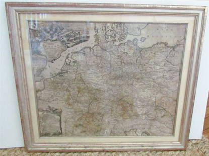
Sold20231769 ANTIQUE MAP of EUROPE framed EUROPEAN POSTAL ROADS & STATIONS1769 ANTIQUE MAP: MAPPA GEOGRAPHICA EXHIBENS POSTAS omnes tam vehiculares quam verdarias Totius Germaniae cum earum accurata distantia Diligentissime propriis sumptibus excudit. Aug. Vindelicor. : TobSee Sold Price
Sold2019TOBIAS CONRAD LOTTER (German 1717-1777) A MAP,TOBIAS CONRAD LOTTER (German 1717-1777) A MAP, "SPATIOSISSIMUM IMPERIUM RUSSIAE MAGNAE JUXTA RECENTIFSIMAS OBFERVATIONES MAPPA GEOGRAPHICA..." "...accuratifsime delineatum opera et fumtibus Tobiae ConSee Sold Price
Sold2022VISSCHER, NICOLAS. Nova Tabula Geographica Complectens Borealiorem Americae Partem...VISSCHER, NICOLAS. Nova Tabula Geographica Complectens Borealiorem Americae Partem... [and] Carte Nouvelle Contenant la Partie d'Amerique la Plus Septentrionale... Large engraved two-sheet map of eastSee Sold Price
Sold2018Framed "Planiglobii Terrestris Mappa Universalis" 1746"Planiglobii Terrestris Mappa Universalis Utrumqs Hemisphaerium Orient et Occidentale …. MDCCXXXXVI." Published in Nuremberg in 1746 by G.M. (George Moritz) Lowitz (1722-1774), Johann Matthias HaseSee Sold Price
Sold2020Seutter's America, California an islandHeading: Author: Seutter, Matthew Title: Novus Orbis Sive America Meridionalis et Septentrionalis per sua Regna, Provincias et Insulas Iuxta Observationes et Descriptiones Resentiss. Divisa et AdornaSee Sold Price
Sold2019Tabula Geographica Mexicae et Floridae, map of MexicoTabula Geographica Mexicae et Floridae, map of Mexico and Florida, hand colored copper engraving, "Carte du Mexique et de la Floride des Terres Angloises et des Isles Antilles", 1722 Jean Covens &See Sold Price
Sold2018(1635) Blaeu Map: Mappa Aestivarvm Insularum,...Historic Maps Hand-Colored "Mappa Aestivarvm Insularum, alias Barmvdas dictarum..." by Willem J. Blaeu, Amsterdam (1635) Hand-Colored Historic Dutch Map titled: "Mappa Aestivarvm Insularum, alias BarmSee Sold Price
Sold2020SEUTTER, MATTHAEUS. Diversi Globii Terr-Aquei.SEUTTER, MATTHAEUS. Diversi Globii Terr-Aquei. Double-page engraved double-hemispheric world map with 8 smaller alternate projections and other diagrams. 20½x23½ inches sheet size, ample marSee Sold Price
Sold2016Roman Statue Hand with Mappa3rd-4th century AD. A life size bronze left hand with the forefinger and thumb slightly extended, the other fingers bent around a mappa, or ceremonial cloth; mounted on a custom-made stand. 723 grams,See Sold Price
Sold2020SEUTTER, MATTHAEUS. Diversi Globi Terr-Aquei.SEUTTER, MATTHAEUS. Diversi Globi Terr-Aquei. Double-page engraved double-hemispheric world map with 8 smaller alternative projections and wind-head spandrel decoration. 21¼x24¼ inches sheetSee Sold Price
2 hrs LeftTrillium Antique Prints & Rare BooksDe Jode, pub. 1593 - Map of part of Germany (Reiterata Episcopatus Monasteriensis geographica?)$100(1 bid)
143 Lots AwayJeschke Jadi Auctions Berlin GmbHGeographia Seu Tractatio Europae Americae Africae et Asiae. Geographica Generalis et Specialis.See Sold Price
369 Lots AwayJeschke Jadi Auctions Berlin GmbHVetter, Johann Georg Tabula Geographica Nova Exhibens Partem infra Montanam BurggraviatusSee Sold Price
2 days LeftSeized Assets AuctioneersSir Peter Paul Rubens - Matthaeus Yrsselius, Abbot of Saint-Michels Abbey in Ant$1
4 days LeftFederal Assets AuctioneersSir Peter Paul Rubens - Matthaeus Yrsselius, Abbot of Saint-Michels Abbey in Ant$1
763 Lots AwayJeschke Jadi Auctions Berlin GmbHPuhlmann, Johann Gottlieb Beschreibung der Gemählde welche sich in der Bildergallerie, den€200
4 days LeftAdam's AuctioneersH.C CAREY AND I.LEA (publishers) A Complete Historical, Chronological and Geographical AMERICAN€1,500
May 04Bright Star Antiques Co.Set of Bleached Shutters 67 3/4"(top of hinge), 67"(top of door), 36"(total)$25
May 07Freeman's | HindmanWORLD ATLASES | Reader’s Digest Great World Atlas. -- National Geographic Atlas of the World.$50(1 bid)


![Seutter. Nova Mappa Geographica Maris...: [Eastern Europe/Western Asia] Nova Mappa Geographica Maris Assoviensis Vil De Zabache Et Paludis Maetidis, accurate aeri incise et in luce edita per Matthaeum Seutter Chalcograph. Map of the Sea of Az](https://p1.liveauctioneers.com/179/117971/60557754_1_x.jpg?height=310&quality=70&version=1520636872)


![VISSCHER, NICOLAS. Nova Tabula Geographica Complectens Borealiorem Americae Partem...: VISSCHER, NICOLAS. Nova Tabula Geographica Complectens Borealiorem Americae Partem... [and] Carte Nouvelle Contenant la Partie d'Amerique la Plus Septentrionale... Large engraved two-sheet map of east](https://p1.liveauctioneers.com/199/251723/130782443_1_x.jpg?height=310&quality=70&version=1655133895)


