Sold2022Antique Map Print - Map of Bohemia - Map of Czech Republic - KingdomAntique outline hand colored map from edition of Meyer’s world atlas, edited by Ludwig Ravenstein, published by Bibliographic Institute in 1872. Technique: Engraving. Place: Leipzig, Germany. SSee Sold Price
Sold2022Original Antique Map -Pommern Provinz - Map of Bornholm Island Baltic SeaAntique outline hand colored map from edition of Meyer’s world atlas, edited by Ludwig Ravenstein, published by Bibliographic Institute in 1872. Technique: Engraving. Place: Leipzig, Germany. SSee Sold Price
Sold2022Original Antique Map - Mecklenburg-Schwerin - Map of Northern GermanyAntique outline hand colored map from edition of Meyer’s world atlas, edited by Ludwig Ravenstein, published by Bibliographic Institute in 1872. Technique: Engraving. Place: Leipzig, Germany. SSee Sold Price
Sold2022Original Antique Map -Bremen Oldenburg - Map of Bremen OldenburgAntique outline hand colored map from edition of Meyer’s world atlas, edited by Ludwig Ravenstein, published by Bibliographic Institute in 1872. Technique: Engraving. Place: Leipzig, Germany. SSee Sold Price
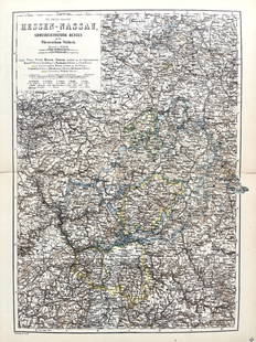
Sold2022Original Antique Map -Hessen Nassau - Map of Furstenthum WaldeckAntique outline hand colored map from edition of Meyer’s world atlas, edited by Ludwig Ravenstein, published by Bibliographic Institute in 1872. Technique: Engraving. Place: Leipzig, Germany. SSee Sold Price
Sold2022Antique Map Print - Map of Schleswig - Holstein - Map of Germany - LauenburgAntique outline hand colored map from edition of Meyer’s world atlas, edited by Ludwig Ravenstein, published by Bibliographic Institute in 1872. Technique: Engraving. Place: Leipzig, Germany. SSee Sold Price
Sold2022Antique Map Print - Map of Mecklenburg-Schwerin - Map of Germany - Roman EmpireAntique outline hand colored map from edition of Meyer’s world atlas, edited by Ludwig Ravenstein, published by Bibliographic Institute in 1872. Technique: Engraving. Place: Leipzig, Germany. SSee Sold Price
Sold2022Original Antique Map - Konicreich Bohmen - Map of Bohmen - Prague - CarlsbadAntique outline hand colored map from edition of Meyer’s world atlas, edited by Ludwig Ravenstein, published by Bibliographic Institute in 1872. Technique: Engraving. Place: Leipzig, Germany. SSee Sold Price
Sold2022Antique Map Print - Map of Rheinprovinz - Map of Germany - Prussian StateAntique outline hand colored map from edition of Meyer’s world atlas, edited by Ludwig Ravenstein, published by Bibliographic Institute in 1872. Technique: Engraving. Place: Leipzig, Germany. SSee Sold Price
Sold2022Antique Map Print - Map of Pomerania - Map of Germany - South of the Baltic SeaAntique outline hand colored map from edition of Meyer’s world atlas, edited by Ludwig Ravenstein, published by Bibliographic Institute in 1872. Technique: Engraving. Place: Leipzig, Germany. SSee Sold Price
Sold2022Antique Map Print - Map of Oldenburg - Map of Germany - Lower Saxony - HunteAntique outline hand colored map from edition of Meyer’s world atlas, edited by Ludwig Ravenstein, published by Bibliographic Institute in 1872. Technique: Engraving. Place: Leipzig, Germany. SSee Sold Price
Sold2022Antique Map Print - Map of Hesja-Nassau - Map of Austria - Prussian ProvinceAntique outline hand colored map from edition of Meyer’s world atlas, edited by Ludwig Ravenstein, published by Bibliographic Institute in 1872. Technique: Engraving. Place: Leipzig, Germany. SSee Sold Price
Sold2022Baedeker, Karl 1879 Lot of 27 Maps. Italy, Switzerland, TyrolLithograph Maps Published 1879, Leipzig for "Switzerland, and the adjacent portions of Italy, Savoy, and The Tyrol" by Karl Baedeker. Folds as issued. Paper Size: Up to 12.5 x 6 inch (32 x 25cm) GoodSee Sold Price
Sold2019Stieler, Adolf 1879 Pair of Celestial Maps. Star Charts"Der Sudliche Stern-Himmel" and "Der Nordliche Stern-Himmel" Southern and Northern Constellations. Steel Engraved Map Published 1879, Gotha, Germany for "Hand-Atlas über alle Theile der Erde und übeSee Sold Price
Sold2019Stieler, Adolf 1879 Astronomy Map. Solar System"Planeten-System der Sonne" Steel Engraved Map Published 1879, Gotha, Germany for "Hand-Atlas über alle Theile der Erde und über das Weltgebäude" by Adolf Stieler. Centre fold as published. Paper SSee Sold Price
Sold2019Stieler, Adolf 1879 Celestial Astronomy Map. The Moon"Die sichtbare Seite der Mond-Oberflache" Steel Engraved Map Published 1879, Gotha, Germany for "Hand-Atlas über alle Theile der Erde und über das Weltgebäude" by Adolf Stieler. Centre fold as publSee Sold Price
Sold2023Reclus, Elisee C1880 Antique Map of Paris, France"Geological Map of the Environs of Paris" Lithograph Map Published 1876-94, London for "The Universal Geography" by Elisee Reclus. Edited by A. H. Keane. Paper Size: 10 x 7 inch (25 x 18cm) Approx. GoSee Sold Price
Sold2022Baedeker, Karl 1911 Lot of 80 Maps of Germany etcLithograph Maps Published 1911, Leipzig for "The Rhine including The Black Forest & The Vosges" by Karl Baedeker. Folds as issued. Paper Size: Up to 13 x 10 inch (33 x 26cm) Good ConditionSee Sold Price
Sold2023Baedeker, Karl 1900 Lot of 63 Maps. Rhine - Germany, Netherlands, AustriaLithograph Maps Published 1900, Leipzig for "The Rhine from Rotterdam to Constance" by Karl Baedeker. Folds as issued. Paper Size: Up to 22.5 x 6 inch (57 x 15cm) Good ConditionSee Sold Price
Sold2023Baedeker, Karl 1880 Lot of 34 Maps of Germany & FranceLithograph Maps Published 1880, Leipzig for "The Rhine from Rotterdam to Constance" by Karl Baedeker. Folds as issued. Paper Size: Up to 11.5 x 6 inch (29 x 16cm) Good ConditionSee Sold Price
Sold2024Baedeker, Karl 1895 Lot of 24 Antique Maps. Southern GermanyLithograph Maps Published 1895, Leipzig for "Southern Germany, including Wurtemberg and Bavaria. Handbook for Travellers" by Karl Baedeker. Folds as issued. Paper Size: Up to 20.5 x 15.5 inch (52 x 39See Sold Price
Sold2024Baedeker, Karl 1895 Lot of 50 Antique Maps. Southern GermanyLithograph Maps Published 1895, Leipzig for "Southern Germany, including Wurtemberg and Bavaria. Handbook for Travellers" by Karl Baedeker. Folds as issued. Paper Size: Up to 8 x 6 inch (20 x 16cm) GoSee Sold Price
Sold2021Brockhaus (Pub) 1890's Lot of 6 Maps of GermanyIncl Elberfeld, German Dialects, Military Positions, Dresden, and Bayern. Lithograph Maps Published 1892-98 by F. A. Brockhaus, Leipzig for "Brockhaus' Konversations-Lexikon" by Various. Paper Size: USee Sold Price
Sold2023Baedeker, Karl 1904 Lot of 25 Antique Maps. Northern GermanyLithograph Maps Published 1904, Leipzig for "Northern Germany as far as the Bavarian and Austrian Frontiers. Handbook for Travellers" by Karl Baedeker. Folds as issued. Paper Size: Up to 13 x 13 inchSee Sold Price
Jun 12Dan Morphy AuctionsGEOLOGY OF THE BLACK AND GRAND RAPIDS OF TEXAS INCLUDING THE EASTERN AND WESTERN CROSS TIMBERS,$100
May 18Trillium Antique Prints & Rare BooksDe Bry - Brazil: Cannibalism: Their ceremonies for killing and eating their enemies$75
May 18Trillium Antique Prints & Rare BooksDe Bry - Brazil - How we decided to sail to Portuguese-controlled St. Vincent, and how we intended$75
5 days LeftJasper52EUROPE GEOLOGICAL. Quaternary Tertiary Cretaceous Jurassic &c JOHNSTON 1906 map$35
4 days LeftJasper521858 Mitchell Map of Great Britain and Ireland [verso] Germany and Switzerland -- No. 22 Map of$25
Featured4 days LeftJasper521716 Homann Map of Northern Germany -- Circulus Saxoniae Inferioris in omnes suos Status et$95
Jun 05Lion Heart AutographsEinstein Letter to Cushing’s Antiquarian Book Dealer, Henry Schuman$1,000
6 days LeftZikorn Arts & History ObjectsWest Indies, Western Cuba 1879 British Admiralty Nautical Map$100
4 days LeftJasper521914 Rand McNally Map of Austria-Hungary [verso] German Empire -- Austria-Hungary [verso] German$30
5 days LeftJasper52Europe. Royaume des Pays-Bas #13 NW Europe Benelux Germany VANDERMAELEN 1827 map$50
5 days LeftJasper52WORLD WAR 2. English Channel & North sea ports. German occupied Europe 1942 map$30
6 days LeftPotter & Potter AuctionsHANDY, R.D. (1879 – 1959). Paul Bunyan’s Pictorial Map of t...$200(1 bid)
2 days LeftSchilb Antiquarian Rare Books1859 AFRICA VOYAGES Barth Timbuktu Tripoli SLAVES Illustrated Slavery MAP African$105(5 bids)


![1858 Mitchell Map of Great Britain and Ireland [verso] Germany and Switzerland -- No. 22 Map of (1 of 2)](https://p1.liveauctioneers.com/5584/328338/176911589_1_x.jpg?height=282&quality=70&version=1715113718)


![1914 Rand McNally Map of Austria-Hungary [verso] German Empire -- Austria-Hungary [verso] German (1 of 2)](https://p1.liveauctioneers.com/5584/328338/176911532_1_x.jpg?height=282&quality=70&version=1715113718)


