Sold2020TWO EUROPEAN MAPS BY WILLIAM BLAEU.Amsterdam, 2nd quarter 17th century, hand colored engravings on rag paper. "Brabantia Ducatus" and "Ducatus Holsatiae". Matching late frames, 22.5"h. 27"w. overall.See Sold Price
Sold2022TWO EUROPEAN MAPS.Mid 17th century, hand colored engravings on laid paper. William Blaeu map of "Karstia, Carniola, Histria et Windorum Marchia". Text on back. Crease. 18.5"h. 22.75"w. And Nicolaum Visscher map of "BelSee Sold Price
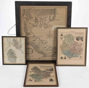
Sold2023ASSORTED EUROPEAN AND ASIAN MAPS, LOT OF FOURASSORTED EUROPEAN AND ASIAN MAPS, LOT OF FOUR, engraving on paper, three with hand-coloring, comprising a map of Buteshire in Scotland by William Home Lizars (Scottish, 1788-1859), two "LA FRANCESee Sold Price
Sold2023G. Williams- Two European Landscape Oil PaintingsG. Williams presents a captivating duo of mid 20th century European landscape oil paintings, each capturing a distinct scene that transports viewers to the beauty of the Old World. The first paintingSee Sold Price
Sold2019Two Maps by Willem Janszoon Blaeu (1571-1638),Two Maps by Willem Janszoon Blaeu (1571-1638), "Virginiae partis australis et Florida partis orientalis," 1640, hand colored, H. - 15 in., W. - 20 in.; together with India Quae Orientalis Diktur et InSee Sold Price
Sold2023Two Folders of Vintage European MapsTwo folders of vintage European maps, including Spain, Portugal, Austrian Dominions, Prussia, Germany, etc. Provenance: Phyllis Lucas Gallery, NYC.See Sold Price
Sold2019Two Maps by Willem Janszoon Blaeu (1571-1638,Two Maps by Willem Janszoon Blaeu (1571-1638, Amsterdam), "Noramndia Ducatus (with History on reverse)," 1640; together with "Languedoc," 1640, hand colored, Languedoc- H. - 19 in., W. 24 in., DucatusSee Sold Price
Sold2019Two Maps by Willem Janszoon Blaeu (1571-1638,Two Maps by Willem Janszoon Blaeu (1571-1638, Amsterdam), "Burgundia Ducatus," 1640; together with "Champagne Latine Campania Comitatus," 1640, hand colored, Champagne- H. - 16 in., W. - 23 in., BurguSee Sold Price
Sold2024Vintage William Blaeu Colored Map of EuropeVintage William Blaeu Colored Print Map of Europe, Framed. Measures 28 inches x 23 inches.See Sold Price
Sold202019th CENTURY WILLIAM BLAEU "ITALY" ENGRAVING19th CENTURY WILLIAM BLAEU "ITALY" MAP HAND COLORED COPPER PLATE ENGRAVING. Height: 27 in. by Width: 31 in.See Sold Price
Sold2024Willem Blaeu, Two Unframed Maps of France(Dutch, 1571-1638) One of Lorraine, "Territorium Metense, Le Pais Messin" and one of Duchy of Nivernais "Nivernium Ducatus Gallice Duche de Nevers" Foxing, stains, tears, creases. 20"h x 23-1/2"w andSee Sold Price
Sold2024Two Maps of the United States by William Faden (London, 1785 and 1796)Two Maps of the United States by William Faden (London, 1785 and 1796) Two hand-colored maps engraved by William Faden (British, 1749-1836), London, 1785 and 1796. Titled "The United States of North ASee Sold Price
Sold2022Two early hand colored European views/maps.Two early hand colored European views/maps including:1)A historical view of the German town of Schleswig by Georg Braun and Frans Hogenberg (between 1572 and 1618) on laid paper - Crease down the middSee Sold Price
Sold20162 vols. The Works of Flavius Josephus.Translated By William Whiston. With Fifty Two Maps and illustration. Bound in full Blue Calf, marbled edges, RB, gilt panels. Pub. London: Chatto & Windus 1897 Free shipping for this item within the cSee Sold Price
Sold2022Hughes, William C1865 Lot of 4 European MapsIncl Europe, Ireland, Baltic and Scotland. Steel Engraved Maps Published C1865 London for "The History of England..." By David Hume, Tobias Smollett and others. Drawn and Engraved by William Hughes. CSee Sold Price
Sold2019Merian maps of Poland & HungaryHeading: Author: Merian, Matthaus Title: Two maps of Eastern European countries Place Published: Frankfurt Publisher: Date Published: c.1640 Description: Includes:See Sold Price
Sold2022Robert Williams Mystery Map of Assinine AtollTwo Robert Williams The Mystery Maps of Assinine Atoll, depicts Assinine Atoll dominated by Funnyman Isle, the atoll’s major features include landmarks such as “The Lost Temple of Mystic Symbols,�See Sold Price
Sold2022Robert Williams Mystery Map of Assinine AtollTwo Robert Williams The Mystery Maps of Assinine Atoll, depicts Assinine Atoll dominated by Funnyman Isle, the atoll’s major features include landmarks such as “The Lost Temple of Mystic Symbols,�See Sold Price
Sold2023TWO ANTIQUE MAPS OF CHINA.Two antique maps of China, including Chinae by Abraham Ortelius, 1595, image 14.25” x 18.25”, with map of Eastern Asia, Le table de la region orientale, image 10” x 13.5”.See Sold Price
Sold2022Two Early Maps and Framed Currency of German InterestTwo Early Maps and Framed Currency of German Interestto include: Blaeu, Willem. Terretorium Abbatiae Heresfeldensis (Amsterdam, 1660s), with Spanish text en verso, presented in two-sided gilt wooden fSee Sold Price
Sold2021Two Early Maps of PolandA map of Poland and Silesia, by W. & J. Blaeu circa 1640 and a map of Poland - Grodków and Nysa by J. Blaeu circa 1660. Dimensions: The frames are 17" x 23" and 19" x 23".See Sold Price
Sold2022THREE EUROPEAN ENGRAVED MAPS.Mid 17th century. Two hand colored maps of Corfu by Johann Baptiste Homann. Some toning, edge damage and one is stained. 21"h. 24.5"w. And uncolored French map of "Bois le Duc, Hertogenbosch", publishSee Sold Price
Sold2024Two Early Maps of West Germany and the Gulf of Pozzuoli in Italy by Blaeu (Amsterdam, 1643-1704)Two Early Maps of West Germany and the Gulf of Pozzuoli in Italy by Blaeu (Amsterdam, 1643-1704) Including "Le Golfe de Pouzol, est une partie du golfe de Naples elle est vers la Ville du Pouzol & lesSee Sold Price
Sold20202 Rare European Route Maps ~ Farmanhere two great airline route maps, also includes postcards, a very rare lot!See Sold Price
7 days LeftTrillium Antique Prints & Rare BooksVan der Aa - Map of India: Hindustan (Explorer: Sir William Methold, first European to visit the$75
4 days LeftJasper52Stratford-upon-Avon & William Shakespeare's life. Kerry Lee pictorial map c1965$460
3 days LeftDallas Auction GalleryPair of English Calling Cord Hall Chairs from King William IV Monarch Era$200
18 hrs LeftCalifornia Historical DesignWilliam Arthur Benson - English Arts & Crafts Brass & Art Glass Lamp c1900$800
Sep 29Fontaine's Auction GalleryWilliam Henry Williamson (British, 1820-1883), "Riding the Storm"$600
Oct 11Lewis & Grant AuctionsTwo Pencil Drawings by Joseph Mallord William Turner (English, 1775-1851)$100
Oct 13Leonard Auction, a division of The Leonard CompanyWilliam Joseph Shayer (British, 1811-1892) 'Travelers Resting at a Country Inn' Oil on Canvas$1,000
Oct 11Lewis & Grant AuctionsTwo Colored Engravings by Joseph Mallard William Turner (English, 1775-1851)$100
4 days LeftJasper52India extrema. Asia & East Indies. Mermaid. SEBASTIAN MÜNSTER 1572 old map$1,500
3 days LeftOreilly's Fine ArtTWO SILVER CROWN ENGLISH COINS, 1688 James II, 1695 William III Both Fine, 30.14 weight€250
5 days LeftFrost & NicklausDefoe, Robinson Crusoe, Compl. 2vol. 1790 Lane Ed., Charles Ansell illustrated$900
5 days LeftFrost & NicklausDumas, 3 Musketeers, Leloir 250 illustrations, 2vol. 1894, 1st Ltd & Numbr. Edition$900