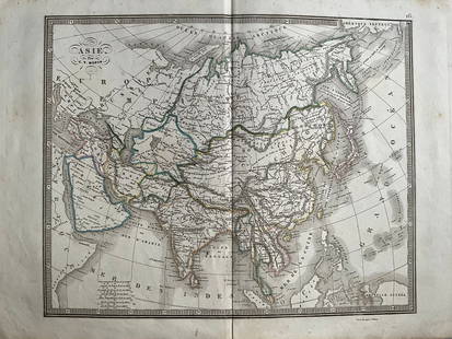
20241839 Asia Map by MoninTitle: 1839 Asia Map by Monin Date/Period: 1839 Materials: Hand colored, engraved Size: 17 1/2 x 12 1/2" This map is an interesting depiction of Asia in 1839 when the continent was still largely unexpSee Sold Price
Sold20241839 Italy Map by MoninTitle: 1839 Italy Map by Monin Date/Period: 1839 Materials: Hand colored, engraved Size: 17 1/2” x 12 1/2” 1839. By V. Monin. Paris. Hand-colored, engraved. Good condition, with some foxinSee Sold Price
Sold20231839 Russia Map by MoninTitle: 1839 Russia Map by Monin Date/Period: 1839 Materials: Hand colored, engraved Size: 17 1/2” x 12 1/2” 1839. By V. Monin. Paris. Hand-colored, engraved. Good condition, with some foxiSee Sold Price
Sold20241839 Europe Map by MoninTitle: 1839 Europe Map by Monin Date/Period: 1839 Materials: Hand colored, engraved Size: 17 1/2” x 12 1/2” 1839. By V. Monin. Paris. Hand-colored, engraved. Good condition, with some foxiSee Sold Price
Sold2017T.D. Monin: Map of Asie Dressee, 1870ASIE Dressee Par T.D. Monin (1870 ?). Asia Map. 73 x 55 cm, T.D. Monin No Reserve: This lot starts at $1 and has no reserve as a courtesy so that collectors can determine the true market value on thisSee Sold Price
Sold20241839 Known Ancient World Map by MoninTitle: 1839 Known Ancient World Map by Monin Date/Period: 1839 Materials: Hand colored, engraved Size: 17 1/2 x 12 1/2" This map is a fascinating illustration of the world as known to the ancient GreeSee Sold Price
Sold2023Russell & Barclay 1839 Hand Col Map. AsiaHand Colored Copper Engraved Map Published 1823-40, by Fisher & Son, "A Complete Atlas of the World" by John Russell et al. A Very Rare Work which is compiled from the same plates used in different edSee Sold Price
Sold20241839. Map of Australia and Pacific by MoninTitle: 1839. Map of Australia and Pacific by Monin Date/Period: 1839 Materials: Hand colored, engraved Size: 17 1/2 x 12 1/2" This is a map of Australia and the Pacific in 1839 when the continent wasSee Sold Price
Sold20241839 Map of Netherlands and Belgium by MoninTitle: 1839 Map of Netherlands and Belgium by Monin Date/Period: 1839 Materials: Hand colored, engraved Size: 17 1/2” x 12 1/2” Netherlands and Belgium with Luxembourg. 1839. By V. Monin.See Sold Price
Sold20231839 Map of United Kingdom and Ireland by MoninTitle: 1839 Map of United Kingdom and Ireland by Monin Date/Period: 1839 Materials: Hand colored, engraved Size: 17 1/2” x 12 1/2” 1839. By V. Monin. Paris. Hand-colored, engraved. Good coSee Sold Price
Sold20241839 Map of North America with the Republic of Texas. By MoninTitle: 1839 Map of North America with the Republic of Texas. By Monin Date/Period: 1839 Materials: Hand colored, engraved Size: 17 1/2 x 12 1/2" This map is a stunning representation of North AmericaSee Sold Price
Sold20241839 Map of Norway and Sweden with insert of Iceland by MoninTitle: 1839 Map of Norway and Sweden with insert of Iceland by Monin Date/Period: 1839 Materials: Hand colored, engraved Size: 17 1/2” x 12 1/2” 1839. By V. Monin. Paris. Hand-colored, engSee Sold Price
Sold20241839. Ancient France (Gaul) by MoninTitle: 1839. Ancient France (Gaul) by Monin Date/Period: 1839 Materials: Hand colored, engraved Size: 17 1/2” x 12 1/2” Map of Ancient France, GAUL. 1839. By V. Monin. Paris. Hand-colored,See Sold Price
Sold20241839. World’s Rivers and Mountains By MoninTitle: 1839. World’s Rivers and Mountains By Monin Date/Period: 1839 Materials: Hand colored, engraved Size: 17 1/2 x 12 1/2" This map is a magnificent illustration of the world's mountains andSee Sold Price
Sold20241839 Germany and Central Europe by MoninTitle/Content: 1839 Germany and Central Europe by Monin Date: 1839 Medium: Hand colored, engraved Description: Map of Germany and all of Central Europe. Including the Austrian Empire. 1839. By V. MoniSee Sold Price
Sold20241839 Balkans with Greece. By MoninTitle: 1839 Balkans with Greece. By Monin Date/Period: 1839 Materials: Hand colored, engraved Size: 17 1/2” x 12 1/2” Map of the entire Balkans with a newly independent Greece. 1839. By V.See Sold Price
Sold20241839. Ancient Germania and Central Europe by MoninTitle/Content: 1839. Ancient Germania and Central Europe by Monin Date: 1839 Medium: Hand colored, engraved Dimensions: 17 1/2" x 12 1/2" Description: Map of Ancient tribal Germany and Central Europe.See Sold Price
Sold20211839 MAP OF ULSTER COUNTY, NEW YORK, BY DAVID H. BURR,1839 MAP OF ULSTER COUNTY, NEW YORK, BY DAVID H. BURR, STONE & CLARK PUBLISHERS, ITHICA, N.Y. NICELY FRAMED, FROM PROMINENT ELLENVILLE, N.Y. ATTORNEYS OFFICE. MAP MEASURES 22" X 23", NICELY FRAMED, ANSee Sold Price
20231803 Voyages in TIBET Bhutan Panchen Lama Buddhism Campe ASIA MAP Samuel Turner1803 Voyages in TIBET Bhutan Panchen Lama Buddhism Campe ASIA MAP Samuel Turner Joachim Heinrich Campe was an 18th-century German author known for his travelogues and histories of voyages. One of hisSee Sold Price
Sold2022Antique Map of Asia - Map of Northern India - Dabhol - Rigobert BonneTitle: Antique Map of Asia - Map of Northern India - Dabhol - Rigobert Bonne Date/Period: 1780 Dimension: 23 cm x 36 cm Material: Paper Additional Information: Antique map of northern India. Covers thSee Sold Price
Sold2017Reichard: Ottoman Empire in Asia Map, 1820Map: Ottoman Empire in Asia Map, "Charte des Osmanischen Reichs in Asien" Cartographer: Reichard Place & Date: Weimar / 1820 Size: 24 3/4" x 19" Condition: light overall age toning; an occasional spotSee Sold Price
Sold20201839 Maps, Middle States, Burgess, MitchellTwo hand colored maps, both dated 1839: "Map of the Middle States and part of the Southern, Engraved to Illustrate Mitchells School and family Geography" by S. Augustus Mitchell, engraved by J. H. YouSee Sold Price
Sold20241860 Mitchell Map of Asia -- Map of Asia Showing its Gt. Political Divisions?Title: 1860 Mitchell Map of Asia -- Map of Asia Showing its Gt. Political Divisions? Cartographer: S Mitchell Year / Place: 1860, Philadelphia Map Dimension (in.): 10.5 x 13.5 in. A magnificent map ofSee Sold Price
Sold20201860 Mitchell Map of Asia -- Map of Asia Showing itsTitle/Content of Map: 1860 Mitchell Map of Asia -- Map of Asia Showing its Gt. Political DivisionsÂ… Cartographer: S Mitchell Year/Place: 1860, Philadelphia Size: 10.5 x 13.5 in. A magnificent mapSee Sold Price
Featured6 hrs LeftJasper52ASIA. Map of the Mountain Chains and the River systems of Asia 1881 old$15(1 bid)
Featured6 hrs LeftJasper52Arid Regions and Closed River Basins of Asia. Sketch map 1885 old antique$8(1 bid)
6 hrs LeftJasper52Middle East ethnic divisions. South west Asia. Sketch map 1885 old antique$8(1 bid)
6 hrs LeftJasper52WW2 ASIA. Japanese-occupied China Indochina Philippines. Middle East 1942 map$35(1 bid)
6 hrs LeftJasper52ASIA. Political. Shows West Bank under Jordanian occupation.BARTHOLOMEW 1952 map$15(1 bid)