Sold20201872 1ed NIAGARA Falls River Geology MAP Canada Indians1872 1ed NIAGARA Falls River Geology MAP Canada Indians Toronto Ontario Erie George Holley’s ‘Niagara’ is a rare 19th-century account of famous waterfall and river in America’s Northeast. ThisSee Sold Price
Sold20211845 1ed Tourist Companion Niagara Falls Saratoga1845 1ed Tourist Companion Niagara Falls Saratoga Seneca INDIANS New York William Pecks “Tourists Companion to Niagara Falls” is a mid-19th-century travel guide written for tourists in NorSee Sold Price
Sold20231799 United States MAP 1ed Rochefoucauld Voyages in Canada INDIANS Saratoga1799 United States MAP 1ed Rochefoucauld Voyages in Canada INDIANS Saratoga La Rochefoucauld-Liancourts account of his voyage to the New World is an important perspective on America and Canada prior tSee Sold Price
Sold2022PANORAMA VIEW OF NIAGARA FALLS."Panorama View of Niagara Falls, River and Gorge, from Victoria Park, Canada." Copyrighted by David Ellis, Buffalo, NY. 57 3/4in. x 10in. Condition: An approx. 6 1/4in. area at the left end is darklySee Sold Price
Sold20221921 1ed Handbook of Yosemite National Park California MAP Indians Geology1921 1ed Handbook of Yosemite National Park California MAP Indians Geology Ansel Halls Handbook of Yosemite National Park is a rare, early 20th-century treatise on the historic American park. First opSee Sold Price
Sold20231834 New York HUGE MAP Niagara Falls Vandewater Tourist Hudson River Travel1834 New York HUGE MAP Niagara Falls Vandewater Tourist Hudson River Travel Robert Vandewaters The Tourist is the preeminent travel guide for tourists visiting the Hudson River in the 19th-century. FiSee Sold Price
Sold20223pc Royal Doulton Photograph Plates, Scenic ViewsSet of 3 plates: Murray River Gums (Australia) D6425. Niagara Falls (Canada) D6476. Maritime Provinces T.C. 1069. Royal Doulton backstamp. #royaldoulton #scenic #plates Issued: 20th c. Dimensions: .8"See Sold Price
Sold20231897 1ed Alaska & Klondike Gold Fields Canada INDIANS Cannibalism Slavery MAP1897 1ed Alaska & Klondike Gold Fields Canada INDIANS Cannibalism Slavery MAP AC Harriss “Alaska and the Klondike Gold Fields” is a 19th-century account of expeditions in Canada and AlaskaSee Sold Price
Sold20231897 1ed Alaska & Klondike Gold Mining Fields Canada Eskimo INDIANS Slavery MAP1897 1ed Alaska & Klondike Gold Mining Fields Canada Eskimo INDIANS Slavery MAP AC Harriss “Alaska and the Klondike Gold Fields” is a 19th-century account of expeditions in Canada and AlasSee Sold Price
Sold20231897 1ed Alaska & Klondike Gold Mining Fields Canada Eskimo INDIANS Slavery MAP1897 1ed Alaska & Klondike Gold Mining Fields Canada Eskimo INDIANS Slavery MAP AC Harriss “Alaska and the Klondike Gold Fields” is a 19th-century account of expeditions in Canada and AlasSee Sold Price
Sold20226 ASSORTED CANADA TRADE DOLLARS 1972 WILDWOODANNUAL KLONDIKE DAYS ALBERTA CANADA, 1978 RED RIVER INDIAN DOLLAR WINNIPEG CANADA, 1979 CALGARY STAMPEDE, 1979 NIAGRA FALLS CANADA CHAMBER OF COMMERCE, 1983 DAUPHIN MANITOBA AND 2 GRAND OLD MEN OF JASSee Sold Price
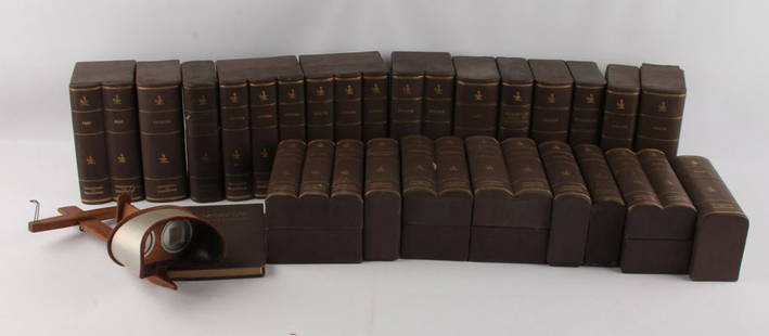
Sold2023[GUIDE BOOKS] NIAGARA FALLS. 1853THE ONTARIO AND ST. LAWRENCE STEAMBOAT COMPANY'S HAND-BOOK FOR TRAVELLERS TO NIAGARA FALLS, MONTREAL AND QUEBEC, AND THROUGH LAKE CHAMPLAIN TO SARATOGA SPRINGS. Illustrated with maps and engravings. BSee Sold Price
Sold20201869 1ed Wild West INDIANS Mormon Gold Mine California1869 1ed Wild West INDIANS Mormon Gold Mine California Railroads MAP Bowles ‘Our New West’ is a record of travel on the Pacific Railroad from the Missouri River to the Pacific Ocean. Bowles givesSee Sold Price
Sold20211869 1ed Wild West INDIANS Mormon Gold Mine California1869 1ed Wild West INDIANS Mormon Gold Mine California Railroads MAP Bowles ‘Our New West’ is a record of travel on the Pacific Railroad from the Missouri River to the Pacific Ocean. Bowles givesSee Sold Price
Sold2023J.S. Blunt Niagara Falls Oil on Canvas Painting.J.S. Blunt Niagara Falls Oil on Canvas Painting. Signed bottom left "J.S. Blunt 1831", signed on verso "Niagara Falls Looking Up River by John S. Blunt, No. 62 Cornhill, Boston 1831", depicts a view oSee Sold Price
Sold2016LARGE LOT OF UNDERWOOD TRAVEL STEREOGRAPH CARDSLARGE LOT OF UNDERWOOD TRAVEL STEREOGRAPH CARDS Includes Austria, Canada, Niagara Falls, Washington, Portugal, Belgium, and more. The whole set includes a Stereograph. Shipping / Pickup: Buyer Pick UpSee Sold Price
Sold2017Attributed to William Traies (British, 1789-1872)Attributed to William Traies (British, 1789-1872), "The Becky Falls, River Wray, South Devon", oil on canvas, unsigned, 36" x 28". In an attractive gesso and giltwood frame.See Sold Price
Sold2020Regis Gignoux Niagara Stream Oil PaintingGignoux, Regis (French/American, Hudson River School, 1816-1882), Rocky Scene Upstream from Niagara Falls, oil on canvas, c.1855, unsigned, 12.5 x 20 inches in a plain wood frame. Title attributed froSee Sold Price
Sold20221834 Map of the Cumberland River TennesseeMap of the Cumberland River from the Falls to Nashville / Made to accompany a Report on the Improvements of that Stream for the navigation of it by Steam Boats; in obedience to a Resolution of CongresSee Sold Price
Sold2023David Johnson Hudson River School Forest Waterfall Signed Framed Oil PaintingDavid Johnson (1827-1908) Possibly Bash Bish Falls. Painted in 1872.Signed with monogram lower right. Signed and dated on verso. Oil on Panel. 5 x 6 1/2 inches. Framed From an important Hudson River SSee Sold Price
2024c1755. French and Indian war era Colonial America and Canada.Title: c1755. French and Indian war era Colonial America and Canada. Date/Period: c1755 Materials: Hand colored, copperplate engraved Size: 18 x 14 1/2” This antique map, created by I. Tirion arSee Sold Price
Sold2024c1755. French and Indian war era Colonial America and Canada.Title: c1755. French and Indian war era Colonial America and Canada. Date/Period: c1755 Materials: Hand colored, copperplate engraved Size: 18 x 14 1/2” This antique map, created by I. Tirion arSee Sold Price
Sold2023Jefferys, Authentic Plan of the River St. Laurence - First StateJEFFERYS, Thomas (c. 1719 - 1771). An Authentic Plan of the River St. Laurence from Silleru to the Fall of Montmorenci with the operations of the Siege of Quebec... Engraved map with original hand colSee Sold Price
Sold2017Mouzon Map of CarolinasAn Accurate Map of North and South Carolina, with their Indian Frontiers, Shewing in a distinct manner all the Mountains, Rivers, Swamps, Marshes, Bays, Creeks, Harbours, Sandbanks and Soundings on thSee Sold Price
3 days LeftHudson Valley Auctioneers LLC Beacon NYLot postcards, ephemera, photographs & more, includes a Vintage postcard album, large lot$50(2 bids)
May 12Schilb Antiquarian Rare Books1883 America Illustrated Yellowstone Erie Canal Saratoga Springs Niagara Falls$14(2 bids)
Jun 02Schilb Antiquarian Rare Books1886 INDIANS 1ed Sa-Go-Ye-Wat-Ha Red Jacket Seneca Revolutionary War Hubbard$1
May 12Schilb Antiquarian Rare Books1875 MEXICO 1ed Travel Yucatan Monterey Cuba Exploration Indians TEXAS WARS$62(2 bids)
6 days LeftHunt and Peck Estate Services, Inc.1836 Paris M. Davis 1st "An Authentic History of the Late War Between the United States and Great$50
May 20Kensington Estate AuctionNorman Wilkinson (British, 1878-1971) Drypoint Etching, Nepisiquit River, Canada$90
1 day LeftTremont Auctions1778 "Il Canada" original map depicting Canada and the US. Hand colored. Fold down center. Framed.$225(2 bids)
1 day LeftTremont AuctionsEarly 19th century British school watercolor landscape. Titled and monogram lower right. Falls of$150
12 hrs LeftD.L. Straight AuctionsRARE 1809 CALLIGRAPHY AND MATHEMATICS/NAVIGATION SCHOOL WORK BOOK LEDGER OF 20-YEAR-OLD “MOSES$100


![[GUIDE BOOKS] NIAGARA FALLS. 1853: THE ONTARIO AND ST. LAWRENCE STEAMBOAT COMPANY'S HAND-BOOK FOR TRAVELLERS TO NIAGARA FALLS, MONTREAL AND QUEBEC, AND THROUGH LAKE CHAMPLAIN TO SARATOGA SPRINGS. Illustrated with maps and engravings. B](https://p1.liveauctioneers.com/8124/283183/149424745_1_x.jpg?height=310&quality=70&version=1679790999)


![(2) Comanche Portraits by Lenny & Sawyers [Cabinet Card] (1 of 2)](https://p1.liveauctioneers.com/7226/322253/173251539_1_x.jpg?height=282&quality=70&version=1710004847)


![NIAGARA FALLS [ORIGINAL 1950 NEW YORK CENTRAL RAIL SYSTEM - VINTAGE POSTER] (1 of 2)](https://p1.liveauctioneers.com/8658/325945/175540907_1_x.jpg?height=282&quality=70&version=1712964944)


