Sold20172 Framed World Maps including Blaeu Wall Map2 Framed World Maps including Blaeu Wall Map. Largest measures 22 x 26 inches.See Sold Price
Sold2023Royal Geographical Society Silver Map #2. Framed Engraved Metal World Map. PTOLEMY version. Issued bRoyal Geographical Society Silver Map #2. Framed Engraved Metal World Map. PTOLEMY version. Issued by the FRANKLIN MINT; Limited Edition. 1976. Thin sterling sheet laid on wood. Deaccessioned from TheSee Sold Price
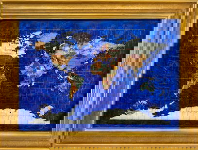
Sold2023Handcrafted Gemstones Framed World MapHandcrafted Gemstones Framed World Map. 23 1/2 x 31 3/8 in.Local Pick up call one day before to make an appointment. TO SHIP THIS ITEM IN USA OR INTERNATIONAL, PLEASE CONTACT THE SHIPPERS : 1) UPS stoSee Sold Price
Sold2022C. S. Hammond & Co. NY Framed World MapC. S. Hammond & Co. NY Framed World Map. 24 1/2" X 20 1/2"See Sold Price
Sold2020FRAMED WORLD MAPCondition: with crease mark from book, spotting, and foxing throughout 11 x 16 1/2 inches sightSee Sold Price
Sold2020Johnson's World on Mercator's Projectionworld map, framed, cracked glass, 16 1/2"x25"See Sold Price
Sold2021(2) ANTIQUE FRAMED MAPSAntique world map approximately 16" x 9.75" w/ frame and Asia minor 11.75" x 9.25" w/ frame.See Sold Price
Sold2023Vintage Needlepoint World MapVintage needlepoint world map of Eastern Hemisphere and Western Hemisphere (?), in gros and petit point. [Each picture: 9 1/2" H x 9 1/2" W; Framed: 14" H x 25" W].See Sold Price
Sold2023Antique Carte Pour L' Intelligence Du Livre Institute L' Esprit De S Loix Old World Framed MapAntique French framed old world map with gold tone frame. Professionally framed. Measures 15 1/2" x 24" total with 9" x 18" matte.See Sold Price
Sold2022Set of Framed 19th C. Relief Maps (3)Printed in Chicago, 1893, set includes a framed relief map of the United States, a relief map of Europe, and a relief map of the world, 27" x 37 1/2" sight, 34" x 47 1/2" framed.See Sold Price
20182 World War II maps2 World War II maps. Pacific and European Theater. Title: 2 World War II map. Framed. Medium: Print. Size: 9.5 X 7.5See Sold Price
Sold2020World MapPrinted Map Of The World. Glazed And framed. Measures 23 1/2 inches x 35 1/2 inches wide.See Sold Price
Sold2017A Framed Color Lithograph of a World Map, AfterA Framed Color Lithograph of a World Map, After Gerardus Mercator20-1/2 x 29 inches (52.1See Sold Price
Sold20211765 Map of the Hemispheres1765 Mape-Monde representee en Hemispheres Oriental et occidental Per Mr l'Abbe, Paris, hand colored map of the world, sight 4 1/2" x 6 1/2", well framed, overall size 14 1/4" x 16 1/4"See Sold Price
Sold2023British School, Needlework "Map of the World"British, 1784, needlework depicting a map of the world with floral decorations at the corners, signed "Ann Smith" l.c., 16 1/2" x 29 3/4" sight size, 18 1/2" x 32" framed.See Sold Price
Sold2017Framed Print Basset Mirror Co. Old World MapFramed Print. Basset Mirror Co. print depicting an old world map, 28 3/4"h. 34 1/2"w.See Sold Price
Sold20231732 H Moll New Map of the Whole World & Tradewinds1732 H Moll New Map of the Whole World with the Tradewinds. Framed, image 8 1/2 x 11 in acid free matt. Hand coloring in map.See Sold Price
Sold2018Set 2 Art Prints of Vintage MapsSet of two gold toned framed Art Prints of Vintage Maps. One world map and one map of the northern section of South America. Both pieces labeled in print as being ‘Appendix 10 - Coast and Geodetic SSee Sold Price
Sold2021Vintage Wall Art Maps- World and NewportTwo Vintage Wall Art Maps- World Map printed in 1930's by Hendrik Willem Van Loon and 1957 Newport Rhode Island Map. Both Framed. Measure 23" x 19 1/2" and 23" x 18". Condition: GoodSee Sold Price
Sold2017A Framed Engraving with Hand Coloring of a WorldA Framed Engraving with Hand Coloring of a World Map, after Abraham Ortelius14-1/2 x 20-1/See Sold Price
Sold2020FRAMED ANTIQUE MAP OF THE WORLDFRAMED ANTIQUE MAP OF THE WORLD, ROBERT DE VAUGONDY, ORBIS VET US, 1752, GEOGRAPHO REGIS ORDINARIO. PAPER IS ACID BURNED AND FOLDED IN THE CENTER. Height: 27 & 19 1/2 in. by Width: 36 1/2 & 29 in.See Sold Price
Featured5 days LeftJasper52Bismarck Archipelago New Guinea New Britain 1943/4. Ports. World War 2 1961 map$8
May 09World of Antiques, Inc.Group of six Antiques 19th C. French Enamel Miniatures on Copper Plaque$450
5 days LeftJasper52World War 2. Guadalcanal Campaign 7-8 Aug 1942 Tulagi Landing Schedule 1959 map$10
5 days LeftJasper52World War 2. Guadalcanal Campaign 7-8 Aug 1942 Landing. Henderson Field 1959 map$10


![Vintage Needlepoint World Map: Vintage needlepoint world map of Eastern Hemisphere and Western Hemisphere (?), in gros and petit point. [Each picture: 9 1/2" H x 9 1/2" W; Framed: 14" H x 25" W].](https://p1.liveauctioneers.com/1221/297727/158975458_1_x.jpg?height=310&quality=70&version=1691943441)


