Sold2017Cary: Antique Map of Upper & Lower Canada, 1807Map: A New Map of Upper & Lower Canada Cartographer: John Cary Place & Date: London / 1807 Size: 20 1/4" x 18" Condition: original color; light overall age toning; a repaired nick in the edge of the uSee Sold Price
Sold2022Antique Map - Map of North America - Canada - Toronto - Montreal - William HugheAn interesting mid 19th century map of Upper and Lower Canada - with an inset of New Brunswick and Nova Scotia - which appeared in Barclay's Universal English Dictionary (London: George Virtue, 1840s)See Sold Price
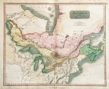
Sold2022(UNITED STATES - REPUBLIC OF TEXAS.) James Wyld. Map of the United States and the Provinces of Upper(UNITED STATES - REPUBLIC OF TEXAS.) James Wyld. Map of the United States and the Provinces of Upper & Lower Canada, New Brunswick, and Nova Scotia, Compiled from the Latest Surveys and Other AuthentiSee Sold Price
20231861 Map of Lower and Upper Canada. By Johnson and BrowningTitle: 1861 Map of Lower and Upper Canada. By Johnson and Browning Date/Period: 1861 Materials: Steel engravedSize: 26 x 18” 1861, by Johnson and Browning. From ‘New Illustrated Family AtlSee Sold Price
Sold2019Upper and lower CanadaTitle/Content of Map: Upper and lower Canada Date 1863 Cartographer: By Johnson & Ward. From, Johnson’s New Illustrated Family Atlas Size: 18x26” Provenance: New York. Hand colored. Text on verso.See Sold Price
Sold20221850s map of British North America, W & R ChambersEngraved map titled “Principal British Possessions in North America.” Nova Scotia, New Brunswick, Lower Canada and Upper Canada are marked in original outline hand color. Above this stretcSee Sold Price
Sold20191798 Hand Colored Map of Upper & Lower Canada1798 hand colored map of upper and lower Canada, published in London by J. Storkdale of Piccadilly. Rough edges and some foxing. Unframed. Measures approximately 8-1/4" in height by 10-1/4" in width.See Sold Price
Sold2016Framed and matted map of Upper and Lower Canada datedFramed and matted map of Upper and Lower Canada dated 1798, published in 1798 by J. Stockdale. Site-7.25"h.x9.5"w.See Sold Price
Sold2016Geographical, Statistical & Historical Map Canada, 1823Map: Geographical, Statistical and Historical Map of Upper and Lower Canada, and the other British Possessions in North America Cartographer: F. Lucas Publishing: Philadelphia / Baltimore, 1823 Size:See Sold Price
Sold2019Lower Canada, New Brunswick, Nova Scotia' Quebec &TITLE/CONTENT OF MAP: 'Lower Canada, New Brunswick, Nova Scotia &c.; Inset map of Newfoundland' DATE PRINTED: 1862 IMAGE SIZE: Approx 31.0 x 45.0cm, 12.25 x 17.75 inches (Large) TYPE: Antique map withSee Sold Price
Sold2017Bradford: Antique Map of Lower Canada, 1838Title/Content of Map: Lower Canada and New Brunswick Date Printed: 1838/1841 Cartographer: Thomas G. Bradford Material/Medium: Paper Size: 16 1/2" x 13 1/2" Hand colored. A General Atlas of the WorldSee Sold Price
Sold2019CanadaTitle: Canada Publication Date: 1829 Cartographer: Anthony Finley Publisher: Anthony FinleySize: 8.5Height - 11.5Width Details Upper & Lower Canada. From: "A New General Atlas... of the Globe..." ShowSee Sold Price
Sold2019Meyer: Upper Canada (Ontario) / Lower Canada (Quebec)Map Title: Ober (Upper) Canada 1849 / Unter (Lower) Canada 1849 Cartographer: Bibliographischen Instituts. Place/Date: Hildburghausen / 1849/1857 Size: 14 5/8" x 11 3/4" Condition: original outline coSee Sold Price
Sold20201858 Map of Lower Canada and New BrunswickAuthor: Johnson Title: 1858 Map of Lower Canada and New Brunswick Medium: Ink on Paper Dimensions: 18"X13' Map of Lower Canada and New Brunswick dated 1858. Engraved by A.J. Johnson. Published by JohnSee Sold Price
Sold2018Thomson: Upper & Lower Canada, Nova ScotiaMap: Canada and Nova Scotia Cartographer: Thomson Place/Date: Edinburgh / 1814/1817 Size: 23 3/4" x 19 1/8" Condition: wash color; light browning along centerfold and in margins; some staining in uppeSee Sold Price
Sold2018Upper & Lower Canada.Reserve Reduced! Title: Upper & Lower Canada. Publication Date: 1835 Cartographer: BRADFORD, T.G. Publisher: AMERICAN STATIONERS COMPANY Size: 7.5 X 9.75 Map showing districts separately colored, townSee Sold Price
Sold2018Colton: Antique Map of Upper Canada, 1859Title/Content of Map: Upper Canada by Colton Date Printed: 1859 Cartographer: H.J. Colton Material/Medium: Paper Size: 17 1/2" x 15" Hand colored, engraved Map. Published in New York in Colton's 'GeneSee Sold Price
Sold2018Colton: Antique Map of Lower Canada, 1859Title/Content of Map: Lower Canada by Colton Date Printed: 1859 Cartographer: H.J. Colton Material/Medium: Paper Size: 17 1/2" x 15" Hand colored, engraved Map. Published in New York in Colton's 'GeneSee Sold Price
Sold2018Lower Canada or East CanadaTitle/Content of Map: Lower Canada or East Canada Date Printed: 1861 Cartographer: J.H. Colton Material/Medium: Paper Size: 14" x 17" Provenance: New York From 'Colton's General Atlas.' Published in NSee Sold Price
Sold2018Lower Canada by TannerTitle/Content of Map: Lower Canada by Tanner Date: 1843 Cartographer: based on the work of H.C. Tanner Material/Medium: Paper Size: 17" x 14" Provenance: New York From the first edition pubished by CaSee Sold Price
Sold2020[CIVIL WAR] Cruchley, G. 1 map[Civil War]. Cruchley, G. F. UNITED STATES WITH UPPER AND LOWER CANADA. London, [c.1860s]. Engraved map, hand coloured. 44cm x 35.3cm (17.25" x 14") black line 46.8cm x 37cm (18.5" x 14.5") sheet A faSee Sold Price
Sold20191ST EDITION / 1ÈRE EDITION, ISAAC WELD, D. 1799A First Edition of Isaac Weld's (B. 1774-1856), "Travels through the states of North America and the provinces of Upper and Lower Canada, 1795, 1796, and 1797", featuring a folding map with coloured oSee Sold Price
Sold2019Carey & Lea: British North AmericaReserve Reduced! Map Title: British Possessions in North America Cartographer: Carey & Lea Place/Date: London / 1823 Size: 9 1/2" x 7 1/2" Condition: outline color; Upper and Lower Canada and the MariSee Sold Price
Sold2024A framed 1844 Mitchell map of New EnglandA hand colored copy of S. Augustus Mitchell's Map of the New England or Eastern States, published in 1844, showing also parts of New York, New Brunswick and "Canada East", as Lower Canada was known frSee Sold Price
BonhamsWELD'S TRAVELS.... WELD, ISAAC, JR. 1774-1856. Travels Through the States of North America, and ...$30(3 bids)
4 days LeftJasper521874 Holmes Plan of New York's Upper East Side -- Map of the Common Lands from 76th to 93rd Street$750
5 days LeftForum AuctionsCartography.- Cary (John) A New Map of England...1821, hand-coloured engraved map, 1823 & others£50
BonhamsDITTERLINE, THEODORE. 1816-1883. Sketches of the Battles of Gettysburg with Explanatory Map. New...$1,600
BonhamsWARHOL SOUP CAN DRAWING. WARHOL, ANDY. 1928-1987. The Philosophy of Andy Warhol (From A to B & B...$950(3 bids)
4 days LeftJasper52Walt Whitman Leaves Of Grass Doubleday Doran 1940 Ill. Lewis C.Daniel VGood HC$130
Swann Auction GalleriesSENDAK, MAURICE. Where the Wild Things Are. Signed and Inscribed, "to Bill Gaston," with small ink d$550
4 days LeftJasper52The Pearl by John Steinbeck 1963 18th Paperback A Bantam Pathfinder Edition Good$55


![[CIVIL WAR] Cruchley, G. 1 map: [Civil War]. Cruchley, G. F. UNITED STATES WITH UPPER AND LOWER CANADA. London, [c.1860s]. Engraved map, hand coloured. 44cm x 35.3cm (17.25" x 14") black line 46.8cm x 37cm (18.5" x 14.5") sheet A fa](https://p1.liveauctioneers.com/1124/187577/94368859_1_x.jpg?height=310&quality=70&version=1607095126)


