Sold2020Antique Amerique Septentrionale Framed MapAntique Amerique Septentrionale Framed Map. Frame measures 13 inches x 17 inches.See Sold Price
Sold2020L'amerique Septentrionale 1706 Map North AmericaL'amerique Septentrionale 1706 Map Of North America (french). 24 X 20 Inches, Framed.See Sold Price
Sold20171749 MAP CALIFORNIA AS AN ISLAND, JACQUES CHIQUETFramed map, c. 1749, "L’AMERIQUE SEPTENTRIONALE qui fait partie des Indes Occidentales. Dressée selon les dernieres Relations des Voiageurs et Suivant les nouvelles Observations de Mur. de lSee Sold Price
Sold2018* ANVILLE, Jean Baptiste Bourguignon d' (1697-1782).* ANVILLE, Jean Baptiste Bourguignon d' (1697-1782). Amérique Septentrionale. Paris, 1746. Engraved map of North America, hand-colored in outline, on 4 sheets joined as 2, overall image 900 x 1730 mmSee Sold Price
Sold2020Amerique SeptentrionaleTitle/Content of Map: Amerique Septentrionale Cartographer: ANVILLE, J.B.B. D' Date: 1746 Publisher: D'ANVILLE Size: 32.3Height - 33.8Width "publiee sous les auspices de Monseigneur le Duc d'Orleans pSee Sold Price
Sold2020Guillaume de L'Isle and Peter Schenk MapGuillaume de L'Isle and Peter Schenk "L'Amerique Septentrionale Dressee sur les Observations...", Amsterdam, Pierre Schenk, 1708, hand-colored engraved map, 17 1/2 in. x 23 in., matted and framed ProvSee Sold Price
Sold201718th Century French Map of North AmericaL’Amerique Septentrionale. Daniel de la Feuille (1640-1709). Engraved map with hand color in full. Amsterdam, 1702 or 1706. 6 x 8 inches visible, 13 x 14 1/2 inches framed. Nicely colored early 18thSee Sold Price
Sold2016Map of Canada Framed Vintage 40s Print After 1720Map of Canada Framed Vintage 40-s Print After 1720 Guillaume De L'Isle Carte Du Canada Qui Comprend la Partie Septentrionale Des Etats Unis D'Amerique Canada and Great Lakes Map Approximately 21 5/8"See Sold Price
Sold20231755 Robert De Vaugondy Map of North America Large1755 Robert De Vaugondy Map of America. Mid-Atlantic, New York, New Jersey, Pennsylvania Virginia, Maryland, New England, Carolina and Ohio. Partie De L'Amerique Septentrionale. Map in matte is aboutSee Sold Price
Sold2024Rigobert Bonne (French, 1727-1794) Hand Colored Engraving Ca. 18th Century, Les Etats Unis DeRigobert Bonne (French, 1727-1794) Hand Colored Engraving Ca. 18th Century, Les Etats Unis De L'Amerique Septentrionale Map, H 16" W 10" | Les etats Unis de l'Amerique septentrionale, contenant en outSee Sold Price
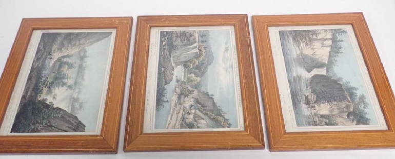
Sold2018Antique Prints of New Jersey Landscape Scenes3 framed Amerique Septentrionale- Etat du New Gersey prints featuring images of the Passaic river and falls. by John Rowson Smith & Jacques Milbert. Height: 12 1/8"; Width: 15 1/4". Image size: 9" x 1See Sold Price
Sold2019Amerique Septentrionale. Antique map of North America.TITLE/CONTENT OF MAP: 'Amerique Septentrionale [North America]' The top image on the right hand side shows the entire map. To view a close up of the map showing the level of printed detail, please cliSee Sold Price
Sold2017de la Tour: Antique Map of Wartime North America, 1777Title/Content of Map: 'L'Amérique Septentrionale' The map was published during the American War of Independence, predating the Louisiana Purchase. Louisiana territory west of the Mississippi appearsSee Sold Price
2020Amérique Septentrionale' by Auguste-Henri Dufour. NorthTITLE/CONTENT OF MAP: 'Amérique Septentrionale' The map shows the Mexican-US border as it was prior to the Mexican-American War, with Mexican Territory including much of the present day US state of CSee Sold Price
Sold2017Dufour: Antique Map of North America, 1836Title/Content of Map: 'Amérique Septentrionale' The map shows the Mexican-US border as it was prior to the Mexican-American War, with Mexican Territory including much of the present day US state of CSee Sold Price
Sold2021Levasseur Map, "Amerique Septentrionale" ca. 1845**Originally Listed At $275** Cartographer: Victor Levasseur (French, 1800-1870). Printer: Joseph Rose Lemercier (French, 1803-1887). "Amerique Septentrionale" - steel engraving with hand coloring. IsSee Sold Price
Sold2017Amerique Septentrionale Victor Levasseur MapAmerique Septentrionale. Maker: Victor Levasseur. Date: Ca. 1845. Size: sheet 14.5" x 20", printed area 11" x 17", Map image 8" x 7". The Atlas Universel Illustre by Victor Lavasseur is one of the lasSee Sold Price
Sold2018C.1850 Levasseur Map Amerique SeptentrionaleLevasseur Map with hand-colored engravings from the Atlas National Illustre' (French). Amerique Septentrionale. 19th Century. Measures approximately 14.5" x 20" sheet size. Unframed, loose and not gluSee Sold Price
Sold2017de Vaugondy: Antique Map of North America in 1783Map: Amerique Septentrionale Dressee sur les Relations les Plus Modernes des Voyageurs et Navigateurs, ou se Remarquent les Etats Unis Cartographer: Robert de Vaugondy Place & Date: Paris / 1750/1783See Sold Price
Sold2021A REPUBLIC OF TEXAS MAP, "Amérique Septentrionale,"A REPUBLIC OF TEXAS MAP, "Amérique Septentrionale," EARLY 20TH CENTURY, hand-colored lithograph on paper, after geographical works by Malte-Brun, Thierry et Barthelmier, engravers, J. Blumenthal,See Sold Price
Sold2023VICTOR LEVASSEUR (1795-1862) A MAP, "Amérique Septentrionale," PARIS,VICTOR LEVASSEUR (1795-1862) A MAP, "Amérique Septentrionale," PARIS, from the "Atlas Universel Illustré, Nouveau Content," lithograph with hand coloring showing the Adams-Onis Treaty boundaSee Sold Price
Sold2019NORTH AMERICA with California as an Island. N CanadaTITLE OF THE MAP: 'Amerique Septentrionale' DATE PRINTED: 1683 IMAGE SIZE: Approx Overall page size 13 x 21cm approximately (5 x 8 inches); image size 10.5 x 14.5cm approximately (4 x 5.5 inches) TYPESee Sold Price
Sold2018NORTH AMERICA with California as an Island. N CanadaTITLE OF THE MAP: 'Amerique Septentrionale' Date: 1683 IMAGE SIZE: Approx Overall page size 13 x 21cm approximately (5 x 8 inches); image size 10.5 x 14.5cm approximately (4 x 5.5 inches) TYPE: OriginSee Sold Price
Sold2021[MAPS] THREE EARLY MAPS OF NORTH AMERICA[MAPS] Three early maps of North America Three maps of North America sold together, including: Francois, Delmarche. AMERIQUE SEPTENTRIONALE. 1833. Engraved map. 27.5 X 33 cm (plate mark). ** Bellin, JSee Sold Price
Jul 16BADO e MART AUCTIONSThree engravings of South America. D’ANVILLE. Amerique Meridionale.€1,200
3 days LeftJasper52Carte du Golfe du Mexique et des Isles de l'Amerique' Caribbean BELLIN 1754 map$200
2 days LeftRapid Estate Liquidators and Auction GalleryFramed Vintage Map Of Le Port Au Prince In The Island Of Santo Domingo$90
3 days LeftJasper52WEST INDIES Caribbean Windward Leeward Islands Barbados Pirates? MALLET 1683 map$240
3 days LeftJasper52Antilles, Golfe du Mexique & Amérique Centrale. Caribbean. MALTE-BRUN c1871 map$35
Jul 11Dan Morphy AuctionsRARE INDEPENDENT GASOLINE & MOTOR OIL FRAMED GRAPHIC HIGHWAY MAP OF ILLINOIS.$125
3 days LeftDOYLE Auctioneers & AppraisersAn eighteenth-century map of Nîmes in Southern France, with views of its Roman monuments$100
Dawsons AuctioneersBeighton Henry: 'A Map of Knightlow-Hundred', 1725, hand coloured, 34.5 cm x 36 cm, together with Ki£40


![Amerique Septentrionale. Antique map of North America.: TITLE/CONTENT OF MAP: 'Amerique Septentrionale [North America]' The top image on the right hand side shows the entire map. To view a close up of the map showing the level of printed detail, please cli](https://p1.liveauctioneers.com/5584/147595/74587297_1_x.jpg?height=310&quality=70&version=1565730371)


![[MAPS] THREE EARLY MAPS OF NORTH AMERICA: [MAPS] Three early maps of North America Three maps of North America sold together, including: Francois, Delmarche. AMERIQUE SEPTENTRIONALE. 1833. Engraved map. 27.5 X 33 cm (plate mark). ** Bellin, J](https://p1.liveauctioneers.com/1124/208511/106199207_1_x.jpg?height=310&quality=70&version=1624388585)


