Sold2017Ortelius Map of Daphne, SyriaDaphne. Abraham Ortelius (1527-1598). from Parergon Theatri. Hand-colored engraving. Antwerp, 1570-1612. 17 3/4 x 22 1/2 inches sheet. Handsome view of the paradise of Daphne, near Antioch in Modern SSee Sold Price
Sold2019[Map, Early Florida] La Florida[Ortelius.] 3 maps on 1 sheet: (upper right) Chaves, Geronimo de. "La Florida. Auctore Hieron Chiaues." (lower right) "Gvastecan Reg." (left) Mendez, Diego de. "Pervviae avriferae regionis typvs." [AnSee Sold Price
Sold2020"Il Mappamondo" World twin hemispheres CookTITLE/CONTENT OF MAP: 'Il Mappamondo o sia Descrizione Generale del Globo ' A decorative map of the world in twin hemispheres, showing the voyages of Cook and Bougainville between 1766-1771. The easteSee Sold Price
Sold20213 PCS, LEOPOLDO MENDEZ WOODCUTS, FRAMED AS SETLeopoldo Mendez (Mexican, 1902-1969). From “Incidentes Melodicas del Mundo Irracional” - 1944, xylograph / woodcut, limited edition of 1200, published by La Estampa Mexicana. Provenance: Private CSee Sold Price
Sold2017Coronelli: Mare Del Nord Auttore, 1690Map: Mare Del Nord Auttore IL PM Coronelli … Il Sig Giovanni Grimaldi Savio di Terra Ferma Maker: Coronelli, Vincenzo Date: 1690 Medium: Copperplate engraving Description: An outstanding map by oneSee Sold Price
Sold2024Abraham OrteliusAbraham Ortelius Galizia, hand coloured engraved map of Galicia circa 1612, Spanish text verso, 37.5 x 48cm (visible) slight split to centre fold line, and small surface crack/gap above 'Portugal' lowSee Sold Price
Sold2017Falda (Giovanni Battista) - Il nuovo teatro delleIl nuovo teatro delle fabriche, et edificii, in prospettiva di Roma moderna , parts 1-3 (of 4), 3 engraved titles and 85 plates (including 3 dedication leaves), 1665-[1669]; Le fontane di Roma nelle pSee Sold Price
Sold2021Mining and Geological Maps. Lot of 31 Maps.Mining and Geological Maps. Lot of 31 Maps. Edite dalla Librairie Polytchnique Ch. Béranger, fine dell’800 - inizi del 900 Il lotto si compone di15 mappe minerarie e geologiche a colori inSee Sold Price
Sold2020[Maps & Atlases] [Africa] Ortelius, Abraham, Group of 2[Maps & Atlases] [Africa] Ortelius, AbrahamGroup of 2 MapsBarbariae et Biledulgerid, nova descriptio(Antwerp, ca. 1570-1612). Hand-colored engraving. Coastal map of North Africa and the Mediterranean,See Sold Price
Sold2022Ortelius - Africae Tabula Nova, MapAbraham Ortelius (1527-1598), Africae Tabula Nova, Antwerp, circa 1570-1612, in two sheets, text verso, engraving on laid paper with hand colored highlights, decorative title cartouche, swordfish, seaSee Sold Price
Sold2022ZATTA, ANTONIO. Il Mappamondo o sia Descrizione Generale Del Globo.ZATTA, ANTONIO. Il Mappamondo o sia Descrizione Generale Del Globo. Double-page engraved double-hemispheric map of the world with decorative continental allegories in each spandrel. 15¼x19 inchesSee Sold Price
Sold2022Dudley Sea Chart of PortugalDUDLEY, Sir Robert (1574-1649). [Portugal] Carta Particolare Del Oceano Che Comincia Con il Capo S. Vincentio E Finisco Con Il Capo Roxo in PortogalloEngraved map. Florence, 1646. 20 7/8" x 17" sheet.See Sold Price
Sold2022Abraham Ortelius and Theodore de Bry, Two Vintage MapsABRAHAM ORTELIUS and THEODORE DE BRY (Belgian, 1527-1598), (German, 1528 - 1598), Maris Pacifici quod vulgo Mar del Zud, 1601, and Hispaniae Novae Sive Magnae, Recens et Vera Descriptio, 1595, two vinSee Sold Price
Sold2019Five Maps by Abraham Ortelius (1527-1598), Three "LaFive Maps by Abraham Ortelius (1527-1598), Three "La Florida Aue Tore Hieron Chiaues; Two Guastecan Reg," 1583, H.- 8 3/4 in., W.- 11 1/2 in., and H.- 17 1/2 in., W.- 11 in. (5 Pcs.)See Sold Price
Sold2023ORTELIUS, Abraham (1527-1598). Americae sive Novi Orbis, Nova Descriptio. Antwerp, ca 1572.ORTELIUS, Abraham (1527-1598). Americae sive Novi Orbis, Nova Descriptio. Antwerp, ca 1572. Engraved map of the Americas with hand-coloring in wash and outline, visible area 15 3/4 x 20 3/4 inches (40See Sold Price
Sold2023Hondius - Map of Virginia and the CarolinasJodocus Hondius (1563-1612), Virginiae Item et Floridae, Amsterdam, circa 1636, text in English verso, engraving on laid paper with hand color, 14-1/8 x 19-3/8 in.; double sided wood frame, 20-1/8 x 2See Sold Price
Sold20191592 Ortelius Map of Central Africa -- PresbiteriTitle/Content of Map: 1592 Ortelius Map of Central Africa -- Presbiteri Iohannis, sive Abissinorum Imperii Descriptio Date: 1592 c., Antwerp Cartographer: A Ortelius Size: 14.8 X 17.3 in. This is an oSee Sold Price
Sold2020Abraham Ortelius Scotiae tabula, map of Scotland, 15thAbraham Ortelius Scotiae tabula, map of Scotland, 15th - 16th C., hand-colored engraving, plate size 14" x 18 3/4". Provenance: Estate of Mark W. Izard MD, Cider Brook Road, Avon, CT.See Sold Price
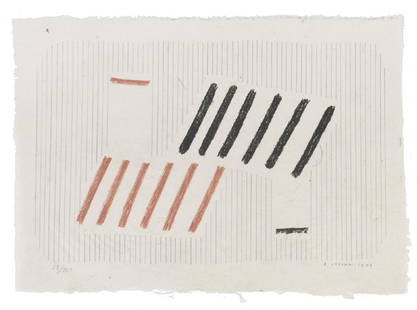
2017AA.VV.Il Segno Concreto n°2, 1980 cartella contenente 3 litografie a colori di Achille Perilli, Bice Lazzari, e Vito Riviello, cm 56 x 41 (misure del foglio), (sc), ess. 22/50 e 15/22, tutte firmate a matiSee Sold Price
Sold2017A PAINTING OF THE 1919 "SOCIEDAD DEL GRAN TEATRO DELA PAINTING OF THE 1919 "SOCIEDAD DEL GRAN TEATRO DEL LICEO BAILE DE MASCARAS" PROMOTIONAL POSTER, BARCELONA, SPAIN, 20TH CENTURY, oil on canvas, signed L/L. 62 1/2" x 44"See Sold Price
Sold20243 Maps1.) Lewis Samuel, A Map of Part of the N. W. Territory of the United States: Compiled from Actual Surveys & the beft Information; 2.) The State of Ohio with Part of Upper Canada; 3.) JSee Sold Price
Sold2024Koudelka, Josef; Teatro del Tempo [STILL SHRINKWRAPPED]Peliti. 2003 Hardcover accordion fold in slipcase. First Edition, First Printing. Italian Editon. 56 pages; 25 double-page b&w photographic plates showing magnificent and exquisitely-printed panoramasSee Sold Price
Sold2016Ortelius map of East Indies 1570Heading: Author: Ortelius, Abraham Title: Indiae Orientalis Insularumque Adjacientium Typus Place Published: [Antwerp] Publisher: Date Published: 1570- Description: Copper-engraSee Sold Price
Sold2024Abraham Ortelius, Map of ChinaAbraham Ortelius (Dutch, 1527-1598), "Chinae, olim Sinarum regionis nova descriptio. auctore Ludouico Georgio", hand-colored engraving. Creases. Sight size: 15"h x 19"w Overall: 22-1/2"h x 26-1/2"w PrSee Sold Price
155 Lots AwayFinarteNino Migliori (1926) - From "Gente del Nord", il garzone del barbiere, 1956See Sold Price
May 14Lucas Milano SRLUn fermacarte e un porta gioie Fermacarte con micro mosaico raffigurante il Colosseo, marmo nero del€500
2 days LeftJasper521630 EGYPT MAP copper engraving ANTIQUE from ENGLISH ED. Mercator-Hondius Atlas$35
4 days LeftHunt and Peck Estate Services, Inc.Abraham Ortelius Map Middle East "Turcici Imperii Descriptio"$240(1 bid)
4 days LeftHunt and Peck Estate Services, Inc.Abraham Ortelius Map Of Fezza And Morocco Kingdom Of Africa Celeberrima$100
4 days LeftHunt and Peck Estate Services, Inc.Abraham Ortelius Map Middle East "Turcici Imperii Descriptio"$140
4 days LeftHunt and Peck Estate Services, Inc.Abraham Ortelius map of Bitiurigum from Theatrum Orbis Terrarum$50
3 days LeftJasper52Qataban & Sheba. Exploring Ancient Kingdoms on the Biblical Spice Routes of Arabia$8
4 days LeftHunt and Peck Estate Services, Inc.Lot of 3 small maps from Scott's Gazeteer "Vermont, New Hampshire and N.W. Territories"$100(1 bid)


![[Map, Early Florida] La Florida: [Ortelius.] 3 maps on 1 sheet: (upper right) Chaves, Geronimo de. "La Florida. Auctore Hieron Chiaues." (lower right) "Gvastecan Reg." (left) Mendez, Diego de. "Pervviae avriferae regionis typvs." [An](https://p1.liveauctioneers.com/3532/154050/77745064_1_x.jpg?height=310&quality=70&version=1572759985)


![Falda (Giovanni Battista) - Il nuovo teatro delle: Il nuovo teatro delle fabriche, et edificii, in prospettiva di Roma moderna , parts 1-3 (of 4), 3 engraved titles and 85 plates (including 3 dedication leaves), 1665-[1669]; Le fontane di Roma nelle p](https://p1.liveauctioneers.com/410/104479/53497294_1_x.jpg?height=310&quality=70&version=1495719828)

![[Maps & Atlases] [Africa] Ortelius, Abraham, Group of 2: [Maps & Atlases] [Africa] Ortelius, AbrahamGroup of 2 MapsBarbariae et Biledulgerid, nova descriptio(Antwerp, ca. 1570-1612). Hand-colored engraving. Coastal map of North Africa and the Mediterranean,](https://p1.liveauctioneers.com/65/180189/90674454_1_x.jpg?height=310&quality=70&version=1601308774)


![Dudley Sea Chart of Portugal: DUDLEY, Sir Robert (1574-1649). [Portugal] Carta Particolare Del Oceano Che Comincia Con il Capo S. Vincentio E Finisco Con Il Capo Roxo in PortogalloEngraved map. Florence, 1646. 20 7/8" x 17" sheet.](https://p1.liveauctioneers.com/1968/250616/130196507_1_x.jpg?height=310&quality=70&version=1654190895)


![Koudelka, Josef; Teatro del Tempo [STILL SHRINKWRAPPED]: Peliti. 2003 Hardcover accordion fold in slipcase. First Edition, First Printing. Italian Editon. 56 pages; 25 double-page b&w photographic plates showing magnificent and exquisitely-printed panoramas](https://p1.liveauctioneers.com/8658/325945/175540639_1_x.jpg?height=310&quality=70&version=1712964944)
![Ortelius map of East Indies 1570: Heading: Author: Ortelius, Abraham Title: Indiae Orientalis Insularumque Adjacientium Typus Place Published: [Antwerp] Publisher: Date Published: 1570- Description: Copper-engra](https://p1.liveauctioneers.com/642/86438/44449716_1_x.jpg?height=310&quality=70&version=1458591928)


