![1593 de Jode Maps of Eastern Germany (Saxony Area) and Western Germany -- Mansfeldiae Comitatus ...: Title: 1593 de Jode Maps of Eastern Germany (Saxony Area) and Western Germany -- Mansfeldiae Comitatus ... [on sheet with] Clivensis et Iuliacensis Ducatum Cartographer: G De Jode Year / Place: 1593,](https://p1.liveauctioneers.com/5584/333309/179943845_1_x.jpg?height=310&quality=70&version=1718737084)
Maps & Atlases
![1593 de Jode Maps of Eastern Germany (Saxony Area) and Western Germany -- Mansfeldiae Comitatus ...: Title: 1593 de Jode Maps of Eastern Germany (Saxony Area) and Western Germany -- Mansfeldiae Comitatus ... [on sheet with] Clivensis et Iuliacensis Ducatum Cartographer: G De Jode Year / Place: 1593,](https://p1.liveauctioneers.com/5584/333309/179943845_1_x.jpg?height=310&quality=70&version=1718737084)
![West Indies. Haiti/Dominican Republic borders differ. BARTHOLOMEW 1886 old map: TITLE/CONTENT OF MAP: 'West Indies' DATE PRINTED: 1886 IMAGE SIZE: Approx 15.0 x 24.5cm, 6 x 9.5 inches (Medium) TYPE: Antique colour map CONDITION: Good; suitable for framing. The image shown may hav](https://p1.liveauctioneers.com/5584/333313/179948000_1_x.jpg?height=310&quality=70&version=1718743877)
![HISPANIOLA. Haiti & Santo Domingo (Dominican Republic) Vintage map 1927: TITLE/CONTENT OF MAP: 'The republics of Haiti & Santo Domingo' DATE PRINTED: 1927 IMAGE SIZE: Approx 8.5 x 14.0cm, 3.25 x 5.5 inches (Small) TYPE: Vintage colour map CONDITION: Good; suitable for fram](https://p1.liveauctioneers.com/5584/333313/179947989_1_x.jpg?height=310&quality=70&version=1718743877)
![[Maps & Atlases] Oliva, Joan: Portolan Chart of the Mediterranean: [Maps & Atlases] Oliva, Joan: Portolan Chart of the Mediterranean Oliva, Joan Portolan Chart of the Mediterranean Marseille, 1615. Illuminated manuscript portolan chart on vellum, in red, blue, green,](https://p1.liveauctioneers.com/65/332523/179335172_1_x.jpg?height=310&quality=70&version=1717709445)
![[Maps & Atlases] Speed, John: Spaine: [Maps & Atlases] Speed, John: Spaine Speed, John Spaine (London): Thomas Bassett and Richard Chiswell, 1626 (but 1675). Engraved hand-colored map, 17 3/8 x 22 in. (441 x 559 mm). Several small tape re](https://p1.liveauctioneers.com/65/332523/179335175_1_x.jpg?height=310&quality=70&version=1717709446)
![[Maps & Atlases] Speed, John: The Turkish Empire: [Maps & Atlases] Speed, John: The Turkish Empire Speed, John The Turkish Empire (London): Roger Rea the Elder and younger, 1626 (but, 1662 or after). Engraved hand-colored map, 16 3/4 x 21 1/2 in. (42](https://p1.liveauctioneers.com/65/332523/179335176_1_x.jpg?height=310&quality=70&version=1717709446)
![Isosahedral Map Patent Model: Joel Elmer Crouch (1899-1957), Cartographic inventor. Patented Icosahedral Map. Original box. Boxes overall 14" x 12" x 5", 12 1/2" x 15" x 6".](https://p1.liveauctioneers.com/1122/332252/179210630_1_x.jpg?height=310&quality=70&version=1717432170)
![[Maps & Atlases] Seutter, Matth(ias).: Novus Orbis sive America...: [Maps & Atlases] Seutter, Matth(ias).: Novus Orbis sive America... Seutter, Matth(ias). Novus Orbis sive America Meridionalis et Septentrionalis… Augsburg, ca. 1730. Engraved hand-colored map of](https://p1.liveauctioneers.com/65/332523/179335174_1_x.jpg?height=310&quality=70&version=1717709447)
![[Maps & Atlases] Braun, Georg, and Frans Hogenberg: Londinum, Feracissimi Angliae...: [Maps & Atlases] Braun, Georg, and Frans Hogenberg: Londinum, Feracissimi Angliae... Braun, Georg, and Frans Hogenberg Londinum, Feracissimi Angliae Regni Metropolis (Cologne, 1574). Engraved hand-col](https://p1.liveauctioneers.com/65/332523/179335170_1_x.jpg?height=310&quality=70&version=1717622830)
![1769 Tirion Map of Japan -- Nieuwe Kaart van't Keizerryk Japan…: Title: 1769 Tirion Map of Japan -- Nieuwe Kaart van't Keizerryk Japan… Cartographer: I Tirion Year / Place: 1769, Amsterdam Map Dimension (in.): 10.8 X 12.4 in. This is a rather handsome map of](https://p1.liveauctioneers.com/5584/333309/179943824_1_x.jpg?height=310&quality=70&version=1718737084)
![Johnson's West Indies. Bermuda Islands. Caribbean Bahamas Antilles 1866 map: CAPTION PRINTED BELOW PICTURE: 'Johnson's West Indies // The Bermuda Islands' DATE PRINTED: 1866 IMAGE SIZE: Approx 41.0 x 58.0cm, 16 x 23 inches (Large); Please note that this is a folding map. TYPE:](https://p1.liveauctioneers.com/5584/333313/179947990_1_x.jpg?height=310&quality=70&version=1718743877)
![VERY RARE Map of Washington D.C & Georgetown Land Reclamation, From a Supreme Court Exhibit: Title: VERY RARE Map of Washington D.C & Georgetown Land Reclamation, From a Supreme Court Exhibit 1879-1899 Date/Period: c1879-1899 Size: 30” x 17” In Washington D.C. and Georgetown, this](https://p1.liveauctioneers.com/5584/333309/179943854_1_x.jpg?height=310&quality=70&version=1718737084)
![6 EARLY ADIRONDACK BOOKS AND MAPS: Includes: - 1895 Stoddard Map of the Adirondacks- 1927 Peaks and People of the Adirondacks by Russell M.L. Carson - 1917 O-Te-Sa-Ga Otsego Lake Cooperstown NY Tour Brochure- late 19th C Wallace's Guid](https://p1.liveauctioneers.com/49/333222/179889384_1_x.jpg?height=310&quality=70&version=1718294549)
![1891 Beer's Atlas of Hudson River Valley (1979 Publ): A 1979 Reproduction of the original 1891 Beer's Atlas of the Hudson Valley from Troy to NYC. In nice shape, full of maps, great reference material](https://p1.liveauctioneers.com/8050/328421/176939506_1_x.jpg?height=310&quality=70&version=1714605816)
![After William Faden, Revolutionary War Map of NY: After William Faden (British, 1749-1836), "A Plan of the Operations of the Kings Army under the Command of General Sr. William Howe, K.B. in New York and East New Jersey", copy on paper, 17 1/2" x 12"](https://p1.liveauctioneers.com/7247/333484/180078520_1_x.jpg?height=310&quality=70&version=1718412243)
![An Antique Framed Map: depicting the Tribe of Benjamin; hand-colored engraving on laid paper Sight: 11 x 13 1/2 in. (27.9 x 34.3 cm.), Frame: 18 1/4 x 20 1/2 in. (46.4 x 52.1 cm.)](https://p1.liveauctioneers.com/1285/333242/180162154_1_x.jpg?height=310&quality=70&version=1718407091)
![[Maps & Atlases] A New Map of North America, with the West India Islands...: [Maps & Atlases] A New Map of North America, with the West India Islands... A New Map of North America, with the West India Islands. Divided according to the Preliminary Articles of Peace, Signed at V](https://p1.liveauctioneers.com/65/332523/179335173_1_x.jpg?height=310&quality=70&version=1717709447)
![Colton's Atlas of the World, 1856, in Two Volumes; plus Africa / Mahdist War Map: 1st and 2nd Items: COLTON'S ATLAS OF THE WORLD, George Woolworth Colton, New York: J.H. Colton and Co., 1856. Two large folio volumes, bound in publisher's brown cloth, with gilt and blind sta](https://p1.liveauctioneers.com/525/332535/179370646_1_x.jpg?height=310&quality=70&version=1717684324)
![1719 BIBLE DUTCH BIBLIA FOLIO w/ CLASPS & MAPS antique decorative binding: Biblia: De Gantsche H Schrifture [...] Dordrecht/Amsterdam, Pieter Keur/Piter Rotterdam, 1719 (46) 332 sheets ( 664 pages), (2) 144 sheets ( 288 pages), (26) 169 sheets ( 338 pages), (4) 58 ( 116 page](https://p1.liveauctioneers.com/5584/332969/179742394_1_x.jpg?height=310&quality=70&version=1718743930)
![1587 Ortelius Map of Holland -- Hollandiae Antiquorum Catthorum sedis Nova Descriptio, Auctore: Title: 1587 Ortelius Map of Holland -- Hollandiae Antiquorum Catthorum sedis Nova Descriptio, Auctore Iacobo A Daventria Cartographer: A Ortelius Year / Place: 1587 c., Amsterdam Map Dimension (in.):](https://p1.liveauctioneers.com/5584/333309/179943863_1_x.jpg?height=310&quality=70&version=1718737084)
![NEW PROVIDENCE. Vintage map. Bahamas. Caribbean 1927 old vintage chart: TITLE/CONTENT OF MAP: 'Island of New Providence, Bahamas' DATE PRINTED: 1927 IMAGE SIZE: Approx 13.0 x 18.0cm, 5 x 7 inches (Small); Please note that this is a folding map. TYPE: Vintage colour map CO](https://p1.liveauctioneers.com/5584/333313/179947997_1_x.jpg?height=310&quality=70&version=1718743877)
![1777 US Revolutionary War Map French Brion de la Tour Theatre de Guerre: TITLE: 1777 US Revolutionary War Map French Brion de la Tour Theatre de Guerre CATALOG NOTES: An original engraved map printed in 1777 showing the theater of war in America's Revolution. It was publis](https://p1.liveauctioneers.com/4239/332397/179265610_1_x.jpg?height=310&quality=70&version=1717529547)
![[Philadelphia & Pennsylvania] Howell, Reading: A Map Of The State Of Pennsylvania: [Philadelphia & Pennsylvania] Howell, Reading: A Map Of The State Of Pennsylvania Howell, Reading A Map Of The State Of Pennsylvania… London: Published 1 August 1792 for the Author, & Sold by Ja](https://p1.liveauctioneers.com/65/332523/179335196_1_x.jpg?height=310&quality=70&version=1717622830)
![Group of 30+ Railroad Route Maps: Includes 1907 big four route, 1905 underground railway of New York, 1906 Columbia River, Santa Fe, Burlington](https://p1.liveauctioneers.com/5173/332857/179643198_1_x.jpg?height=310&quality=70&version=1717871038)
![Bound Map of Columbia County: Large, hand-colored bound in map, Published my Dolph & Stewart.](https://p1.liveauctioneers.com/7247/333484/180078807_1_x.jpg?height=310&quality=70&version=1718412243)
![18th c. Hand Drawn Map of Africa: 18th c. hand drawn map of Africa. Signed ….Briggs. Sight 9 1/2" x 11 1/2", overall 11 1/2" x 13 1/2". Provenance: The Edward Herrmann Estate, Salisbury Connecticut.](https://p1.liveauctioneers.com/1122/332252/179210680_1_x.jpg?height=310&quality=70&version=1717432170)
![Two Early Maps of the American Revolution's Southern Theater: Two Early Maps of the American Revolution's Southern Theater to include: A New and Accurate Map of North Carolina and Part of South Carolina with the Field of Battle between Earl Cornwallis and Genera](https://p1.liveauctioneers.com/250/333695/180278744_1_x.jpg?height=310&quality=70&version=1718649382)
![Carte de l'Isle de la Grenade'. Grenada. West Indies. BELLIN 1759 old map: CAPTION PRINTED BELOW PICTURE: Carte de l'Isle de la Grenade [Map of the island of Grenada] DATE PRINTED: 1759 IMAGE SIZE: Approx 22.0 x 16.0cm, 8.5 x 6.25 inches (Medium) TYPE: Antique copperplate ma](https://p1.liveauctioneers.com/5584/333313/179948003_1_x.jpg?height=310&quality=70&version=1718743877)
![COLONIAL CARIBBEAN. West Indies. Danish Virgin Islands.Telegraph cables 1886 map: CAPTION PRINTED BELOW PICTURE: 'The West India Islands, and Central America; Inset map of Jamaica' DATE PRINTED: 1886 IMAGE SIZE: Approx 36.0 x 52.0cm, 14.25 x 20.5 inches (Large); Please note that th](https://p1.liveauctioneers.com/5584/333313/179947996_1_x.jpg?height=310&quality=70&version=1718743877)
![1720 Homann Map of the Caspian Sea Region -- Provinciarum Persicarum Kilaniae nempe Chirvaniae: Title: 1720 Homann Map of the Caspian Sea Region -- Provinciarum Persicarum Kilaniae nempe Chirvaniae Dagestaniae Cartographer: J Homann Year / Place: 1720, Nurnberg Map Dimension (in.): 19.2 X 22.8 i](https://p1.liveauctioneers.com/5584/333309/179943814_1_x.jpg?height=310&quality=70&version=1718737084)
![COLONIAL CRAFTSMAN CIRCA 1940 MAP OF CAPE COD 21.5" x 27". Framed 23.5" x 29".: COLONIAL CRAFTSMAN CIRCA 1940 MAP OF CAPE CODShows Cape Cod, Martha's Vineyard and Nantucket, surrounded by vignettes of historic sites throughout the region.21.5" x 27". Framed 23.5" x 29".](https://p1.liveauctioneers.com/7634/333049/179792507_1_x.jpg?height=310&quality=70&version=1718199059)
![ORBIS TERRAE COMPENDIOSA MAP MERCATOR: FRAMED MERCATOR ORBIS TERRAE COMPENDIOSA MAP. MAP HAS NOT BEEN INSPECTED OUTSIDE THE FRAME, EXACT PRINT DATE CANNOT BE STABLISHED. FRAME SIZE: 26.5 X 20.5 INCHES APPROX. SHIPPING IN THE U.S VIA USPS P](https://p1.liveauctioneers.com/6312/332015/179402255_1_x.jpg?height=310&quality=70&version=1717703346)
![1874 Map of India: 1874 Map of India. Sight 16" x 14", overall 17 1/2" x 15". Provenance: The Edward Herrmann Estate, Salisbury Connecticut.](https://p1.liveauctioneers.com/1122/332252/179210672_1_x.jpg?height=310&quality=70&version=1717432170)
![ENGRAVING SURVEY MAP OF SOUTH CAROLINA AND GEORGIA: This original engraved map is a Survey of Chart no.55 from Hunting island to Ossabaw Island from South Carolina and Georgia. Issued: 1873 Dimensions: 43"L x 35.25"H Country of Origin: UNITED STATES](https://p1.liveauctioneers.com/6087/333784/180322518_1_x.jpg?height=310&quality=70&version=1718728239)
![Greene County, NY Directory for 1896 by Fred Craigie, Catskill NY with Map: The Greene County, NY Directory for 1896 publ. by J.H. Craigie of Catskill, NY. 328pgs in length, retains the original map. Measuring 6" x 9" in size, intact bindings, clean. Full of advertising & gen](https://p1.liveauctioneers.com/8050/328421/176939474_1_x.jpg?height=310&quality=70&version=1714605816)
![Vintage Wool Needlepoint Embroidered Map of Nantucket Island: Vintage Wool Needlepoint Embroidered Map of Nantucket Island, in Nantucket red, with Nantucket Island flag, and artist's signature daisy flower symbol lower left. Sight 9.5 in. x 15 in. Overall 16.5 i](https://p1.liveauctioneers.com/6681/333076/179801209_1_x.jpg?height=310&quality=70&version=1718285153)
![1702 Homann Map of Northern Italy, Milan Included -- Belli Typus in Italia…: Title: 1702 Homann Map of Northern Italy, Milan Included -- Belli Typus in Italia… Cartographer: J Homann Year / Place: 1702 c., Nurnberg Map Dimension (in.): 19 X 22.5 in. This is a magnificent](https://p1.liveauctioneers.com/5584/333309/179943808_1_x.jpg?height=310&quality=70&version=1718737084)
![1659 Blaeu Map of Southern Norway -- Dioecesis Stavangriensis, & Partes Aliquot Vicinae, Opera L.: Title: 1659 Blaeu Map of Southern Norway -- Dioecesis Stavangriensis, & Partes Aliquot Vicinae, Opera L. Scavenii, S.S. Cartographer: J Blaeu Year / Place: 1659, Amsterdam Map Dimension (in.): 16.3 X](https://p1.liveauctioneers.com/5584/333309/179943836_1_x.jpg?height=310&quality=70&version=1718737084)
![British, Dutch & French Guiana. Suriname Guyana. LOWRY 1860 old antique map: CAPTION PRINTED BELOW PICTURE: 'British, Dutch, and French Guiana' DATE PRINTED: 1860 IMAGE SIZE: Approx 36.5 x 30.5cm, 14.5 x 12 inches (Large); Please note that this is a folding map. TYPE: Antique](https://p1.liveauctioneers.com/5584/333313/179948002_1_x.jpg?height=310&quality=70&version=1718743877)
News about Maps & Atlases
![Historic maps and atlases chart course to Swann Dec. 7](https://www.liveauctioneers.com/news/wp-content/uploads/2023/11/165833907_1_x.webp)
Historic maps and atlases chart course to Swann Dec. 7
[av_heading heading=’Historic maps and atlases chart course to Swann Dec. 7′ tag=’h1′ style=” subheading_active=” show_icon=” icon=’ue800′ font=’entypo-fontello’ size=” av-desktop-font-size-title=” av-medium-font-size-title=” av-small-font-size-title=” av-mini-font-size-title=” subheading_size=” av-desktop-font-size=” av-medium-font-size=” av-small-font-size=” av-mini-font-size=” icon_size=” av-desktop-font-size-1=” av-medium-font-size-1=” av-small-font-size-1=” av-mini-font-size-1=” color=” custom_font=” subheading_color=” seperator_color=” icon_color=” margin=’,,35px,’ av-desktop-margin=” av-desktop-margin_sync=’true’ av-medium-margin=” av-medium-margin_sync=’true’ av-small-margin=’,,20px,’ av-mini-margin=” av-mini-margin_sync=’true’ headline_padding=” headline_padding_sync=’true’ av-desktop-headline_padding=” av-desktop-headline_padding_sync=’true’ av-medium-headline_padding=” av-medium-headline_padding_sync=’true’ av-small-headline_padding=” av-small-headline_padding_sync=’true’ av-mini-headline_padding=” av-mini-headline_padding_sync=’true’ […]
![Celebration of Scottish engineering on display at Lyon & Turnbull Feb. 7](https://www.liveauctioneers.com/news/wp-content/uploads/2024/01/Screenshot-2024-01-25-at-9.14.33 AM.png)
Celebration of Scottish engineering on display at Lyon & Turnbull Feb. 7
EDINBURGH – A cache of material from a well-known Scottish engineering dynasty will be offered at Lyon & Turnbull. The Rare Books, Manuscripts, Maps & Photographs auction on Wednesday, February 7 includes 50 lots from the Stevenson family – designers across four generations of many of the U.K.’s lighthouses. Absentee and Internet live bidding will […]
![Dickens & Twain set world records at Potter & Potter Aug. 28](https://www.liveauctioneers.com/news/wp-content/uploads/2021/09/395-1.jpg)
Dickens & Twain set world records at Potter & Potter Aug. 28
CHICAGO – Potter and Potter‘s spectacular August 28 Fine Books and Manuscripts Sale was the company’s highest-grossing auction to date. After a day of spirited bidding, 107 lots realized between $1,000-4,999; 22 lots realized between $5,000-9,999; and 16 lots broke the five digit mark.
![Jasper52 vintage map auction Nov. 5 going global](https://www.liveauctioneers.com/news/wp-content/uploads/2019/10/77325761_3_x.jpg)
Jasper52 vintage map auction Nov. 5 going global
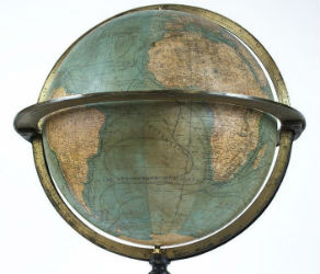
NEW YORK – A 19th century French terrestrial globe tops an auction of vintage maps that will be conducted by Jasper52 on Tuesday, Nov. 5. Fifteen globes and more than 130 maps and atlases are offered in the online auction. Bid absentee or live online exclusively through LiveAuctioneers.