Sold2017Two hand colored engraved double page large folio mapsTwo hand colored engraved double page large folio maps including The United States of America and Map of New York and the Adjacent Cities. 16 1/2" x 27" and 17 1/2" x 27" Provenance: Property from CSee Sold Price
Sold2022(AFRICA.) Two hand-colored double-page engraved eighteenth-century maps of the continent.(AFRICA.) Two hand-colored double-page engraved eighteenth-century maps of the continent. Nuremberg, 1715-1730s - Homann Heirs. Africa Secundum Legitimas Projectionis Stereographicae. 20¾x24¼See Sold Price
Sold2020SPEED, JOHN. Caermarden; and Breknoke.SPEED, JOHN. Caermarden; and Breknoke. Together two hand-colored double-page engraved county maps with town insets. Approximately 16x21 inches each sheet size, ample margins, English text on verso; vaSee Sold Price
Sold2022(ASIA.) Jean Janvier. l'Asie Divisee en ses Princepaux Etats.(ASIA.) Jean Janvier. l'Asie Divisee en ses Princepaux Etats. Large hand-colored double-page engraved map of the Asian continent, Indonesia, and a remarkably distorted island(?) of New Guinea. 21½See Sold Price
Sold2022Impressive and scarce engraved large map of CaliforniaExtremely scarce double-page vertical map of California. Fully hand colored in pastels with fine level of detail throughout. Shows railroads, wells, springs, towns, rivers, lakes, topography, deserts,See Sold Price
Sold2022SENEX, JOHN. Group of 25 full-sheet and double-page engraved maps in fine original hand-color.SENEX, JOHN. Group of 25 full-sheet and double-page engraved maps in fine original hand-color. 12 large two-sheet double-page maps measuring approximately 40x26 inches each; 13 unfolded full-sheet mapSee Sold Price
Sold2018WALKER, John and Charles.WALKER, John and Charles. Hobson's Fox-Hunting Atlas. London: J. and C. Walker, [ca 1868-1871]. Folio (368 x 242 mm). 42 engraved or lithographic double-page maps hand-colored in outline, hunts stampeSee Sold Price
Sold2017DIDIER ROBERT DE VAUGONDY (FRENCH, 1688-1766) ATLASDIDIER ROBERT DE VAUGONDY (FRENCH, 1688-1766) ATLAS VOLUME "Atlas Universel", 1757, folio, leather boards, engraved title page, 106 hand-colored double-page maps, missing numbers 24 and 40. With proteSee Sold Price
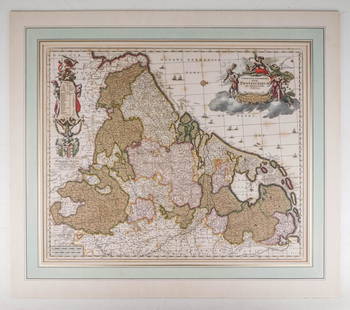
Sold2020Visscher, Claes .Germaniæ Inferioris XVIIVisscher, Claes .Germanie Inferioris XVII Provinciarum. Fine hand colored engraved double-page map. 18-1/2 x 22-1/2 inches plus margins, blank on verso, neatly matted; some browning, generally sound.See Sold Price
Sold20191705 map of France by Nicolas de FerBeautifully hand-colored, copperplate engraved double-page map of France from the scarce 1723 edition of Nicolas de Fer’s Petit Nouveau Atlas. “La France Avec Ses Acquisitions Iusqu’a, l’AaneeSee Sold Price
Sold201517th C. John Speed, Huntington & Ely MapJohn Speed (British, 1552-1629), "Huntington, both Shire and Shire Town with the ancient citie Ely Described," hand colored, double engraved-page map originally created by noted cartographer, John SpeSee Sold Price
Sold2022ANTIQUARIAN GERMAN WORLD ATLAS,ANTIQUARIAN GERMAN WORLD ATLAS, H. Kiepert, C.F. Weiland, C. Graf, Allgemeiner Hand-Atlas der Erde und des Himmels, comprising 70 copper-plate engraved double-page maps hand-colored in outline, maps dSee Sold Price
Sold2022SPEED, JOHN. The Kingdome of Persia.SPEED, JOHN. The Kingdome of Persia. Hand-colored double-page engraved map of modern-day Iran, Pakistan, and Afghanistan with carte-a-figures and city plan border panels. 16½x21¼ inches sheeSee Sold Price
Sold2018GEORG BRAUN & FRANS HOGENBERG HAND COLORED MAPGEORG BRAUN & FRANS HOGENBERG HAND COLORED DOUBLE-PAGE ENGRAVED MAP, H 13 1/4", W 19", "LUTETIA, VULGARI NOMINE PARIS":DEPICTING 16TH CENTURY PARIS, WITH A DECORATIVE TITLE-CARTOUCHE FEATURING COAT OFSee Sold Price
Sold2020SPEED, JOHN. Bohemia.SPEED, JOHN. Bohemia. Hand-colored double-page engraved map of the Czech Republic with carte-a-figures and city plan border panels. 16¼x20½ inches sheet size, margins shaved to the neatline,See Sold Price
Sold2022(ITALY.) Gerard Mercator. Italia.(ITALY.) Gerard Mercator. Italia. Hand-colored double-page engraved map of Italy. 15½x19¼ inches sheet size, ample margins, French text on verso; center fold reinforced on verso, Duisberg, 1See Sold Price
Sold2020ORTELIUS, ABRAHAM. Hispaniae Novae Sivae Magnae, RecensORTELIUS, ABRAHAM. Hispaniae Novae Sivae Magnae, Recens et Vera Descriptio. Hand-colored double-page engraved map of southwestern Mexico. 17x21½ inches sheet size, wide margins, Latin text on verSee Sold Price
Sold2019ROBERT de VAUGONDY, GILLES Map.ROBERT de VAUGONDY, GILLES: Environs de Paris, Par Le Sr. Robert Geographe Ordinaire Du Roi with Privileged 1753 Hand-colored double-page engraved map of the country surrounding Paris. 20 ¼ x 2See Sold Price
Sold2020BLAEU, WILLEM. Persia Sive Sophorum Regnum.BLAEU, WILLEM. Persia Sive Sophorum Regnum. Hand-colored double-page engraved map of modern-day Afghanistan, Pakistan, Iraq, Iran, and the Persian Gulf region. 15½x21 inches sheet size, top and bSee Sold Price
Sold2018Janssonius Joannes Nova Belgica Et Anglia Nova doubleJanssonius Joannes Nova Belgica Et Anglia Nova double page engraved map, hand colored, ss 15 1/2" x 20"See Sold Price
Sold2015Cary's New Universal Atlas,Containing Distinct Maps of All the Principal States and Kingdoms, etc., London: Printed for J. Cary, Engraver, 1811, with 56 double-page engraved hand-colored maps on 60 numbered sheets (complete), rSee Sold Price
Sold2024Johann B. Homann- Virginia, Marylandia et CarolinaJohann Baptist Homann (German, 1664-1724). "Virginia, Marylandia et Carolina in America septentrionali Britannorum Industria Exclutae," Mid-Eighteenth Century. Double page hand-colored engraved map, pSee Sold Price
Sold2023WILLEM BLAEU (1571-1638) MAP of NORMANDIADouble-page engraved map with hand-colored highlights and printed on heavy laid paper 18 3/4 x 23 inches. framed 21 1/2 x 27 inches (overall)See Sold Price
Sold2020(CELESTIAL.) Cellarius, Andreas. Typus Aspectuum,(CELESTIAL.) Cellarius, Andreas. Typus Aspectuum, Oppositionum et Coniuntionum Etz in Planetis. Hand-colored double-page engraved celestial chart with a map of the world on a north-polar projection shSee Sold Price
Jun 07Freeman's | HindmanHAMILTON, William. -- HANCARVILLE, Pierre-Francois Hugues d'. Collection of Etruscan, Greek andUS$35,000
Jun 07Freeman's | HindmanWOOLWARD, Florence. The Genus Masdevallia... 1890-1896. FIRST EDITION.US$1,200
Jun 07Freeman's | Hindman[MAPS]. HOMANN, Johann Baptist, HOMANN HEIRS, and Georg Matthäus SEUTTER. [Composite Atlas].US$15,000
Jun 07Freeman's | HindmanGODMAN, Frederick DuCane and Osbert SALVIN, editors. -- MAUDSLEY, A. P. BiologiaUS$1,000
May 23Potter & Potter Auctions[“SOLDIER IN THE CIVIL WAR”]. Group of 8 Engraved Illustrat...US$50
May 30Forum AuctionsItaly.- Zuccagni-Orlandini (Attillio) Atlante Geografico degli stati Italiani...[&] Atlante£1,500
May 30NY Elizabeth 1728 ANTIQUE LARGE FOLIO ARMORIAL VELLUM LATIN & GREEK THESAURUS ECCLESIASTICUSUS$50
Jun 07Freeman's | HindmanFURBER, Robert and Richard BRADLEY. The Flower-Garden Display'd... 1732. FIRST EDITION.US$500
May 30NY Elizabeth 1791 OLD CULINARIAE OLD FASHIONED INTERESTING CULINARY PRACTICES IN OLD ENGLISHUS$50
Jun 07Freeman's | HindmanTHORNTON, Robert John. Temple of Flora, or Garden of the Botanist, Poet, Painter, and Philosopher.US$3,000
Jun 07Freeman's | HindmanMURCHISON, Roderick Impey, Sir. The Silurian System. 1839. COMPLETE WITH VERY RARE HAND-COLOREDUS$1,500
Jun 07Freeman's | HindmanTOD, George. Plans, Elevations and Sections, of Hot-Houses, Green-Houses... 1823. THIRD EDITION.US$400
May 30Forum Auctionsd'Anville (Jean Baptiste Bourguignon) [Untitled Composite Atlas with 102 map sheets], [probably£2,000
May 30Forum AuctionsItaly.- Rizzi-Zannoni (Giovanni Antonio) [Atlante Geografico del Regno di Napoli], c.1788-1812£500
5 days LeftBonhamsJoseph Davey Cunningham, A History of the Sikhs, from the Origin of the Nation to the Battles of...£1,600
Jun 07Freeman's | HindmanBROOKSHAW, George. Groups of Flowers, Drawn and Accurately Coloured after Nature... 1819.US$400
May 29Julien's AuctionsThe Rolling Stones | Bill Wyman Deluxe Edition of Salvador Dali's Illustrated "Alice's Adventures InUS$4,000
6 days LeftJasper521866 Johnson Map of Wisconsin and Michigan -- Johnson's Michigan and WisconsinUS$55
7 days LeftJasper52Russie d'Asie 29 NW Kazakhstan Orenburg Chelyabinsk Russia VANDERMAELEN 1827 mapUS$50


![WALKER, John and Charles.: WALKER, John and Charles. Hobson's Fox-Hunting Atlas. London: J. and C. Walker, [ca 1868-1871]. Folio (368 x 242 mm). 42 engraved or lithographic double-page maps hand-colored in outline, hunts stampe](https://p1.liveauctioneers.com/197/119933/61100797_1_x.jpg?height=310&quality=70&version=1522758048)


![[MAPS]. HOMANN, Johann Baptist, HOMANN HEIRS, and Georg Matthäus SEUTTER. [Composite Atlas]. (1 of 5)](https://p1.liveauctioneers.com/197/329395/177650530_1_x.jpg?height=282&quality=70&version=1715364962)

![[“SOLDIER IN THE CIVIL WAR”]. Group of 8 Engraved Illustrat... (1 of 4)](https://p1.liveauctioneers.com/928/328184/176813702_1_x.jpg?height=282&quality=70&version=1714496988)

![Italy.- Zuccagni-Orlandini (Attillio) Atlante Geografico degli stati Italiani...[&] Atlante (1 of 4)](https://p1.liveauctioneers.com/5458/329231/177514980_1_x.jpg?height=282&quality=70&version=1715269091)


![[HAND-COLORED AQUATINTS]. [HEATH, William (1795-1840), arti... (1 of 5)](https://p1.liveauctioneers.com/928/328184/176813397_1_x.jpg?height=282&quality=70&version=1714496988)


![d'Anville (Jean Baptiste Bourguignon) [Untitled Composite Atlas with 102 map sheets], [probably (1 of 3)](https://p1.liveauctioneers.com/5458/329231/177514974_1_x.jpg?height=282&quality=70&version=1715269091)
![Italy.- Rizzi-Zannoni (Giovanni Antonio) [Atlante Geografico del Regno di Napoli], c.1788-1812 (1 of 2)](https://p1.liveauctioneers.com/5458/329231/177514979_1_x.jpg?height=282&quality=70&version=1715269091)


