Sold20211828 Map of Ancient GermanyAuthor: Hall Title: 1828 Map of Ancient Germany Materials: Ink on Paper Dimensions: 10.5"X8.5" Description: Map of Ancient Germany dated 1828. Part of Butler's Antique World Atlas. Drawn and engravedSee Sold Price
Sold2018Arrowsmith: Antique Map of Ancient Germany, 1828TITLE/CONTENT OF MAP: 'Germania; Vel Regiones intra Rhenum f1. Oceanum, Sinum Codanum, Vistulam f1. Montes Sarmaticos et Danubium f1. Sitae' DATE PRINTED: 1828 IMAGE SIZE: Approx 25.5 x 28.5cm, 10 x 1See Sold Price
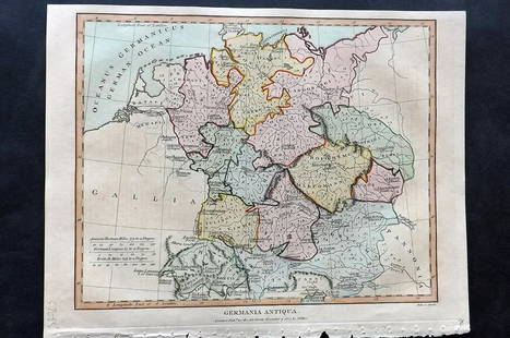
Sold2021Wilkes, John 1807 Hand Col Map. Ancient Germany"Germania Antiqua" Finely Hand Colored Copper Engraved Map Published 1796-1828 London for "Encyclopaedia Londinensis, or universal dictionary of arts, sciences and literature" by John Wilkes et al. PaSee Sold Price
Sold2017Janssonius: Map of Ancient Germany, 1645TITLE/CONTENT OF MAP: 'Germaniae Veteris Nova Descriptio [Ancient Germany newly described]' A map of ancient Germany, based on Ortelius' map, which was in turn based on the writings of Ptolemy, Pliny,See Sold Price
Sold2016Map of Ancient Germany by JanssonHeading: Author: Jansson, Jan Title: Germaniae Veteris, Typus Place Published: Amsterdam Publisher: Date Published: c.1640 Description: Copper-engraved map, hand-colored inSee Sold Price
Sold20211828 Map of Ancient EgyptTitle: 1828 Map of Ancient Egypt Medium: Ink on Paper Dimensions: 10.5"X8.5" Map of Ancient Egypt dated 1828. Part of Butler's Antique World Atlas. Drawn and engraved by Sydney Hall. Published by LongSee Sold Price
Sold20211828 Map of Ancient Rome and NaplesAuthor: Hall Title: 1828 Map of Ancient Rome and Naples Medium: Ink on Paper Dimensions: 10.5"X8.5" Map of Ancient Naples and Rome dated 1828. Map captures the Central Part of Modern day Italy. Part oSee Sold Price
Sold20211828 Map of Ancient SicillyAuthor: Hall Title: 1828 Map of Ancient Sicilly Medium: Ink on Paper Dimensions: 10.5"X8.5" Map of Ancient Sicilly dated 1828. Part of Butler's Antique World Atlas. Drawn and engraved by Sydney Hall.See Sold Price
Sold20211828 Map of Ancient GreeceTitle: 1828 Map of Ancient Greece Medium: Ink on Paper Dimensions: 10"X8.5" Description: Map of Ancient Greece dated 1828. Part of Butler's Antique World Atlas. Drawn and engraved by Sydney Hall. PublSee Sold Price
Sold20211828 Map of Ancient PalestineAuthor: Hall Title: 1828 Map of Ancient Palestine Medium: Ink on Paper Dimensions: 8.5"X10.5" Map of Ancient Palestine dated 1828. Part of Butler's Antique World Atlas. Drawn and engraved by Sydney HaSee Sold Price
Sold20211828 Map of Ancient Greek IslesTitle: 1828 Map of Ancient Greek Isles Medium: Ink on Paper Dimensions: 8.5"X10.5" Description: Map of Ancient Greek Isles dated 1828. Part of Butler's Antique World Atlas. Drawn and engraved by SydneSee Sold Price
Sold20211828 Map of Ancient GreeceAuthor: Hall Title: 1828 Map of Ancient Greece Medium: Ink on Paper Dimensions: 10.5"X8.5" Map of Ancient Greece dated 1828. Part of Butler's Antique World Atlas. Drawn and engraved by Sydney Hall. PuSee Sold Price
Sold20211828 Map of Ancient Asia MinorAuthor: Hall Title: 1828 Map of Ancient Asia Minor Medium: Ink on Paper Dimensions: 10.5"X8.5" Map of Ancient Asia Minor dated 1828. Map captures modern day Turkey. Part of Butler's Antique World AtlaSee Sold Price
Sold20211828 Map of Ancient Syria and PalestineAuthor: Hall Title: 1828 Map of Ancient Syria and Palestine Materials: Ink on Paper Dimensions: 10"X9" Description: Map of Ancient Syria and Palestine dated 1828. Part of Butler's Antique World Atlas.See Sold Price
Sold20211828 Map of Ancient MacedoniaAuthor: Hall Title: 1828 Map of Ancient Macedonia Medium: Ink on Paper Dimensions: 10.5"X8.5" Map of Ancient Macedonia dated 1828. Map captures modern day Greece, Turkey, Romania and Serbia. Part of BSee Sold Price
Sold20211828 Map of Ancient ArmeniaAuthor: Hall Title: 1828 Map of Ancient Armenia Materials: Ink on Paper Dimensions: 10.5"X8.5" Description: Map of Ancient Armenia dated 1828. Part of Butler's Antique World Atlas. Drawn and engravedSee Sold Price
Sold20211828 Map of Ancient BritainAuthor: Hall Title: 1828 Map of Ancient Britain Medium: Ink on Paper Dimensions: 8.5"X10.5" Map of Ancient Britain dated 1828. Part of Butler's Antique World Atlas. Drawn and engraved by Sydney Hall.See Sold Price
Sold20211828 Map of Ancient MacedoniaAuthor: Hall Title: 1828 Map of Ancient Macedonia Medium: Ink on Paper Dimensions: 10.5"X8.5" Map of Ancient Macedonia dated 1828. Map captures a territory comprised of modern day, Greece, Serbia andSee Sold Price
Sold20181828 ATLAS MAPS Ancient & Modern Geography Asia Africa1828 ATLAS MAPS Ancient & Modern Geography Asia Africa Turkey Greece Delamarche Felix Delamarche was a well-known and important French cartographer from the 18th-century. His best and most widely usedSee Sold Price
Sold2019Delamarche, Felix 1829 Maps (2) Ancient France, Germany"Germania Antiqua" and "Galliae Antiquae" Copper Engraved Maps Published 1829, Paris for "Atlas de La Geographie..." by Felix Delamarche. Contemporary outline hand colour. Centre fold as published. PaSee Sold Price
Sold20241839. Ancient Germania and Central Europe by MoninTitle/Content: 1839. Ancient Germania and Central Europe by Monin Date: 1839 Medium: Hand colored, engraved Dimensions: 17 1/2" x 12 1/2" Description: Map of Ancient tribal Germany and Central Europe.See Sold Price
Sold20211828 Ancient Armenia MapAuthor: Hall Title: 1828 Ancient Armenia Map Medium: Ink on Paper Dimenions: 11"X8.5" Description: Map of Ancient Armenia dated 1828. Part of Butler's Antique World Atlas. Drawn and engraved by SydneySee Sold Price
Sold20211828 Ancient Hungary MapTitle: 1828 Ancient Hungary Map Author: Butler Materials: Ink on Paper Dimensions: 10.5"X8.5" Description: Map of Ancient Hungary dated 1828. Map also captures Dalmatia(modern day Croatia). Part of BuSee Sold Price
Sold20211828 Ancient Greece MapAuthor: Hall Title: 1828 Ancient Greece Map Medium: Ink on Paper Dimensions: 8.5"X11" Map of Ancient Greece dated 1828. Part of Butler's Antique World Atlas. Drawn and engraved by Sydney Hall. PublishSee Sold Price
Jul 08Hermann Historica GmbHTwo German maps of Bavaria and Lower Bavaria, Augsburg/Nürnberg, 1st half of the 18th century€240
4 days LeftTrillium Antique Prints & Rare BooksDe Jode, Rare, pub. 1593 - Frontispiece or Title Page with Map of Germany, Poland and the Low$100
Featured10 hrs LeftJasper521593 de Jode Maps of Eastern Germany (Saxony Area) and Western Germany -- Mansfeldiae Comitatus ...$700
9 hrs LeftJasper521720 antique MAP of LOWER SAXONY GERMANY 18th CENT. Circulus Saxoniae inferioris$75
2 days LeftNY Elizabeth 1760 WORLD'S HISTORY ON OLD GERMAN VELLUM, ILLUSTRATED WITH A MAP OF CENTRAL ASIA$100
9 hrs LeftJasper521759 HISTORY OF THE WORLD in GERMAN antique ILLUSTRATED w/ MAP of ARABIA vellum$200
2 days LeftWeatherham Estate TreasuresAuthentic COPACABANA THEOREMA German Craftsmanship Automatic Watch$600
Jul 18Weatherham Estate TreasuresAuthentic COPACABANA THEOREMA German Craftsmanship Automatic Watch$600
2 days LeftWeatherham Estate TreasuresAuthentic Pionier 35 Jewel Movement Diamond Inset Automatic Watch$650
2 days LeftNY Elizabeth ILLUSTRATED ANCIENT ROMAN CHURCH HISTORY FRANCE ITALY GERMANY SWITZERLAND 1700$100
5 days LeftBrandywine Valley AuctionsRare Antique 17th Century William Beery English Map of Bavaria$25(1 bid)
Jul 08Hermann Historica GmbHA German silver-gilt reliquary cross and brass-mounted horn box, circa 1800/19th century€200


![Janssonius: Map of Ancient Germany, 1645: TITLE/CONTENT OF MAP: 'Germaniae Veteris Nova Descriptio [Ancient Germany newly described]' A map of ancient Germany, based on Ortelius' map, which was in turn based on the writings of Ptolemy, Pliny,](https://p1.liveauctioneers.com/5584/103242/52831744_1_x.jpg?height=310&quality=70&version=1493321322)


