Sold2021MAP OF CROATIAN ISLANDSIn burl frame. Dimensions: (Frame) H 41" x W 29.25" Condition: No issues to note.See Sold Price
Sold2017Neele: Antique Map Islands of the Pacific Ocean, 1817Map: Map of the Islands in the Pacific Ocean Publication Date: 1817 Cartographer: NEELE, sc. Publisher: THOMSON'S NEW GENERAL ATLAS Size: Folio – 19.50 H x 23.75 W Inches From a famous Scottish atlaSee Sold Price
Sold2023Frame Map "Islands of Minorca" 28" x 36"Frame Map "Islands of Minorca" 28" x 36"See Sold Price
Sold2021Tallis, John (Pub) 1852 Map Islands in the Indian OceanSteel Engraved Map with Original Outline Hand Color Published 1852-56 by John Tallis, London for "The Universal Pronouncing Dictionary" by Thomas Wright. Drawn & Engraved by John Rapkin. Centre fold aSee Sold Price
Sold2021Tallis, John (Pub) 1852 Map. Islands in the AtlanticShowing Canary Islands, Madeira and Bermuda. Steel Engraved Map with Original Outline Hand Color Published 1852-56 by John Tallis, London for "The Universal Pronouncing Dictionary" by Thomas Wright. DSee Sold Price
Sold2019Anon 1816 Hand Col Map. Island of St. Helena, Africa"The Island & Forts of St. Helena" Copper Engraved Map Published 1816 by Nuthall, Fisher & Co., Liverpool. Unknown Cartographer/Engraver. Paper Size: 10.5 x 8.5 inch (27 x 22cm) Chip to bottom marginSee Sold Price
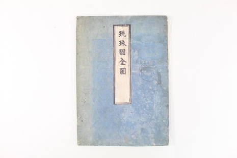
Sold2021Japanese Fold Out Handmade Ink Drawn Map,Islands,RoutesJapanese Fold Out Handmade Ink Drawn Map,Islands,Routes. This is a beautiful, handmade map of what appear to be islands and possibly routes. It is written in Japanese. The two hard covers are attachedSee Sold Price
Sold2019INDIAN OCEAN Madagascar Seychelles Maldives MauritiusReserve Reduced! TITLE/CONTENT OF MAP: 'ISLANDS IN THE INDIAN OCEAN. Madagascar, Amirantes, Seychelle Archipelago, Socotra, Lakadive Islands, Maldive Islands, Andaman Isles, Nicobar Isles, Chagos GrouSee Sold Price
Sold2022Three Antique Hawaiian Maps, US Government3 1920s Hawaiian Maps. Island Of Oahu Map Approximately 47.1875 x 36.5 in. Hawaiian Islands Approximately 45.875 x 35.125 in. Hawaii To Oahu Approximately 46.4375 x 35.5625 in.See Sold Price
Sold2019ATLANTIC ISLANDS. Bermuda Madeira Canaries.TenerifeTITLE/CONTENT OF MAP: 'Islands in the Atlantic' The map shows the islands of Madeira, the Azores, the "Bermudas or Summers Islands", the Canary Islands and teh Cape de Verde Islands. Vignettes: Fayal,See Sold Price
Sold2017Tallis: Map of Islands in the Indian Ocean, 1851Map: Islands in the Indian Ocean Cartographer: Tallis Place & Date: London/New York / 1851 Size: 13 1/4" x 10 1/2" The superb Indian Ocean islands map from Tallis' Illustrated Atlas extending from theSee Sold Price
Sold2020Island Juan Fernandez 1748 J. N. BellinTitle/Content of Map: Island Juan Fernandez 1748 J. N. Bellin Cartographer:J. Nicolas. Bellin Date Printed: 1748 Material/Medium: Paper Size: Sheet Size 34 x 24 cm. Image 28 x 19 cm. Reserve: $95.00 SSee Sold Price
Sold2018Bellin: Antique Map of Haiti & Dominican Republic, 1740Title/Content of Map: Island of Hispaniola, Haiti & Dominican Republic by Bellin Date Printed: 1740-70's Cartographer: J.N. Bellin & J.F. La Harpe Material/Medium: Paper Size: 14" x 10" Copperplate enSee Sold Price
Sold2017Bellin: Antique Map of Island of Juan Fernandez, 1740Title/Content of Map: Island of Juan Fernandez rare and early view of Chile's island Date Printed: c 1740-70's Cartographer: J.N. Bellin & J.F. La Harpe Material/Medium: Paper Size: 13" x 9 1/2" CoppeSee Sold Price
Sold2017Bellin: Antique Map of New Zembla Island, 1750Title/Content of Map: Island of New Zembla Northern Russia Arctic Ocean Date Printed: 1750's -60's Cartographer: Jacques Nicolas Bellin Material/Medium: Paper Size: 9 1/2" x 7" Copperplate engraving.See Sold Price
Sold2017Homann: British West Indies/Atlantic Islands Map, 1740Map: Dominia Anglorum. British West Indies/Atlantic islands of St Christopher (St Kitts), Antigua, Bermuda, Jamaica & Barbados Date Printed: c1740 Image Size: Approx 52.5 x 59.5cm, 20.5 x 23.25 inchesSee Sold Price
Sold2018Mercator/Hondius: Composite West Indies Islands MapCartographer: Mercator / Hondius Place/Date: Amsterdam / 1628/1630 Size: 20" x 14 1/4" Condition: wash color; cleaned and stabilized; minor spotting and tiny repaired wormhole in the sea in the PuertoSee Sold Price
Sold2017New Holland & Asiatic Islands Map, Thomson, 1817TITLE/CONTENT OF MAP: 'New Holland and Asiatic islands' DATE PRINTED: 1817 IMAGE SIZE: Approx 53.0 x 65.0cm, 21 x 25.5 inches (Large); Please note that this is a folding map. TYPE: Antique early 19thSee Sold Price
Sold2022DOLE MAP HAWAIIAN ISLANDS BY PARKER EDWARDSThe Dole Map of the Hawaiian Islands, U.S.A. - Being a descriptive portrayal of the history, transportation, industries and geography of the Territory of Hawaii, U.S.A.', artwork by Parker Edwards, HaSee Sold Price
Sold2017Majorca, Minorca, & Ibiza Islands Map, Jansson, 1650Insulae Balearides et Pytiusae. Jansson's edition of Blaeu's beautiful map of the islands of Majorca, Minorca, and Ibiza, including the coasts of Catalonia and Valencia. As in Blaeu's version, sea monSee Sold Price
Sold2023FRAMED MAP Balearic Islands - “Carte des Isles de Maiorque, Minorque et D’Yvice†after TobiasFRAMED MAP Balearic Islands - “Carte des Isles de Maiorque, Minorque et D’Yvice” after Tobias Conrad Lotter, hand colored engraving, title cartouche, 19-1/2 x 22-1/2 inches framed CSee Sold Price
Sold20221756 GENTLEMANS MAGAZINE, w/Caribbee Islands MAPHistoric Maps 1756 French & Indian War Map of the "Caribbee Islands" August 1756-Dated French & Indian War, THE GENTLEMAN'S MAGAZINE with its Map, London, England, Very Fine. Published By Sylvanus UrbSee Sold Price
Sold2023MAP, Channel Islands, MercatorChannel Islands. Mercator/Hondius, Anglesey [on sheet with] Wight Vectis Olim [and] Garnesay [and] Iarsay, from Gerardi Mercatoris - Atlas sive Cosmographicae..., 1630 (published). Hand Color. Very haSee Sold Price
Sold20201750 Bowen Map of Islands off the Coast of Africa --Title/Content of Map: 1750 Bowen Map of Islands off the Coast of Africa -- Particular Draughts Of Some Of The Chief African Islands In The Mediterranean, As Also In The Atlantic And Ethiopic Oceans CaSee Sold Price
2 days LeftJasper52HAWAII HISPANIOLA. Hawaiian Isles; Haiti San Domingo Dominican Republic 1898 map$20
3 days LeftA.H. Wilkens Auctions & AppraisalsBOWEN. A NEW & ACCURATE MAP OF THE ISLANDS (1747)CA$225(2 bids)
2 days LeftJasper52WEST INDIES Caribbean Windward Leeward Islands Barbados Pirates? MALLET 1683 map$240
2 days LeftJasper52Windward or South Caribbean Islands. Barbados St. Lucia Trinidad. LOWRY 1860 map$55(1 bid)
2 days LeftJasper52Leeward Islands. Cuba, Hayti/Haiti or Santo Domingo, Puerto Rico. LOWRY 1859 map$110
2 days LeftJasper52BRITISH/US VIRGIN ISLANDS Tortola Virgin Gorda St Croix St Thomas/John 1923 map$55
2 days LeftJasper52BRITISH/US VIRGIN ISLANDS Tortola Virgin Gorda St Croix St Thomas/John 1927 map$55
2 days LeftJasper52BRITISH/US VIRGIN ISLANDS Tortola Virgin Gorda St Croix St Thomas/John 1935 map$60
2 days LeftJasper52Puerto Rico & Virgin Islands. Haiti, Hispaniola or St. Domingo. THOMSON 1817 map$140
2 days LeftJasper52BRITISH WEST INDIES Jamaica Trindad Antilles Virgin Cayman Islands SDUK 1844 map$160
2 days LeftJasper52Cartes de supplément pour les Isles Antilles. West Indies Islands BONNE 1790 map$40
2 days LeftJasper52Amér. Sep. Ile de Cuba #67. Cuba & Jamaica Cayman Islands. VANDERMAELEN 1827 map$160
3 days LeftSwann Auction Galleries(HAWAII.) Hiram Bingham. A Residence of Twenty-One Years in the Sandwich Islands.$300
2 days LeftJasper52MEXICO CENTRAL AMERICA WEST INDIES. Panama & Proposed Nicaragua canals 1912 map$35
2 days LeftJasper52Windward or South Caribbean Islands. Barbados St. Lucia. Guianas. LOWRY 1859 map$60
3 days LeftA.H. Wilkens Auctions & AppraisalsJEFFERYS. AN EXACT CHART OF THE RIVER ST. LAURENCECA$200(1 bid)
Featured2 days LeftJasper52British West Indies. Virgin Leeward Windward Islands. Bermuda. SWANSTON 1860 map$120
2 days LeftJasper52Amér Sep Porto Rico #69 Puerto Rico & Virgin Islands VANDERMAELEN 1827 old map$140


![MAP, Channel Islands, Mercator: Channel Islands. Mercator/Hondius, Anglesey [on sheet with] Wight Vectis Olim [and] Garnesay [and] Iarsay, from Gerardi Mercatoris - Atlas sive Cosmographicae..., 1630 (published). Hand Color. Very ha](https://p1.liveauctioneers.com/6576/279721/147265402_1_x.jpg?height=310&quality=70&version=1677104593)


