Sold2022Ancient Holy land. 12 tribes 1810 by DelalainAncient Holyland showing the twelve tribes. 1810 published in ‘Atlas tables elementaires de geographie ancienne et moderne’, Paris, by Auguste Delalain. Hand-colored outline copperplate enSee Sold Price
Sold20231810 Published,Ancient world Roman empire mapOrigin:France Date/Period:19th.c Material:Paper Approximate Size: 9 1/4 x 8'' Additional Information: 1810 Published, in Atlas tables elementaires de geographie ancienne et moderne', Paris, by AugusteSee Sold Price
Sold2022Europe 1810 by DelalainEurope. 1810 published in ‘Atlas tables elementaires de geographie ancienne et moderne’, Paris, by Auguste Delalain. Hand-colored outline copperplate engraved. Excellent condition. 13 1/2See Sold Price
Sold2023France into four regions. 1810 by DelalainTitle: France into four regions. 1810 by Delalain Date/Period: 1810 Materials: Copper plate engraved Size: 13 1/2 x 8” France, 4 regions. 1810 published in ‘Atlas tables elementaires de geSee Sold Price
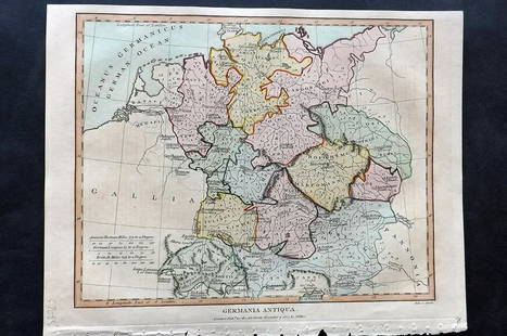
Sold2021Wilkes, John 1807 Hand Col Map. Ancient Germany"Germania Antiqua" Finely Hand Colored Copper Engraved Map Published 1796-1828 London for "Encyclopaedia Londinensis, or universal dictionary of arts, sciences and literature" by John Wilkes et al. PaSee Sold Price
Sold2016Map of Ancient Germany by JanssonHeading: Author: Jansson, Jan Title: Germaniae Veteris, Typus Place Published: Amsterdam Publisher: Date Published: c.1640 Description: Copper-engraved map, hand-colored inSee Sold Price
Sold2022Lyttleton, George 1810 Antique Map of Germany"Germany Exhibiting the present seat of War 1805" Copper Engraved Map Published 1810, London for "The History of England..." by George Courtney Lyttleton. Folds as issued. Paper Size: 17.5 x 16 inch (See Sold Price
Sold2019Lyttleton, George 1810 Hand Col Map of Germany"Germany Exhibiting the present seat of War 1805"Hand Coloured Copper Engraved Map Published 1810, London for "The History of England..." by George Courtney Lyttleton. Folds as issued. Paper Size: 17.See Sold Price
Sold2019Delamarche, Felix 1829 Maps (2) Ancient France, Germany"Germania Antiqua" and "Galliae Antiquae" Copper Engraved Maps Published 1829, Paris for "Atlas de La Geographie..." by Felix Delamarche. Contemporary outline hand colour. Centre fold as published. PaSee Sold Price
Sold2021Dussieux, Louis 1859 Mixed Lot of 6 MapsIncl Europe, UK, France, French Empire, Ancient Britain/Germany and Persian Empire/Asia Minor. Steel Engraved Map Published 1859, Paris for "Atlas Complet de Geographie Elementaire" by Louis Dussieux.See Sold Price
Sold2019Delamarche, Felix 1829 Lot of 6 Ancient Europe MapsIncl Ancient France, Spain, Germany, Greece, Alexander the Great Empire, and Asia Minor. Copper Engraved Maps Published 1829, Paris for "Atlas de La Geographie..." by Felix Delamarche. Contemporary ouSee Sold Price
Sold2018Germany's north central region. Insert of Hamburg &Germany's north central region. Insert of Hamburg & Bremen 1861 J.H. Colton 17 1/2" x 13 3/4" Hand colored steel engraved Map. From 'Colton's General Atlas.' Published in New York. Please note that thSee Sold Price
Sold2022Ancient map of a region of Bavaria, 1628Authentic vintage map of the Rhineland Palatinate of Bavaria in Southern Germany. From an edition of Mercator’s Atlas Minor. Jocodus Hondius created the Atlas Minor in 1607 as a smaller versionSee Sold Price
Sold2018Arrowsmith: Antique Map of Ancient Germany, 1828TITLE/CONTENT OF MAP: 'Germania; Vel Regiones intra Rhenum f1. Oceanum, Sinum Codanum, Vistulam f1. Montes Sarmaticos et Danubium f1. Sitae' DATE PRINTED: 1828 IMAGE SIZE: Approx 25.5 x 28.5cm, 10 x 1See Sold Price
Sold20222-sheet map of ancient Egypt by Ortelius 1584Heading: Author: Ortelius, Abraham Title: Aegyptus Antiqua Place Published: Antwerp Publisher: Date Published: 1584 Description: Copper engraved map on two sheets, north anSee Sold Price
Sold2024De Jode, Rare, pub. 1593 - Map of Germany (Germaniae Totius, Nostrae Europae celeberrimae regionis,This truly significant map is from one of the rarest atlases ever published, Gerard and Cornelis de Jode's Speculum orbis Terrae. The work was published in Antwerp in 1593 by Arnold Coninx for the widSee Sold Price
Sold2019Delamarche, Felix 1829 Lot of 3 Maps. Europe & Germany"L'Europe a l'Epoque du demembrement de l'Empire de Charlemagne" "L'Europe avan l'Invasion des Barbares" and "Germania Antiqua et regiones Danubium" Copper Engraved Maps Published 1829, Paris for "AtlSee Sold Price
Sold2017Mercator (Gerard) - Atlas sive Cosmographicae,Editio Quinta, engraved pictorial title, prelims, 49 double-page maps, including Asia, Russia, Turkey, Lithuania, Asia Minor and Persia, regions of Italy Spain, Germany and Eastern Europe, and 11 singSee Sold Price
2018Published Chavin Pottery Polychrome Stirrup VesselPre-Columbian, northern Peru, Chavin culture, Jequetepeqye-Templadera type, ca. 1200 to 800 BCE. One of the more striking examples of ancient pottery I have seen from this region. Brownware stirrup veSee Sold Price
Sold2021A New Map of Texas, Oregon and California"A New Map of Texas, Oregon and California with the Regions Adjoining" by S. Augustus Mitchell, engraving with hand-coloring, 1st edition, published Philadelphia, 1846; framed together with original bSee Sold Price
Sold2022Mitchell "Map of Texas, Oregon and California, 1846"Mitchell "Map of Texas, Oregon and California with the Regions Adjoining compiled from the most recent authorities Philadelphia, published by S. Augustus Mitchell, Northeast Corner of Market and SevenSee Sold Price
Sold2020MONTBLANC Artisan Ed: URBINO RAPHAEL Ltd Fountain PenHeading: Author: Montblanc Artisan Edition Title: Master of Urbino [Raphael Sanzio da Urbino] 18K Gold Limited Edition Filigree Fountain Pen Place Published: Germany Publisher: Date Published: <See Sold Price
Sold2019MONTBLANC Arena di Verona ArtisanHeading: One of 49 Author: Montblanc Artisan Edition Title: Arena di Verona 18K White Gold Limited Edition Fountain Pen Place Published: Germany Publisher: Date Published: 2006 DescriptSee Sold Price
Sold2019Impressive Chinese 6th Cent. Marble Stele of a BuddhistImpressive Chinese 6th Cent. Marble Stele of a Buddhist Trinity 27''x14.5''x7.5''. Exceptional published ancient marble carving from the C.K. Chan Collection. Pictured in color on page 27 of the bookSee Sold Price
2 days LeftJasper521641 MAP of ITALY antique authentic TERRITORIUM BONONIENSE IL BOLOGNESE original$160
7 days LeftArtelisted18th C. Geographie Moderene Historique et Politique: Cercles de Baviere de Franconie et de Souabe$150
7 days LeftArtelisted18th C. Geographie Moderene Historique et Politique: Cercles de Westphalie Haut et Bas Rhin$150
5 days LeftTrillium Antique Prints & Rare BooksSchedel, pub. 1493 - Pair of Pages of Engravings with Biblical Scenes$75
5 days LeftTrillium Antique Prints & Rare BooksSchedel, pub. 1493 - 4 Pages of Engravings of Town Views & Historic or Religious People$75
5 days LeftTrillium Antique Prints & Rare BooksSchedel, pub. 1493 - 3 Pages of Engravings of Town Views & Historic or Religious People$75
5 days LeftTrillium Antique Prints & Rare BooksKollner, Rare - Niagara Falls, Horseshoe Fall, from the Canada Side$200
4 days LeftFrost & NicklausSans Souci Palace Picture Gallery Guide, Potsdam, Germany, in Russian, 1stEd. 1981$10
Oct 07Rapid Estate Liquidators and Auction GalleryAntique G. Klee German Heroic Epic In German Hardcover$1(1 bid)
4 days LeftFrost & NicklausJohann Elias Ridinger, Wild Animals & Art of Hunting, 1950 Copper Engravings$7


![MONTBLANC Artisan Ed: URBINO RAPHAEL Ltd Fountain Pen: Heading: Author: Montblanc Artisan Edition Title: Master of Urbino [Raphael Sanzio da Urbino] 18K Gold Limited Edition Filigree Fountain Pen Place Published: Germany Publisher: Date Published: <](https://p1.liveauctioneers.com/642/176650/88936419_1_x.jpg?height=310&quality=70&version=1597439617)


![[MAPS] 1855 Antique Map of Paris (1 of 3)](https://p1.liveauctioneers.com/7226/343679/186655055_1_x.jpg?height=282&quality=70&version=1726238840)


