Sold2018BRITISH EMPIRE. World Mercator. Currents. SteamshipTITLE/CONTENT OF MAP: 'The World (Mercator); Inset map of France' The top image on the right hand side shows the entire map. To view a close up of the map showing the level of printed detail, please cSee Sold Price
Sold2017Bonne: Antique Map of World on Mercator's ProjectionTitle/Content of Map: 'Planisphere suivant la Projection de Mercator' A map of the world on Mercator's projection, showing the trade winds Date Printed: 1780 Image Size: Approx 23.0 x 35.0cm, 9 x 13.7See Sold Price
2017Bonne: Antique Map of World on Mercator's ProjectionTitle/Content of Map: 'Planisphere suivant la Projection de Mercator' A map of the world on Mercator's projection, showing the trade winds Date Printed: 1780 Image Size: Approx 23.0 x 35.0cm, 9 x 13.7See Sold Price
Sold2017Johnson: Map of the World On Mercator's ProjectionMap Title: Map of the World On Mercator's Projection Publisher: Johnson And Ward, Alvin Jewett Johnson Publishing Date: 1861 Size: Double Folio - 15.25 x 24.00 inches Large, Handsome world map showingSee Sold Price
Sold2023Nat. Encyclo. 1890's Large Map. World on Mercator's ProjectionSteel Engraved Map Published 1891-1901 by William Mackenzie, London for "The National Encyclopedia: A dictionary of Universal Knowledge" Folds as issued. Paper Size: 20.5 x 13.5 inch (52 x 33cm) A couSee Sold Price
Sold2019Cortambert, Eugene 1874 Lot of 4 Maps. UK, World EuropeTwo of the British Isles, Europe Physical Map and World on Mercators Projection. Hand Coloured Lithograph Maps Published 1874, Paris for "Atlas de la Geographie de L'Europe" by Eugene Cortambert. PapeSee Sold Price
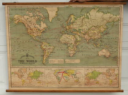
Sold2019WORLD/British Empire. 'Steam routes to the colonies'.TITLE/CONTENT OF MAP: 'The World on Mercator's Projection' Vignettes: Gibraltar; London; Constantinople; Niagara; The Pyramids of Ghizeh; Pont Neuf, Paris; Vesuvius. The steam ship routes to the colonSee Sold Price
Sold2019Map of the World On Mercator's Projection,Title/Content of Map: Map of the World On Mercator's Projection, Date: 1874 ca. Cartographer: BEERS, J. B. & CO. Size: 14.25Height - 23Width Publisher: J.B. BEERS & CO. Detailed, showing nautical distSee Sold Price
Sold2015Bacon's Excelsior Map of The WorldOn Mercator's Projection, printed in London by G. W. Bacon & Co., Ltd., circa 1880. Chromolithograph laid on canvas with both original wood hangers. 39 1/2" x 30".See Sold Price
Sold2020NORTHERN LATITUDES POLE ARCTIC British Columbia part ofTITLE OF MAP (NOT PRINTED ON THE PAGE):'WORLD ON GNOMONIC PROJECTION, V., From North Pole to 45 N Lat' The top image on the right hand side shows the entire map. To view a close up of the map showingSee Sold Price
Sold2017World on Mercator's Projection 1841 MapWorld on Mercator's Projection' Hall Singapore Town/Island Inset 1841 Map. Title/content of Map: 'the World of Mercator's Projection.' the Map Includes Large Insets Of, from Bottom Left, 1) a Sea CharSee Sold Price
Sold2024Chart Of The World According To Mercators Projection Showing Tracks & Discoveries Of Capt. CookPublished by Wilkie & Robinson, J Mawman, and the other propietors, engraved for Guthries new system of geographySee Sold Price
Sold2023A map of the world on Mercators Projection. Davis Land. GENTS MAG 1755 oldTITLE/CONTENT OF MAP: 'A map of the World, on Mercators Projection' The map notes the European discovery of Alaska in 1741, and shows in dotted outline a pre-Cook guess at the east coast of Australia.See Sold Price
Sold2017Thomson: Antique World Map, Mercator's Projection, 1814Map: Chart of the World on Mercator's Projection Cartographer: Thomson Place & Date: Edinburgh / 1814 Size: 20" x 17 3/4" Condition: b&w; overall age toning; browning along centerfold; two small, repaSee Sold Price
Sold2021Encyclo. Britannica C1830 Map of The WorldThe World on Mercator's Projection. Steel Engraved Map Published 1830-42, Edinburgh for "Encyclopedia Britannica" Seventh Edition. Centre fold as issued. Paper Size: 16 x 11 inch (40 x 28cm) Minor tonSee Sold Price
Sold2016Map of World / Mercators Projection, 1868Original engraving from Johnson's Atlas of the World, 1868. Map includes vignette of Long Island & cities, towns and territories. Dimensions: 18" x 26". Shipping Domestic: Shipping rates are determindSee Sold Price
Sold2020A World Map on Mercator's ProjectionA World Map on Mercator's Projection George F. Cram Co., Chicago, 19th/20th Century 17 7/8 x 26 1/8 inches (visible). Property from a Corporate Art CollectionSee Sold Price
Sold2017Tallis World Map World on Mercator's Projection 1851Tallis World Map The World on Mercator's Projection 1851 . J. Tallis, 1851 London, 10.5 X 14 In.. This Is a Decorative and Striking Steel Engraved World Map That Was Produced from the Same Plate UsedSee Sold Price
Sold2022Large Framed Johnson's Mercator's Projection Map of the World 40"x34" World MarketLarge Framed Johnson's Mercator's Projection Map of the World 40"x34" World MarketSee Sold Price
Sold2022Brewster, David 1830 Antique Map. World on Mercator's Projection"Charte of the World on Mercator's Projection with the dip and variation of the Compass. The Trade Winds & Monsoons" Copper Engraved Map Published 1808-1830, Edinburgh for "The Edinburgh EncyclopaediaSee Sold Price
Sold2023Lizars, Daniel 1831 LG Rare HC Map. World on Mercator's ProjectionLarge Folio Copper Engraved Map Published 1831-2 by John Hamilton, Successor to Daniel Lizars, Edinburgh for "The Edinburgh Geographical and Historical Atlas..." First Edition by Daniel Lizars. Very fSee Sold Price
Sold2024Blackie (Pub) 1882 Large Map. World on Mercators ProjectionLithograph Maps Published 1882 by Blackie & Son, London for "The Comprehensive Atlas & Geography of the World" by W. G. Blackie. Paper Size: 22.5 x 15.5 inch (57 x 39cm) Good conditionSee Sold Price
Sold2021Guthrie, William 1798 Map World of Mercators ProjectionCopper Engraved Map Published 1798, London for "A New Geographical, Historical and Commercial Grammar..." by William Guthrie. The maps are by John Senex, Thomas Kitchin and others. Folds as issued. PaSee Sold Price
Sold2022Guthrie, William 1805 Map. World on Mercators ProjectionCopper Engraved Map Published 1805, London for "A New Geographical, Historical and Commercial Grammar..." by William Guthrie. Folds as issued. Paper Size: 10.5 x 8 inch (27 x 21cm) Approx. Some toningSee Sold Price
1 day LeftTrillium Antique Prints & Rare BooksHarris - Map of the World (With Australia and part of New Zealand)$120(4 bids)
1 day LeftTrillium Antique Prints & Rare BooksHarris - Map of the West Indies or Antilles Islands with Florida, Louisiana, part of Mexico and$80(2 bids)
1 day LeftTrillium Antique Prints & Rare BooksHarris - Chart of the Meditterranean and Adriatic Seas (Southern Europe and Northern Africa)$75(1 bid)
Jul 14Schilb Antiquarian Rare Books1927 Lawrence of Arabia 1st ed ARAB Revolt in the Desert World War I Ottoman$30(4 bids)
2 days LeftLeonard Auction, a division of The Leonard CompanyWorld: British and French Gold Coins$300
4 days LeftFreeman's | Hindman[Early Printing] [Incunable] (Macrobius, Ambrosius Aurelius Theodosius: In Somnium Scipionis exposit$300
6 days LeftJulien's AuctionsQueen Victoria | 1897 Commemorative Lace Celebrating The Diamond Jubilee$50
2 days LeftEast Coast Fine Arts LLC1777 US Revolutionary War Map French Brion de la Tour Theatre de Guerre$1,000


![[Early Printing] [Incunable] (Macrobius, Ambrosius Aurelius Theodosius: In Somnium Scipionis exposit (1 of 3)](https://p1.liveauctioneers.com/65/332523/179335062_1_x.jpg?height=282&quality=70&version=1717709446)


![[Maps & Atlases] Speed, John: The Turkish Empire (1 of 2)](https://p1.liveauctioneers.com/65/332523/179335176_1_x.jpg?height=282&quality=70&version=1717709446)


